
I read The Guardian daily for its perspective and honesty, and not so much for its editorial opinions. The paper, even in its American incarnation, has more UK news than one usually finds on this side of the Atlantic, and a host of interesting articles on food, travel, the arts, and areas of the world neglected by the American press.
A few days ago, I came across a review of a retrospective of the Michael Palin travel series. A fan of Palin since his Monty Python days, and having watched and enjoyed several of his travelogues, I read The Guardian review with interest. Palin’s following comments about his travels in Morocco spoke directly to me, and drew me into memories of my youth:
“This is something I did entirely on my own. I wanted to go to a place called Taroudant, which is across the Atlas mountains from Marrakech. They said: ‘Oh, you must hire a car.’ I said: ‘Is there any public transport?’ They were like: ‘You must be joking. There is a bus service, but it leaves at about 3am and takes hours.’ And I said: ‘That’s the one for me.’”
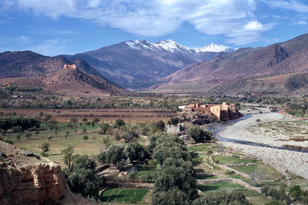
“It was the most fantastic journey. We did keep stopping. We stopped for people to get off for a pee, have some tea and stretch their legs. By the time we got to the top of the Atlas Mountains we knew each other quite well. There were no westerners there at all. It was entirely Moroccans, which I think was great. I felt very privileged to be there.”

Every Peace Corp volunteer could tell this story. Certainly most would admit to feeling privileged, too. Volunteers normally never traveled any other way.

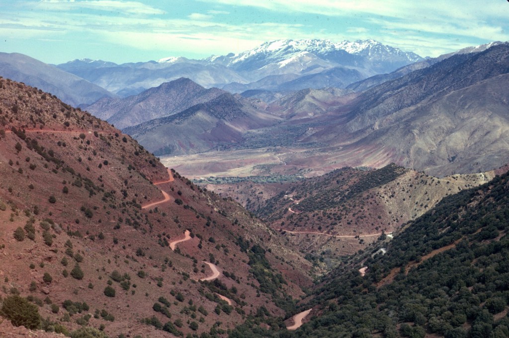
Those trained in dialectical Arabic or Berber never had a problem conversing with the other travelers. Those volunteers who only knew French could usually find a French speaker nearby. Palin’s preferred travel was what we took for granted. Shared taxis, buses, and second- and third-class trains fit both our tastes and our pocket books, and always provided something more than exotic locales and beautiful scenery. We were either traveling for work or sightseeing, but either way we always traveled as Moroccans did.
Most of my travel in life was based on specific goals, usually business, historical, or recreational, but some of the best trips came after spur-of-the-moment decisions.

In 1967, finishing up my summer work at the Peace Corps training site in La Pocatière, Quebec, I planned to go to Finland to visit an old girl friend. I had a couple of weeks free before the start of my own training in Hemet. A Dear John letter dashed my hopes for a reunion so I looked for something else to do.
My college friend Jim had been accepted to the same Peace Corps training program as myself, and he had time to kill, too. I suggested that we do some short hikes in the Canadian Rockies. I had never hiked in any wilderness area before so it would be a new experience for me, though I had traveled through the Canadian Rockies more than once. Though Jim lived in Montana, he had never visited the Canadian Rockies, so he was interested. He agreed to drive north to Jasper, Alberta in his Volkswagen Beetle, where we would meet for a few days of backpacking.
Jim was there to meet me when I got off the Canadian National train. The train pulled in after midnight, and it was very dark. Jasper was a small place, and there wasn’t much around the station. It was a great place to watch the skies, but not such a great place to miss a rendez-vous late at night.


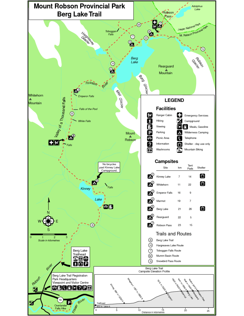
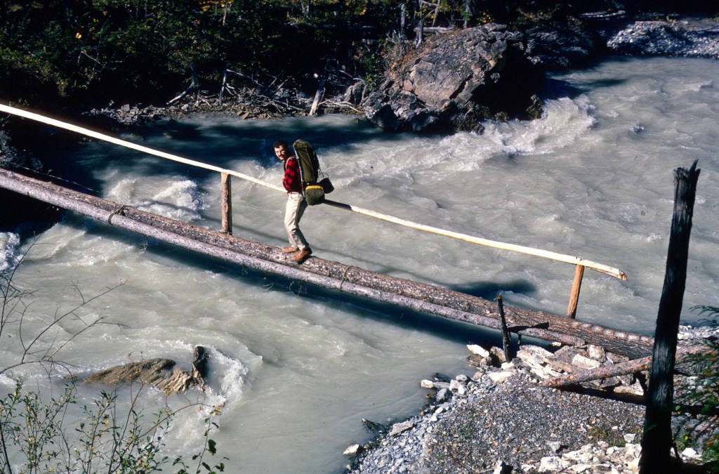
Our first hike was to be in Mount Robson Provincial Park, in British Columbia, which in 1967 was less well known than the big Canadian national parks. I think I had learned about it from a tourism magazine, Beautiful B.C., which had a stunning photo of the Emperor Falls.
At that time, the park was accessible by a thirty- or forty-mile drive on the Yellowhead Highway, an excellent road, but unpaved and definitely not all-season. Talking with Jim today, I found out that his recollection was that the road wasn’t great at all and that he complained about it at the time, I stand corrected there. Memory is a funny thing. Since that time, I have driven a lot of unimproved roads, including a long stretch of the ALCAN Highway, but Jim drove the Yellowhead, so he, a Montanan and no stranger to unpaved roads, would have the better memory.
The road crossed the Continental Divide through Yellowhead Pass at 1133 meters, on the border of Alberta and British Columbia, and then descended following the Fraser River. The name Yellowhead supposedly came from a blonde Métis trapper, Pierre Bostonais, and further down the highway, past Mount Robson Provincial Park, there is a town called Tête Jaune Cache.
I was reminded of this trip by a second recent Guardian article, this one featuring the Mount Robson Provincial Park. The park is more accessible today, though still a bit off the main tourist circuit.
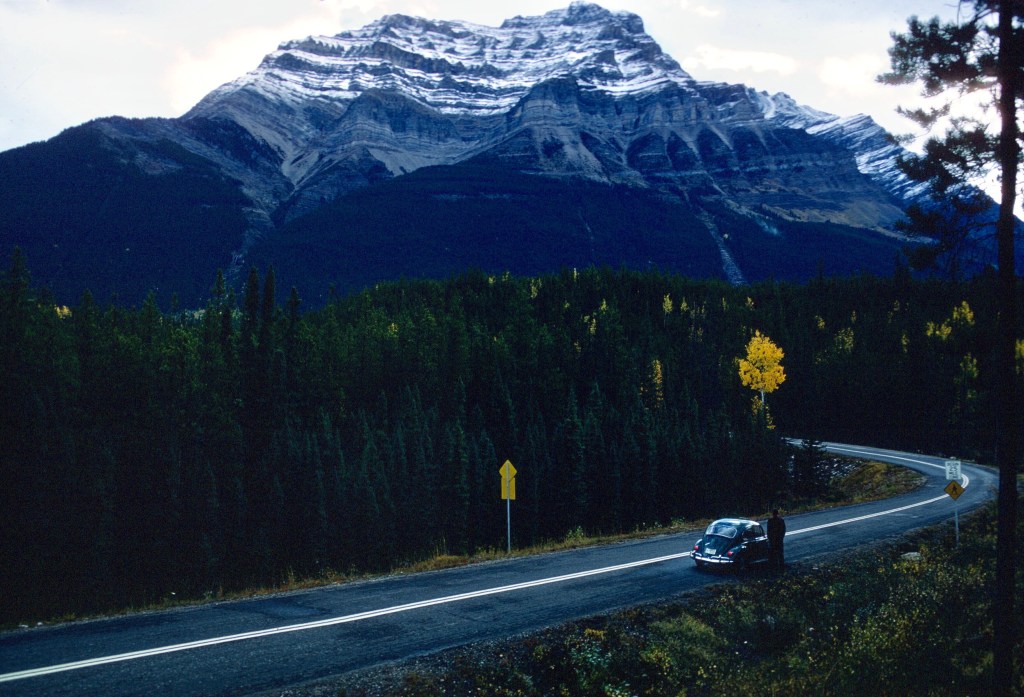
Railroad travelers are treated to a splendid view of Mount Robson, the highest peak in the Canadian Rockies, as the Via Rail trains climb toward the Continental Divide on their way east. In the summer of 1972, I rode a CN train from Vancouver to Toronto and awoke on the second day of the trip to a sunrise view of that magnificent mountain. The railroad parallels Highway 16 much of the way, and tourists can also take a train excursion from Jasper to the Mount Robson area.
When Jim picked me up at the station in Jasper, he really was a sight for sore eyes. I had worried just a bit that he might be late, wondering how I might contact him if he were not there. We now take cell phones for granted, but before they existed communication was certainly more difficult. I don’t recall that we made any special arrangements for the possibility of a late train or a flat tire, but I had known Jim for four years, and I knew that he was dependable.
Great Falls is almost 600 miles from the town site where the CN train station is located. Jim’s quickest route was up to Calgary and through Banff Park and over the newly completed and spectacular Icefields Pakway. Our plan was to camp the night in Jasper, and leave early in the morning for Mount Robson. Though I was weary from a two-day train ride, I was excited to see Jim. Jasper’s air was fresh and fragrant, a great contrast to the Pullman car I had just left. The campground, within the Jasper town site, was simply a series of concrete slabs, with places to pitch tents, on the edge of a forest.
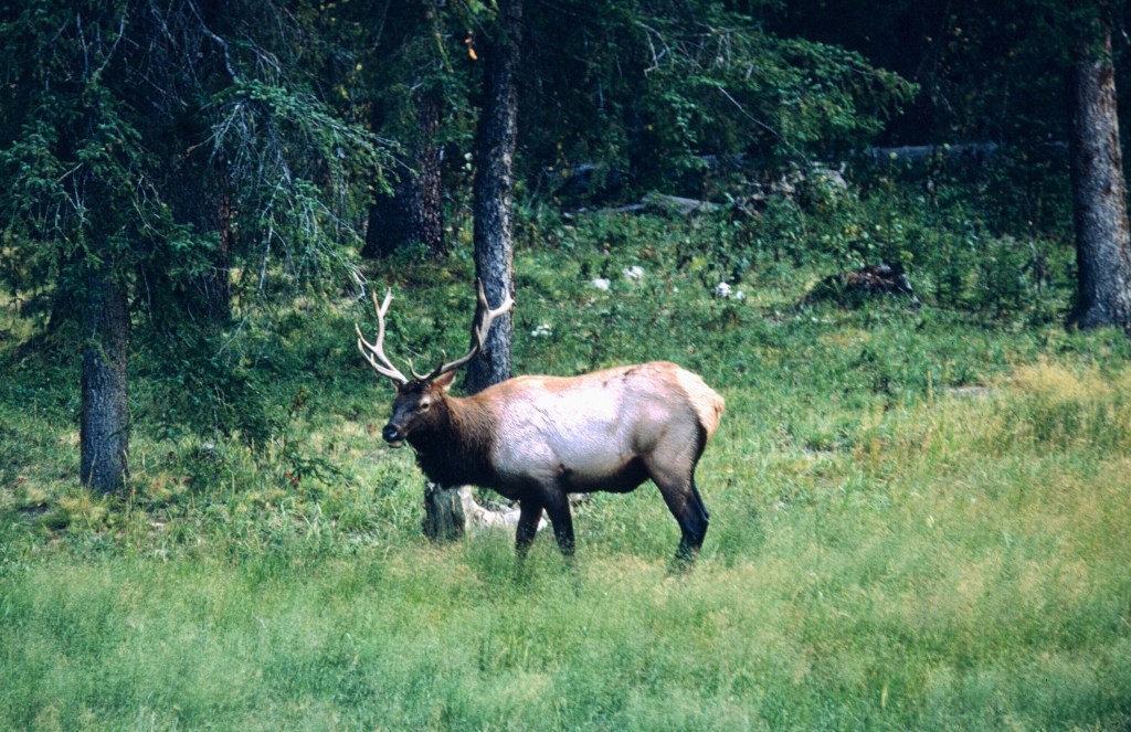
Though I was tired, I found it hard to sleep. It was late September or early October, the rutting season of elk, and the bulls were bugling in the surrounding forests. I had never heard elk bugle before, and I found the silvery whisking sound strange and eerie.
After finally drifting off to sleep, Jim and I were awakened by the sound of a loud crash. Unable to see anything in the dark, I went back to sleep. In the morning we found that a black bear had broken into the supplies of the campers next to us. Hearing the noise outside their tent, they had opened the fly to come face to face with the bear. They zipped the tent back up, and hoped that the bear would be satisfied with their provisions. Jim and I had no tent. We had spread our sleeping bags in the open, and we were thankful that we had escaped the midnight snack visit. Our provisions were stored in the VW.


Our plan was to do two hikes, one in Mount Robson Provincial Park and the other in the Tonquin Valley-Amethyst Lakes area of Jasper National Park. We set off early for Mount Robson and I enjoyed the easy drive while Jim worried about his car.
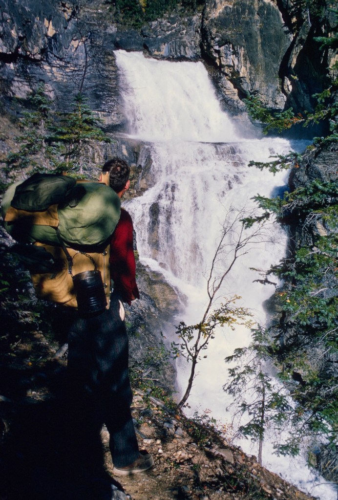
We arrived at the trailhead before noon, with plenty of time to begin our hike. In those days the park was far less developed than it is today. Now one needs permits for day hikes and overnight campers must sign in, and there are many more facilities for campers. The trail to Berg Lake and back was about 20 or 25 miles round trip, I think. We had neither tent nor rain gear, and we were counting on good weather. Luckily, the weather cooperated with clear skies and warm sunshine.


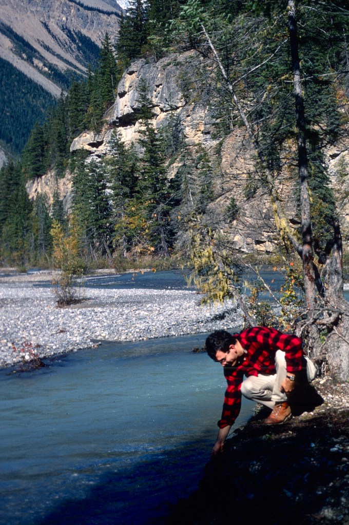
After an easy start, the trail rose quickly. By the time we reached Berg Lake we had climbed about 800 meters on a trail that rose rather steeply. On the first day, as the sun set, we were not near any campground, so we stepped off the trail and camped above the Robson River. To be truthful, I don’t know that we even had a trail map that showed campgrounds.
In a forested area, just off the path, the rushing water in the gorge beside us made for a damp evening as well as a loud one. In the morning, we noticed bear tracks on the trail. We had no protection against bears, but Jim put a rock in a tin can, the idea of which is that the rattle might prevent us from startling a bear. We jangled along and never saw any bears.
Everything was all rather casual, and certainly would not be permitted today. I don’t know if campfires were permitted then, but we made them where we camped. Today they are strictly forbidden.
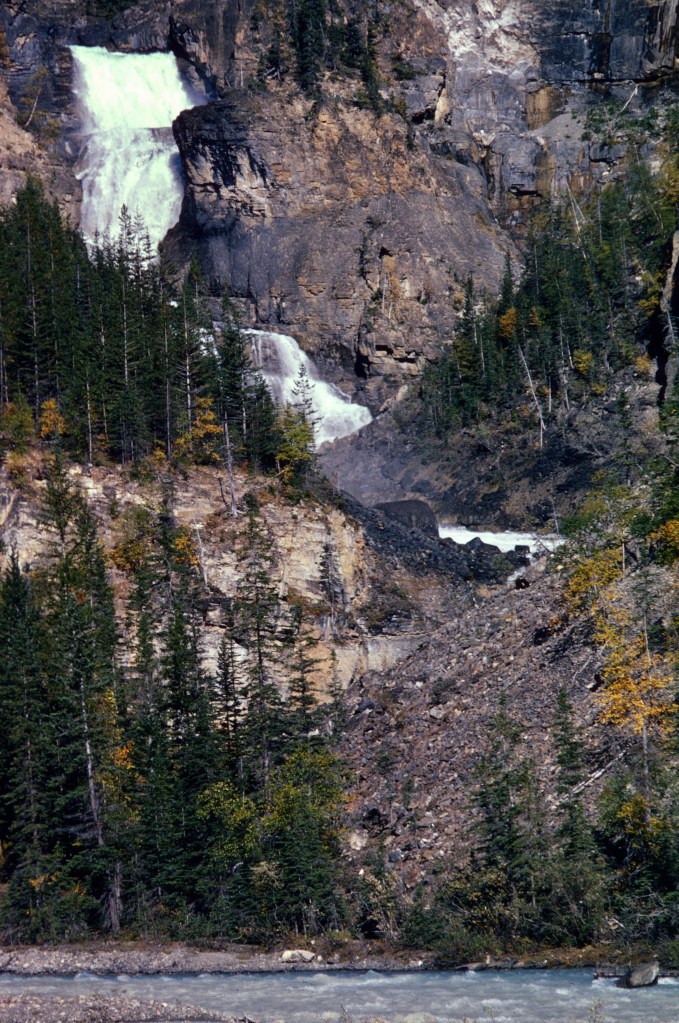
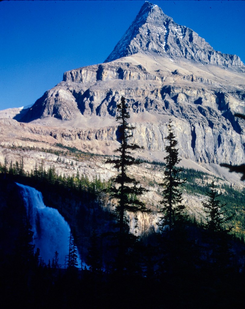
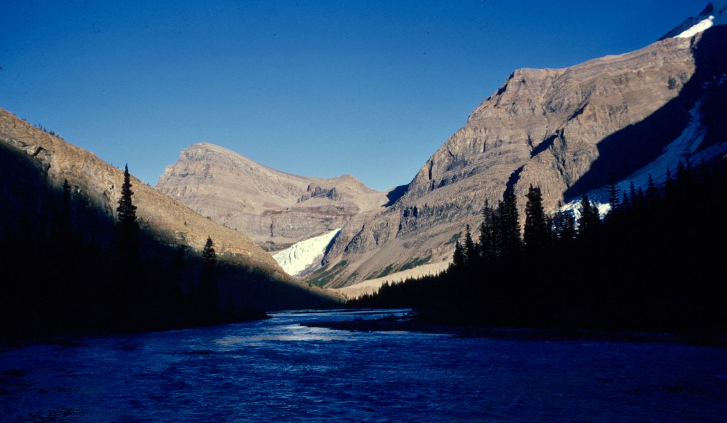
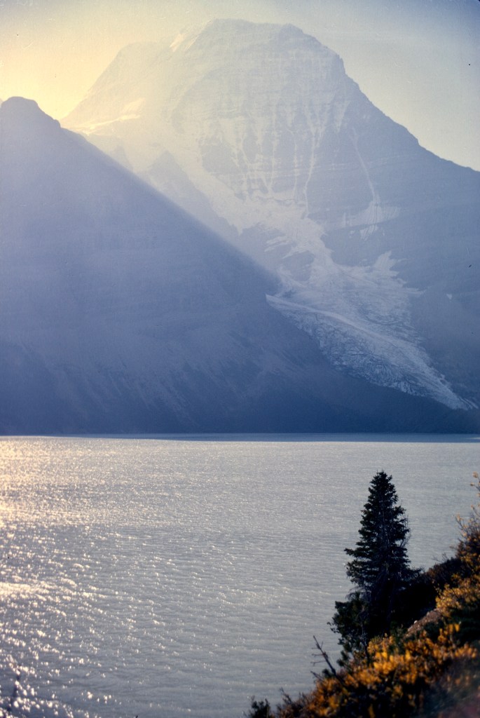
The scenery was spectacular: shining lakes, hanging glaciers, and waterfall after waterfall, all set among high glaciated peaks.
At one point we saw a party on horses in the distance. The horses shared our trail in places, and where they did, their hooves tore it up so that the trail was sometimes muddy or boggy, and unpleasant for those of us on foot. Since the horses could easily cross fords where the river was braided, they made much better time.
In the three days we were out, we met no other hikers, but perhaps that was just a question of how late in the season we were there. In any case, we weren’t unhappy for the solitude. The trail was ours for a few days, and it was a gem.
The second day out was beautiful, once again warm with a clear sky, and the mountain scenery was terrific.


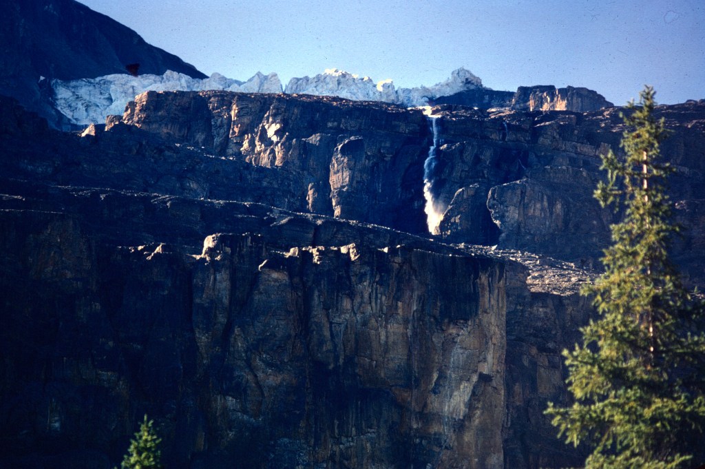
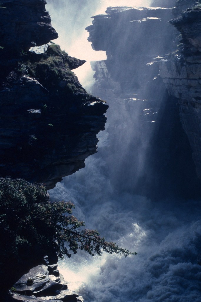
We passed the Emperor Falls, a spectacular waterfall, under the shoulder of Mount Robson.

The Berg Lake trail is not demanding, but we carried heavy gear. The days of lightweight synthetics were still in the future. Jim was in good shape, but I struggled a bit to keep up. By the time we climbed out of The Valley of a Thousand Falls, I was beat and we camped at a spot near the exit of the Robson River from Berg Lake. The sun was setting. The September days were still warm, but they were growing short, and long before the last light disappeared from the high peaks, the valleys had fallen into darkness.
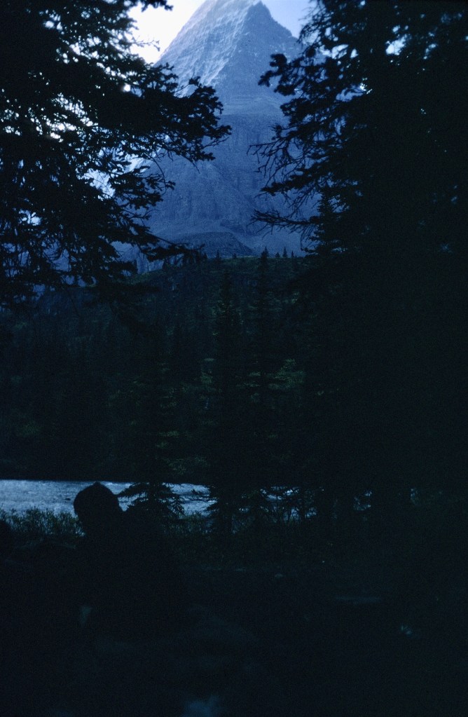
In the morning we hiked a bit further to get some pictures of Mount Robson’s face and Berg Lake. There was some haze, possibly from forest fires, a regular summer occurrence in the west, though not on today’s scale.


With the weather changing and with no tent, we headed back to the trailhead. The walk down was easy and we were able to spend the night, a rainy one, in a Jasper motel. The warm shower there felt great, and I was fortunate to find a large tick before it had a chance to settle in and make a meal from me.
We decided that the weather and the distance would not permit the Tonquin Valley-Amethyst Lakes trip, a long hike in, so we headed south along the Icefields Parkway to the Lake Louise area in Banff National Park where we could do an interesting day hike, but that’s for another post.
Time was running out. Summer had ended. The Peace Corps beckoned. And snow was beginning to fall at higher elevations.
Though I was able to return to Jasper, I have never been back to the Mt. Robson area. I did see the mountain again in 1972, however. I had been visiting Marc Miller (Morocco X) at his parents’ summer home on Camano Island just north of Seattle. I needed to return East to begin a summer Arabic program at Georgetown, and I had little money left. Marc and his younger brother drove me to Vancouver where I got a coach seat on a Canadian National train to Toronto.The two and a half day ride seemed much longer, and, sleeping in a coach seat and breathing the stale air of the train. I felt pretty grubby by the time that I arrived in Toronto. I had done the trip before in a Pullman car, and that was luxurious by comparaison.

On the morning of the first full day on the train, I woke to a spectacular view of Mt. Robson just after daybreak. The CN tracks pass through the Yellowknife Pass, and the southern face of the mountain is in full view. Today tourist trains give the same view, albeit with much more comfort.
Shortly after viewing the mountain, the train stopped briefly in Jasper. I got off to stretch my legs. In the summer sun, the air was so fresh and sweet that I needed to remind myself that I was due in Washington in a few days and could not stay. I boarded the train with true regret.
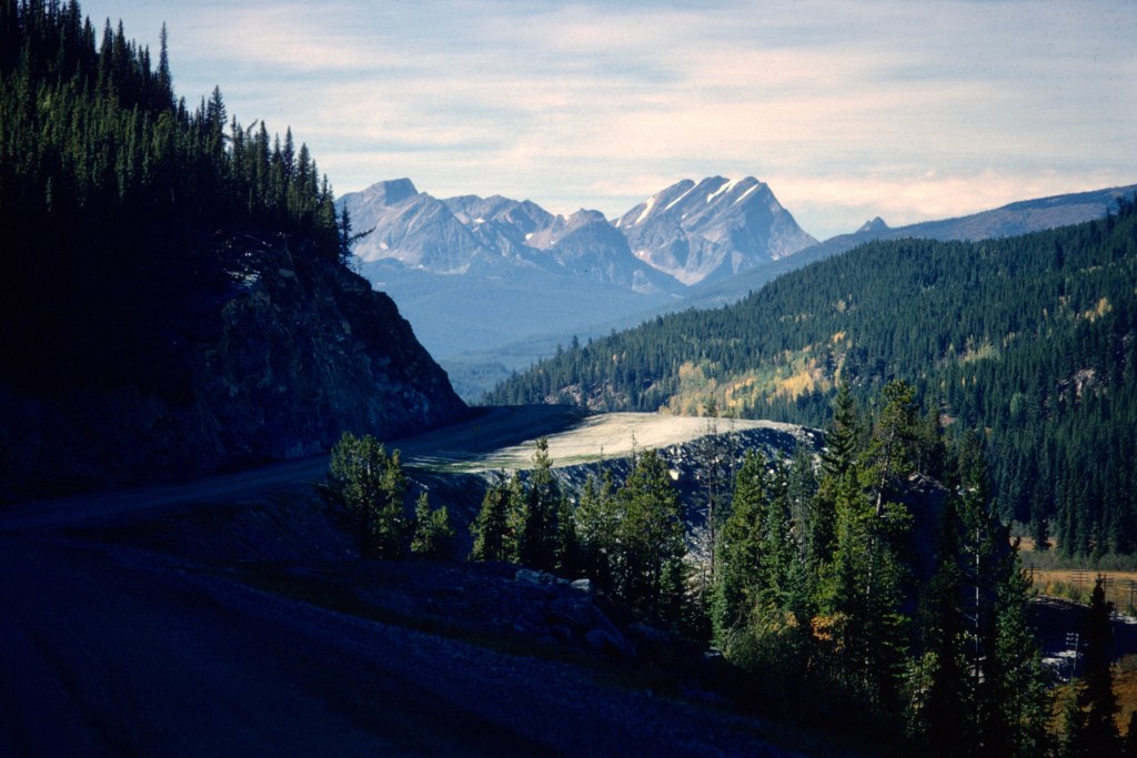
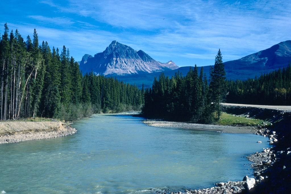
Here are a few views from the drive from Jasper south to Banff. They really do not do the scenery justice. The splendor is continuous.


There is no danger that the Athabaska will disappear soon, though some predict that 500 miles south in the American Glacier National Park, the glaciers that give the park its name may disappear by the end of the decade. Near Jasper, the Angel Glacier, which seems to float on the side of Mount Edith Cavell, has visibly changed shape since I first saw it in 1966.

Great story and amazing pictures – thanks.
( The Guardian used to be known as the Grauniad due to its (alleged) many typographical errors. I suspect that computers have put paid to that! )
LikeLike
Thank you. For a young city kid, it was a great trip. And thanks for the tidbit about the Guardian. As to typos, you should see the drafts of my posts. My friend Jim works hard at correcting them—and he does a lot of factchecking, too. About 10 years ago there was an interesting article in The New Yorker by the essayist John McPhee on factchecking and how seriously some publications work at it. It’s unfortunate that our politicians don’t give it the same importance.
LikeLiked by 1 person
Well, I don’t look for typos in the Guardian, but I did find one in the second article that I read this morning. I wish that I could see my own typos so effortlessly.
LikeLiked by 1 person
Dave, I immensely enjoyed this account and the photos. You write to well I feel like I am there. The photos show me what I missed.
LikeLike
That’s a nice thing for you to say, Kinza. Thank you! I get a lot of help with my writing from Jim Erickson, who has the ability to write well in several languages!
LikeLike
Wow…Some hike you guys had in ’67, and the awe inspiring views you captured along the way certainly do it justice, but the leap from Guardian to glacier did seem like kind of a stretch.
LikeLike
Just looking for something to write about using the old slides that I have digitized. Interestingly, I have much more vivid memories of the trip than Jim has. Maybe living in Montana, he took it all for granted a little bit. But I think Michael Palin’s comments on how to travel really should be taken seriously by all travelers.
After writing the post, I thought about how many times I have been to the Canadian Rockies, and was surprised. I went through them or camped there in 1964, 1966, 1967, 1972, 1974, and 1989. I have some other hikes to write about, but whether or not they fit neatly into a blog about Peace Corps is a stretch.
I wrote earlier about being frustrated by the couloir de neige on Tazaghart. There was a lot of snow in it when Louden and I went there, but the issue for us, new to crampons and ice, was the start as I think we could have done it. The snow would have been soft once we exited the chimney midway up and were in the morning sun. I keep hoping that someone will comment about the snow conditions there today.
With COVID-19 in full force, I spend these days thinking about old trips and splitting wood. I think both activities keep me warm.
LikeLike
Dave,
Wonderful wonderful pictures. My God, I had forgotten how magnificent the country we hiked through was and is still today. Weird too to see my old camping gear. As you say, before outdoor technology took off, camping & hiking gear was simple and sometimes clunky, like the 10 gallon tin can for cooking that dangled down from my Trapper Nelson backpack, and my Redwing hiking boots — though Redwings are still great boots today. Sorry I complained too much about the bumpy gravel road. It’s just that my VW beetle was a city kid. Thank you so much for preserving and resurrecting our long ago adventure.
Jim
LikeLike
Thanks for the kind comment, Jim, a comment full of detail that I had forgotten. You and that green VW Beetle made that trip possible!
LikeLike
But it was a 1 gallon tin can dangling from my backpack, not a 10 gallon can!
Jim
LikeLike
Size doesn’t matter. We didn’t meet any bears on the trail, you used it for cooking, and, best of all, it cost nothing!
LikeLike
Wow!
LikeLike