
The Oued Sebou is not the longest of Morocco’s rivers, yet still carries the largest volume of water of any of them. Bringing vital water to irrigated agriculture in the Gharb, one of Morocco’s richest agricultural areas, the Sebou flows into the Atlantic at Kenitra. The Sebou is the only Moroccan river navigable by ships, and Kenitra has the country’s only natural port. The lack of navigable rivers and safe Atlantic harbors no doubt constituted a major factor in the preservation of the area’s independence from ancient times til the twentieth century.
The Sebou begins on the high basalt covered plateaus of the Middle Atlas Mountains, plateaus dotted by recent volcanic cones.


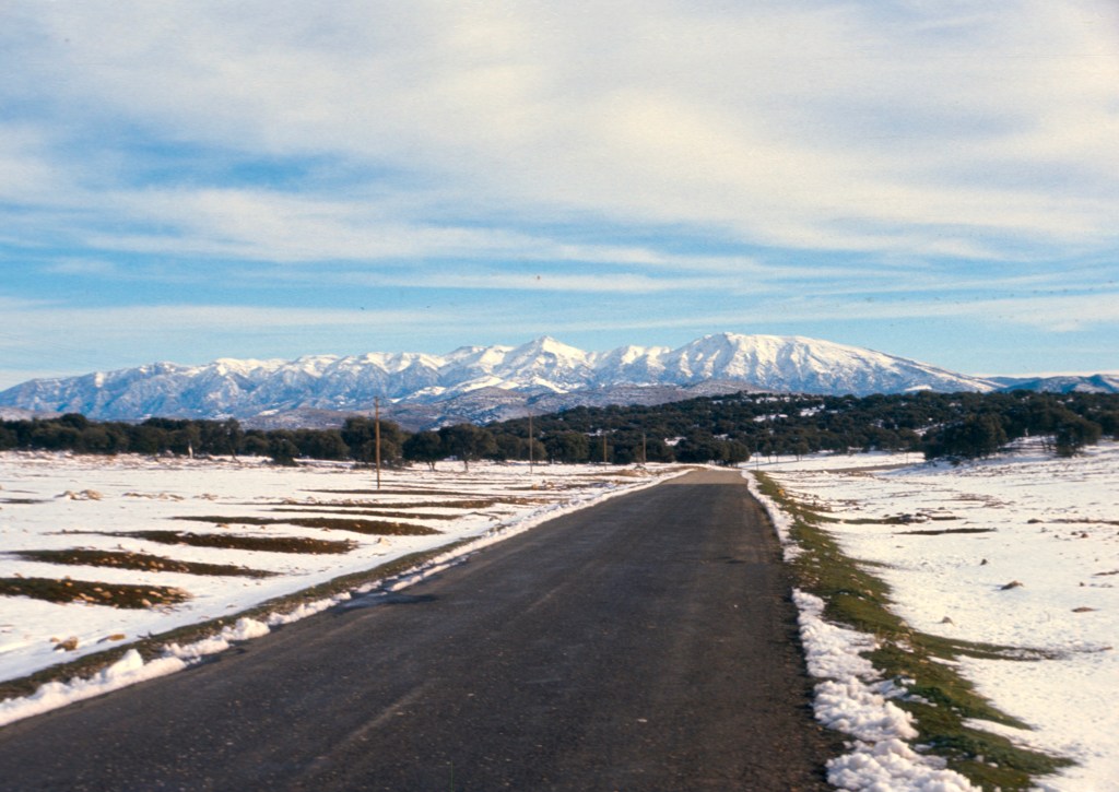
Near the villages of Timhadite and Guigou, it appropriately has a Berber name in its upper reaches, Asif n Guigou. It flows southeast away from the Moulouya river basin.


Flowing down through foothills and limestone plateaus, it gains water, from artesian springs, as well as an Arab name, Oued Sebou, though it is thought that the origin of this Arabic name is also Berber. Pliny the Elder, the Roman writer who wrote The Natural History, mentions it as Sebubus, so the name is ancient indeed. Pliny the Elder was a general. He had an immense library, and though he never visited Morocco, then Mauretania Tingitana, a part of the Empire, he wrote about it. Pliny died tragically, or maybe imprudently, trying to rescue friends from the eruption of Vesuvius in 79 C.E. That eruption was witnessed by his nephew, Pliny the Younger, who wrote of his family’s dramatic escape.

The Sebou cuts very deep gorges in places, winding through the mountains of the Middle Atlas. Here it is about to exit the mountains, before flowing down toward the Saïs plain near the city of Fes.

Shortly thereafter, it gains more water from rivers flowing from the Rif before meandering again across the croplands of the Gharb and into the Atlantic Ocean.

My experience with the Sebou comes from its proximity to Sefrou. A bridge crosses it on the road to El Menzel, where it emerges from a deep gorge.
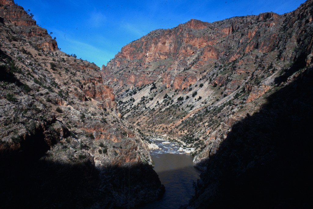
this photo.

At that point the Sebou often flowed clear, especially in the summer when an artesian spring, the Ain Sebou dilutes its muddy waters.
One could not miss the river if one traveled to El Menzel, or farther to Ahermoumou, where one had a superb view of Bouiblane.


The gorges were a wild place to hike, and the river was clean and cold enough for a refreshing swim in the summer.

The Ain Sebou, ain means spring in Arabic, was impressive, with cold, clear water unwelling into a basin and then immediately overflowing into the muddy waters of the adjacent river. I never swam in the spring, but watched others do it, and, in retrospect, I wish I had. Just another of those things one wishes one had tried, but never got around to doing.

After leaving the mountains, downstream toward Fes, the river flows peacefully.

Near Fes, however, flooding from the Sebou begins to represent a significant problem, and after that it receives great early spring floods from the rains and melting snows of the Rif.


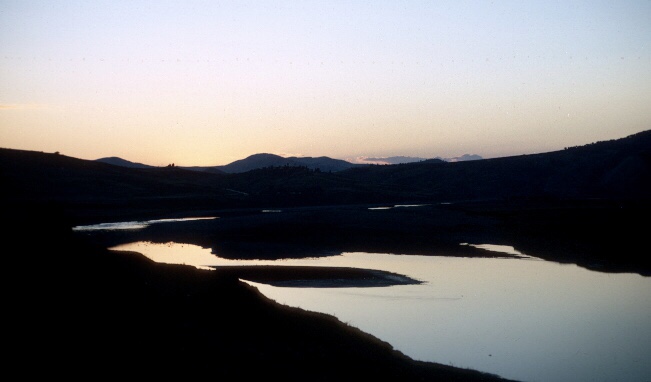
Only near it’s mouth on the Atlantic, does the Sebou become calm and placid, a safe anchorage for ocean going ships.
Today the Sebou suffers from pollution. The runoff from agriculture and the lack of infrastructure for waste treatment in a country with a rapidly growing population make water quality a serious issue for Moroccans. The variation in flow between summer and winter months and increasing diversions along the course of the river only exacerbate the water quality problems that the Moroccan government faces along the Sebou and other rivers.
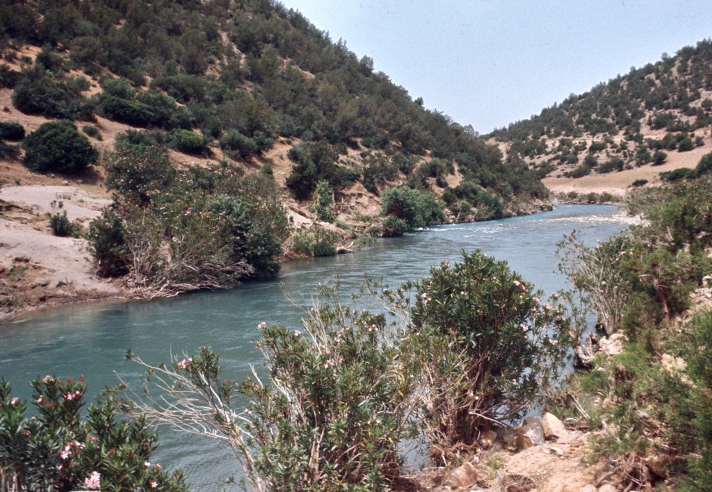
Far away in time and place, I remember a different river, pouring out of hillside, and flowing clear and clean among the blooming oleanders.

Well if were in any doubt about the beauty of Morocco, we aren’t now.
LikeLike