This article has been contributed by Louden Kiracofe, friend, climbing buddy, and retired doctor.
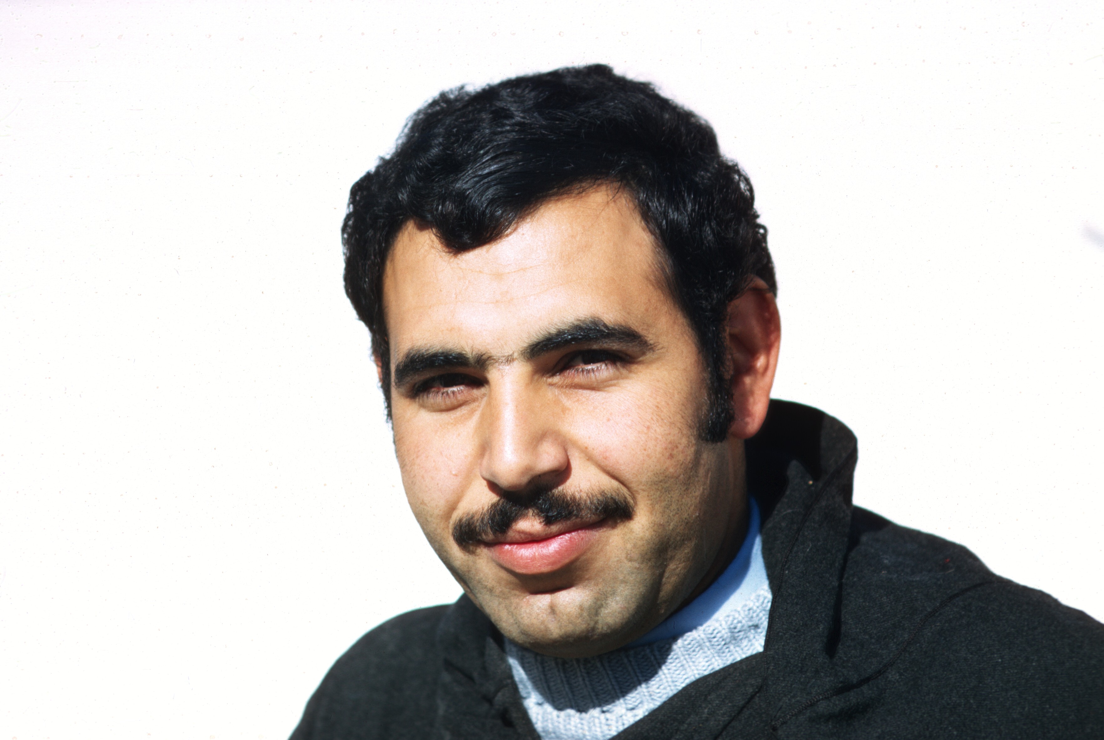
Aissawa at the Cherry Festival, Sefrou. June 1968. Photo by Gaylord Barr.
My wife and I arrived in Rabat in July 1969 – the year of the first lunar landing – for my two-year assignment as Peace Corps physician to care for the P.C. volunteers. The volunteers were situated throughout Morocco. I would see each one at least twice a year to administer required immunizations. As a physician from the United States, I was often asked to see individual Moroccans as patients and was frequently invited to attend private ceremonies rarely seen by foreigners. Often I was sought for medical advice by tourists and Americans living in Morocco. Vincent Crapanzano contacted me regarding his wife, Jane, who had seen a local doctor and was told she had chronic appendicitis and had been scheduled for surgery. At Vincent’s request I saw Jane. After my examination I believed Jane had a bacterial infection – salmonellosis – a common bacterial infection that many volunteers (as well as myself) contracted. I did not believe she needed surgery (an appendectomy) and started her on antibiotics. She rapidly responded. They were grateful and we began to occasionally get together.
Aissawa musician, Sefrou. 1968
Vincent is a world-renowned cultural anthropologist who was researching Sufi beliefs and healing ceremonies. His investigations were later published in a book: Tuhami: Portait of a Moroccan. Vincent asked if I’d accompany him to a Sufi healing ceremony. He had previously witnessed such a ceremony and wanted to be certain that what he’d seen was actual fact (really happening) and not the consequence of his being in a trance along with the Sufis performing the ritual. I readily accepted his invitation.
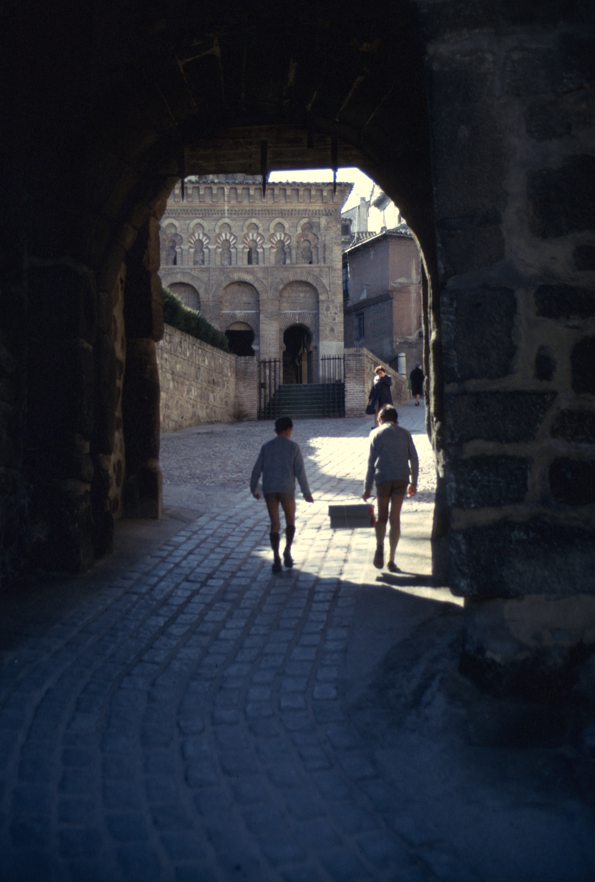
Eating fire, being bitten by snakes, and dancing into a trance. Sefrou, 1968.
We, one late evening, drove to an old section of Rabat – an area where tourists didn’t venture. Vincent rapped on a door and we were invited in and up the stairs to a small unfurnished room with only two chairs which were for us. The healing ceremony was to heal the young daughter of the host. The 8-year old girl had suddenly suffered a paralysis of her right arm. It was thought to be the consequence of having offended a djinn, a spirit. It would be considered a “conversion reaction” by Western medical standards. Several minutes later another door opened and 10 men clothed in heavy djellabas filed in. One sat on a small stool in a corner with a drum. Seated next to him a man who played the raita, a double-reeded flute with a high pitched, shrill sound. A hibachi with glowing coals was positioned in the center of the room and a small kettle was placed upon it. It quickly began to steam. The rest of the men formed a circle. The playing began. With the loud drumming and shrill sounds of the raita, the circle of men began to chant as they shuffled forward. As the music and chanting grew louder and louder, several men started to brandish jambiyyas (a traditional curved dagger) which had been concealed in their djellabas. At that point it seemed to me that the men were in a trance. The host positioned himself protectively in front of Vincent and me. One of the dancers began slashing his bald scalp with his jambiyya. Blood flowed freely down his face. Another went to the hibachi, picked up the kettle and began pouring the boiling water into his mouth. I could see steam coming from his mouth. Then another removed his sandals and with bare feet stood upon the glowing coals. Then rejoined the men still shuffling in the circle. With no apparent signal the ceremony abruptly ended. The men all left the room together and after several minutes they re-entered having animated conversations with each other. I looked very carefully and saw no evidence of scalp wounds on the man who slashed his shaven bald head; no evidence of discomfort in the man who stood barefooted on the hibachi. Another door suddenly opened and several women carried in large trays of food. Everyone began eating and amiably conversing including the man who’d poured boiling water into his mouth. It was understood that the afflicted girl was healed. I did not have any sense of having been in a trance and believed I could verify that what Vincent had been observing and what we both saw that night had – though almost unbelievable – actually occurred.
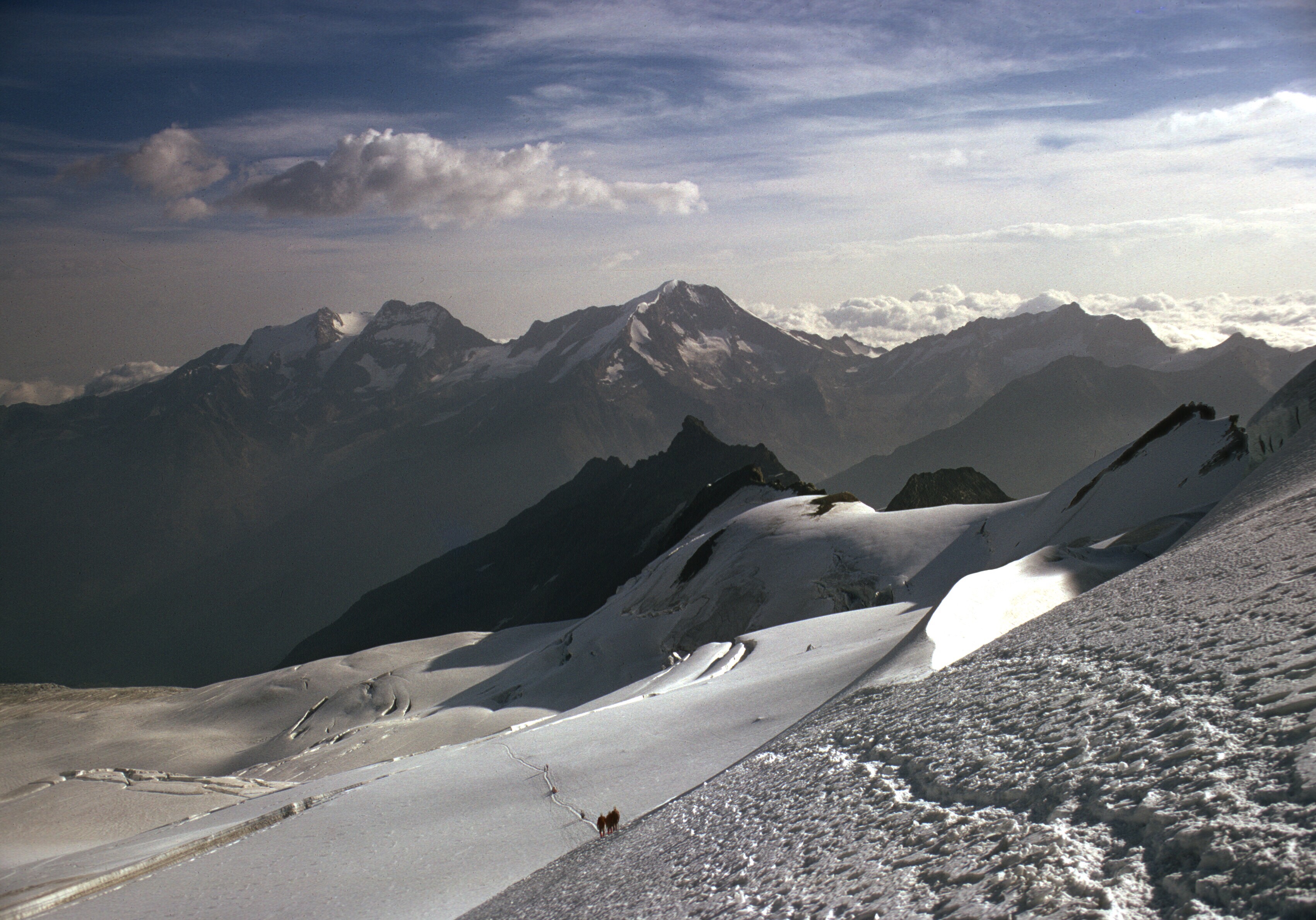
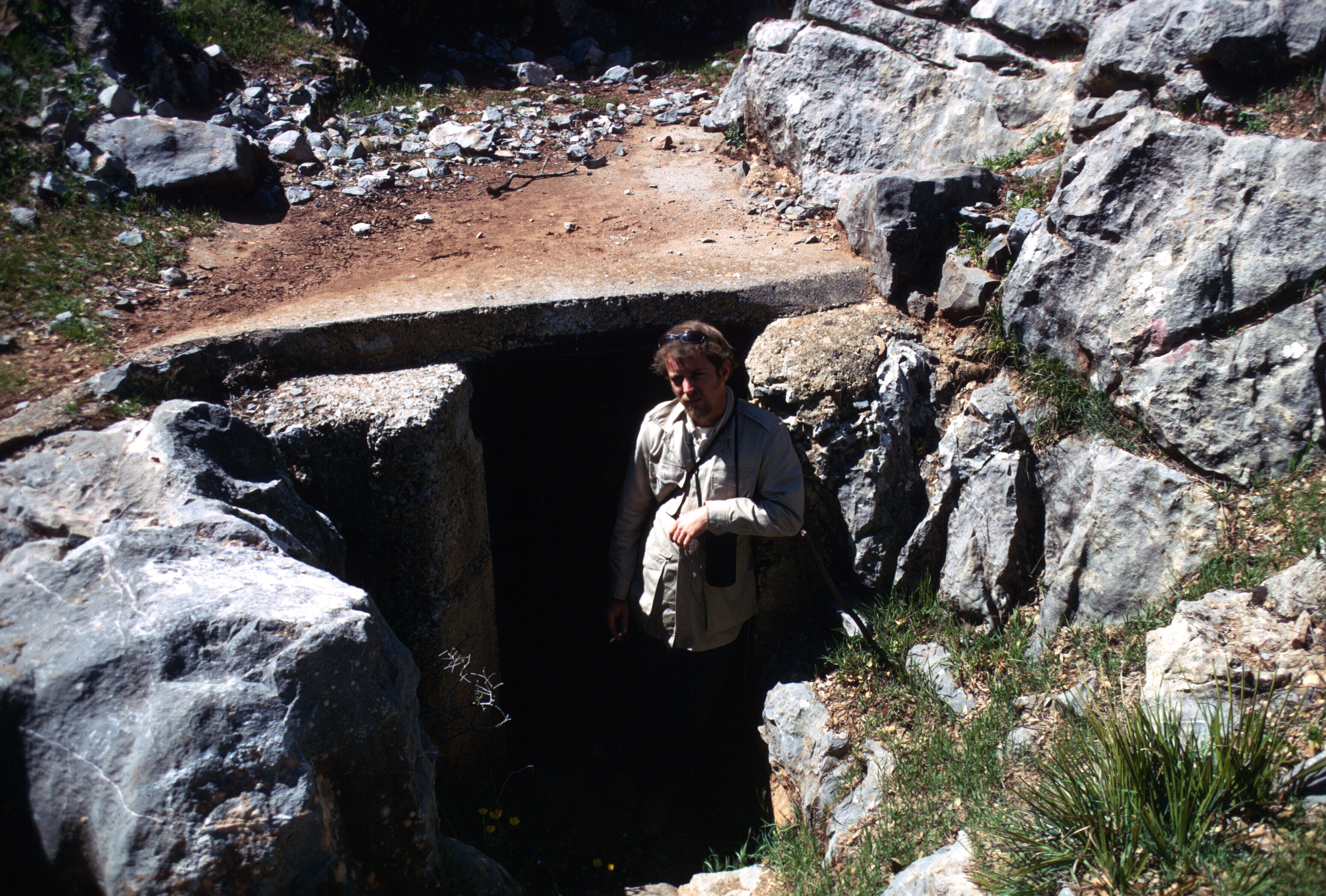
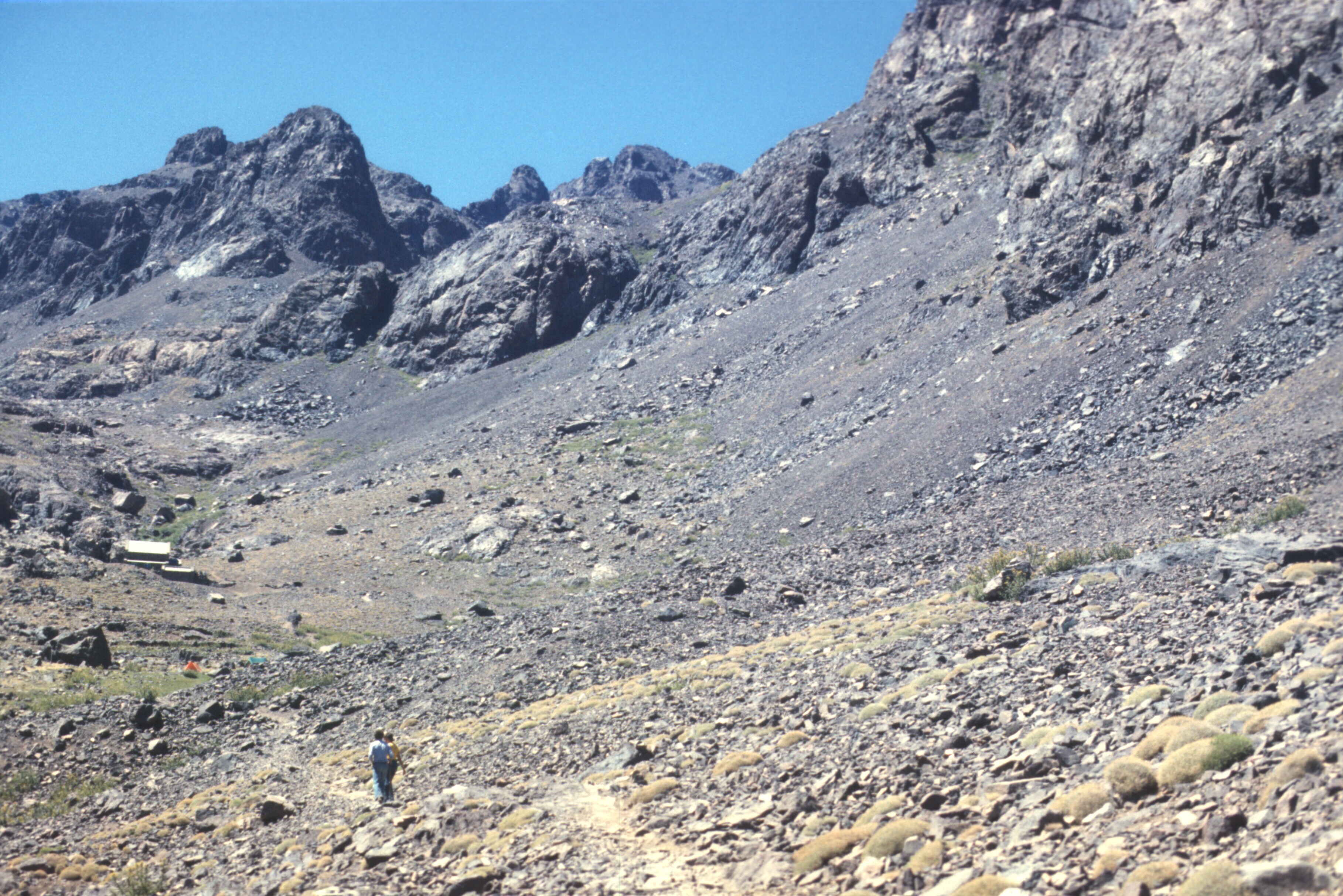
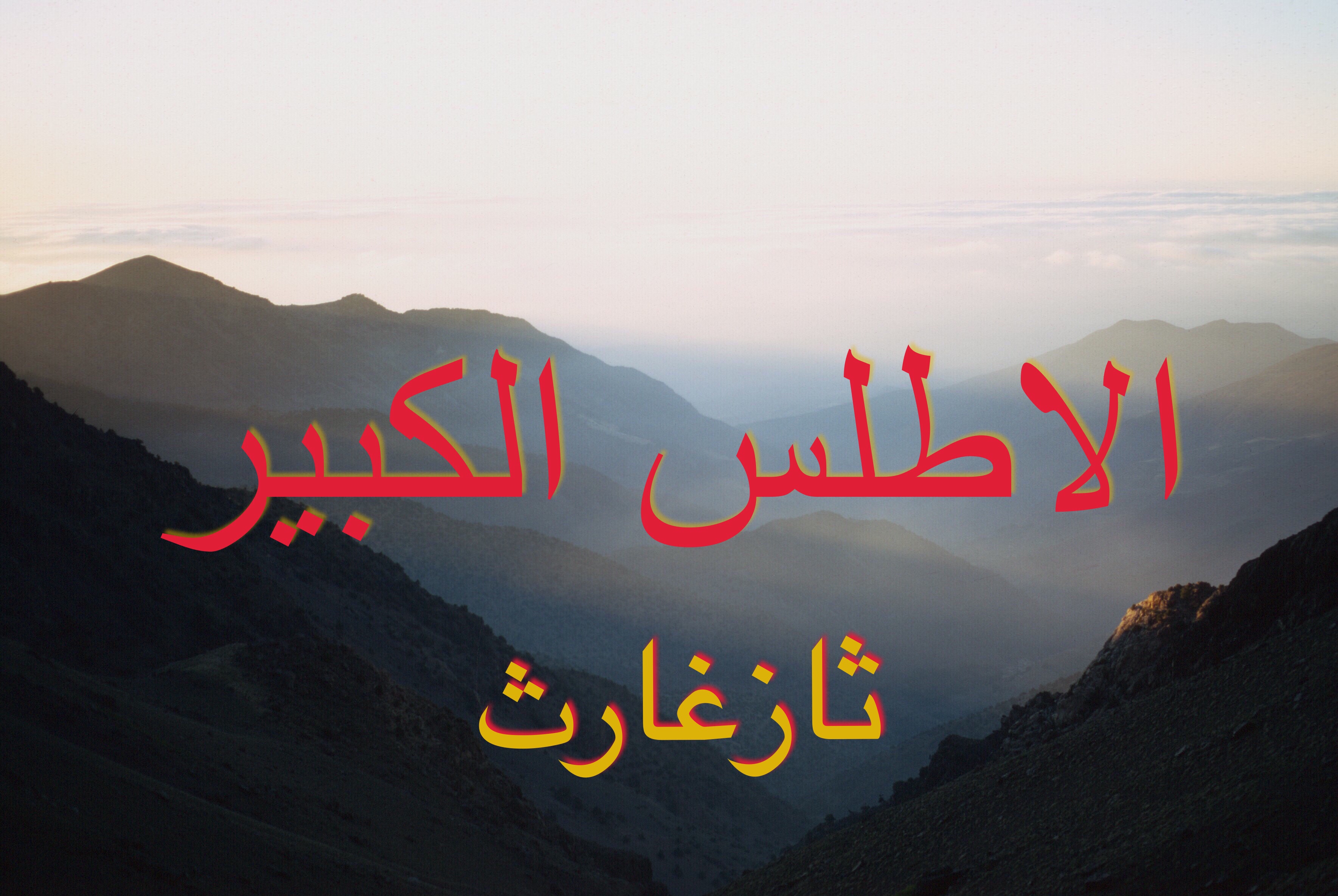
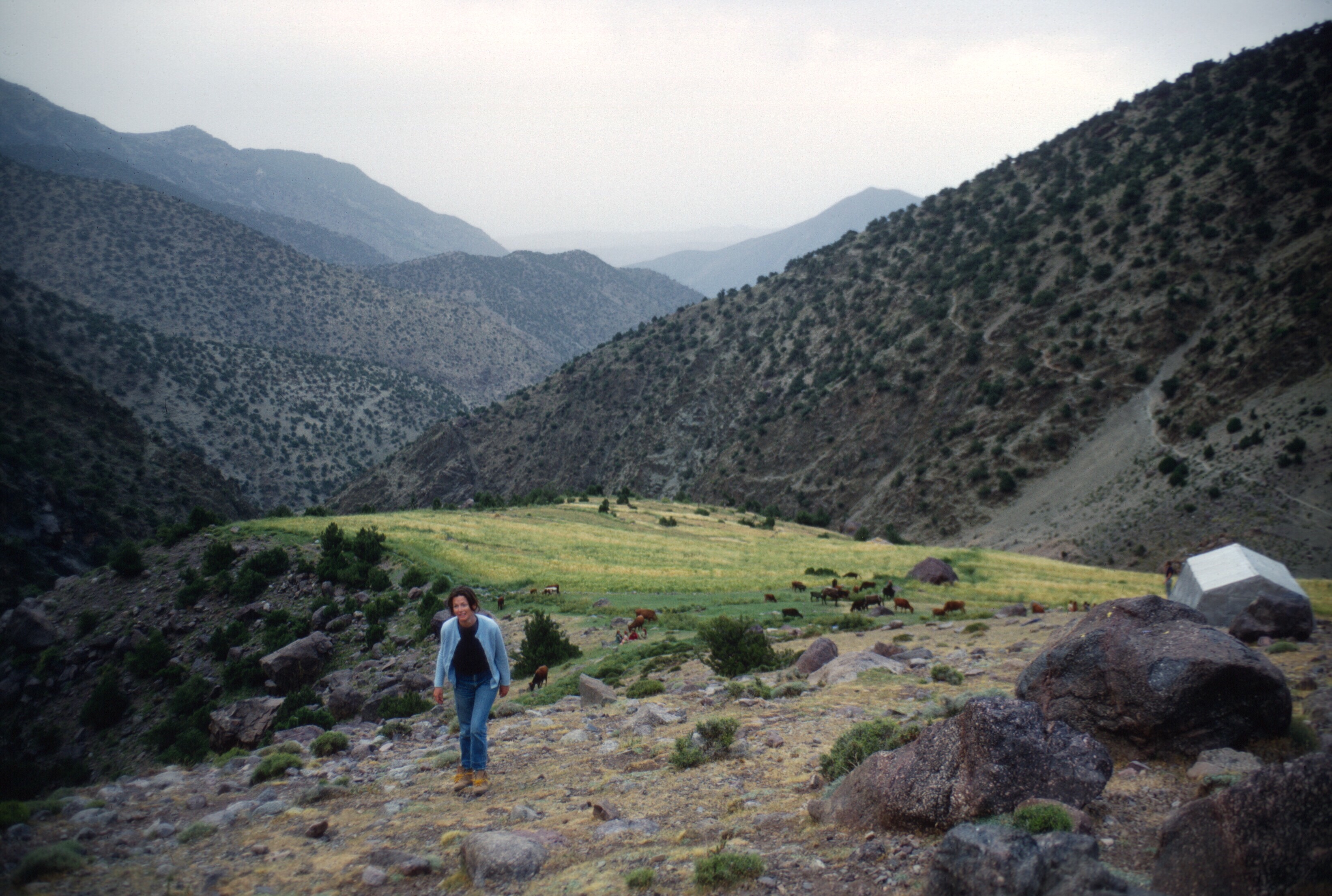
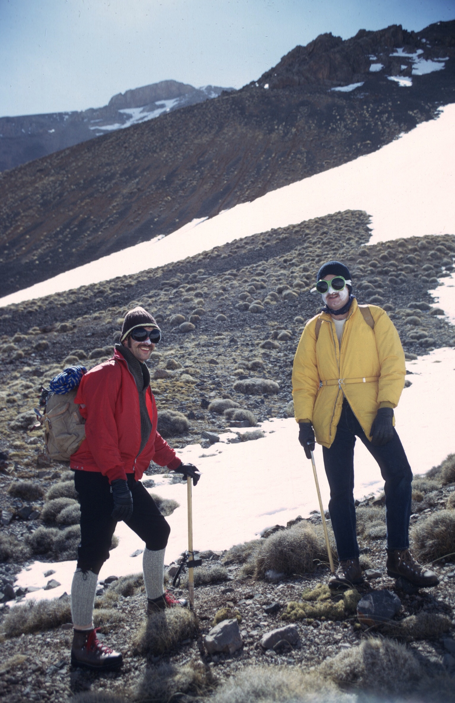
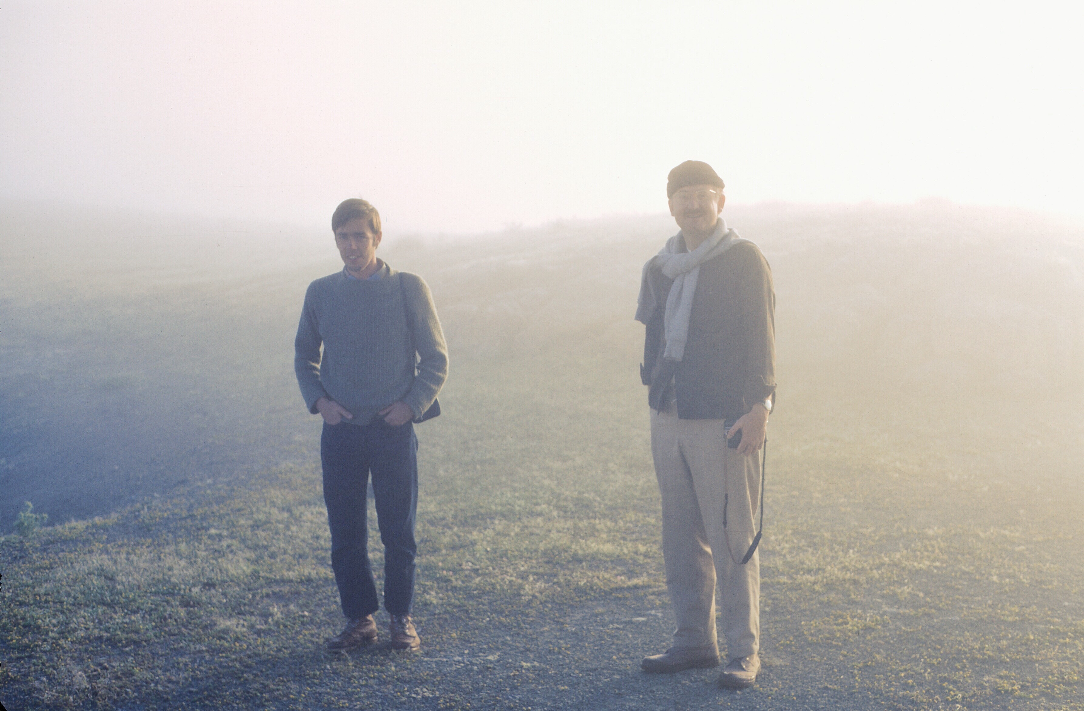
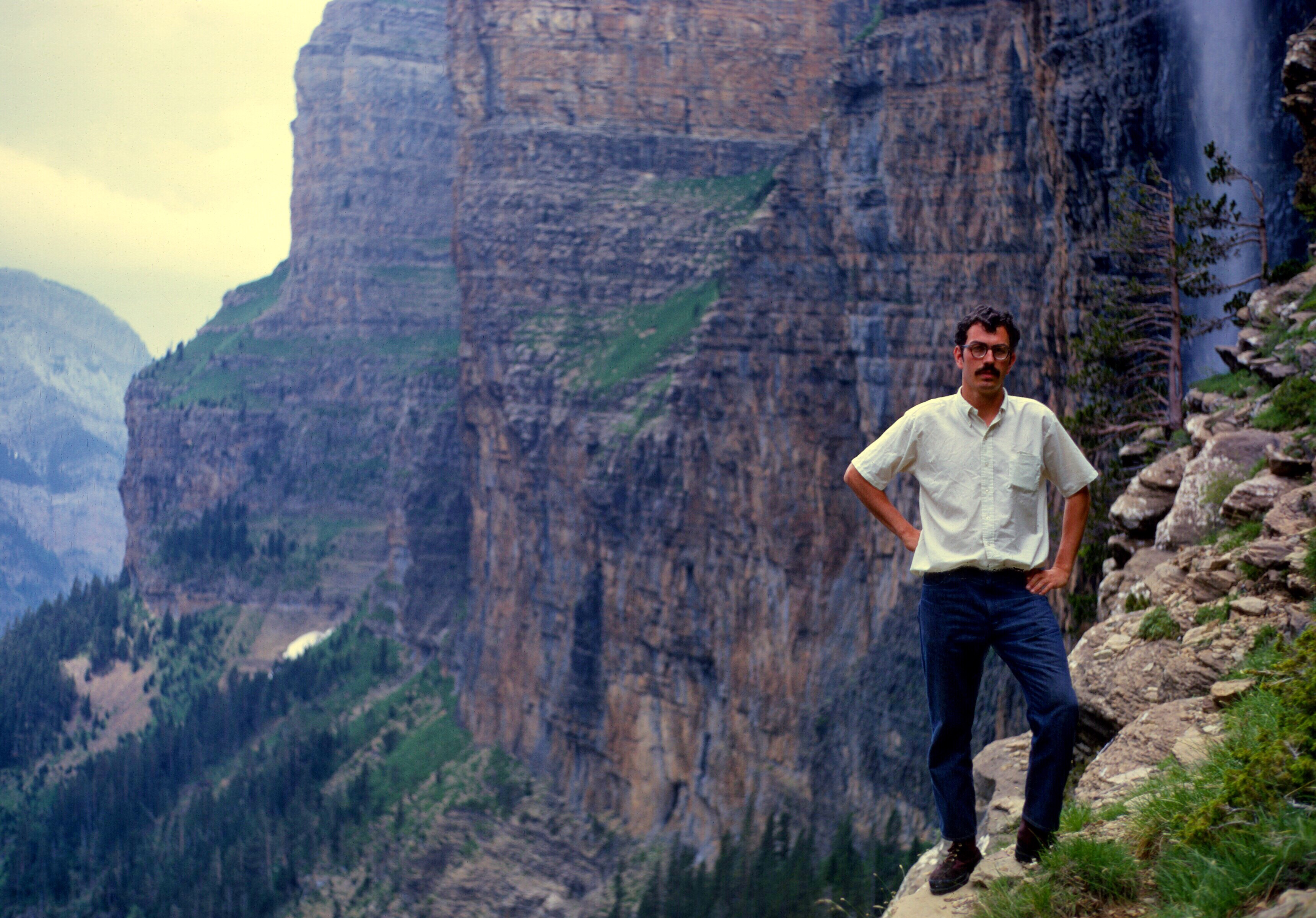
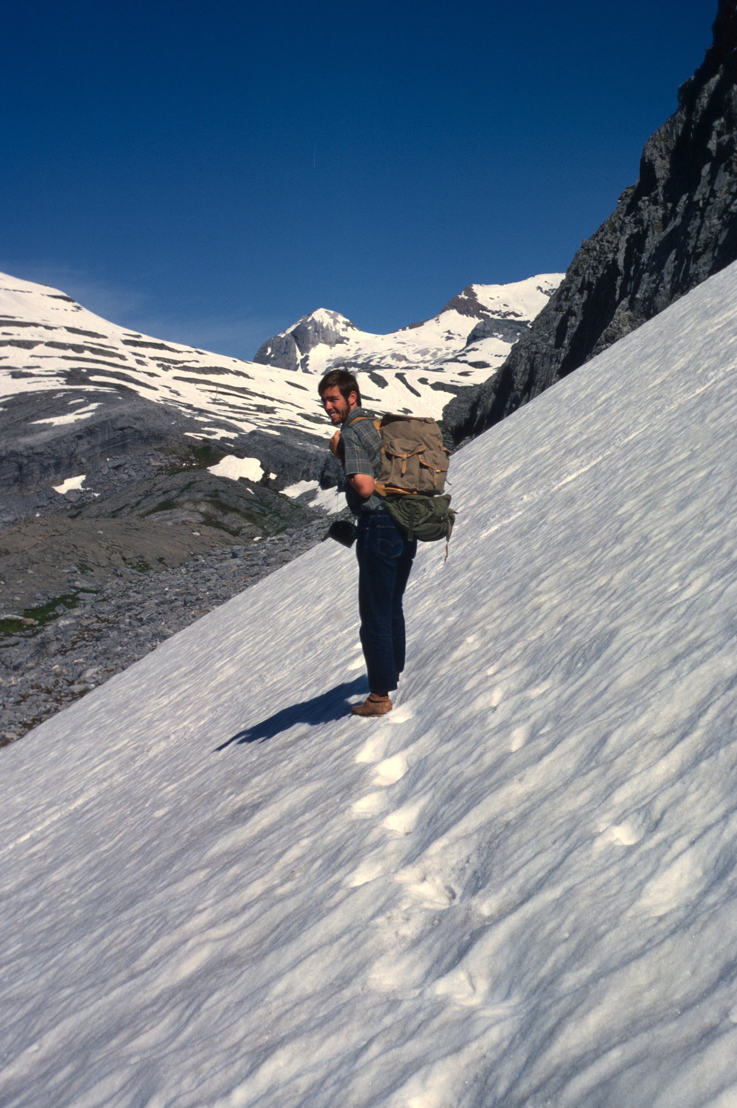
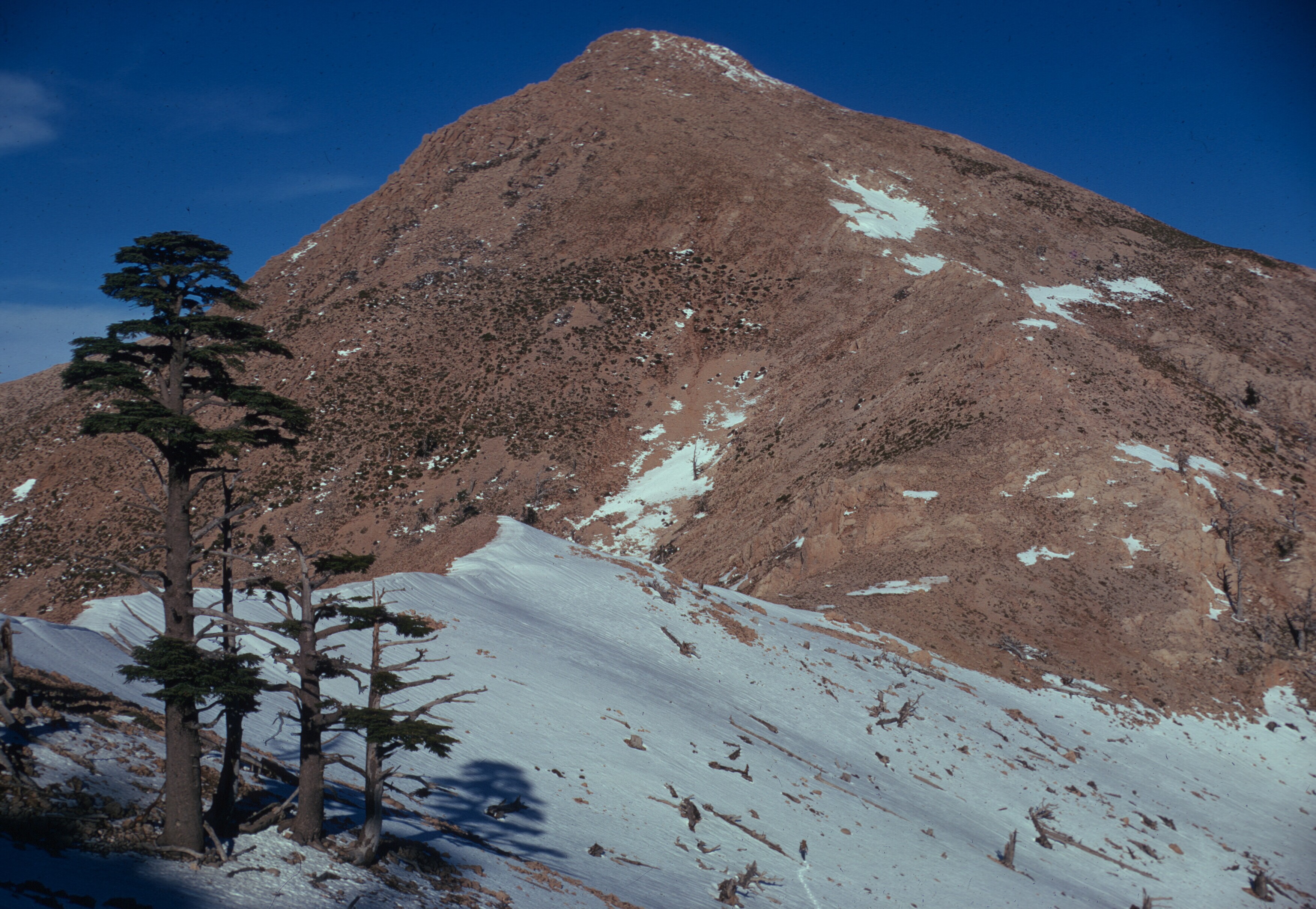
H. Louden Kiracofe, July, 1970 in the azib, en route to his first encounter with Jbel Tazaghart.
Récemment un lecteur marocain de ce blog, qui m’écrivait de l’Alberta, m’a demandé si j’avais des photos que je pouvais partager de la fête des cerises.
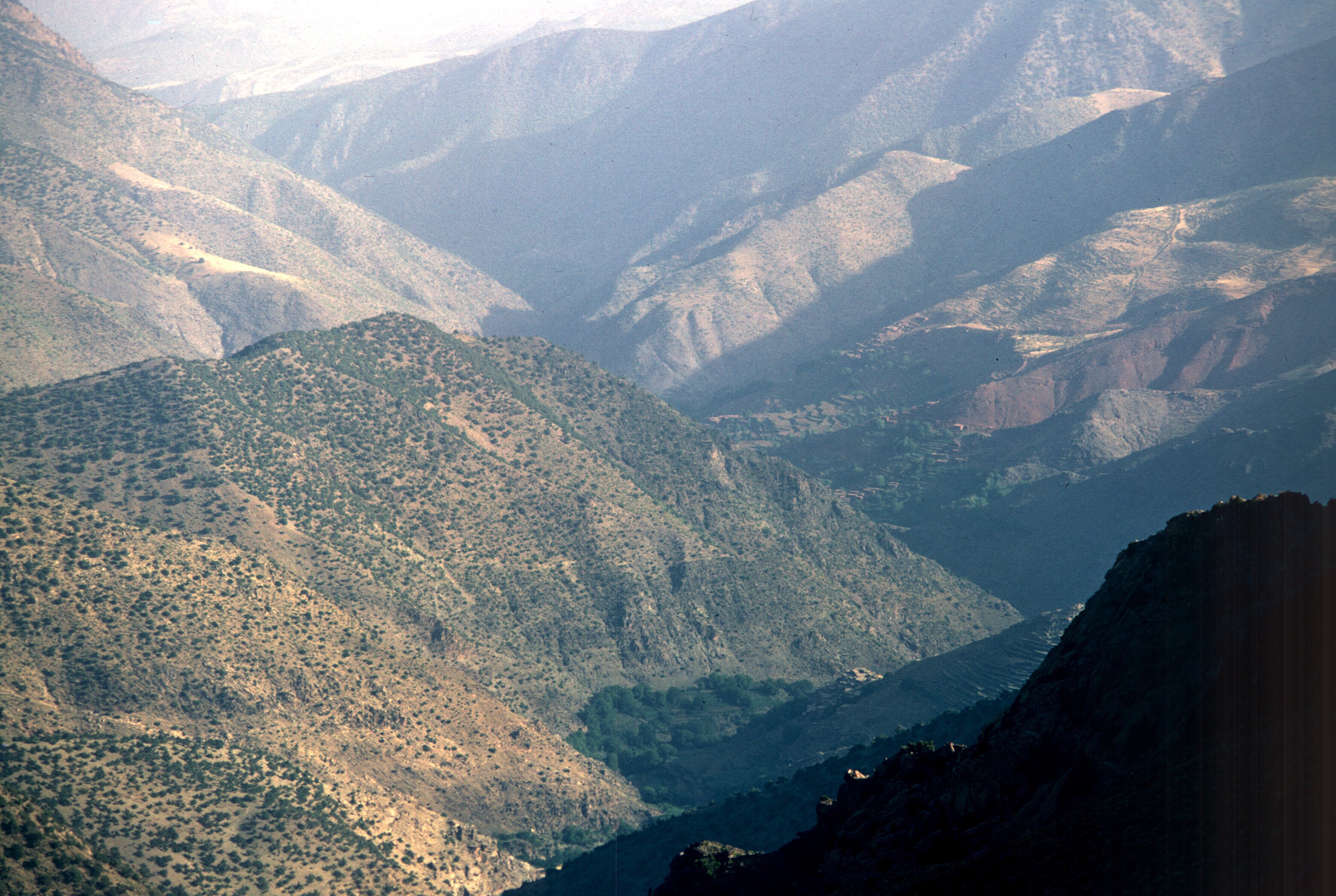
Le Maroc, spectaculaire par sa beauté naturelle, est également un pays de spectacles. Quant à moi, le festival folklorique de Marrakech vient immédiatement à l’esprit, ainsi que les diverses célébrations de saints hommes et de confréries religieuses. Ceci étant dit, il existe au pays de nombreux festivals plus modestes et moins connus. Parmi eux, le festival des cerises de Sefrou, dont le premier date de 1920, est le plus ancien.
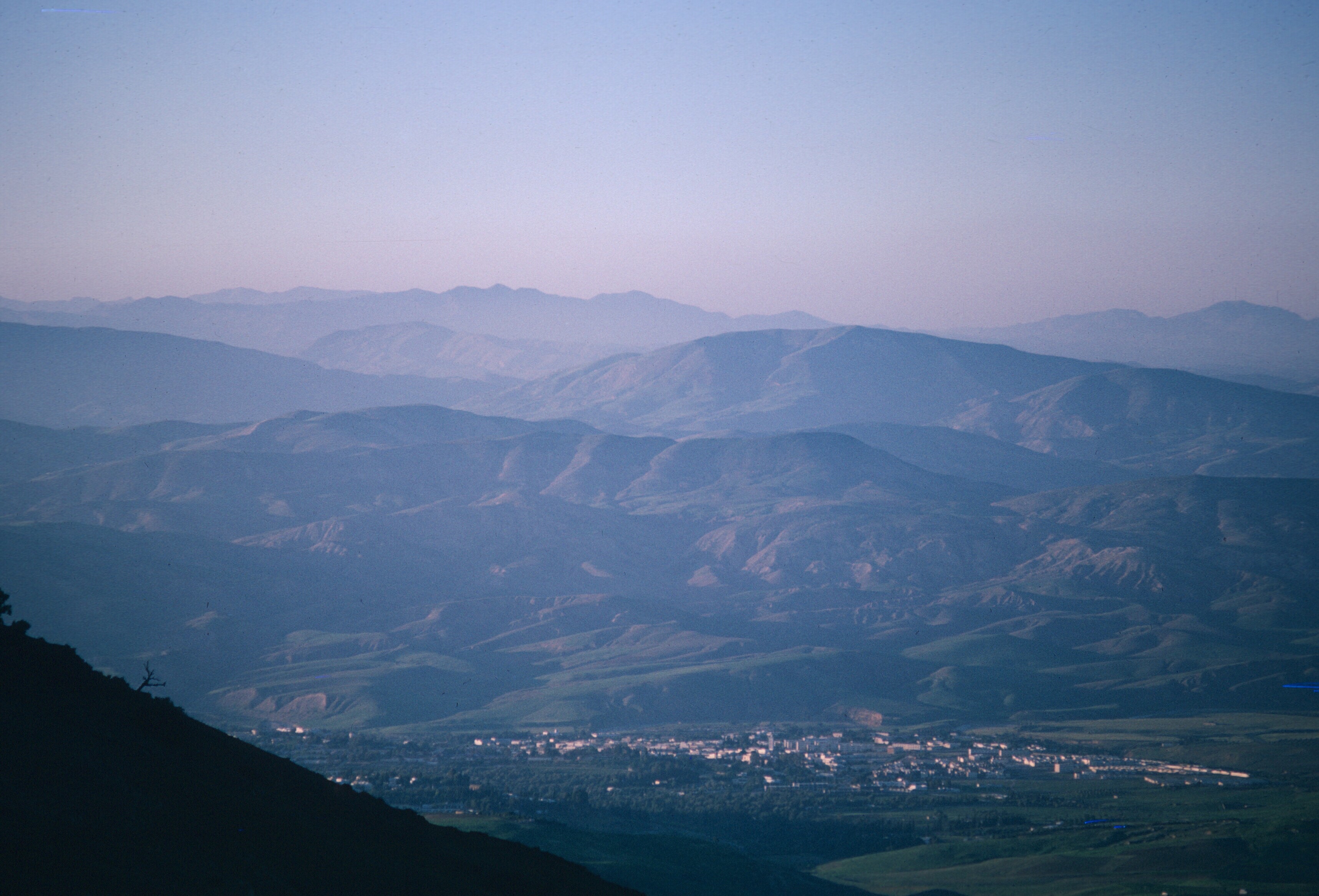
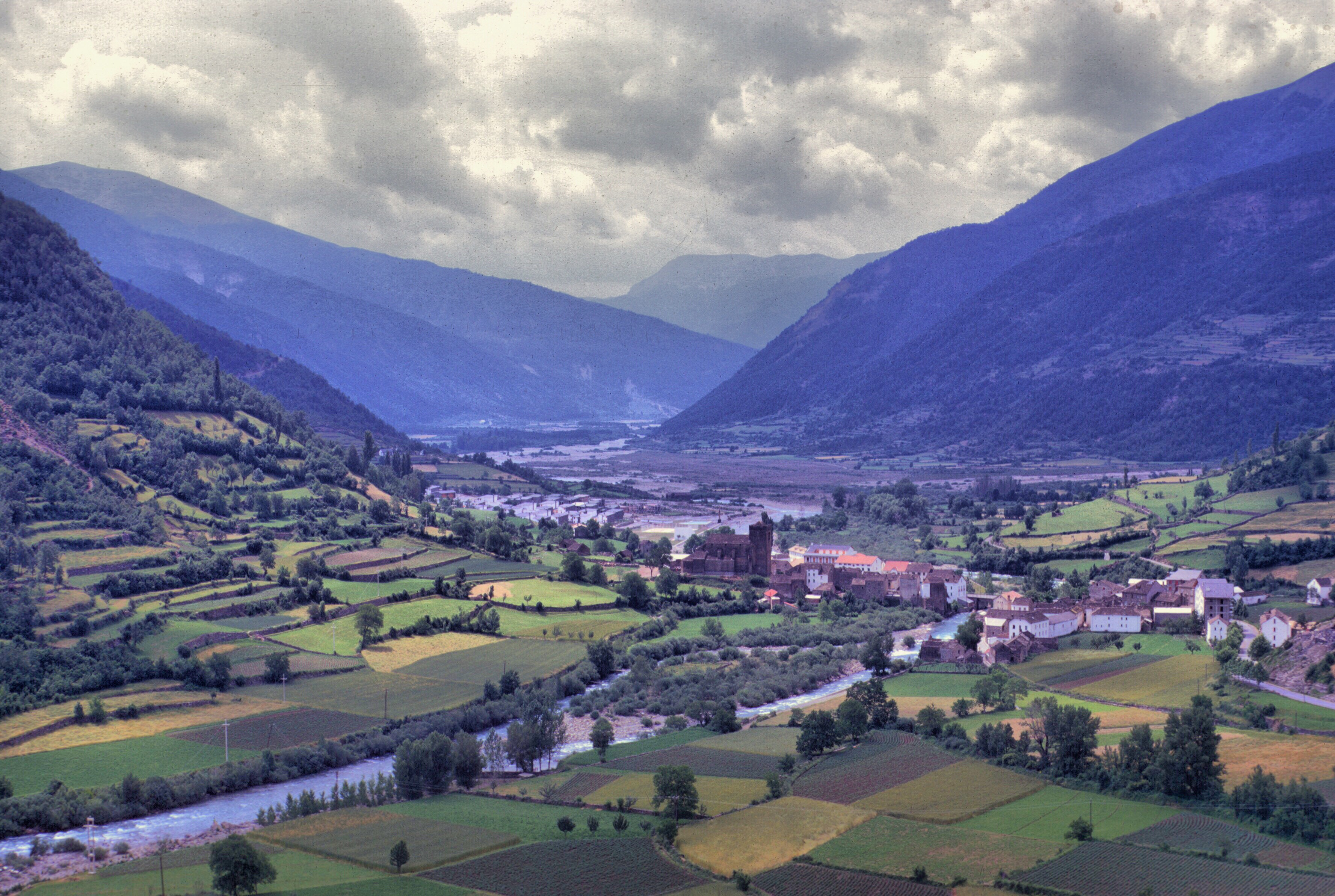
Sefrou, à seulement 28 kilomètres au sud de Fès, possède l’une des fêtes locales les plus connues, la fête des cerises. Cette ancienne ville, très proche de Fès, est traditionnellement le dernier endroit véritablement urbain au sud de Fès, sur une route autrefois connue sous le nom de treq es-sultan, soit la route du roi. Une grande route suit l’ancien itinéraire des caravanes, traversant le Moyen Atlas, descendant dans les plaines de la haute Moulouya, puis remontant pour traverser le Haut Atlas et aboutir à Tafilelt, berceau de la dynastie alaouite, à l’extrême limite du Sahara. Aujourd’hui, les touristes empruntent cette route pour atteindre les impressionnantes dunes de sable d’Erfoud, et les camionneurs transportent leurs cargaisons de produits manufacturés, de dattes et de safran vers et depuis Fès, en bravant les routes glissantes et enneigées des plateaux du Moyen Atlas.
Table d’orientation palais jamaï Fes : Cette table d’orientation, objet typiquement français, se trouvait dans les jardins de l’hôtel Palais Jemaï, sur les hauteurs de la ville de Fès, et indiquait les points de repère importants vers le sud. Une vue de l’Oued Agaï représente Sefrou, mais après l’inondation de 1950, la ville aurait pu être mieux symbolisée par ses jardins–ou ses cerises.
La ville, qui abritait autrefois une très importante communauté juive, est aujourd’hui visitée par de nombreux touristes juifs depuis l’établissement de relations diplomatiques entre le Maroc et Israël. Il existe plusieurs sites Internet consacrés aux Juifs de Sefrou, et la ville elle-même remonte à l’époque de la fondation de Fès, ou peut-être même plus tôt.
« Une ville enfouie dans les arbres » Carte postale ancienne avec une partie de la Kelaa au premier plan à gaucheUn plan ancien de Sefrou montre presque toutes les structures de la ville enfermées derrière son mur défensif. Les Français développaient la zone située à l’extérieur du mur, à l’ouest, pour eux-mêmes. Ma maison, à l’intérieur du mur, n’avait pas encore été construite et son emplacement était encore un jardin. Plan de la ville de Sefrou. 1924
Peu de temps après mon installation à Sefrou en 1968, j’ai assisté pour la première fois à la fête des cerises de Sefrou. Gaylord Barr se trouvait déjà à Sefrou, où il travaillait à l’un des centres de travaux agricoles du ministère de l’agriculture, et Jerry Esposito enseignait l’anglais au lycée qui venait d’ouvrir, bien que Jerry ait peut-être déjà terminé son service et quitté le pays en juin. Carolis Deal et John Abel, qui avait initié dans une école primaire le poulailler dont j’ai pris la responsabilité, étaient eux aussi déjà partis.
Plusieurs autres volontaires se sont pointés à Sefrou pour participer cette année-là : Phil Morgan, Marc Miller et Steve Boeshar. Gaylord Barr, Marc Miller, et Phil Morgan, tous volontaire au sein de la cohorte Morocco X. 1968
La proximité de Sefrou avec Fès et la facilité d’accès ont fait du festival des cerises une attraction régionale majeure et, comme des volontaires demeuraient déjà à Sefrou, trouver du logement n’a jamais posé de problème.
Jan, Ruth et Gaylord ont tous trois enseigné l’anglais au lycée. Pendant le festival de 1970.
Je ne savais pas grand-chose de cet événement, si ce n’est qu’il mettait en vedette les cerises. Les Marocains appellent les cerises hab el-moulouk, ce qui signifie l’amour des rois, et la variété locale, el-beldi, est réputée pour être particulièrement sucrée et savoureuse. Sefrou occupe une dépression montagneuse à une altitude suffisamment élevée pour que les cerises y prospèrent, mais la ville comptait de nombreux autres fruits et légumes dans les anciens jardins qui l’entouraient. Dans les vergers qui entouraient la ville, poussaient des oranges, des grenades, plusieurs variétés de figues et de nombreux oliviers. Personnellement, j’ai préféré les fraises locales aux cerises.
Cueillette de fraises au printemps. 1968Ce champ se trouvait seulement à quelques minutes de marche de la médina. 1968Cueillette de fraises avec Mohammed Chtatou et Ali Azeriah. À noter les oliveraies. 1970
De nos jours, la population de la ville a connu une augmentation fulgurante, doublant depuis l’époque ou j’y ai vécu, et la zone bâtie s’est étendue bien au-delà des murailles de la vieille ville. Cette croissance a surpris Gaylord Barr qui a fait un arrêt à Séfrou lors de son retour de l’Arabie saoudite en 1997. Dans mon souvenir, les zones extra-muros, à l’exclusion de la ville nouvelle, se limitaient essentiellement aux quartiers de Derb el-Miter, Habouna et Seti Messaouda. Je fais cette digression sur la démographie et l’urbanisation de Sefrou avant l’étalement urbain pour souligner à quel point il était facile de sortir de la médina et, en quelques minutes, de se retrouver dans les jardins qui entouraient la ville. Le vendredi, les femmes se promenaient en groupes, leurs petits enfants à la main, pour pique-niquer dans les vergers, manger des fruits frais, prendre l’air et, bien sûr, bavarder autour d’une tasse de thé. J’ai apprécié la proximité de la campagne et je faisais fréquemment des promenades au village avoisinant de Bhahlil, célèbre pour ses habitations troglodytiques.
Vue du village de Bhalil vers le sud, en direction de la plaine du Saïs et de Fes. 1969
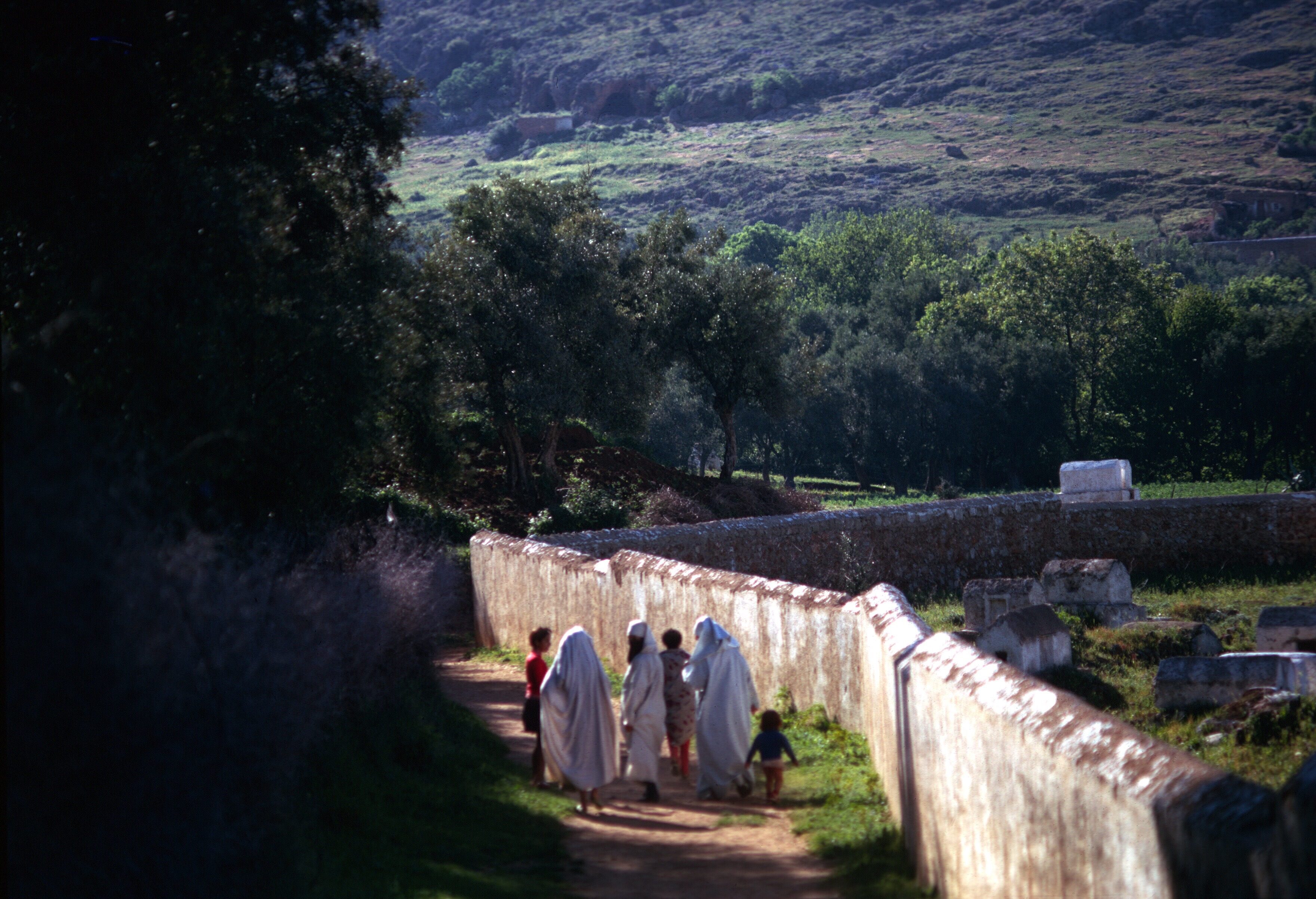
Promenade aux jardins, le long du mur de l’ancien cimetière juif. 1969
On parlait de Sefrou avant l’inondation. Je me demande s’ils parlent aujourd’hui de Sefrou avant l’étalement urbain, l’époque où tout le monde, à l’exception des riches, des puissants et des étrangers, vivait dans la médina et autour d’elle. Les jardins et les vergers de Sefrou caractérisaient la ville à cette époque, et les voyageurs la comparaient parfois à une oasis.
Vue vers le sud-est. Le cimetière juif est situé en bas à gauche de la photo. Sefrou occupe un bassin dont la majeure partie est entourée de collines. 1969
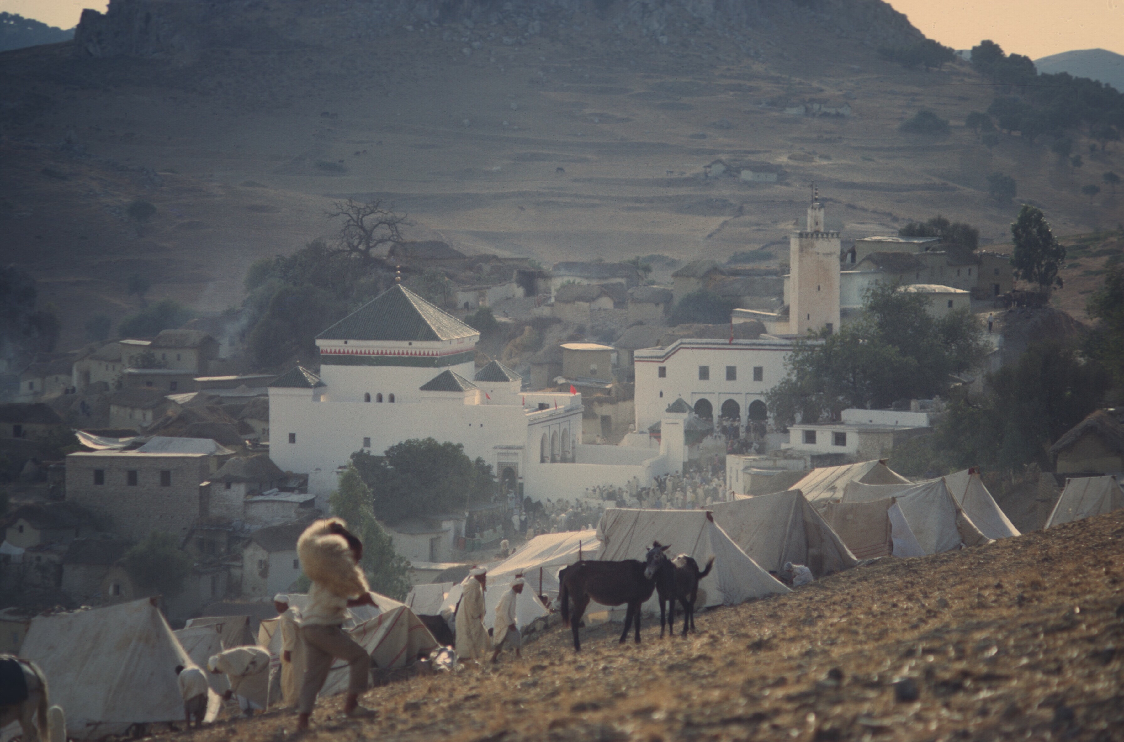
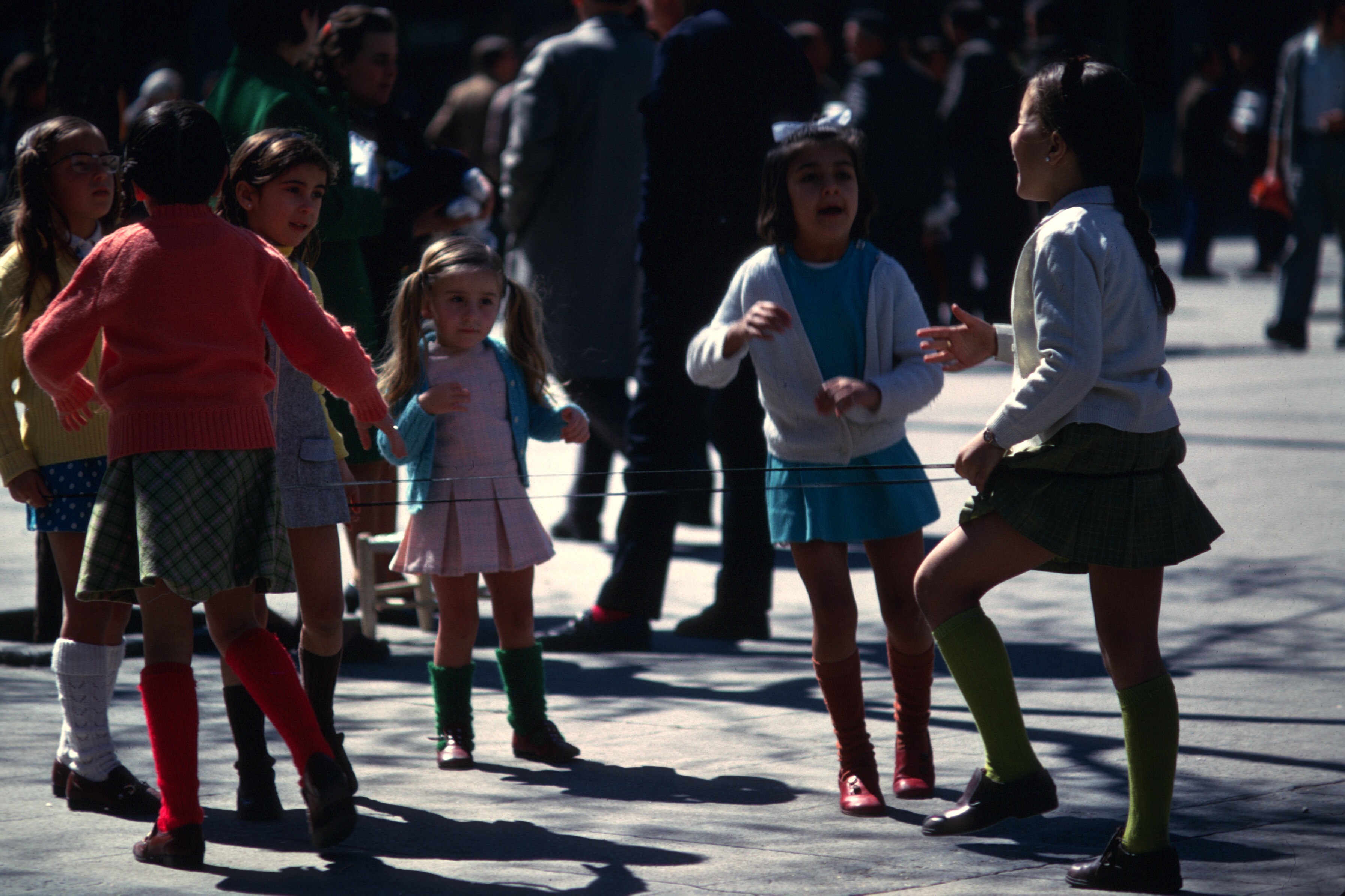
Le terme moussem a été utilisé pour décrire le festival, mais d’après ce que j’ai pu comprendre, la fête des cerises, créée vers 1920, se célébraient plutôt comme une foire agricole au sens européen ou américain du terme. Le mot moussem a souvent le sens d’un pèlerinage religieux sur la tombe d’un saint local, pratique fréquente au Maghreb. Il y avait plusieurs zawias, ou confréries religieuses, à Sefrou, ainsi qu’un marabout et quelques lieux sacrés aux yeux des habitants, mais je n’ai assisté à aucune célébration religieuse régionale de l’importante de celles que l’on trouve à Moulay Bouchta ou à Jbel Alam. Le festival des cerises est apparu comme un événement uniquement séculier dans un pays où la religion imprègne généralement la plupart des cérémonies publiques. La sélection d’une « Miss Cerise » et le défilé de la jeune femme m’ont semblé en contradiction avec les valeurs de l’islam.
Il y avait, bien sûr, les habituels dîners sous tente pour les dignitaires locaux que l’on trouve lors de toute célébration publique marocaine, ainsi que des marchands ambulants qui offraient toute sorte d’articles, de nourriture, de sucreries et de boissons. Les gens circulaient dans la ville nouvelle.
Femmes se reposant à l’ombre. 1968Promenade parmi les tentes au bord de la ville nouvelle. 1968Un porteur d’eau fait le plein à un robinet public. 1968Différentes générations se regardent. 1968Gaylord se mêlant à une foule d’enfants……et discutant avec un cavalier berbère de sa monture. 1968Les manèges offraient un plaisir particulier en dehors des grandes villes. 1968Le long de la rue principale de la ville nouvelle, les gens se sont rassemblés pour regarder le défilé. 1970 ou 1973La rue principale lors d’une journée d’été plus typique. L’effervescence de la vie urbaine régnait dans la médina et aux alentours. La ville nouvelle s’étendait sur les pentes à droite. Tout en haut, un fort français, des casernes et un marabout. 1969
Un jury composé de personnalités locales sélectionne une Miss Cherry, qui défile dans la rue principale de la ville nouvelle à bord d’un char. L’un des chars de cette première année comportait également des danseurs qui se produisaient au fur et à mesure du défilé.
Danseurs professionnels du Moyen Atlas. D’après de nombreux Marocains, la danse ne constituait qu’une de leurs professions.Photo prise par Gaylord Barr. 1968Les danseurs avec un musicien, à l’extérieur de la tente des notables. 1968Danser pour la foule. Photo par Gaylord Barr. 1968Les spectateurs 1968
Le défilé comprenait l’exhibition publique d’une femme, ce qui est tout à fait inhabituel dans un pays où les femmes se couvrent en public. La foule qui se pressait le long de la rue principale de la ville nouvelle faisait preuve de curiosité.
Les foules le long du parcours du défilé étaient denses et composées principalement de femmes et d’enfants. 1973Le char du ministère de l’Agriculture 1970
.
L’affiche sur le char allégorique présente les avantages des charrues modernes. 1970Un porteur d’eau offre des boissons à la foule. 1973Miss Cherry. 1969 ou 1970Femmes et enfants assis le long du trottoir. 1973
Le festival donnait l’occasion aux confréries religieuses de se réunir et de se livrer à leurs activités particulières, peut-être comme un divertissement pour les spectateurs, mais comme un rituel sérieux pour les participants.
J’ai toujours appelé ceux que j’ai vus Aissawa, ce qui aurait fait d’eux des membres de la confrérie soufie centrée à Meknès. Il existe à Meknès un grand sanctuaire avec un mausolée où repose le maître soufi Ben Aissa, également appelé shaykh el-kamal, le chef parfait. Un important moussem s’y déroule chaque année le jour de la naissance du prophète Mahomet, le Mouloud.
La cour devant le sanctuaire à Meknès à l’occasion du Mouloud 1976Partie d’une procession Aissawa à Meknès 1976
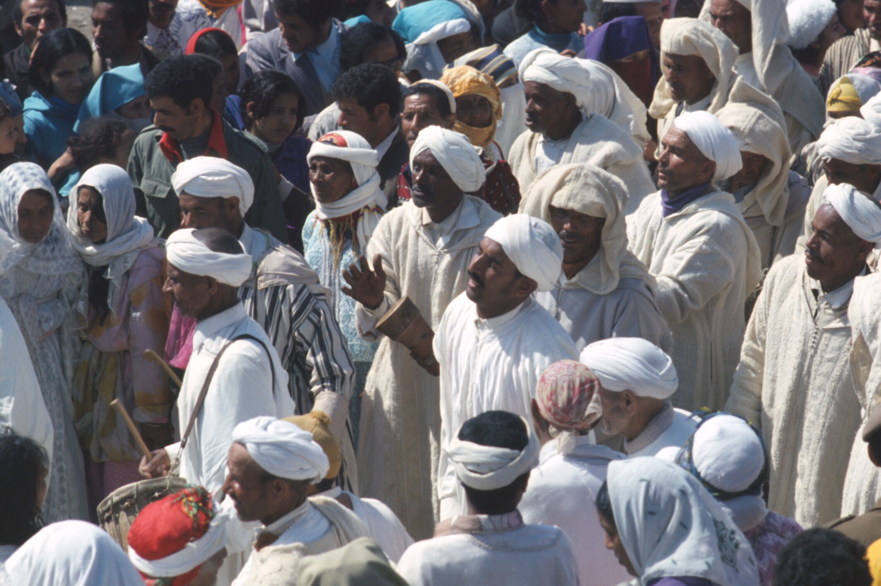
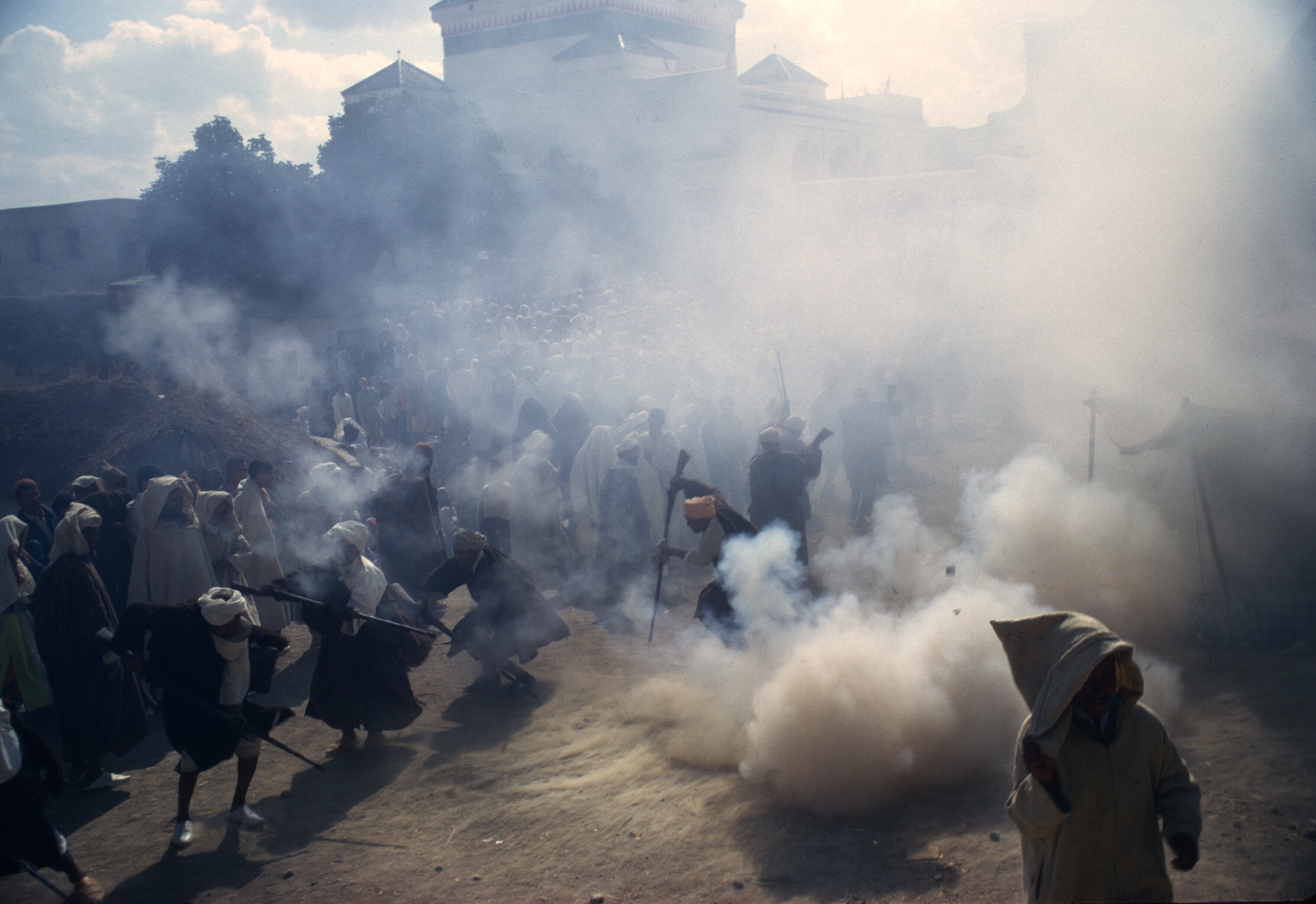
Lors du premier festival des cerises auquel j’ai assisté, un groupe d’Aissawa ou, peut-être, d’Hamadsha, qui mangeaient du feu et manipulaient des serpents mordants, ont dansé jusqu’à l’état de transe. Quelques-unes des photos montrent les visages écarquillés des spectateurs : ces spectacles étaient loin des rituels formels de l’islam de tous les jours !
Les hommes dansaient en cercle, en chantant et en se frappant la poitrine. Photo de Gaylord Barr. 1968.L’un des musiciens. Photo de Gaylord Barr. 1968Les instruments étaient tous traditionnels. 1968Les danseurs se relayaient pour se produire au centre du cercle. La plupart de ces photos ont été prises sur un film Kodak Ektachome. Cette photo a été bâclée lors du développement : le centre de l’image ne devrait pas être rose. Aujourd’hui, prendre des photos est D’une grande simplicité et, les pellicules n’étant plus utilisées à grande échelle, les appareils photo électroniques et les téléphones cellulaires peuvent capturer et stocker une quantité impressionnante d’images. Je prenais soit 20 ou 36 photos sur un rouleau de film, le film coûtait cher et sa sensibilité se limitait aux conditions lumineuses. 1968Chants et danses. Les amulettes portaient des inscriptions religieuses. 1968…à mesure que la musique continuait……la danse continuait. L’homme à droite a des serpents drapés autour du cou. 1968Manger du feu faisait partie du rituel. J’adore le regard des spectateurs. Le groupe a commencé par demander à la foule des contributions ou des dons. 1968Feu et serpents. 1968Le feu était réel……et les serpents étaient sans l’ombre d’un doute bien réels. Je voyais le sang qui suintait des piqûres de serpents. 1968Certains portaient des serpents et mangeaient du feu. Le spectacle était envoûtant et, si je n’avais par été occupé à prendre des photos, mon visage aurait pu montrer autant d’attention que celui des spectateurs sur ces photos. 1968
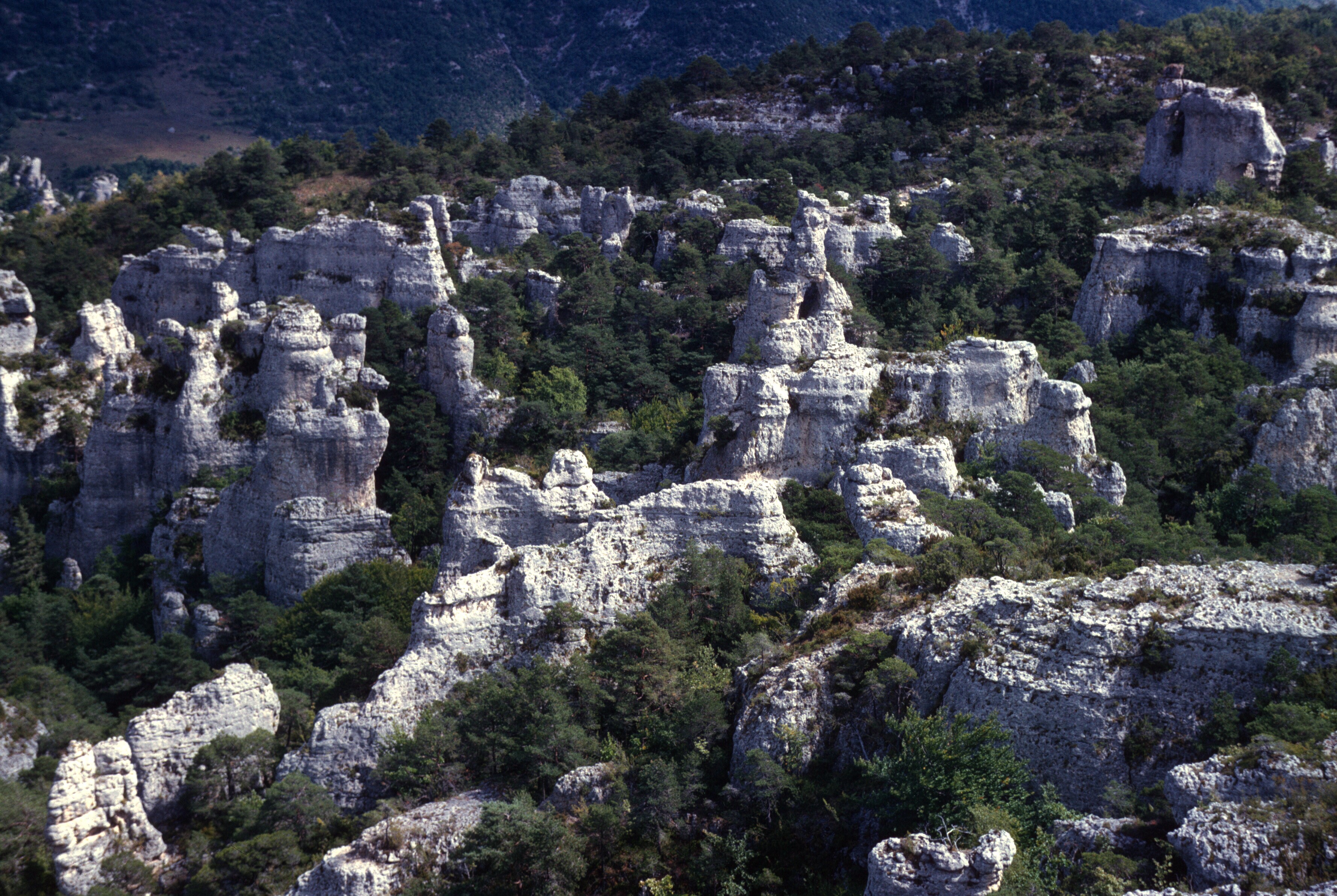
Traditionnellement le festival durait trois jours, mais je ne me souviens que d’une seule journée. L’année suivante, en 1969, je me trouvais peut-être ailleurs pendant le temps du festival. En 1970, j’y ai de nouveau assisté et cette année-là, il y a eu une fantasia, un spectacle traditionnel de jeux de poudre et d’équitation—le seul auquel j’ai assisté pendant mon séjour au Maroc. Enfin, le seul comportant des chevaux, car à Moulay Bouchta, un cortège d’hommes armé de vieux mousquets s’était rendu sur l’espace devant le sanctuaire et a offert un spectacle impressionnant.
Jeu de poudre devant le sanctuaire à Moulay Bouchta 1970
A la fête des cerises, les cavaliers alignaient leurs chevaux sur un terrain plat, les éperonnaient et galopaient le long du terrain en agitant leurs mousquets avant de tirer une salve en l’air.
L’un des cavaliers. Photo de Gaylord Barr. 1968On se prépare pour la course. 1970Chargement des mousquets 1970Les cavaliers des tribus berbères environnantes sont fiers de leur savoir-faire équestre et leur beaux chevaux. 1970
.
Au galop le long du le terrain. 1970Tirant leurs mousquets 1970Pour ensuite recharger tout en se regroupant. 1970Bon nombres des cavaliers étaient des hommes de tribu plus âgés et suffisamment riches pour s’offrir un beau cheval. 1970Il y a eu plusieurs courses le long du terrain. 1970Certaines courses comptaient plus de participants que d’autres. 1970Les participants s’apprêtant à tirer. 1970Déchargeant leurs mousquets au grand galop. 1970Et produisant toujours des nuages de poussière. 1970
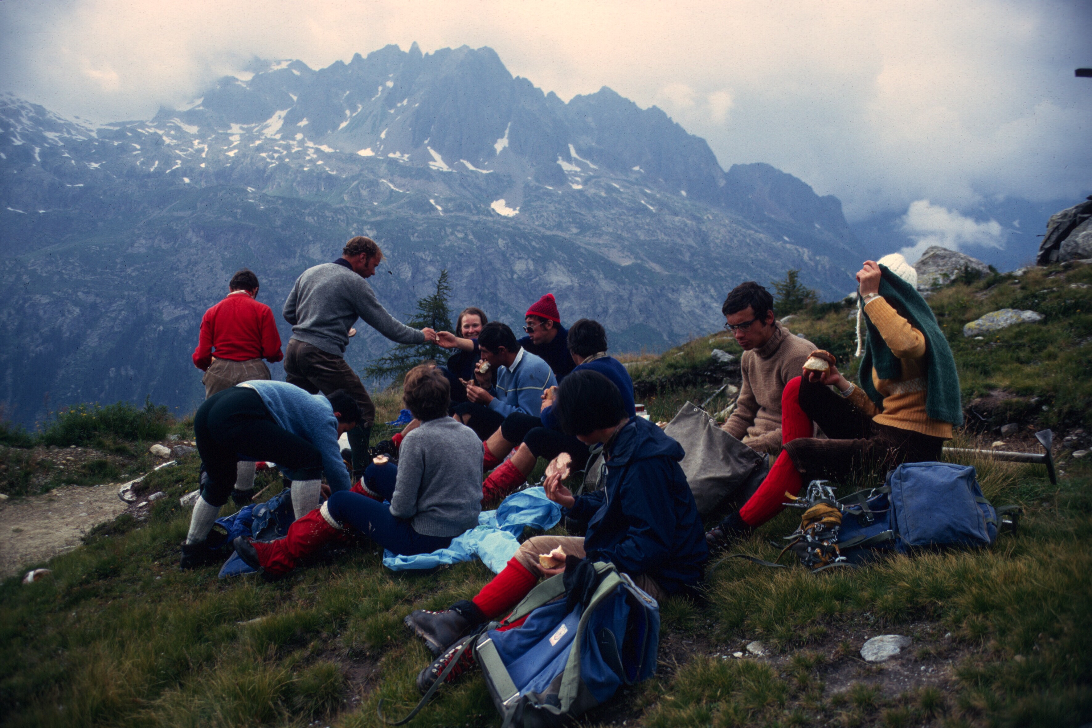
Les photos de ce billet présentent la fête des cerises telle que je l’ai vécue, à la fois en tant que nouvel arrivant dans le pays et en tant que personne ayant vécu à Sefrou pendant quelques années. Les foires d’État et de comté sont courantes aux États-Unis et au Canada, partout où l’agriculture est importante, mais je n’ai jamais visité la foire du comté de Niagara à Lockport, dans l’État de New York, près de l’endroit où j’habite. Les foires, ce n’est vraiment pas mon truc, même si assister à l’exposition nationale canadienne a été un moment fort de mon enfance, parce que j’aimais les manèges et la nourriture.
Le festival des cerises a été très divertissant. En juin, il faisait toujours beau. La ville nouvelle était bondée, les animations étaient intéressantes et des amis de tout le Maroc venaient nous visiter. Ceci étant dit, bien des années plus tard, maintenant que je suis de nouveau chez moi, je ne me rends pas au festival de la pêche à Lewiston NY, à seulement 12 kilomètres de chez nous, ni au festival de l’éperlan de Lewiston, un événement beaucoup plus modeste célébrant le petit poisson savoureux qui remonte la rivière au printemps. Je trouve que les foires sont faites pour les jeunes, les exposants, les vendeurs et les marchands. Toutefois, le festival des cerises est désormais reconnu par l’UNESCO comme faisant partie du patrimoine national du Maroc. Si vous vous trouvez dans le nord du Maroc en juin, je vous encourage à y participer. Au minimum, vous aurez le plaisir de voir des foules de Marocains s’amuser. À l’époque où je restais au Maroc, la vie était difficile pour beaucoup et les fêtes nationales ou locales s’avéraient des occasions de célébrer avec des amis et avec la famille. Je m’imagine qu’à cet égard, rien n’a changé du tout.
Just recently, I was asked by a Moroccan reader of this blog, who wrote from Alberta, Canada, if I had photos that I could share of the Cherry Festival.
Now, Morocco, spectacular for its natural beauty, is also be a country of spectacles. For me, the Marrakesh Folk Festival comes to mind immediately, along with the various celebrations of holy men and religious fraternities although there are many other culture and sports events. Still, there are many smaller festivals that are less well-known. Among them, the Cherry Festival in Sefrou is the oldest, having been founded in 1920.
Sefrou, only 28 kilometers south of Fes, has one of the best known local festivals, La fête des cerises. This ancient city, very close to Fes, has traditionally been the last truly urban place south of Fes, on a road formerly known as the treq es-sultan, the king’s road. A major highway follows the old caravan route, crossing the Middle Atlas Mountains, descending onto the plains of the upper Moulouya River, and then rising again to cross the High Atlas Mountains to end in the Tafilelt, birthplace of the ruling Alouite dynasty, on the very edge of the Sahara. Today tourists travel that highway to reach the impressive sand dunes at Erfoud, and truckers carry their cargos of manufactures and dates and saffron to and from Fes, braving slippery snow-covered roads on the Middle Atlas plateaus.
This table d’orientation, a very French object, stood in the gardens of the Palais Jemaï hôtel high above the the city of Fes, and pointed out important landmarks to the south. A view from the Oued Agaï represents Sefrou, but after the flood of 1950, the city might have been better symbolized by its gardens—or cherries.
Once a home to a very large Jewish community, many Jewish tourists now visit the city since the establishment of diplomatic relations between Morocco and Israel. There are several websites dedicated to documenting the Jews of Sefrou, and the city itself dates back to the time of the founding of Fes or perhaps even earlier.
“A city buried in the trees.” Early postcard with a part of the Kelaa in left foreground.An early map of Sefrou shows almost all the city’s structures enclosed by the defensive wall. The French were developing the area outside the wall to the west for themselves. My house, inside the wall, had not yet been built and its site was a still a garden.
Not long after I moved to Sefrou in 1968, I attended Sefrou’s Cherry Festival for the first time. Gaylord Barr was already in Sefrou working at the Ministry of Agriculture CT (Centre des travaux agricoles). Jerry Esposito, who had been teaching English at the newly opened lycée, may have completed his service and already left the country by time of the festival in June. Carolis Deal and John Abel, who had started the primary school chicken coop that I took over, also had left.
Gaylord Barr, Marc Miller, and Phil Morgan, all Morocco X volunteers. 1968
Several other volunteers showed up in Sefrou to attend that year: Phil Morgan, Marc Miller, and Steve Boeshar.
Sefrou’s proximity to Fes and easy access made the Cherry Festival a major regional attraction, and, with volunteers already living in Sefrou, accomodation was never a problem for the visitors.
Jan, Ruth, and Gaylord all taught English at the lycee. During the 1970 festival.
I knew little about the event, other than it featured cherries. Moroccans call cherries hab el-moulouk, which mean the love of kings, and the local variety, el-beldi, is reputed to be especially sweet and flavorful. Sefrou occupies a mountain depression at a high enough altitude for cherries to thrive, but the city had many other fruits and vegetables in the old gardens that surrounded it. In the orchards grew oranges, pomegranates, figs of more than one variety, and many olives trees. I really liked the local strawberries more than the cherries.
Picking strawberries in the spring. 1969This field was only a couple of minutes walk from the medina.Picking strawberries with Mohammed and Ali. Note the olive groves. 1970
The city population has more than doubled since I lived there, and the built-up area has spread far beyond the old city’s walls. The growth surprised Gaylord Barr who stopped in Sefrou on a trip home from Saudi Arabia in 1997. In my memory, the extra-muro areas, excluding the ville nouvelle, were mostly limited to the Derb el-Miter, Habouna and Seti Messaouda quarters. I make this digression into the demography and urbanization of Sefrou before the sprawl simply to underline how easy it used to be to walk out of the medina, and, within a few minutes, be in the gardens that surrounded the city. On Fridays women would walk in groups, small children in hand, to picnic in the orchards, eating fresh fruit, getting some fresh air, and, of course, gossiping over tea. I loved the proximity to the country and took frequent walks to the neighboring village of Bhahlil, famous for use as caves for dwellings.
A stroll to the gardens, along the wall of the old Jewish cemetery. 1969
People used to talk about Sefrou before the flood. I wonder if they now talk about Sefrou before the sprawl, the time when almost everyone, save the rich and powerful and foreigners, lived in and around the medina. The gardens and orchards of Sefrou characterized the city in those days, and sometimes travelers not unsurprisingly likened the city to an oasis.
A view looking southeast. The Jewish cemetery is located in the lower left of the photo. Sefrou occupies a bassin, with hills surrounding most of it. 1969
The term moussem has been used to describe the festival, but from what I can gather, the Cherry Festival, created around 1920, was celebrated more as an agricultural fair in the European or American sense. The word moussem often has the meaning of a religious pilgrimage to the tomb of a local saint, common in the Maghreb. There were several zawias, or religious brotherhoods, located in Sefrou, as well as a marabout and a few special places sacred to the locals, but I never witnessed a regional religious celebration on the scale one finds at Moulay Bouchta or Jbel Alam. The Cherry Festival appeared to be a uniquely secular event in a country where religion permeated daily life and most public ceremonies. The selection of a “Miss Cherry” and parading the young woman struck me as at odds with Muslim values.
There were, of course, the usual tented dining facilities for local dignitaries that one would find at any public Moroccan celebration as well as hawkers of wares, foods, sweets, and drinks. People from the medina and the countryside circulated in the ville nouvelle.
Women resting in the shade. 1968Strolling among the tents on the edge of the ville nouvelle. 1968A water carrier refills at a public tap. 1968Different generations regard each other. 1968Gaylord in a crowd of kids.……and chatting with a Berber horseman about his mount. 1968Amusement rides were a special treat outside major cities. 1968Along the main street of the ville nouvelle, people gathered to watch the parade. 1970 or 1973The main street on a more typical summer day. The hustle and bustle of city life was in and around the medina. The ville nouvelle spread up the slopes to the right. Perched at the very top was a French fort and military barracks and a marabout. 1969
A jury of prominent locals selected a Miss Cherry, who was paraded down the main street of the ville nouvelle aboard a float. One of the floats that first year also featured dancers performing as they were carried along.
Professional dancers from the Middle Atlas. Dancing was only one of their professions according many Moroccans. Photo by Gaylord Barr. 1968The dancers with a musician, outside the tent of the notables. Photo by Gaylord Barr. 1968Dancing for the crowd. Photo by Gaylord Barr. 1968Spectators.
The parade included the public display of a woman quite unusual in a land where women covered themselves in public. The crowds along the main street of the ville nouvelle were curious.
The crowds along the parade route were dense and mostly women and children.The float of the Ministry of Agriculture.The poster on the float shows the benefits of modern plows.A water carrier offering drinks to the crowd.Miss Cherry. 1969 or 1970.Women and children sitting along the curb.
The festival did offer the opportunity for religious brotherhoods to perform, perhaps as entertainment for the spectators, but as serious ritual for the performers.
I have always referred to those I saw as Aissawa, which would have made them part of the Sufi brotherhood centered in Meknes. A large shrine with a mausoleum where the Sufi master lies, Ben Aissa, who is also referred to as shaykh el-kamal, the perfect leader, exists in Meknes. An important moussem takes place there every year on the day celebrated for the birth of the Prophet Mohammed, the Mouloud.
The courtyard before the sanctuary in Meknes on the Mouloud.Part of an Aissawa procession in Meknes.
In the first Cherry Festival that I attended, a group of Aissawa or, perhaps, Hamadsha, who ate fire and handled biting snakes, danced themselves into a trancelike state. A few of the photos show the wide-eyed faces of onlookers: these performances were far from the formal rituals of everyday Islam!
The men danced in a circle, chanting and beating their breasts. Photo by Gaylord Barr. 1968One of the musicians. Photo by Gaylord Barr. 1968The instruments were all traditional.Dancers would take turns performing in the center of the the circle. Most of these shots were on Kodak Ektachome film. The processor botched this one: the center of the image should not be pink. Today it is so simple to take photos and, with film no longer widely used, electronic cameras and cell phones can capture and store a truly enormous amount of pictures. I had either 20 or 36 pictures on a roll of film, the film was expensive, and its sensitivity was limited to bright conditions.Chanting and dancing. The amulets held religious writings.As the music continued……the dancing continued. The man on the right has snakes draped around his neck.Fire eating became part of the ritual. I love the looks on the spectators’s faces. They group began by asking the crowd for contributions or donations.Fire and snakes.The fire was real……and the snakes were certainly real. I could see blood oozing from the punctures of the snake bites.One could carry snakes and eat fire. The show was mesmerizing and, if I hadn’t been taking photos, my face might have shown as the same rapt attention as the faces of the spectators in these photos.
The festival traditionally lasted three days, though I only remember one day. The following year, 1969, I may have been away during the festival. In 1970, I once again attended. That year there was a fantasia, a traditional display of powder play and horsemanship—the only one that I ever witnessed while living in Morocco. Well, the only one with horses, because at Moulay Bouchta a procession armed with old muskets walked to the space before the shrine and put on an impressive display.
Powder play before the sanctuary of Moulay Bouchta.
At the Cherry Festival, the riders lined up their horses on flat ground, spurred on their steeds, and galloped down the field waving their muskets before firing salvos into the air,
One of the riders. Photo by Gaylord Barr. 1968Getting ready for the ride.Loading muskets.Getting ready.Galloping down the field.Firing their muskets.And then reloading while regrouping.Many of the riders were older tribesmen, wealthy enough to keep a beautiful horse.There were several runs up and down the field.Some charges had more participants than others.Getting ready to fire.Discharging their muskets at full gallop.And always producing clouds of dust.
The photos in this blog piece present the Cherry Festival as I saw it, both as a newcomer to the country, and then as one who had lived in Sefrou for a couple of years. State and county fairs are common in the US and Canada, wherever agriculture is important, but I have never visited the Niagara County Fair, in Lockport, NY, close to where I live. Fairs are not for me, though attendance at the Canadian National Exposition in Toronto, Ontario, was a highlight of my childhood because I loved the amusement rides of the midway and the foods.
The Cherry Festival was great fun. In June the weather was always fine. The ville nouvelle was crowded. The entertainment was interesting. And friends visited from all over the country. That said, years later, at now home again, I do not go to the Peach Festival in Lewiston, NY, just 12 kilometers away, nor to Lewiston’s Smelt Festival, a much smaller affair celebrating a small but tasty fish that runs up river in the spring. I think that fairs are for the young, the exhibitors, and vendors and merchants. But the Cherry Festival is now recognized by UNESCO as a part of the national heritage of Morocco. If you happen to be in northern Morocco in June, you should think of attending. At the very least, you will have the pleasure of seeing crowds of Moroccans enjoying themselves. When I lived in Morocco, life was difficult for many and holidays were opportunities to celebrate with friends and family. I imagine that in that respect nothing has changed at all.
Moroccans used the term harka (حركة) to describe the military expeditions that sultans led to extract taxes from tribal areas and to force tribes into submission when necessary. Walter Harris, in Morocco That Was, describes a harka during the reign of the Sultan Moulay AbdelAziz, as does Gavin Maxwell in his book, Lords of the Atlas.
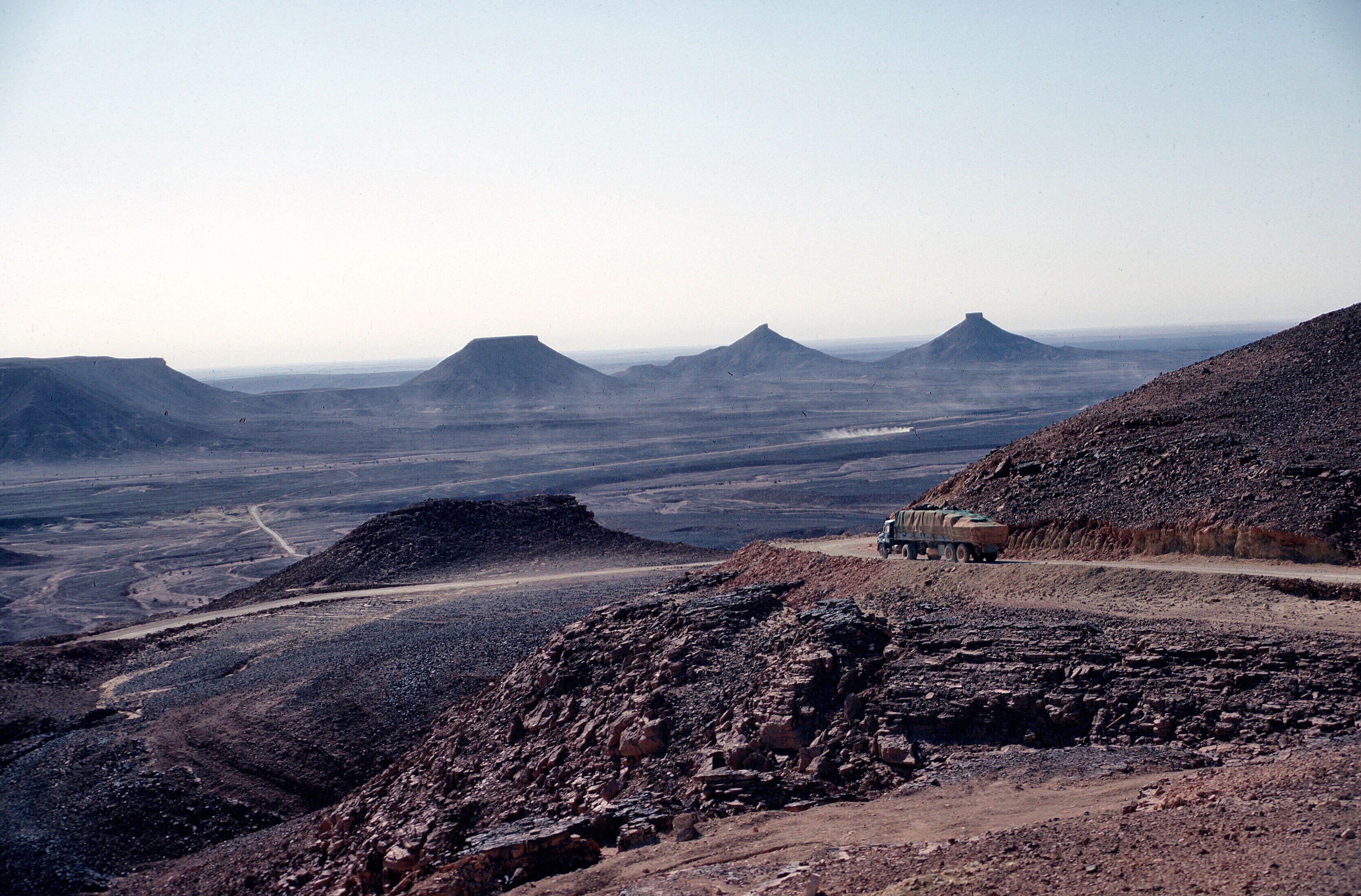
A view of the Algerian desert along the Algiers-Agadez route. 1971
Why Moroccan Peace Corps volunteers chose the word as a title for their volunteer newsletter in 1963 is a mystery. Perhaps the first issue explained their choice. In any case, volunteers, with Peace Corps office support, publishedthe Harka at irregular intervals during the first 10 years of the Peace Corps.
Electronic copy machines such as those made by Zerox were just appearing in the mid nineteen sixties. I still remember my cousin Irene’s husband, John Maroney, proudly showing one to me in his Union Carbide offices in Manhattan in 1964. The Peace Corps administration in Morocco still did not yet have one when I arrived in 1968. All cheap reproduction was still done by mimeograph from copy prepared on typewriters. The process required a special machine and produced copies relatively slowly.
As the contributions to the Harka came from volunteers spread over a large country, the editing and assembly of each issue demanded time and patience from the editors, who presumably lived near Rabat. Depending upon who typed up the manuscript, some strange errors crept in. How many editions of the Harka appeared and when the newsletter ceased publication in its paper form are unknown to me. Perhaps one of this blog’s readers can enlighten us about the publication’s origins, history, and demise. There is little question in my mind that the Peace Corps administration looked upon the free expression of volunteer views with a bit of trepidation.
I have at least four copies of the Harka, two generously furnished by Don Brown. The four date from 1966 to 1968. I will post them on the blog as an incipient archive, hoping that readers may have additional issues to share.
The articles in the Harka present insight into what volunteers were thinking in the late nineteen sixties, not only about voluntary service abroad and all that it entails, but also contemporary cultural issues such as the draft and marijuana use.
The March 1968 issue contained an article by Bob Draper that was particularly of interest to me. Draper crossed the Sahara by the central western Saharan route, south to north beginning in GAO and ending in Oran after traveling on the Niger River through Mopti to Timbuktu. What a great journey! Draper led the way for other volunteers, demonstrating that one could reach West Africa overland from Morocco, and do it on a small budget to boot. If Draper could do it, some of us reckoned, we could do it, too, and so a few of us did.
Draper found the desert scenery uninteresting, but enjoyed his river travel and some of the people he met in West Africa. His brief cultural observations were similar to mine though his style and tone are not. Traveling the westernmost route, by way of contrast, I saw some spectacular scenery and visited more of West Africa, but missed out on the wildlife and the fabled Timbuktu.
Today the trip is mostly made by migrants trying to make their way to Europe at great risk to themselves, as Islamic and ethnic insurgencies plague the western Sahel.
Draper’s account of his trip follows, with typos and original grammar mostly left uncorrected:
DRAPER IN AFRICA (March 1968)
I must begin every letter nowadays with “Sorry to have been out of touch for so long but there was too much sun and too much newness and no motivation whatsoever to put pen to paper, beggin’ your pardon.” The jungle, the savannah, the steppe country. And the Sahara, which had filled my mind for two years, always the Big Thing, which turned out to be a flat lot of sand, the only interesting part being the people—the Touaregs and the Arab truckers who pilot 20-ton snarling hunks of metal through a country still staggering in its huge emptiness, and have pieces of infinity in their eyes. But it’s true anywhere, that it’s the people in a country or town that are interesting, that the sperm and the egg that formed you in the U.S.A. would have been the seed of a savage had it developed in the rain forest, or that in the fishing village of the Niger, would have been shaped into something still different.
You tell more about the forest, get a better feel for it, by seeing the little stocky guy trotting along with his machete and poison arrows than by looking at bone-white trees in the rank greenery. You see a piece of the Niger river, water and bank and hippos, but the Iong Bouzou, an intricately-worked black needle pirogue which seems an extension of his body, heavy with cargo, or used as a pointed mobile stage for the flinging of a circular net, is an intensification and quintessence of the river past and present, the distillate of the whole scene, what’s left in the bottom of the centrifuge tube after everything has been concentrated.
I was dead afraid when I bounced off the boat at Abidjan from Casa. The jungle and heat were overpowering, at that point mainly the heat. I gobbled a salt tablet. I couldn’t move or breathe. The animals and birds looked as if they had been assembled by an insane child, armed with an infinity of feathers, scales and colors. I was dizzied by the colors on the women’s dresses and by the fresh pineapple and mangos and birds. My toes rotted in my boots, had to buy sandals. Heard of some missionaries in town so I stayed with them, because I was afraid to put up the tent in the jungle and because there were no clearings there in the solid mass of green and thorns. I could see why authors call the jungle malignant. The green is too green, the animals are insane. God knows what could be lurking three feet away and who would know. Little guys with poison arrows. Man.
A devious route up to Bobo Dioulasso miles and days on “mille-kilos” and Peugeot taxis to my rendez-vous at the big French research center with the tse-tse fly boys in Bobo. Plunged into a life of super-color for a couple of weeks, fantastic food served and prepared well, the first~class seats in the movie (second-class ? Oh, that’s for them…) really an evil sort of unhappiness for most of the French there: the middle class, always the source of racism, always searching for reasons for their miserable lot, weaving “C’est ca, les Africains”, incredible looms of boredom. Bobo, in the savannah, not so overpowering as the forest or the desert, because there’s neither the absolute closeness nor the too openness.
A Renault mille kilos. The rear of this little truck was fitted with bench seats. Filled to capacity and perhaps more, open windows provided ventilation. After a few hundred kilometers of dusty, washboard dirt roads, passengers were always happy to arrive at their destination. Niger. 1971
It’s just when you get upon a hill and look out and see the same twisted thornbush and head-high grass stretching and rolling out to infinity that you say God, we’ll never get there, the truck will break and there is nothing here. You can’t eat these thorns and dry grass. Fear.
A Peugeot Taxi. Niger. 1971
Then it happened, a flat and then another. No tire repair kit on a back road, sun sucking the moisture out of every pore. The Africans? Nothing. The chauffeur takes a bicycle off the top of the truck, puts a boy on it, sends it off towards the south down the endless washboard. Two very tall men amble off into the brush with very big knives. The chauffeur takes out inner tubes, finds the hole, kind of primitively trial-and-error like, trying several ways of getting the tire off of the rim before succeeding. The two lanky guys get back dragging large branches which they lay beside the chauffeur; they sit under a shrub, cleaning their teeth with chunks of twigs, turning their eyes inward. The chauffeur takes an old inner tube, makes a patch, sticks it on with the sap from the hacked off branches, puts the tube in the tire, the kid shows up with a pump he borrowed from a village off the road somewhere, they pump up the tire, leave, after leading me to my seat because I was saying: “Wha?” and standing around with my mouth open.
After having gone through an hour of “I used to work in an American filling station, bums, want me to show you how?” the sight of a bouncy, healthy tire was too much: I have preserved dried leaves of the “tire-repair” tree.
Most of the nights I was lodged in with the Africans in whatever village we were at when night fell. Smetimes, though, I stayed with missionaries, who were more than glad to feed me and have me listen to them, satisfied with a sleepy nod now and then at random points in their monologue, breaking out dusty bottles of spirits hidden away for medicinal puposes. One good old boy was from Memphis, Tennessee, and after praying together, we threw place names at each other (we had no common acquaintances.) Grits and gravy for breakfast. “Bye, now, write us a letter…”. Teenage daughter looks like Candy, going to Bible College in Nashville, ministering to the pagans along with her father. Asking for the good Lord’s help in a heathen land.
Next random impressions: the sexual freedom of all the natives I saw outside of the Arabs. Many of the Europeans working in the African bush have mistresses supplied them by their villages with the understanding and maybe an occasional present is the only payment required. After dinner in one household three beautiful girls walked in, sat down, were greeted and started to Ieaf through magazines. Wild colored dressed. Chattering in a local language but quietly with grace. Equally as quietly going off with their men, one of whom, as I learned later, was soon going to marry his girl. The others would go off leaving presents and maybe a baby, of which the girl and the village would be proud.
I will write now of the two modes of transportation possibly the least used by most tourists in Africa and possibly the cheapest and most interesting.
Boat on the Niger: bi-weekly Mopti-Timbuctoo-Gao. $25 2nd class, five days good food. Hippopatamuses and crocodiles. Fishermen and nomads at the stops. Old cities along the river, notably Timbuctoo, Gao, Djenne and Mopti. Beautiful people. Feels at times like the womb of the earth, the constant fertility in the middle of the desert. Traditional evening baths each evening in the shallows for everyone.
Truck on the desert: Gao-Adrar (western trail) or In Salah-Tamanrasset-Agades (eastern trail). Western trail-constant traffic (dates and tobacco down, sheep up) never a wait of more than a few days for a truck. $16, 1500 km., 5-3 days, good food. Take a chapstick and a sleeping bag, cigarettes for trading with the Touaregs for milk or with the truckers for dates. Clean , dry air.
Enough, because if anyone is going there they’re welcome to get more information of general or specific nature by sitting down with me over a coffee somewhere, and those that aren’t, aren’t, regardless of how much is written. The important communication is that it’s no big thing, no pilgrimage to the wilderness, no ordeal, no masochism. The trip was a pleasure and not at all hard. No problems, Coca-Cola partout. Everyone everywhere loves tourists including in Mali and Algeria, even though the only books I saw in Mali were “Pensées de Mao” and slogans on schools, the usual thing, “Work hard you brats”—all had the little “Mao” underneath. Skinny Chinese cats nervously smiling and bowing to hotel clerks as they paid their bills. Worthy of note is a widely distributed poster in Algeria of the “watch out for deviationists and revisionists” ilk, on the bottom of which you see in boldface except, of course, for our tourists to whom we should extend the traditional warm welcome.
Surprisingly, the total trip Casa-Abidjan-Bobo Diolasso-Gao-Bechar-Oran-Oujda was cheap, $290~for 12,000 km. eating well, frequent beers, traveling slowly. The trick is to always to plead poverty and refuse to stay in the hotels, or at least the European ones, which are all $10 or so a night minimum. I stayed 1/3 of the time with Africans, some with European and American missionaries. (Only two small nonviolent cases of diarrhea the whole way—polymagma-controllable.)
The only bit of proselytizing I’ll do is to say that there’s a certain amount of value in exposing yourself to a third primitive culture (after American and Moroccan). I found I had made certain generalizations about underdeveloped countries which did not hold water outside the Arab world. And, on a much simpler level, I enjoyed the trip because I left the rain and cold and sinusity behind and swam and played in the sun, and lost (temporarily, to be sure) sight of the Peace Corps and the realization of selfless service and the lousy job and could just wonder a while. It’s kind of nice.
Bob Draper
The Harka March 1978
A Touareg herd near Tammanrasset. The Ahoggar mountains in the distance. Algeria. 1971
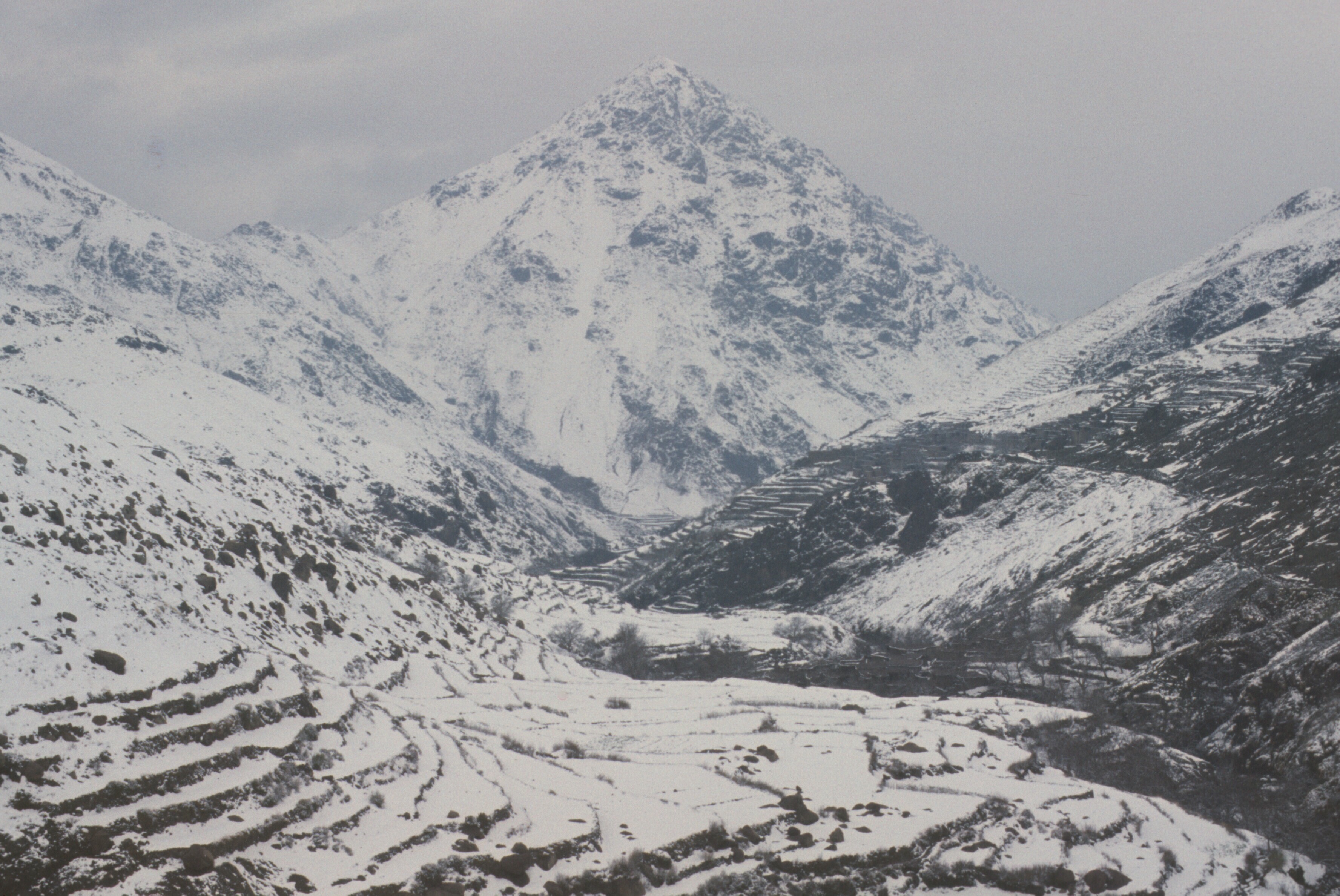
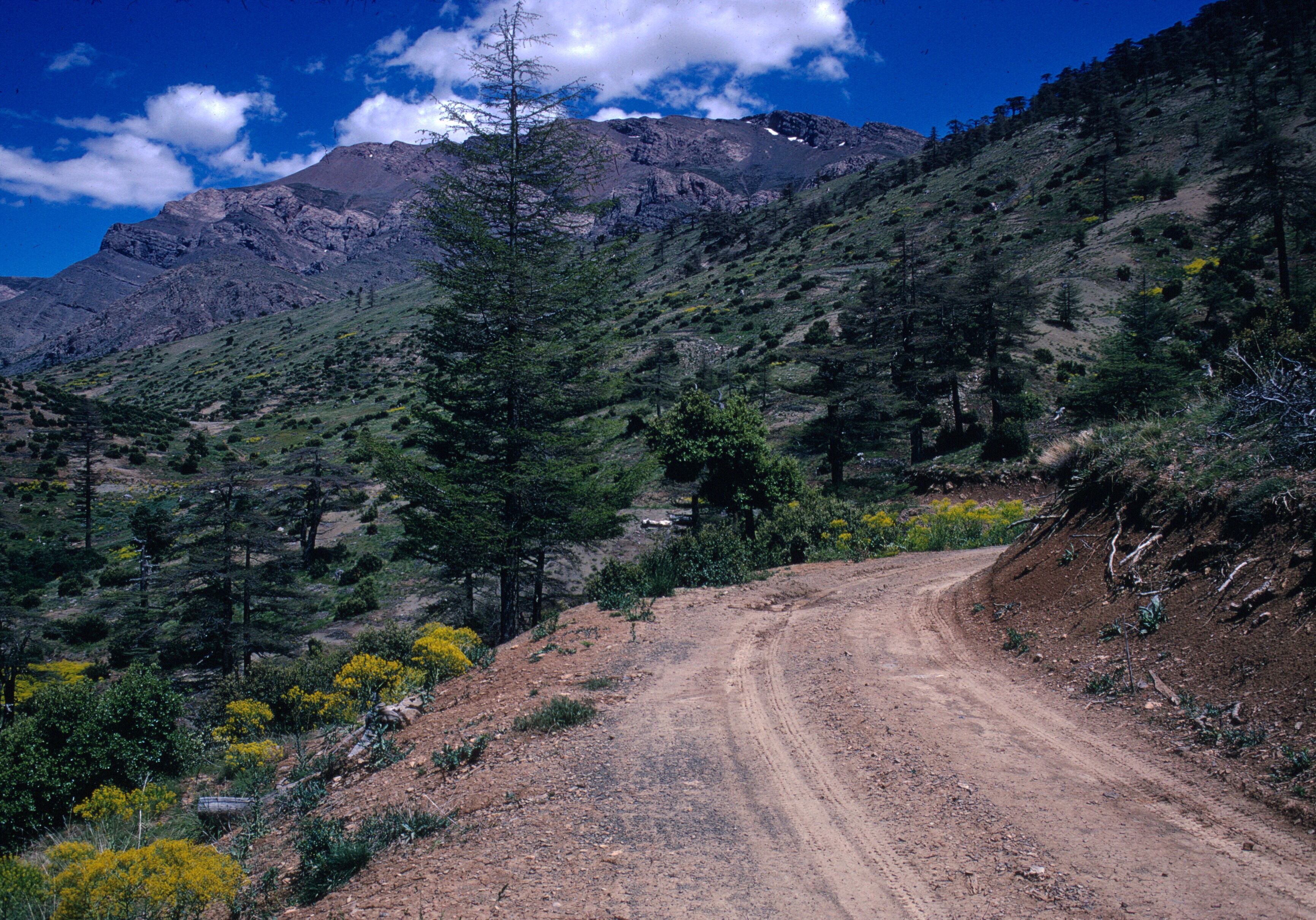
In the nineteen sixties, there was no paved road to the foot of Bouiblane. Today there may be one, at least part way, and perhaps the slopes have been developed for skiing. I believe that the French, during the Protectorate, skied there. In 1968, the way in, whether you came from Sefrou or Taza, was by mountain tracks. Streams flooded the pistes, rockfalls blocked them, and in the cold months, snow on them increased the danger of slipping off the road, and potentially down some very steep slopes.
Travelling from Oujda to Taza, Bouiblane is visible from the plains of the lower Moulouya, and, of course, from the air.
The long crest is particularly evident from Taza. Aerial view.
Bouiblane also is visible from the region of Fes. The mountain was visible from my rooftop in Sefrou. It was my Kanchenjunga, and Sefrou, perhaps, my Darjeeling. Not the ominous looming presence of Kanchenjunga of the nuns of Black Narcissus, but a friendly, steady presence. The mountain beckoned. It was impossible to resist the temptation to see it up close. Ahermoumou offered a belvedere and a grand view, but at the price of a drive.
Jbel Bouiblane and Moussa ou Salah from Ahermoumou.
Climbing the stairs to the roof of my house was far easier. In the twilight on clear winter days, Bouiblane slopes slowly turned pink, as the kestrels living in the city wall did a few more acrobatics before disappearing into their holes for the night.
From the rooftop of the Sefrou house’
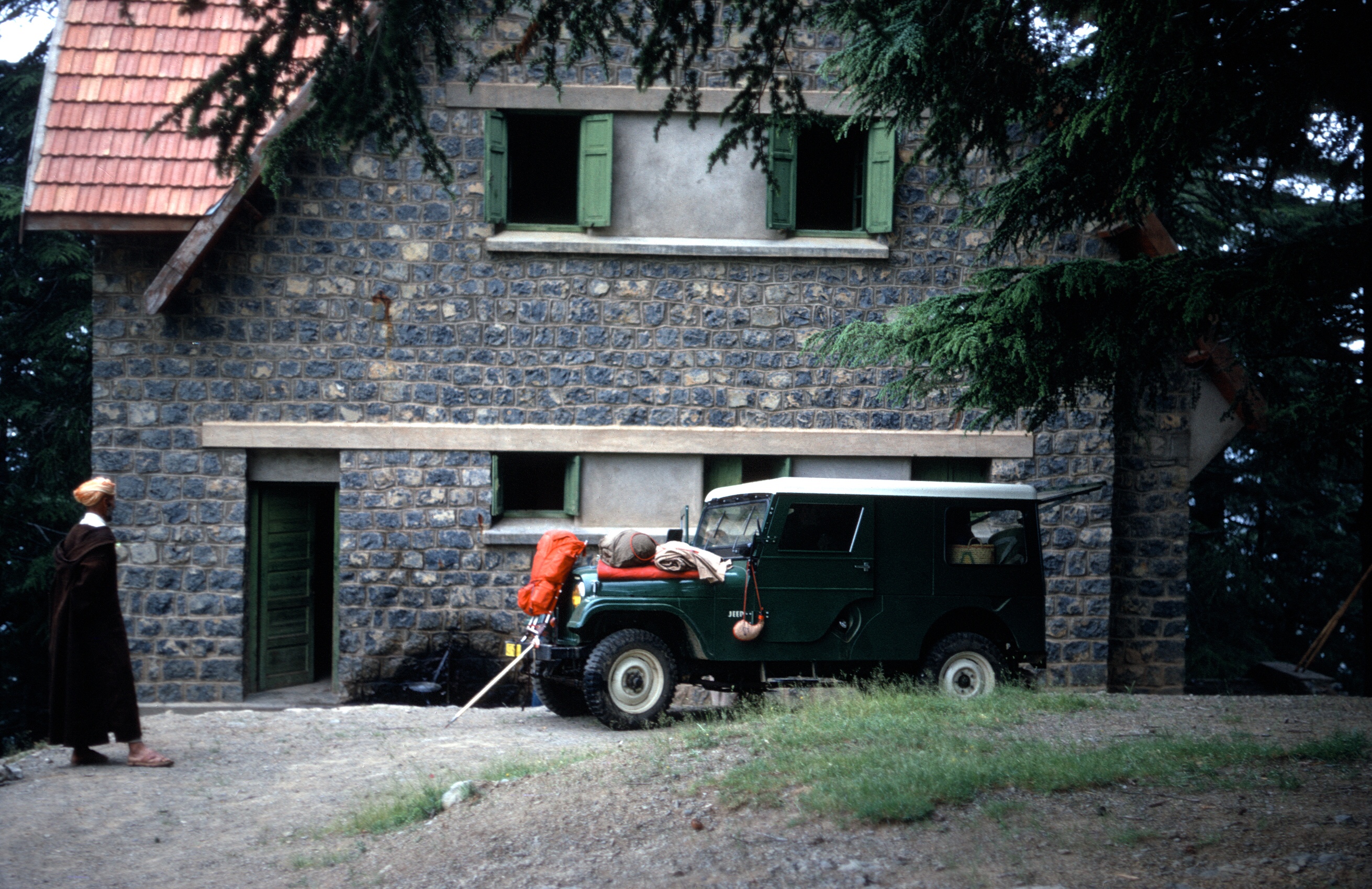
And so we off we went, Gaylord Barr and myself, on one winter weekend, on the route de Bouiblane. I had been assigned one of the Peace Corps Willys jeeps.Gaylord and I stop to talk with farmers on the road to El Menzel.
Strictly speaking I was not supposed to use it for tourism. And I was very good about that generally speaking. I used buses and taxis to go back and forth to my job in the Ministry of Agriculture in Fes, for example. The jeep would have made the commute much shorter and more convenient, but most of the time I read and enjoyed the commute. In restrospect, though, I wish I had used the jeep much more for touring my corner of Morocco. I never went to Erfoud and Merzouga to see the dunes, though I saw plenty crossing the Algerian Sahara after leaving the Peace Corps.
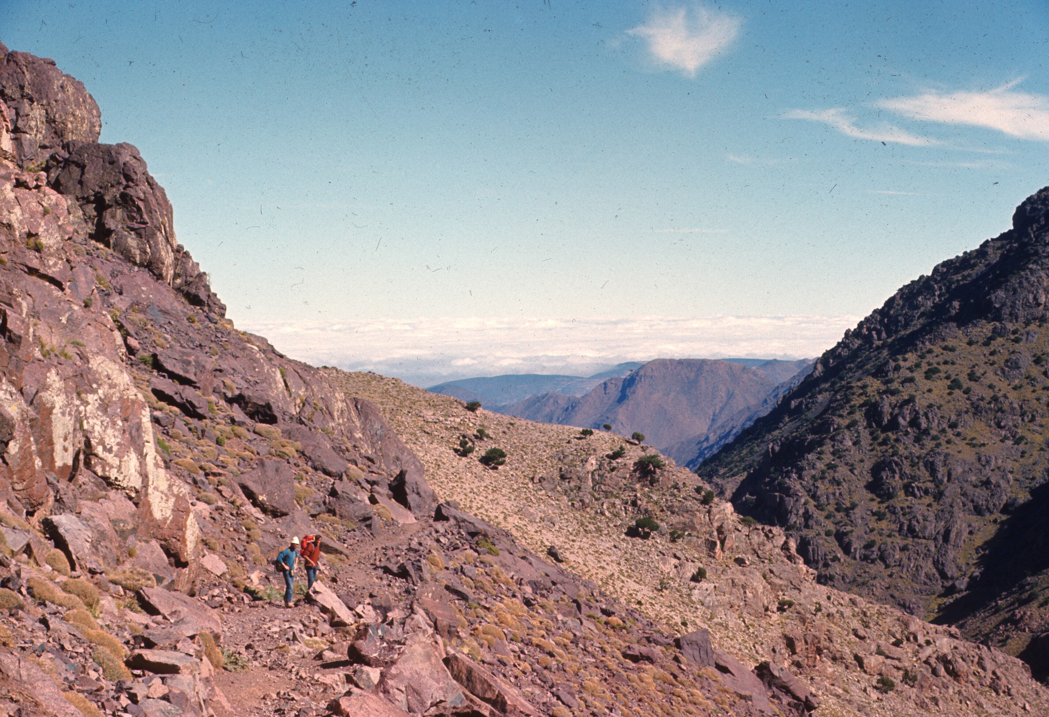
Gaylord and I set off with no good plan in mind. I think we knew that there was a forestry station or an old ski chalet at Taffert. It was probably mentioned in the Guide Bleu. We took some food and sleeping bags in any case, and made pretty good progress until the last 15 or 20 kilometers, where we began to encounter snow on the road. The jeep had off the road tires. They were not much good on snow. Coming around a long, deep curve, the jeep began to slide toward the edge of the road where there was nothing but a steep slope. Luckily I recovered control. From that point, we slowed down considerably. We also began to wonder how we would get back if it snowed overnight. We didn’t have a weather forecast, but the skies were clear, and, foolishly optimistic, we continued. It certainly would have been embarrassing to get stuck there.
Not long after the slipping and sliding incident, the road leveled out and paralleled the mountain crest. We picked up a local man and he rode all the way to Taffert, where, after thanking us, he wrapped his sandaled feet in rags, and made straight up the mountain toward the pass at the western end of Bouiblane, referred to as Tizi Bouzabel. A dirt road goes through it, and I imagine that once he was over the pass there was less snow and the going got easier. The sun was setting and it was getting colder, so we wished him well and he wasted no time. He was up and over before the sun set.
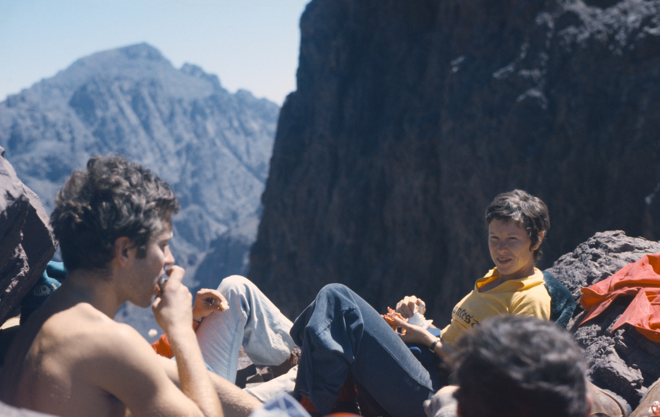
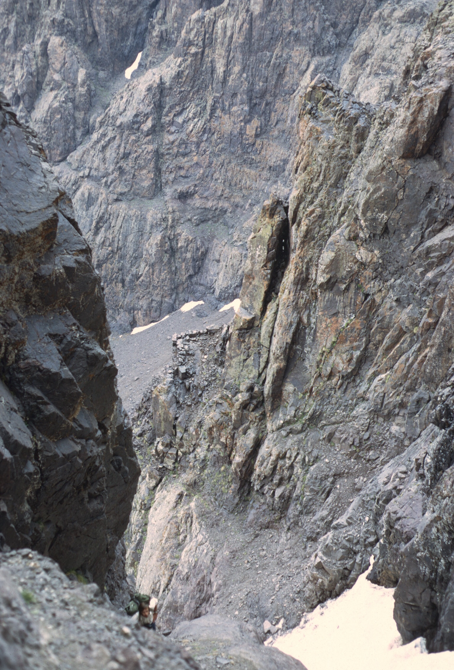
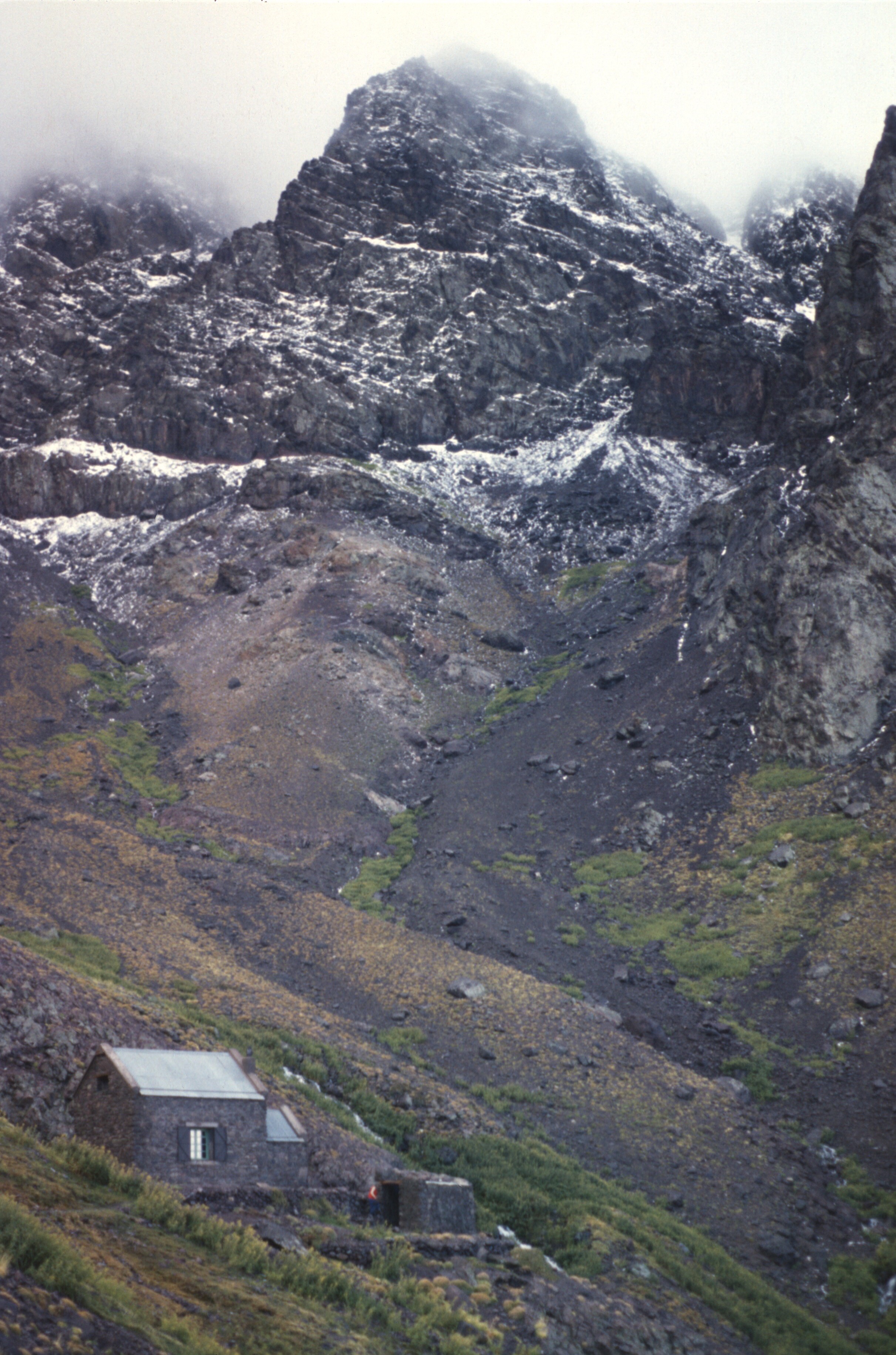
At the refuge at Taffert.
There was a guardian at Taffert, but the building, though substantial, was dilapidated, and there was no fire to temper the cold. I reckon it wasn’t used much at the time. I don’t recall electricity either.
A view from the cedars of Taffert, just before sunset.
So we ate and went to sleep in our sleeping bags.
The next morning was grey and overcast, and the mountain, covered with snow, looked a bit menacing. We were still worried about the road conditions, so we left early and returned home. There were no problems but we drove cautiously.
The next trip was with Louden and his wife, Ginny, and their dog, Pigpen. We didn’t get very far past Ahermoumou.
Crossing a ford on the road to Taffert.
The track was muddy and snowy, and the streams, with enough water to flow over the crossings, had to be forded. I think we gave up when faced by more serious snow. Pigpen loved the trip, a real change of pace from his yard in Rabat.
Winding along toward Taffert.
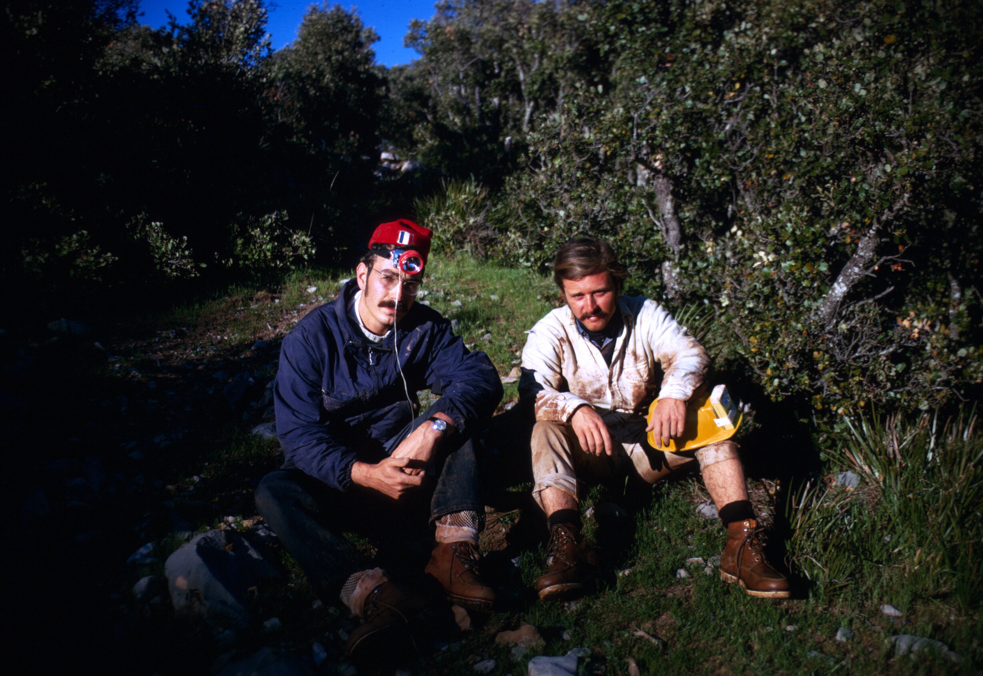
That trip set the stage for the next. Don Brown, then an administrator, and formerly a Peace Corps volunteer in Oujda, had always wanted to climb Bouiblane, which he had frequently seen on trips back and forth to Oujda. Now we had a newer Jeep. Louden was there, along with a volunteer, John Paulas. Gaylord and I filled out the roster. It was spring and we started out very early.
Sunrise. Bouiblane is still in the distance.
There was no problem getting to Taffert aside from some fallen rocks.
Stopping to see if the road was passable.
I don’t remember whether we went on our hikes immediately.
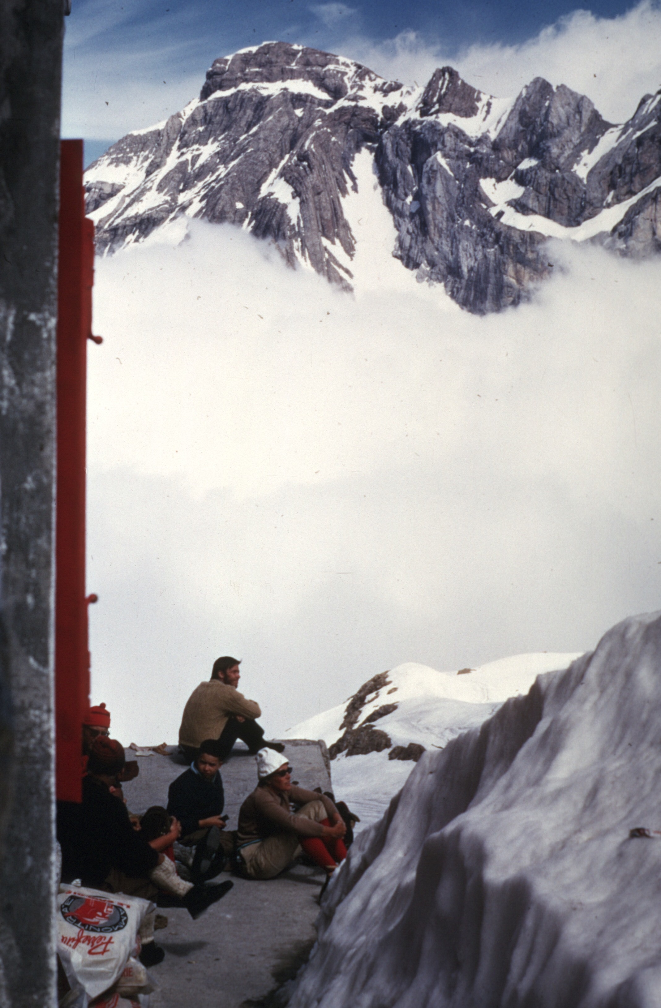
The refuge at Taffert
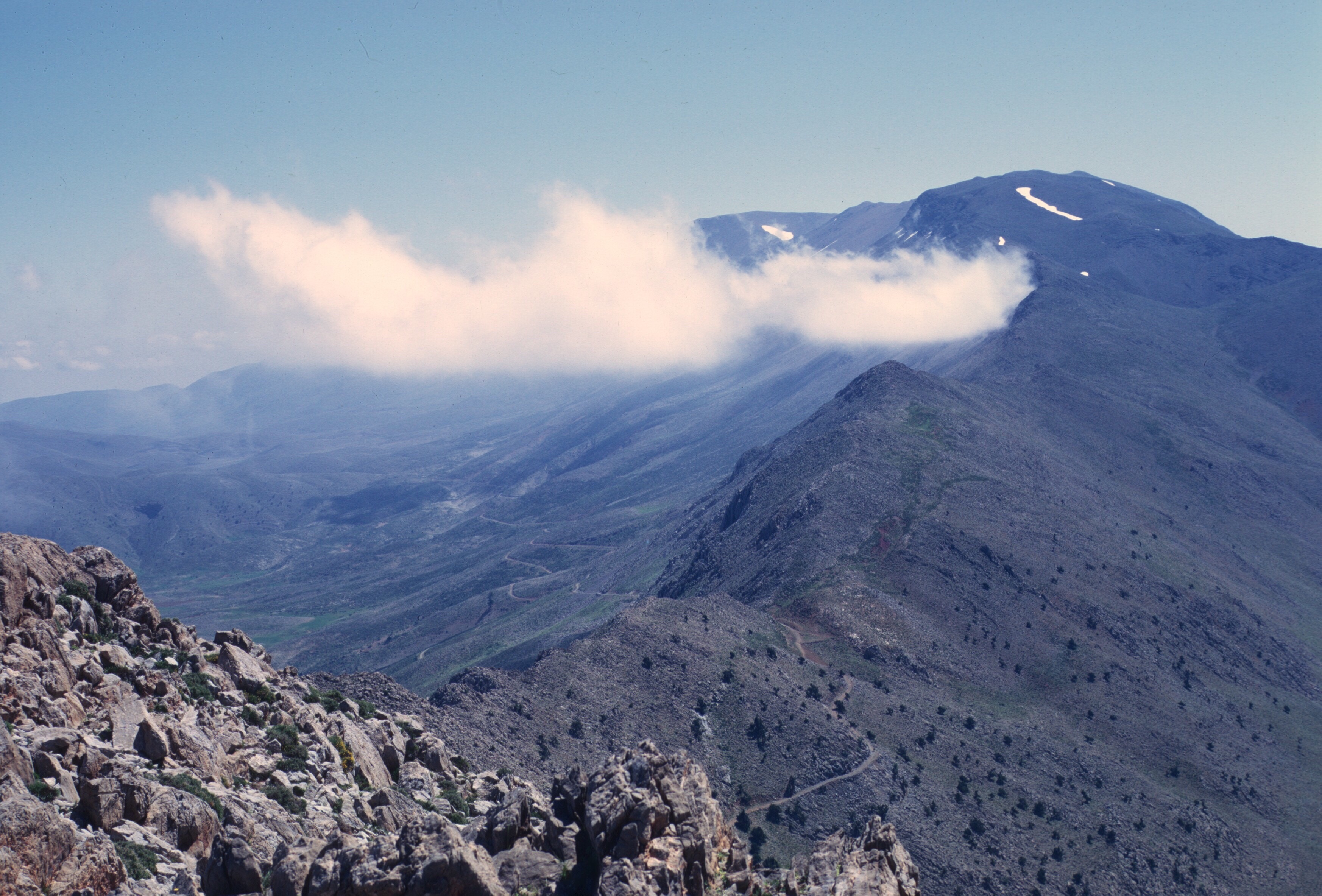
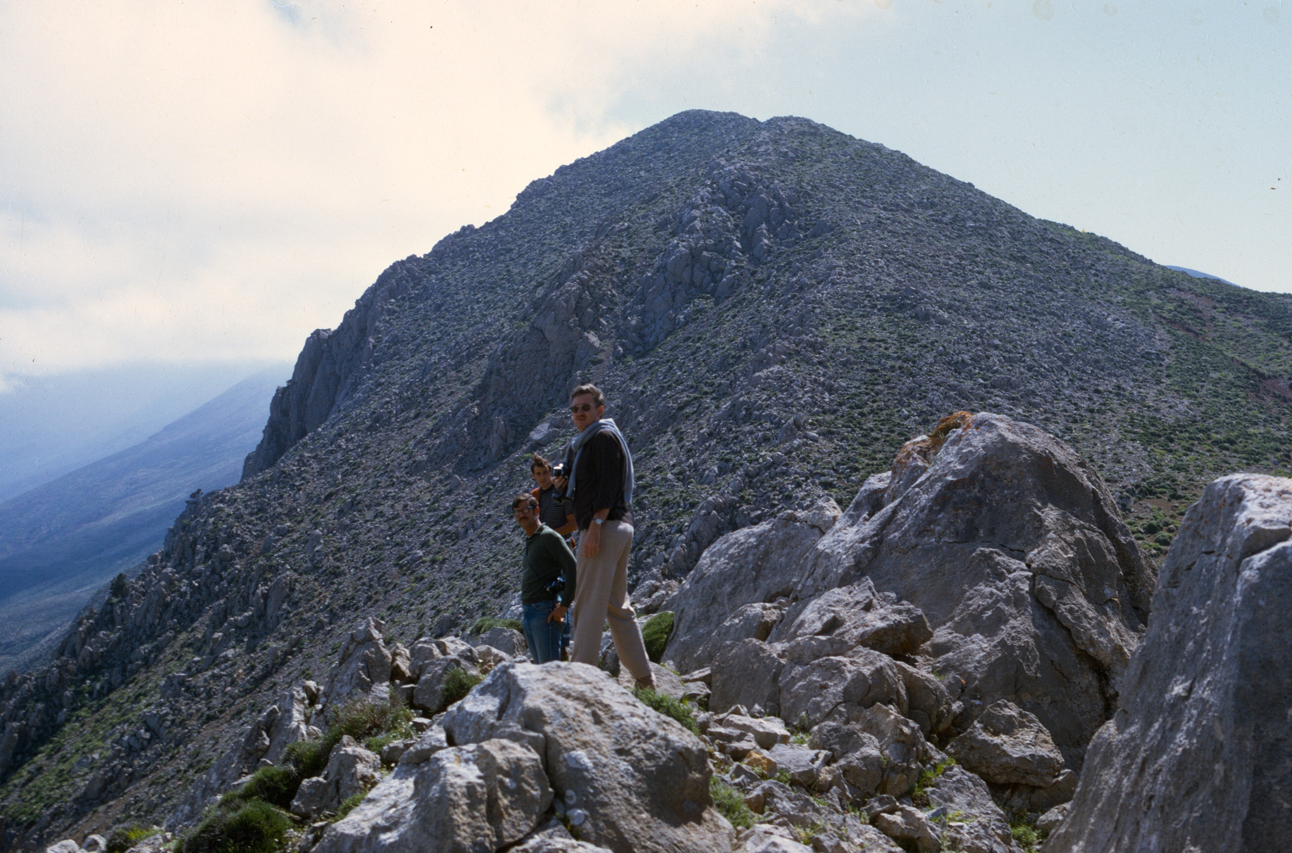
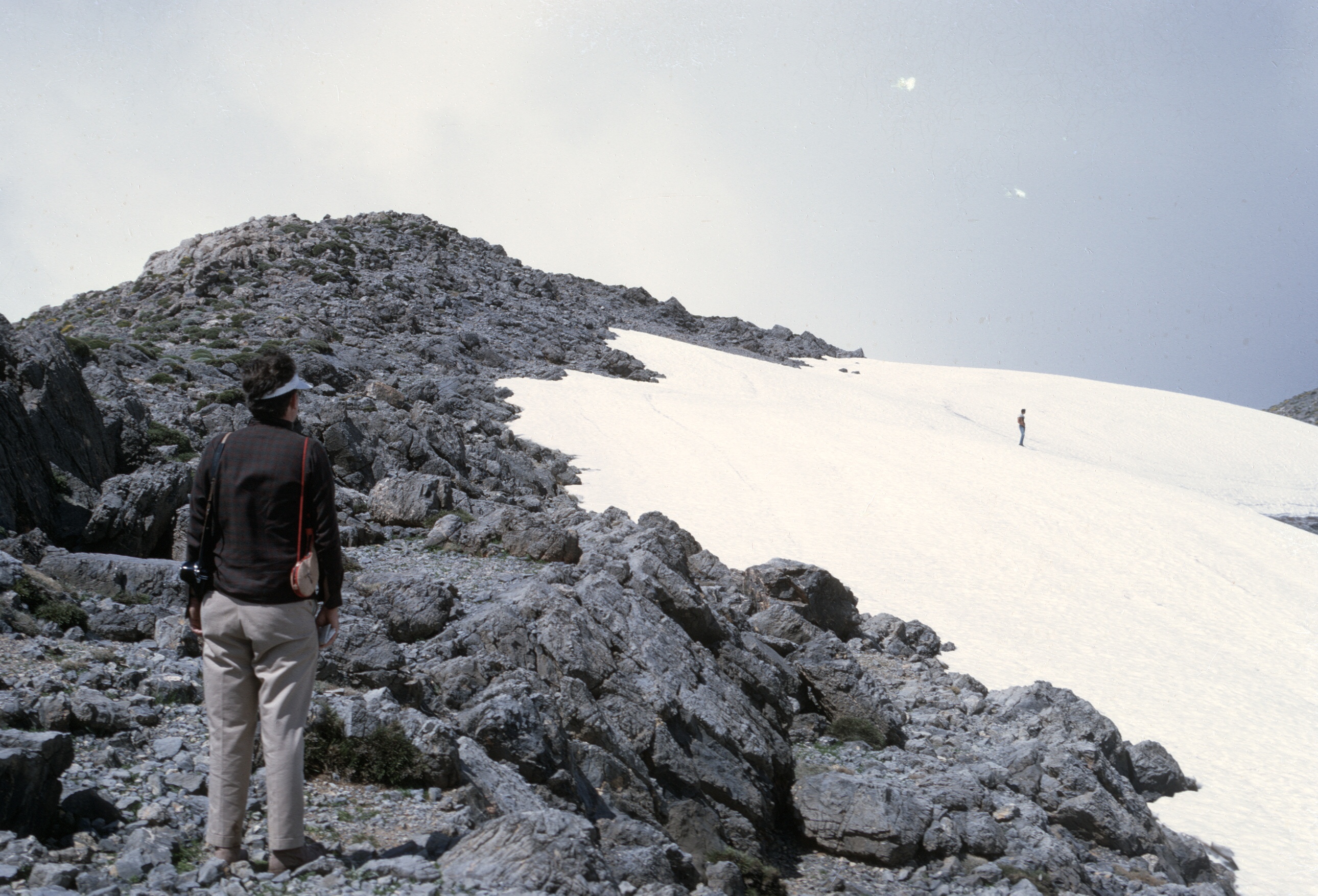
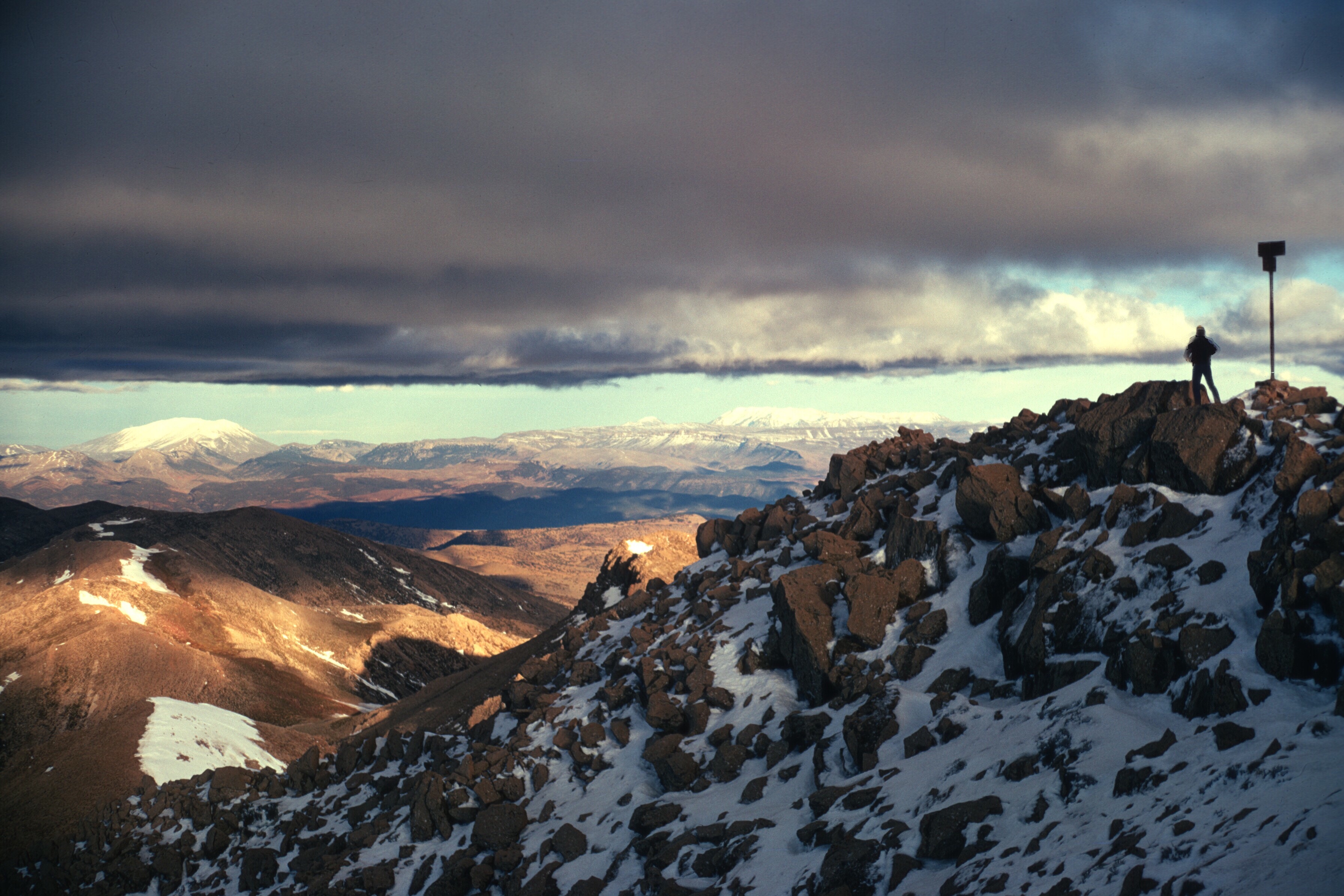
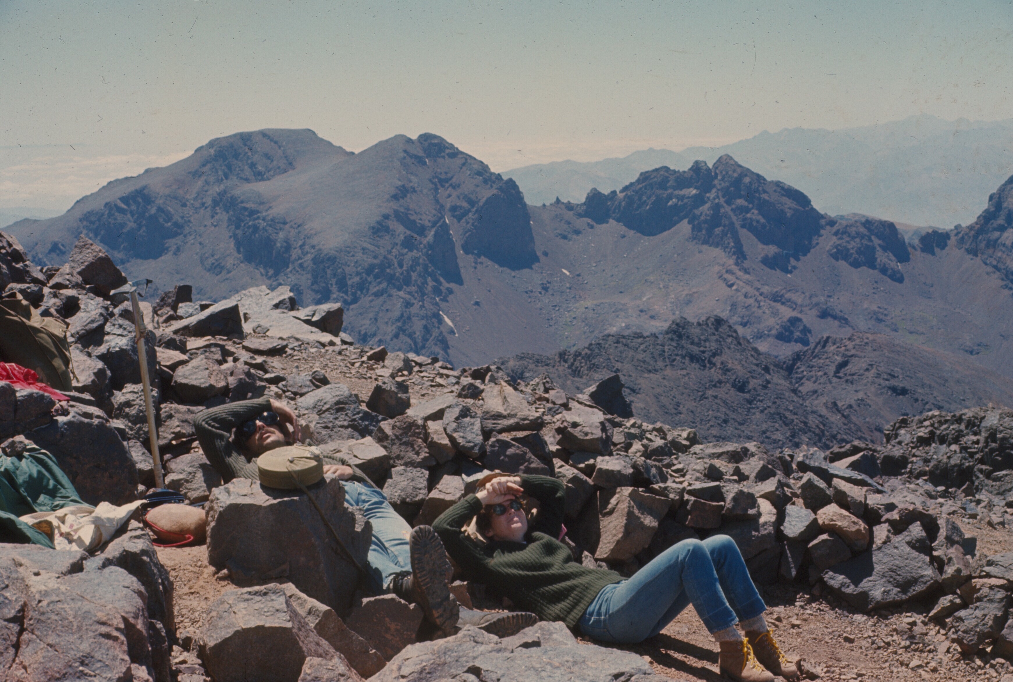
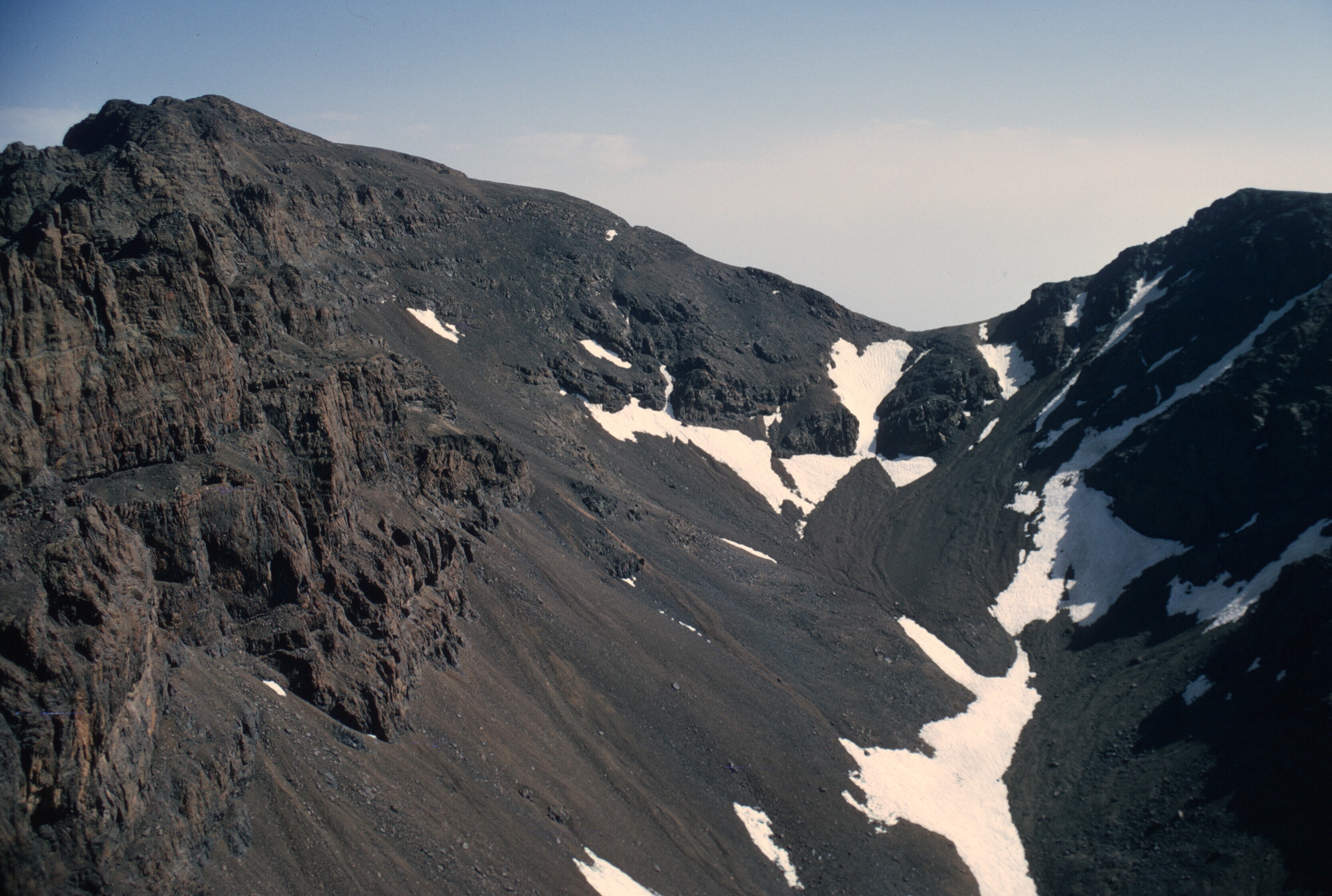
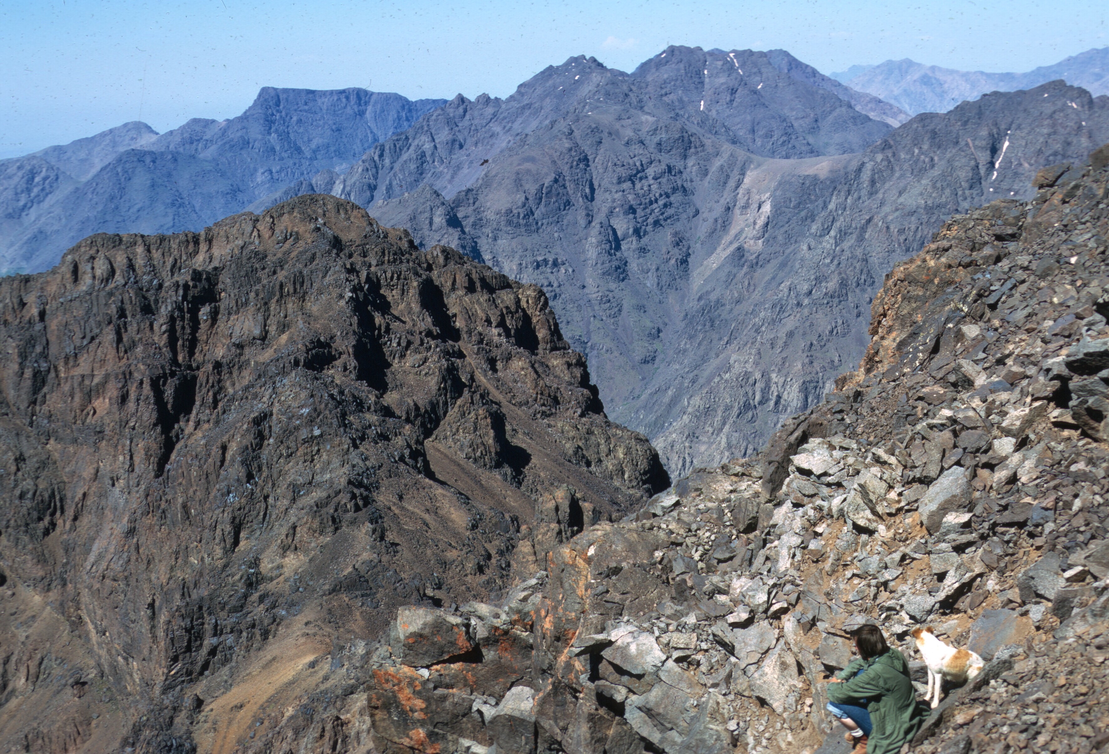
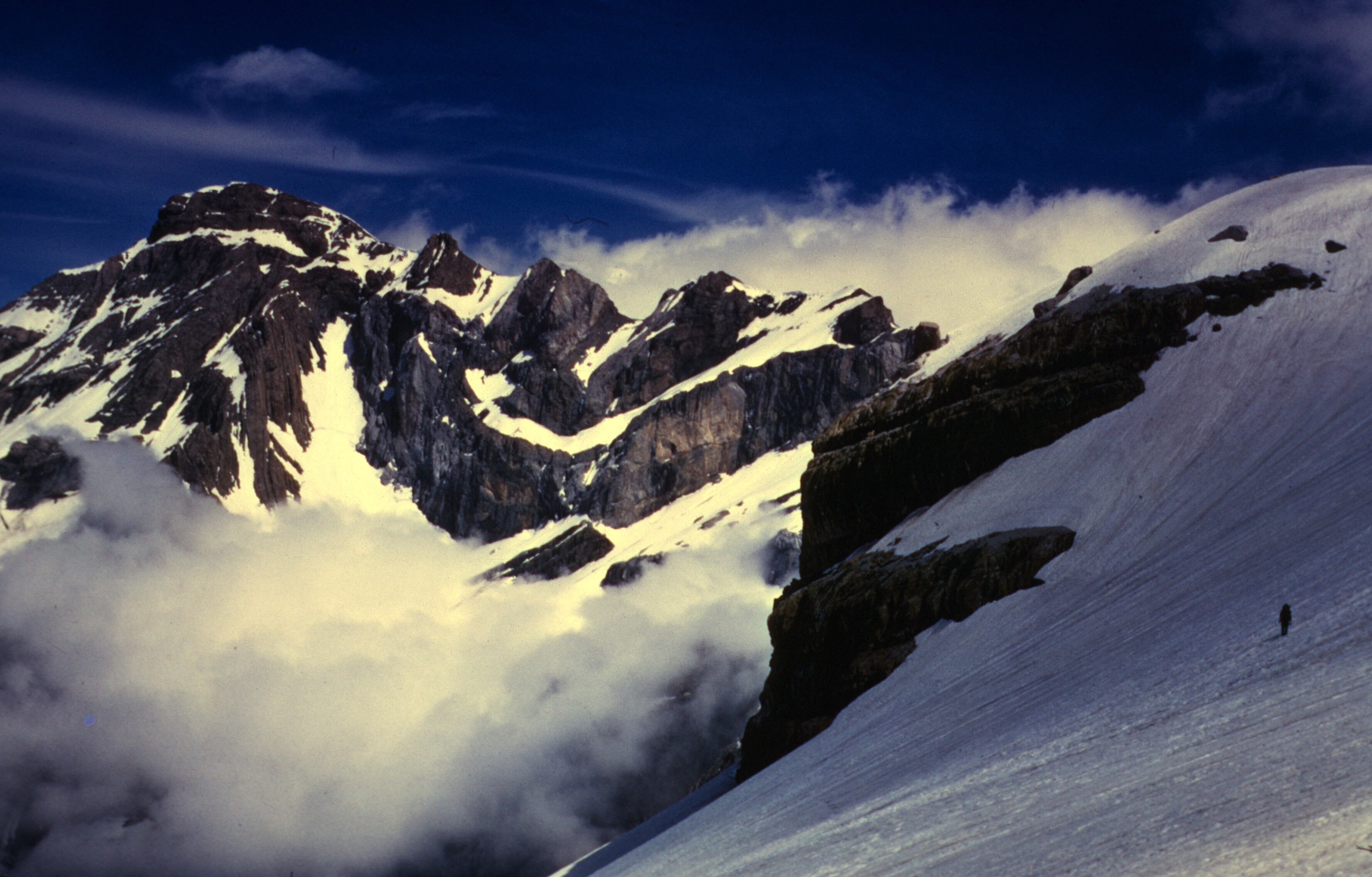
I think Don, Louden, Gaylord, and John were set on getting to the summit of Moussa ou Salah. For whatever reason, I think it was weather, I decided that a shorter hike made more sense. I think I suspected that there wasn’t enough time. I climbed the little pinnacle to the left of the Tizi Bouzabel, directly above the refuge at Taffert, and was rewarded with some great views.
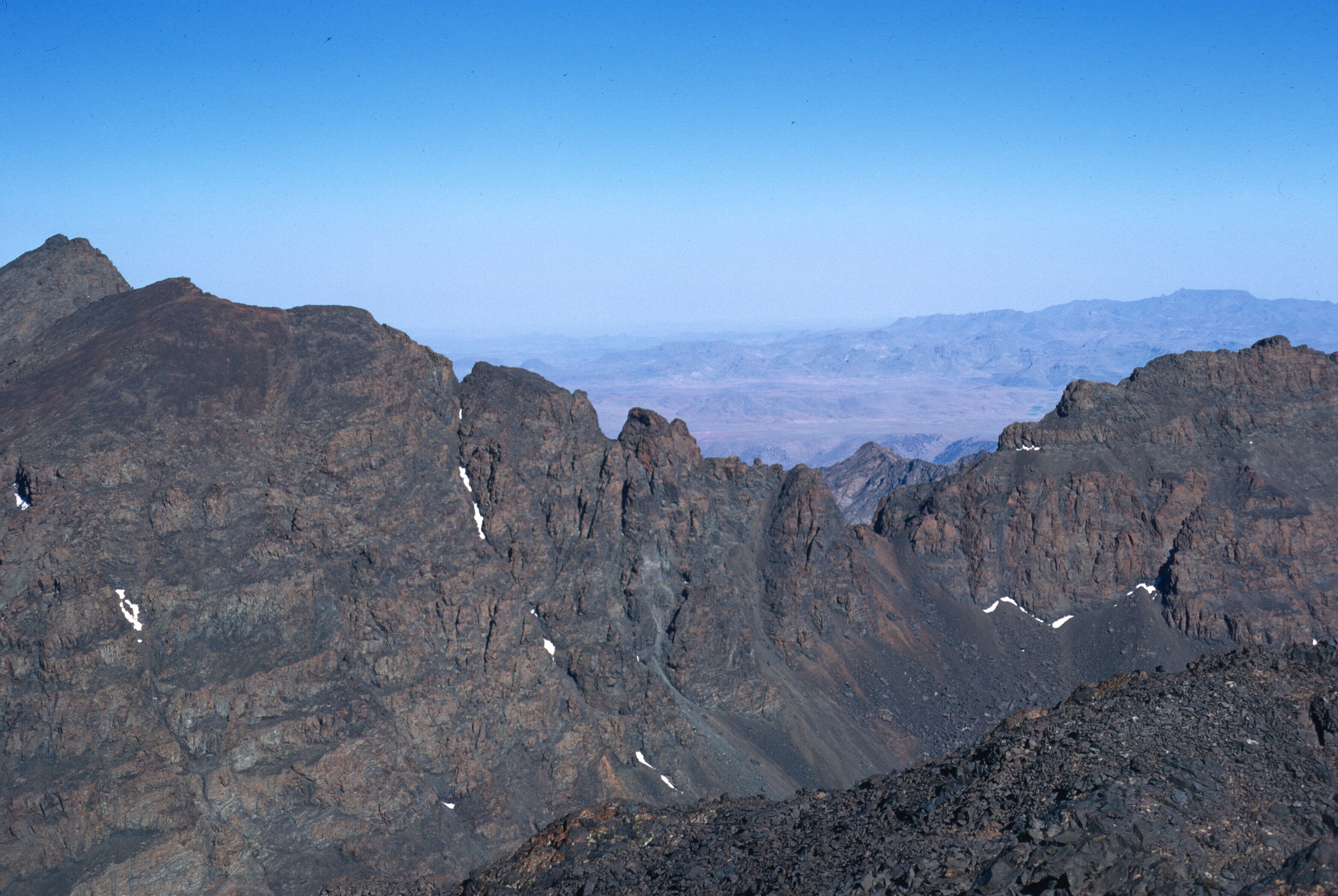
Looking east along the ridge of Bouiblane, toward Moussa ou Salah, from near the summit of Sidi MouminLooking to the southeast, Jbel Bou Naceur, the culminating point of the eastern end of the Middle Atlas.
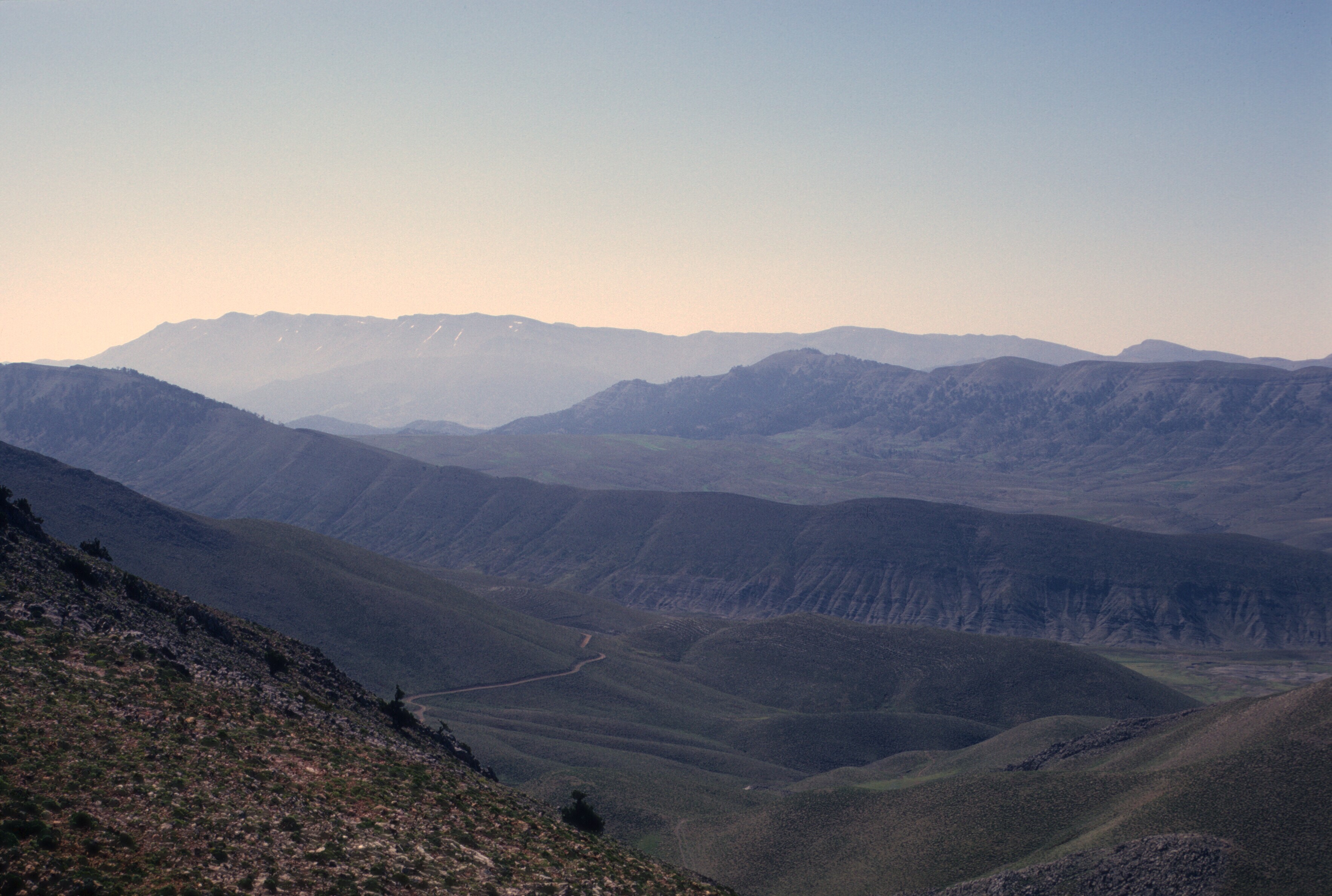
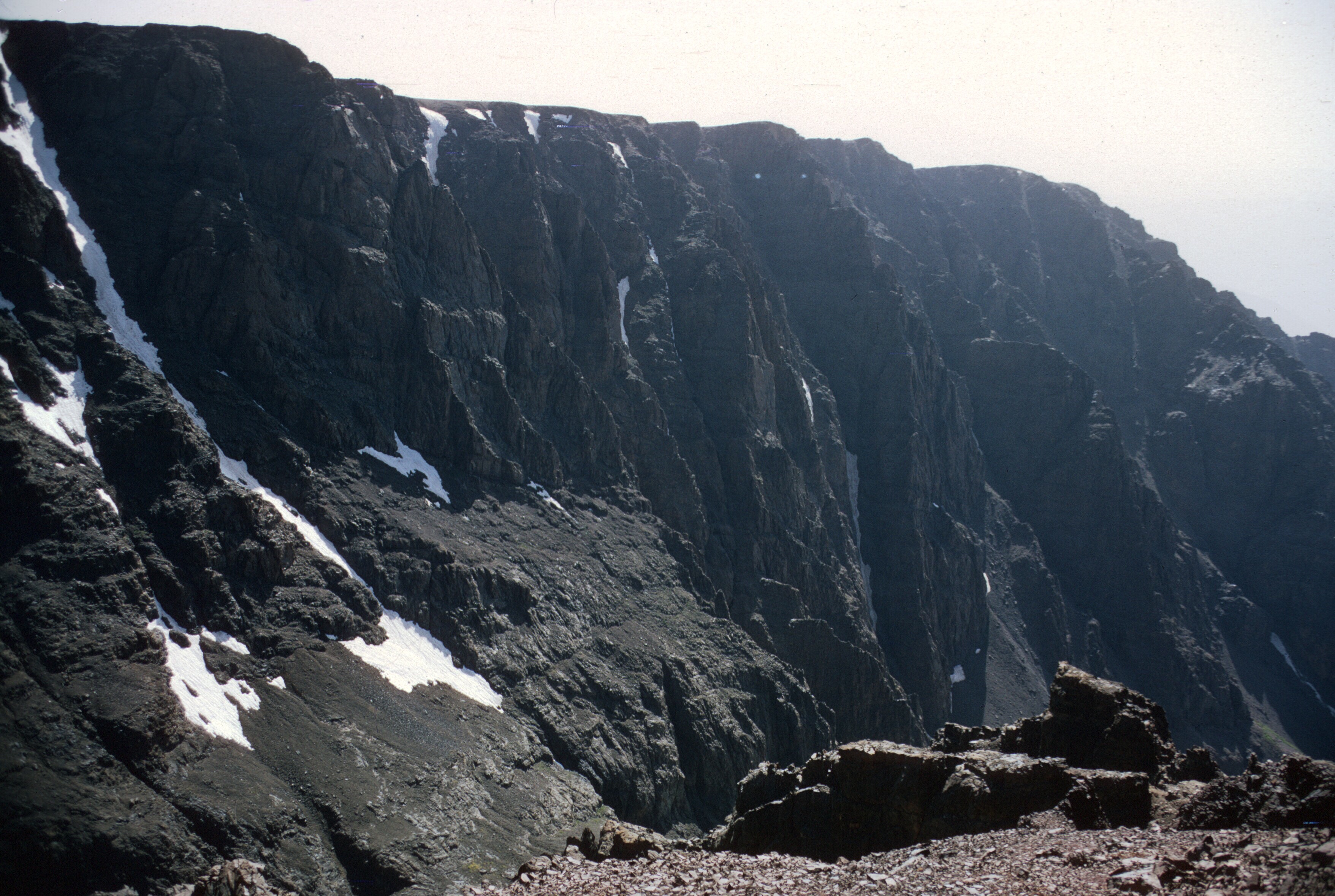
The others soon found out the obvious, that the crest of Bouiblane was a very long slog, and only took them to the saddle between Bouiblane and Moussa ou Salah.
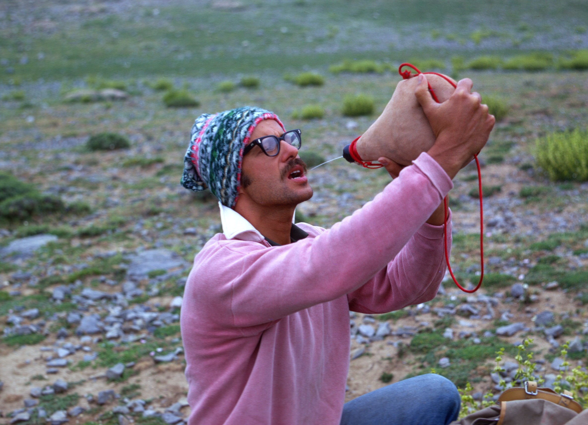
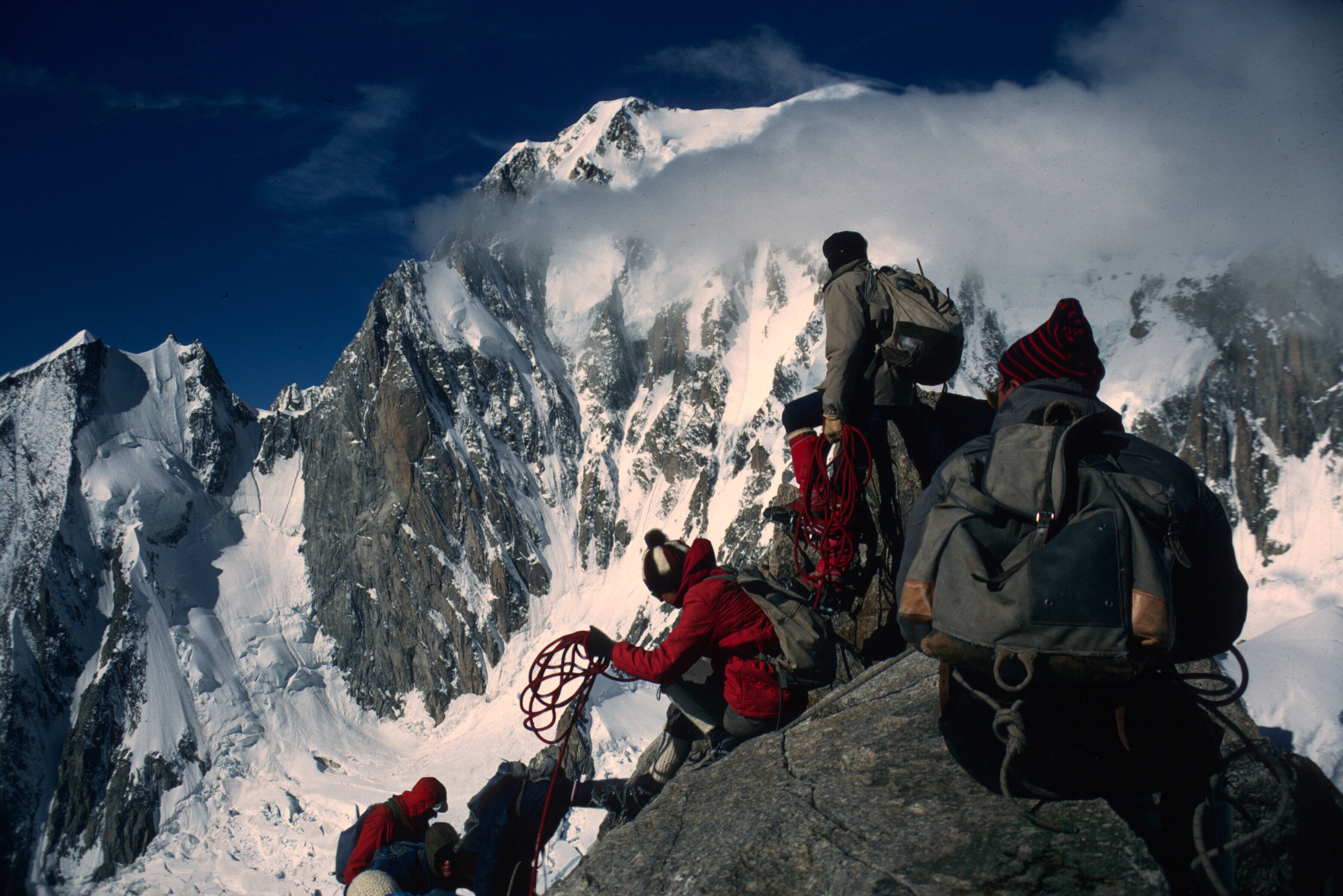
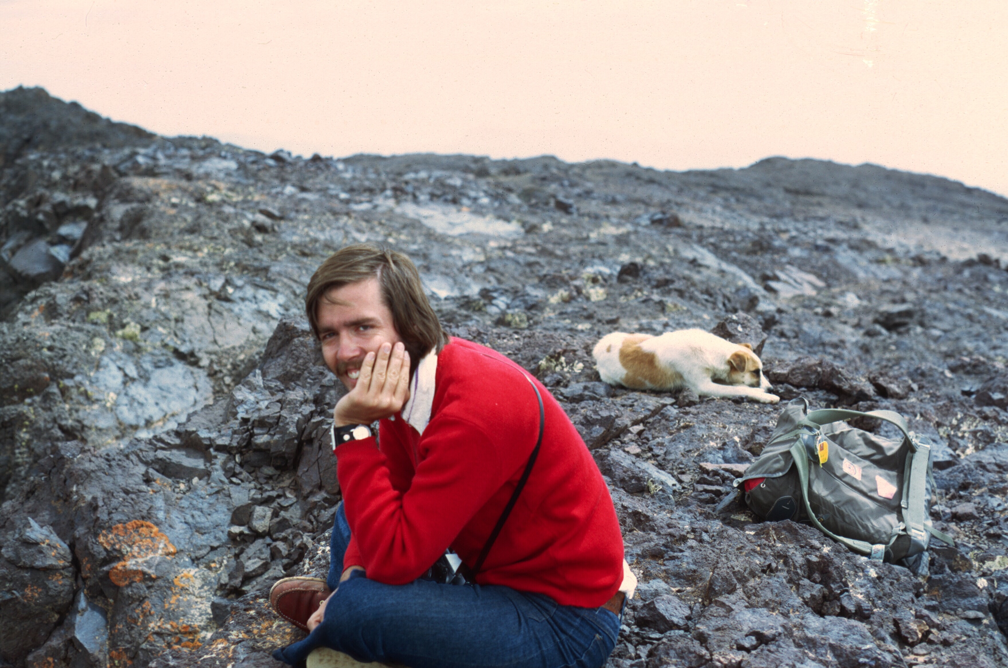
Louden heading toward the ridge.On the ridge.Snowfield along the main crest.Louden and his bota.Clouds settle in toward the end of the day. Moussa ou Salah still far off.
From that point, they could see clearly that the summit of Moussa ou Salah was higher, but it was very late and they were tired, so they returned defeated. The next day it was foggy at Taffert so we returned home via the Sefrou track.
Gaylord Barr and Don Brown.
This set the stage for two more attempts, both via the Taza track. Louden and John returned. Maybe Louden will elaborate if he reads this post, but I think he or John told me that that they went up in moonlight. It is only about a three or four hour climb, so perhaps they witnessed a sunrise, which would have been awesome. It’s always great to be on a big mountain at sunrise and sunset. In the Alps, this is often the plan as you want to be down and out of range of the rocks that hurdle down the snowfields in the warming sun of the afternoon. If you ever experience the sound that these projectiles make, you will never forget it.
Maine people await the first sunrise in the Lower 48 from Cadillac Mountain or, much more rarely, Mount Katahdin. I witnessed a sunset from Toubkal, but paid for it, descending through a damp and cold mist.
Tadat from Toubkal.
I also saw a sunset descending the west ridge of Angour, and another from the summit of Tichoukt. One of my favorite sunsets, though, was from the summit of Pic du Midi de Bigorre, which resulted in a long, long moonlit walk down to a ski place in La Mongie. My companion and I were lucky it was a warm night, and the receptionist was surprised that we arrived at the nearly deserted ski resort without a car! We tried hitching, but very few cars were crossing the Col du Tourmalet that night, and none of them was interested in picking up hitchhikers in the dark.
Sunset from Pic du Midi de Bigorre. August, 1965.
In May of 1970 I finally got my chance at Moussa ou Salah, when a group of staff and volunteers took a couple of jeeps in from Taza.
The Taza Gap where the Rif and the Middle Atlas meet. The city of Taza lies in the valley.
The views from the drive to the base of the mountain were often beautiful.
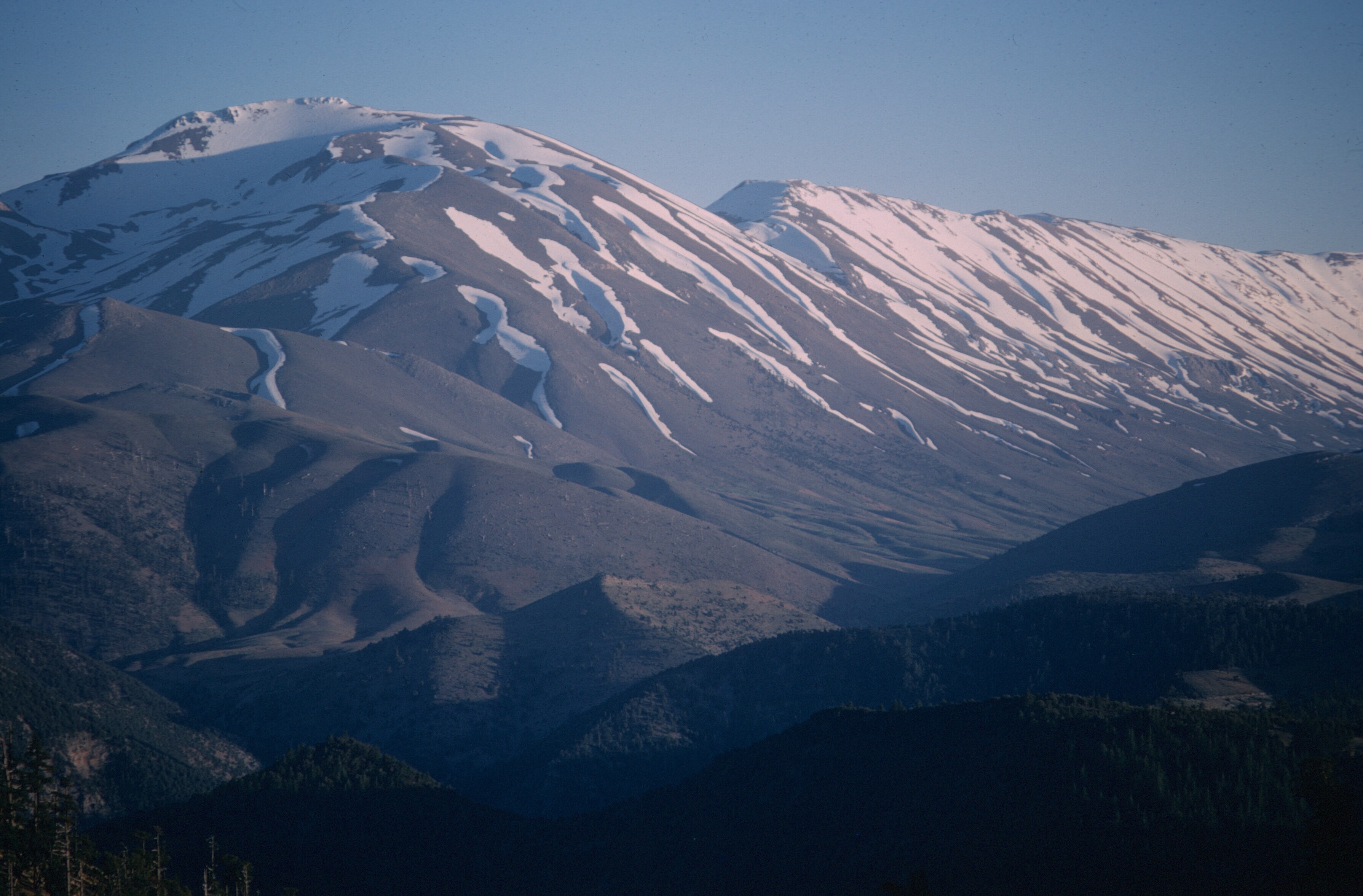
Moussa ou Salah from the Taza road.Moussa ou Salah and Bouiblane from the Taza road.Moussa ou Salah and Bouiblane in twilight.Moussa ou Salah and Bouiblane in twilight.
We camped overnight and climbed the next morning. The views from the summit of Moussa ou Salah were nothing special. There was a cairn on the summit. Was it a burial spot for a local holy man?
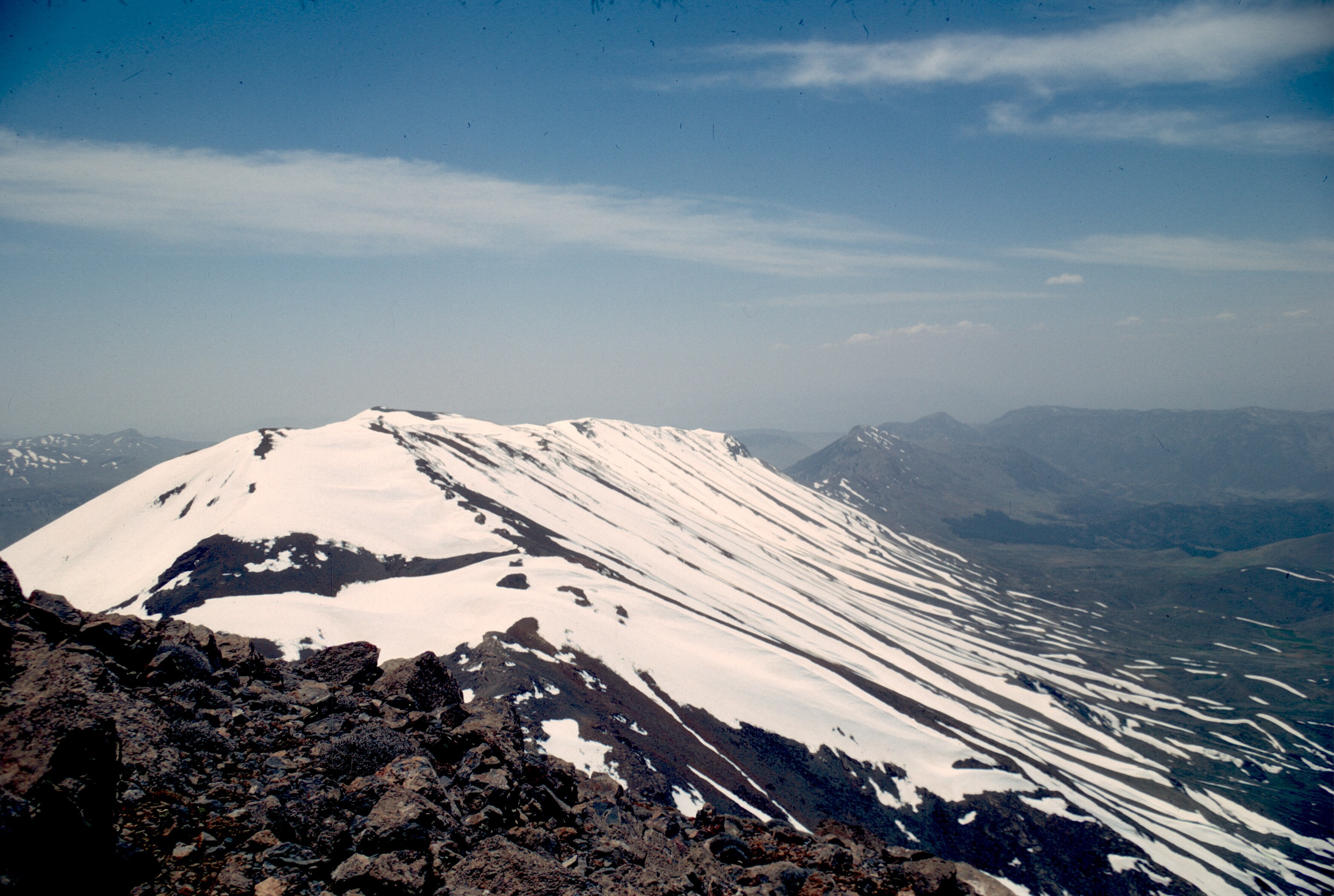
Bou Naceur seen from the summit of Moussa ou Salah..The long summit crest of Bouiblane.
I think John Paulas and some Peace Corps trainees later climbed Bou Naceur, visible from the summit of Moussa ou Salah, probably in the summer. That must have been a long, hot and dry ascent. There is not a lot of water on any of Morocco’s mountains in the summer.
Morocco is such a beautiful country!
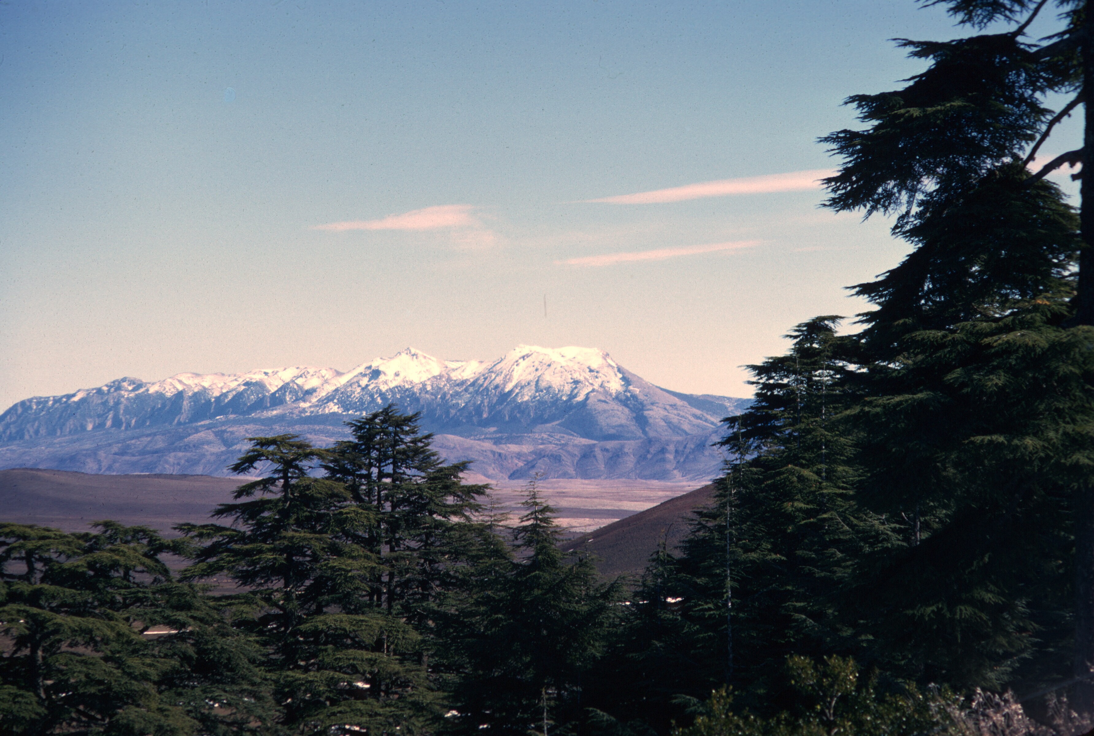
Bouiblane and Bou Naceur from the summit of Tichoukt
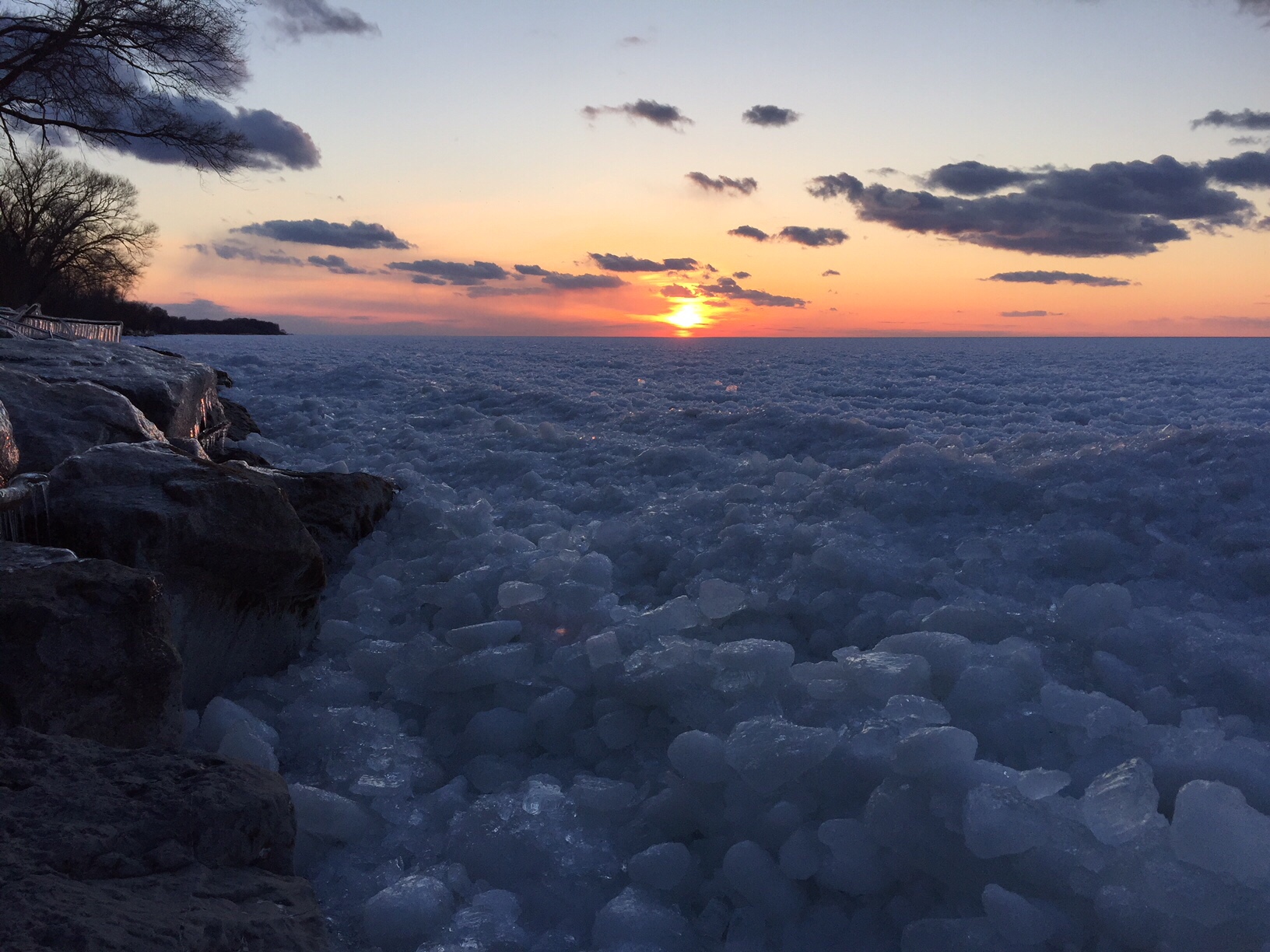
This shore ice accumulated after strong winds blew it out of Lake Erie and probably over Niagara Falls.
Before the Peace Corps, I grew up in the city of Niagara Falls, New York, a small industrial town on the Canadian border. The city sits along the Niagara River where early use of hydroelectric power fueled a chemical industry that sustained the city’s economy through the mid-twentieth century. Today the city’s economy is in a steep decline, a fate shared by many smaller cities in the Rust Belt.
Less a river in the traditional sense than a strait connecting Lake Erie with Lake Ontario, the Niagara receives almost all its water from Lake Erie.
The Great Lakes of the U.S. and Canada contain twenty percent of the world’s fresh water. Only Lake Baikal in Russia has about the same amount.
An ice-covered Lake Baikal. 344 rivers flow in. One flows out, equivalent to the Niagara. ESA.
That’s where similarities end. Lake Baikal is over thirty million years old, far older than virtually any other lake in the world. In geological terms, lakes are here today and then gone in a flash. Baikal is exceptional because it sits in a continental rift zone. The lake is over 5,000 feet deep, and getting deeper. Its age accounts for all the endemic species found in it, including the only freshwater seal in the world. Its remoteness protected its natural setting until Soviet times, and because Baikal is in the middle of Siberia, the lake freezes over completely in the winter.
The Great Lakes are much younger, the result of recent glaciation during the last ice ages, a few tens of thousands of years ago. None are nearly as deep as Lake Baikal, but four of the five are relatively deep, so deep that they do not freeze over during the winter.
A view of ice coverage in the middle of a harsh winter. Ice covers most of Lake Erie, but not the other Great Lakes. NASA
Only Lake Erie is so shallow that it exhibits a typical dimictic limnological cycle, where the lake water turns over en masse in the autumn and spring. Erie’s surface freezes solid during cold winters, too.
A close-up of the ice on Lake Erie. The Niagara River is visible in the upper right of the photo. NASA
Yes, if you are intrepid, you can walk from the city of Erie, Pennsylvania, across the lake to the northern Ontario shore, though no one would recommend it. Winds cause the ice to heave and form pressure ridges that obstruct movement. And it would be a long, cold, and dangerous walk, and one strongly discouraged by law enforcement agencies.
Every winter the New York Power Authority, which manages a large hydroelectric plant in Lewiston, New York, just north of Niagara Falls, installs an ice boom across the source of the Niagara River at Lake Erie. Made of massive timbers chained together, the ice boom floats on the lake surface and keeps lake ice from floating into the river where it might clog the intakes to the American and Canadian hydro plants.
The Lake Erie ice is held back by a boom in the lake. The Niagara River is ice-free except where ice accumulates in the gorge below the falls. NASA
Keeping ice from entering the river also helps to prevent ice jams, which sometimes cause serious flooding. In the mid-nineteenth century, an ice jam formed such a solid barrier that Niagara Falls actually went dry for a short time.
Since the boom floats, strong winds can force ice over it, which is part of the design. A few days ago continuous winds from the west blew so much lake ice over the boom and into the river that the ice continued downstream over the falls, through the gorge below the falls, and into Lake Ontario where it collected along the shoreline, which happens to include a part of my backyard. Hence the initial picture. Because of its depth, Lake Ontario never freezes over, but ice does form along the shore during the winter months.
Typical shore ice that accumulates along Lake Ontario.
By the end of March this year, the shore ice had disappeared, but a few days ago it suddenly reappeared. It was Lake Erie ice that had made its way downriver into Lake Ontario.
This isn’t rare, and usually happens when the Power Authority removes the ice boom. In this case, it happened with the boom in place. The Power Authority just began yesterday to remove the boom, but the ice remaining on the eastern end of Lake Erie is now minimal. Today most of the shore ice is already gone. Diving ducks, geese, and an occasional loon are stopping for a feed on their journey north.
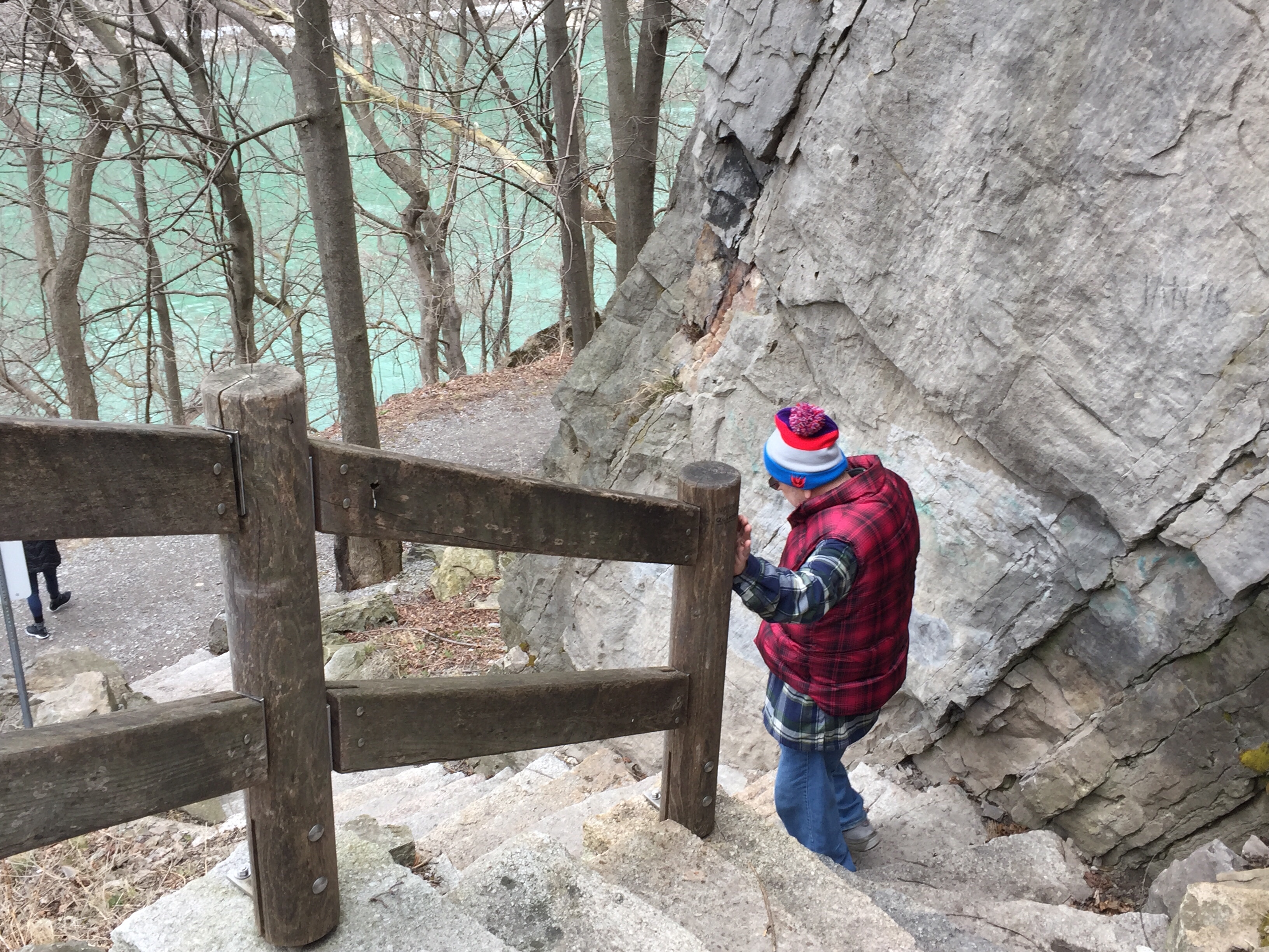
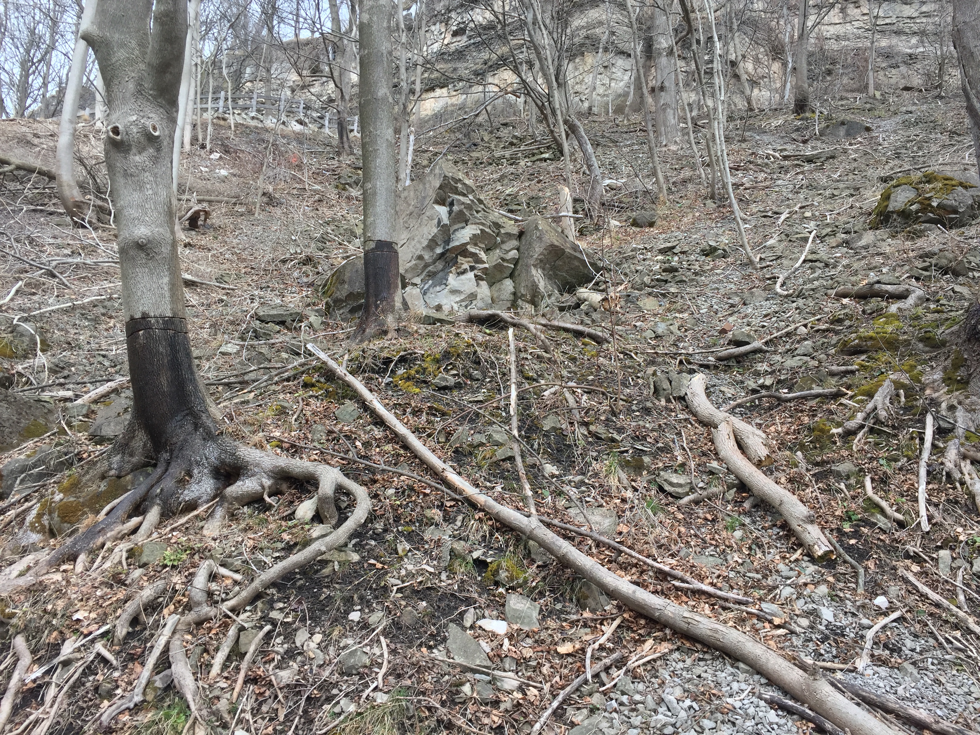
My younger daughter, Kate, has been visiting, and Kate, my wife, and myself, wanting to get some fresh air, went into the city and walked down some newly created stairs near the Whirlpool Rapids bridge, part of a larger trail-building project in the Niagara Gorge.
New stairs lead to the old gorge railway trail.
The stairs led to a section of the Old Gorge Railway roadbed.
Rockfalls and frozen seeps are characteristic of the gorge in the winter and early spring
I took this last fall when the Buffalo News was doing a story. The News photographer was adjusting his camera.
Early spring and winter are the least scenic times to visit the gorge. Fall is my favorite, though I spent many summer days fishing there.
Until the mid-nineteen thirties, a trolley ran from Niagara Falls, through the gorge, to the village of Lewiston. In the railroad’s early days, a similar trolley ran along the Canadian side. The route was scenic, and many tourists included it in their visits to the area. In 1901, President McKinley rode it the day before he was assassinated in Buffalo, New York.
President McKinley riding on the Great Gorge Railway at Niagara Falls, Sept. 5, 1901. Photographer: G.D. Brinckerhoff. Source: Western Electrician, v.29, no.2 (September 21, 1901) p.182. Courtesy of the University of Buffalo.
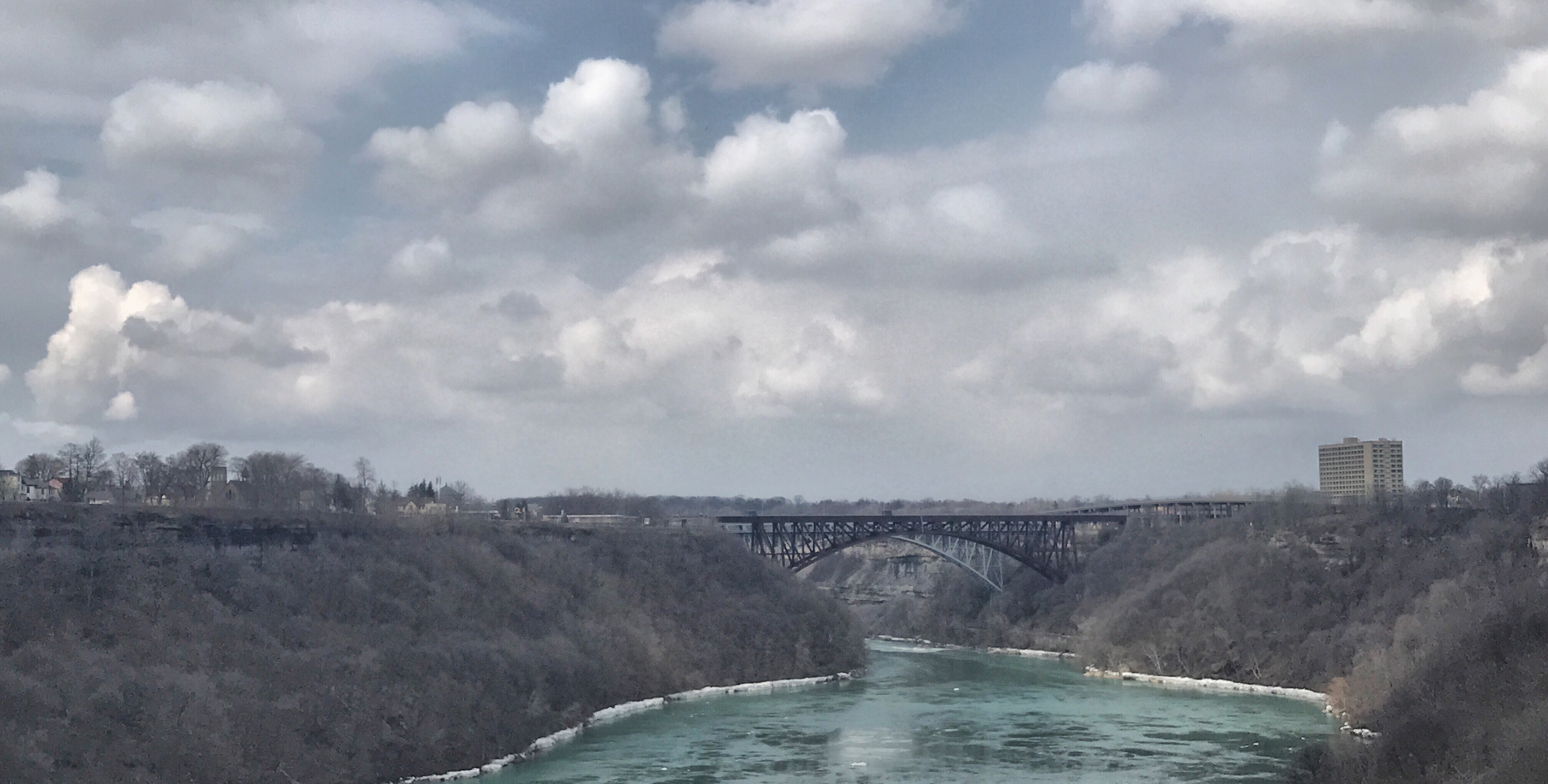
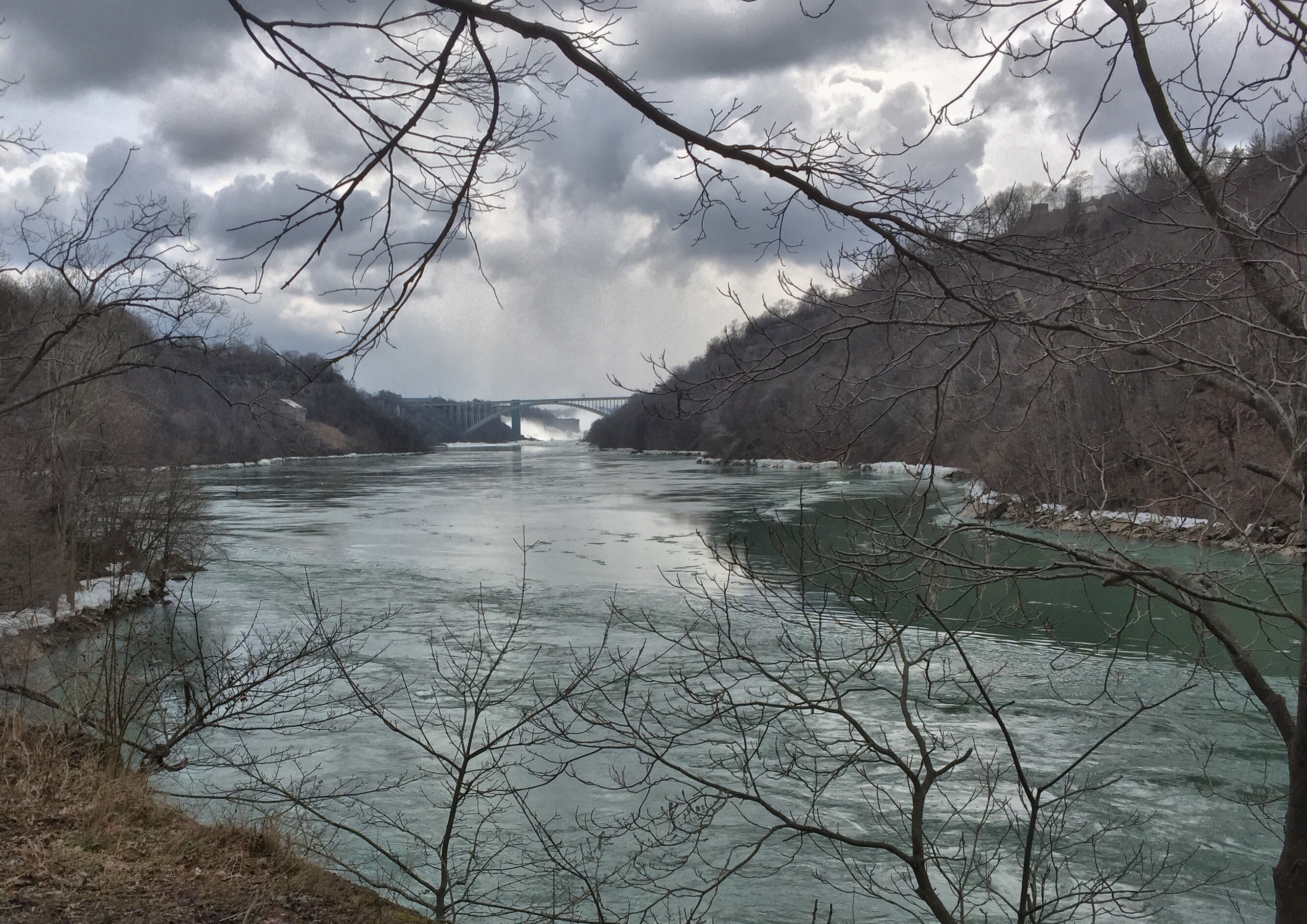
Frequent rock falls and changing transportation technology forced abandonment of the trolley, but the roadbed remains in place for much of the former American route, and today it offers a convenient way to descend to the area below the international bridges where the Whirlpool rapids begin, or even farther, though shale slides make certain passages difficult. The Whirlpool rapids are Class VI, and seldom attempted by kayakers.
Two arch bridges connect Niagara Falls, New York with NIagara Falls, Ontario. One is a commercial railroad bridge. The other carries autos and trains. The first bridge built on this spot was a suspension bridge designed by John Roebling, who also designed the Brooklyn Bridge in New York City. To start the cables, a kite flying contest was held. The rapids begin just beyond the bridges.
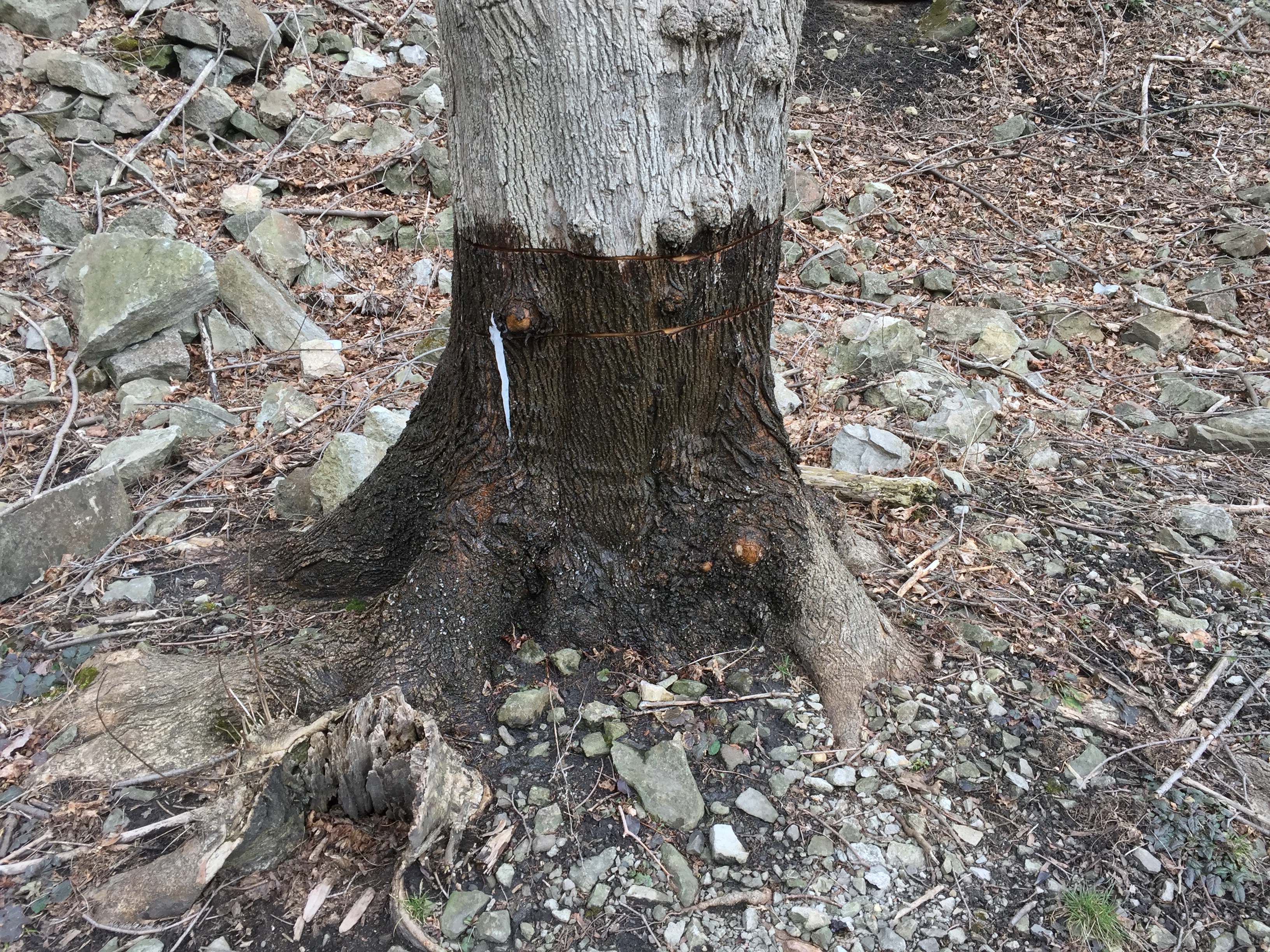
Having a unique microclimate, the gorge provides a home to many plants, including very old cedars (Thuya occidentalis), but due to the railroad and urban development, the natural flora has been severely degraded. The Nature Conservancy is in the midst of an ambitious project to restore native vegetation. After mapping invasive species, the Conservancy’s first step is to remove them, primarily Norway maple and Tree of Heaven (Ailanthus altissima). Girdling will kill the trees, removing competitors, and letting light reach through the canopy to the forest floor, where native species can regenerate and compete.
Sap flowing from the girdled trunk darkens the bark of this maple.
Many of the larger trees are invasive, and have been girdled.
The Niagara Gorge is a small, but unique place, and totally overlooked by most tourists. Let’s hope a new trail system and an emphasis on restoration of the native vegetation will make it even more interesting.
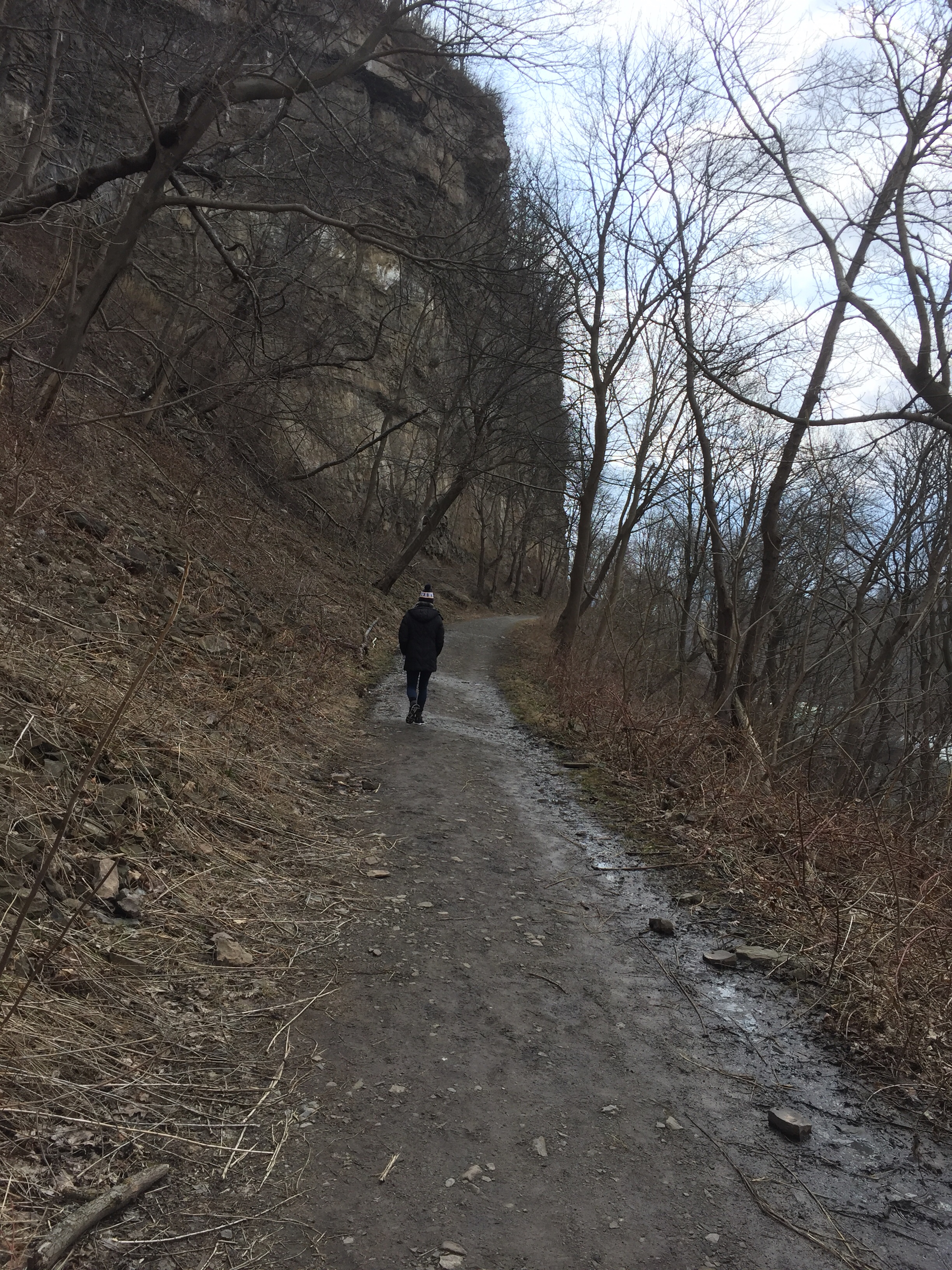
My daughter, Kate leading the way up and out.
Following the railroad trail out of the gorge rewards the hiker with views of Niagara Falls. Indeed, the former village of Bellevue took its name from the view.
A view of the Falls from below the Whirlpool rapids bridges.
Americans sometimes regard the Muslims as if they all are cut from a common cloth. Of course, that is not the case. There is probably as much variability in Islam as in Christianity. Even in a single country like Morocco, a wide variety of beliefs and practices coexist and compete.
The city of Fes boasts one of the oldest institutions of higher learning in the world: the Qarawiyyin. A center for religious studies, the school teaches Islamic law and religion. The Qarawiyyin has been a center of orthodox Islam since the Middle Ages.
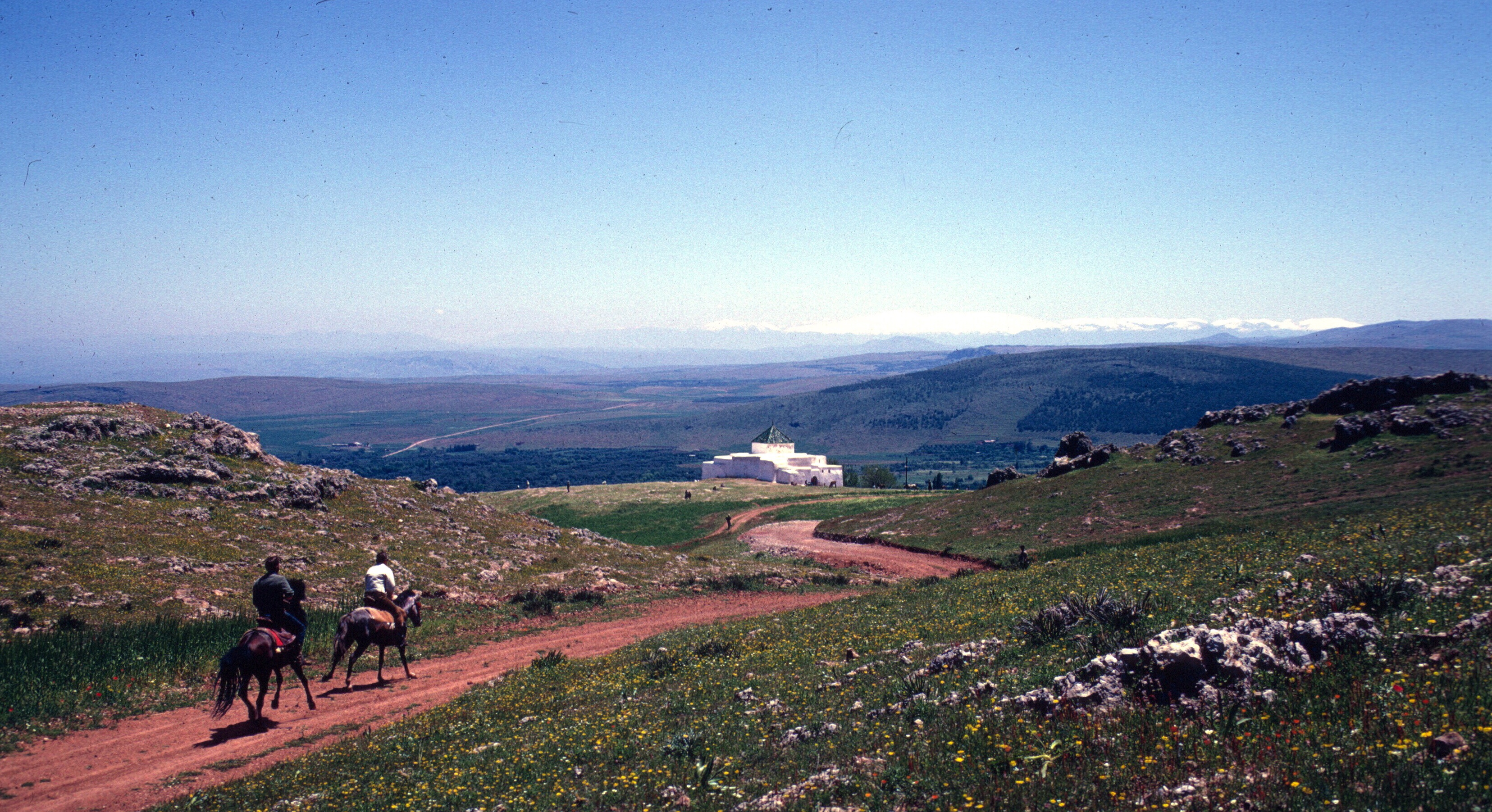
The tomb of Moulay Idris is under the large green tiled building on the left. The Qarawiyyin mosque and university are in the center.
Leo Africanus, whom I mentioned in a post on architecture, lived and studied there after his family fled Granada.
Adjacent to the Qarawiyyin is the zawiyya of Moulay Idris, founder of Fes, which contains his tomb, and a center for devotions.
An entrance to the shrine of Moulay Idris. Deep in the medina of Fes.
Like his father, Idris I, and like some of Morocco’s modern sovereigns, Idris II had baraka, acquired through piety or inheritance. A kind of blessing from God, baraka can cure illness or bring fertility.
The Islamic world, both Sunni and Shi’a, hosts tens, if not hundreds, of thousands of tombs of men and women whose holiness confers benefits to those who venerate them. The Saudis and other Muslims practicing extreme forms of Salafism abhor this. ISIS in Iraq destroyed every tomb they could find. The Saudis consider some Moroccan practices as idolatry and witchcraft.
Folklore and superstition do mix with religion, however, and some of the Moroccan brotherhoods, attached to zawiyyas, do things that seem strange, not just to us, but to their fellow Muslims in Morocco. On the other hand, some Christian sects in America dance with snakes. Who am I, a non-Muslim, to judge? The people in my photographs were often friends, neighbors, students, and co-workers. They welcomed me to their country and took care of me. I will be grateful to them until I die.
The tombs of saints come in all sizes and shapes.
Tombs near Beni Mellal
Wood roofed tombs near Imouzzer des Marmoucha.
The shrine of Sidi Ali Bouserghine. Sefrou.
Shrine in the Sahara. If one circles it three times and leaves an offering, one’s journey will be blessed.
Moulay Bouchta. Pre-Rif, north of Fes.
Whether in the wilderness of the Sahara, the middle of a great city, the empty countryside, or in a village, many tombs and brotherhoods have rituals and practices unique to themselves.
Aissawa during the Miloud (the Prophet Mohammed’s birthday).
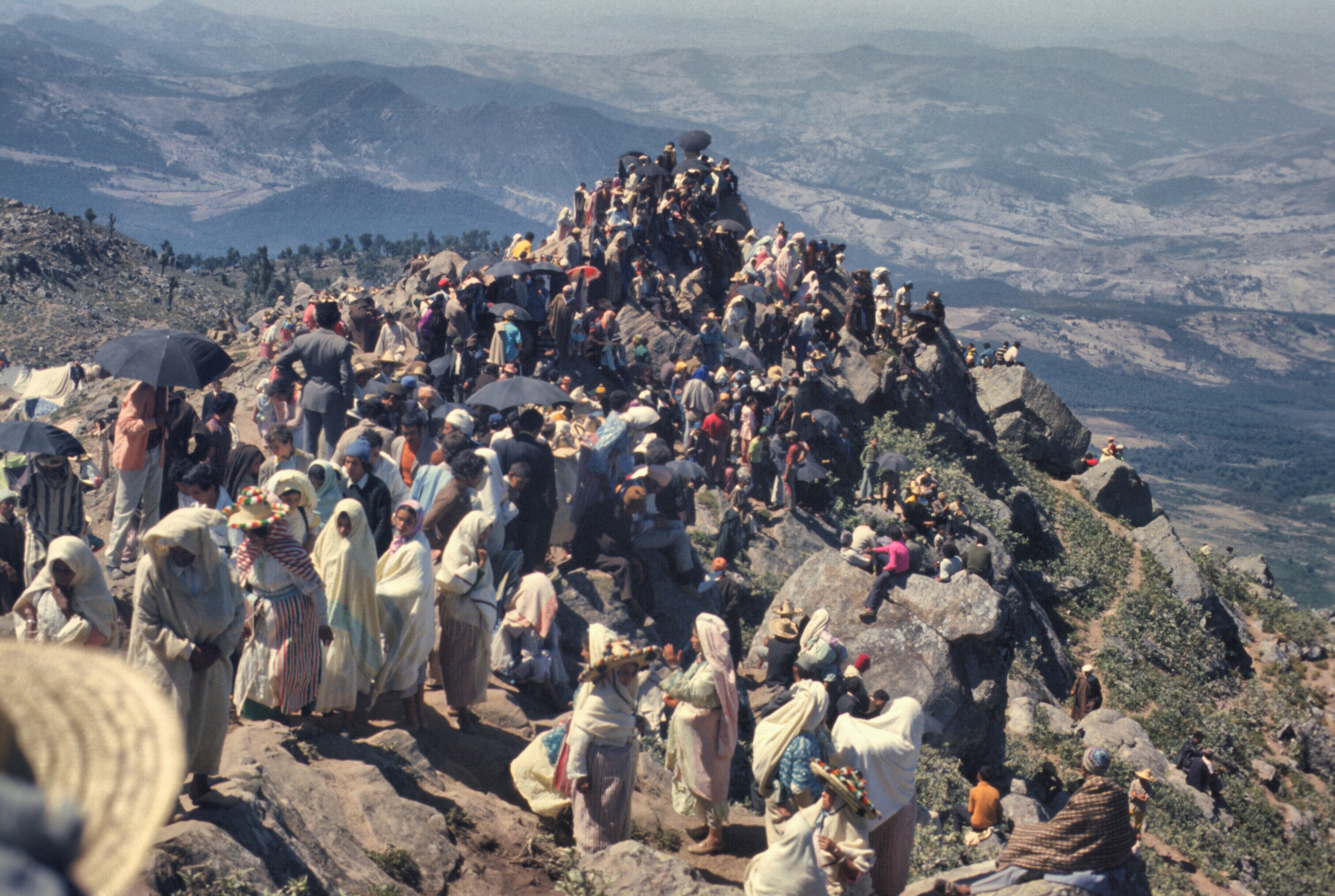
On top of Jbel Alam, for the moussem of Sidi Abdeslam Ben Mechich. It took a convoy of trucks to get the crowds to the top of this mountain..
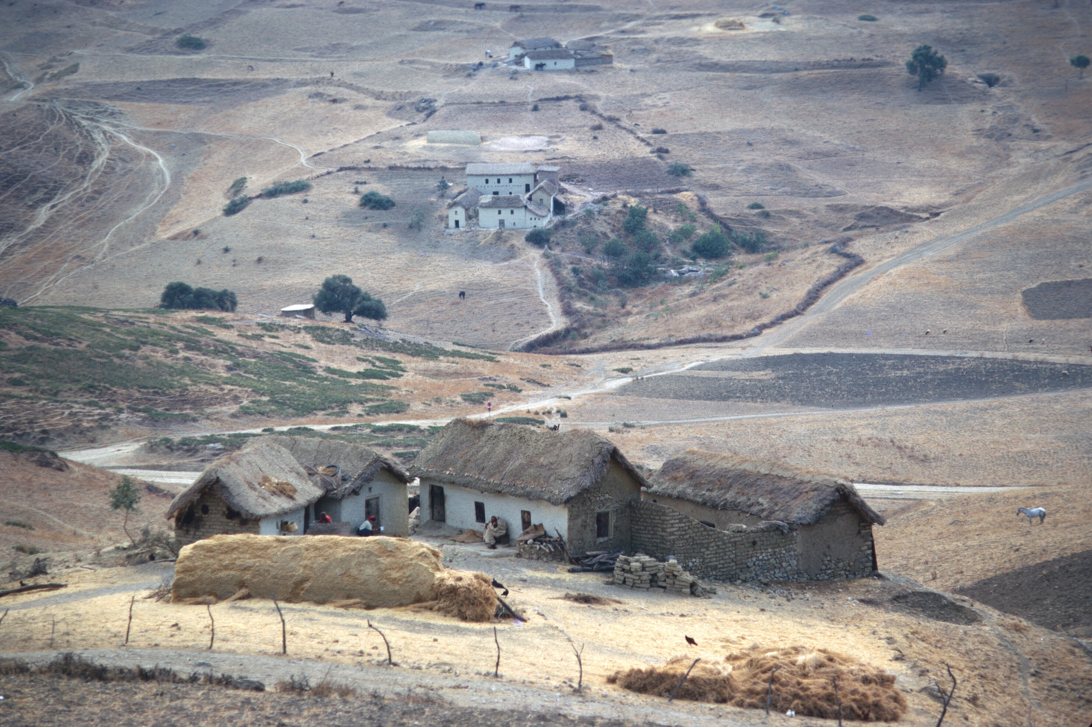
Aissawa at the Cherry Festival. Sefrou. The snakes were not poisonous, but they bit the dancers, drawing blood.
Moulay Bouchta. Gun play before entering the shrine.
None of the scenes above were staged for tourists. Those in them are not of the same ilk as the performers at the Jemaa el-fnaa in Marrakesh. They were taken at religious festivals, or moussems. Indeed, few non-Muslims have stood on top of Jbel Alam in the Jbala during the moussem dedicated to Sidi Abdeslam Ben Mechich. I consider myself fortunate.
I have many more pictures from these events. Perhaps I will do a separate post on each if there is any interest, and try to explain in more detail what is happening.
Here in America, Netflix has just premiered a Spanish series, Love in Times of War, which takes place in Morocco in the nineteen twenties, during the Rif uprising by Abdelkrim. Filmed in Morocco, much of the series is situated in the Spanish enclave of Melilla.
Not well known outside of Morocco, except in Spain, the Rif rebellion was an unmitigated military disaster for the Spanish, and an episode of Moroccan history that showcases Berber resistance in the North, never a popular subject with the Makhzen, the Moroccan government. The Rif remains a region where the government is unpopular and its rule is heavy-handed.
The Rif War was marked with corruption and incompetence, and fought with conscripts so poor they sometimes sold their weapons for food and clothing. Against common sense, the Spanish set up a series of forts extending west from Melilla, through the dry hills and rugged mountains of the Rif. Many were located in spots without permanent water sources. In the hot summer of 1921, the Riffians, after warning the Spanish not to advance deeper into their territory, struck simultaneously along the line and cut off each fort from resupply. The rout in the battle of Annual is immortalized in the Spanish novel by Arturo Barea, The Track (La Ruta), part of his larger work, The Forging of a Rebel. Over 13,000 Spanish soldiers died, and for a long time afterwards the Spanish army was confined to Melilla. Barea sought asylum in Britain after the civil war, and his wife and friends helped him translate his autobiographical novel into English. An interesting footnote to this story, Barea lost the Spanish copy after the translation. The Spanish version of his book, La forja de un rebelle, is a translation of its English translation.
In only two battles of the war, the Spanish suffered casualties of roughly 30,000 men. The next disaster was Chauen.
City gate, Chauen..
In the retreat from Chauen in 1924, with the weather turning bad and fear that the army would be trapped in the mountains without supplies for the winter, the Spanish attempted withdraw to Tetuan through narrow mountain valleys with poor roads.
Chauen. During the rainy season.
The weather was rainy and the road turned into mud. The Riffians waited until the Spanish column was strung out, then attacked along its whole length.
Road between Chauen and Tetuan.
It was a slaughter for the Spanish and a major victory for Abdelkrim. Franco was an officer involved in the debacle. Indeed, Spanish Morocco might be seen as the incubator for the Spanish Civil War.
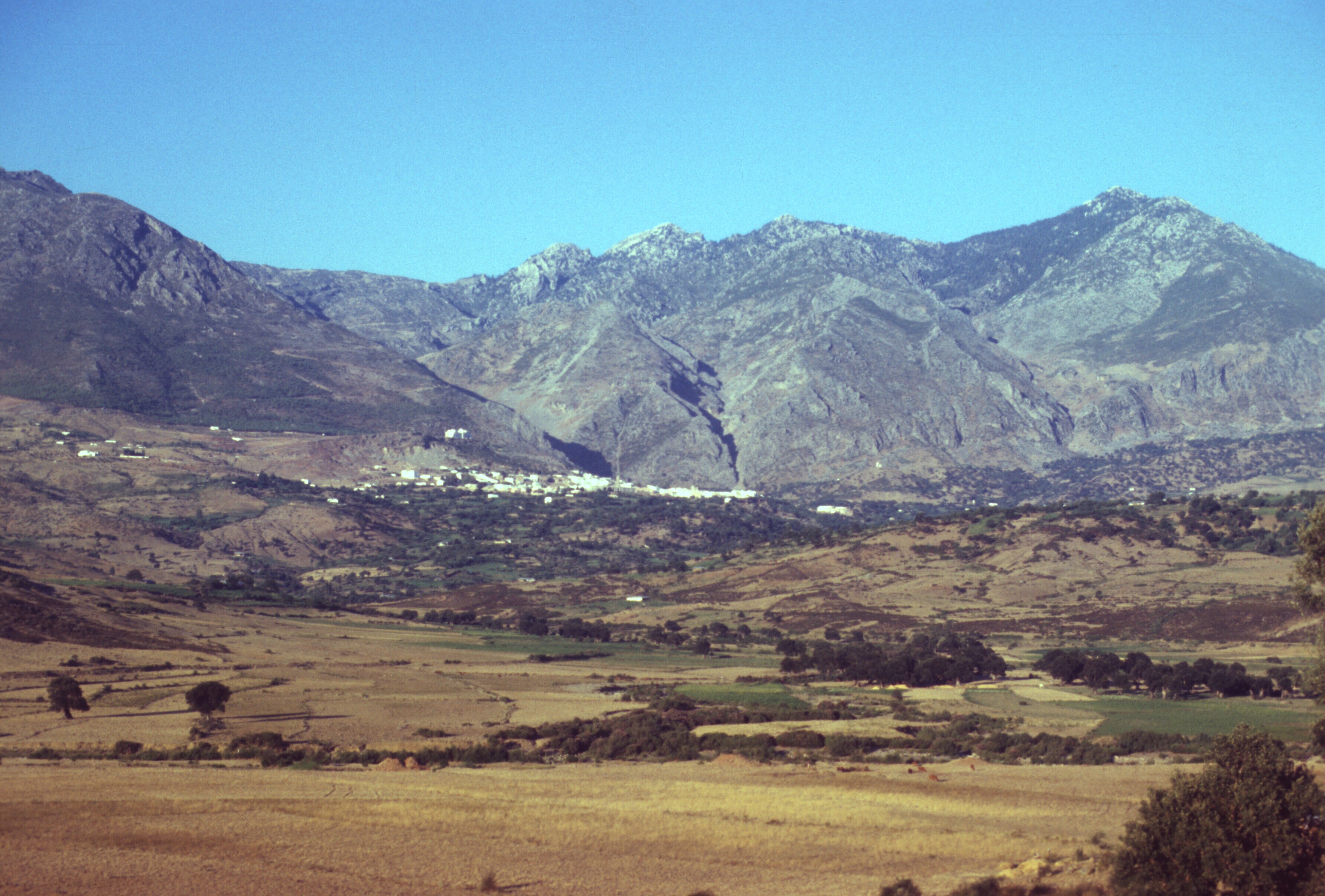
Rif viewed from Jbel Alam. The Chauen-Tetuan road runs in the valley below.
Abdelkrim’s succes was also his downfall. The French, deciding that he had become a threat to their interests, intervened massively, put down the rebellion, and sent Abdelkrim into exile.
My first encounter with the Rif was early in my Peace Corps service. My job often took me to the pre-Rif as Fes Province extended north.
Pre-Rif seen from ruins of old fortress near Moulay Bouchta.
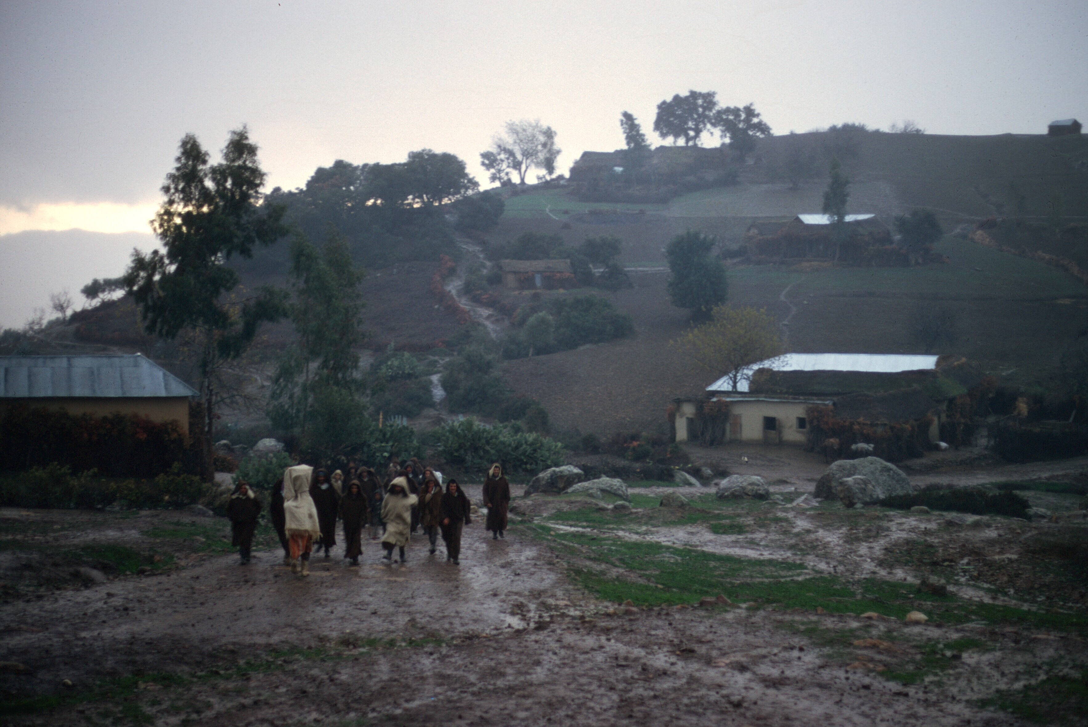
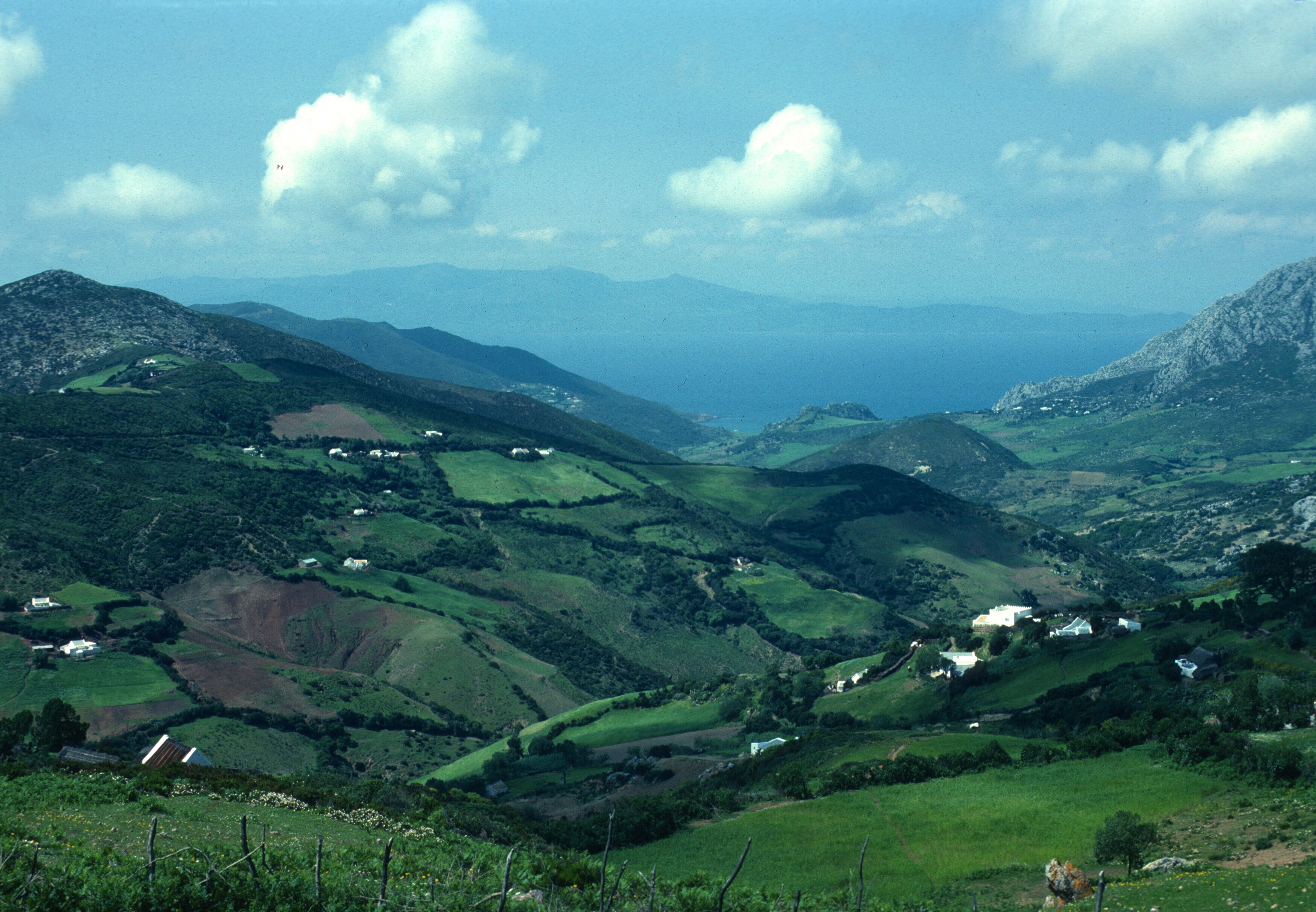
By the winter of 1968, I was sharing a house in the Sefrou medina (old city) with another volunteer, Gaylord Barr. He had decided that he needed a 35 mm SLR. He had brought over an 8 mm movie camera from home, but found it insufficient. I had been taking color slides, and he wanted to do the same. We decided to hitchhike to Ceuta from Fes. Ceuta was a free port: no taxes. The route was straightforward, north of Fes, along the western edge of the Rif Mountains. It went through the hilly country of the pre-Rif, where I occasionally worked, and by Chauen to Tetuan.
Typical pre-Rif houses.
In the winter, the houses kept you warm and dry, but the roads turned into mud where they were not improved.
The Rif seen from the pre-Rif. Road north of Fes.
We did it in one harrowing ride. It really was a dark and stormy night. There were rockfalls along the route from the recent earthquake and all the usual mudslides from the winter rains, and the driver had been drinking!
Erosion and heavy winter rains played havoc with the roads. Here in the pre-Rif a bus is being extracted. This was a common scene in the sixties.
In the heart of the Rif, near Ketama. So much marijuana is grown here that all over southern Spain air samples show marijuana pollen.
Chauen from the Tetuan to Fes road.
The ride was scary, but we arrived safely in Tetuan and Gaylord got his new camera in Ceuta. Sadly, it got lost on the train crossing Algeria in 1971. Gaylord was a good photographer, but most of his Moroccan slides seem to have been lost.
If you decide to watch Love in Times of War, perhaps you may reflect on the drama playing outside of Melilla today. NPR just feature the story of an African migrant trying to get past the fences and barriers, hoping for refugee status.
In the This American Life program, look for this reportage:
ByDavid Kestenbaum
There are two tiny Spanish towns on the African continent protected by multiple layers of razor wire, cameras and guards. A man from Cameroon tells producer David Kestenbaum about his attempt to get through the obstacle course and onto European soil. (19 minutes)
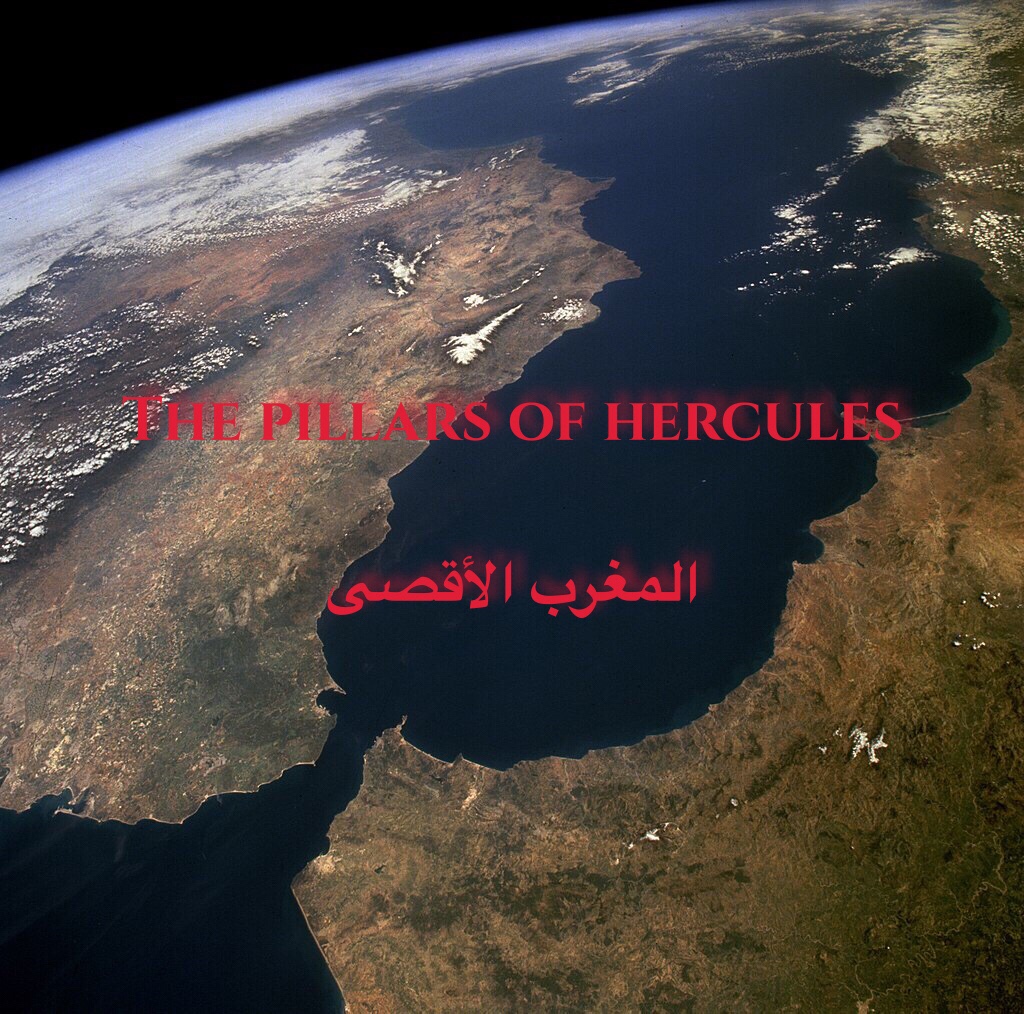
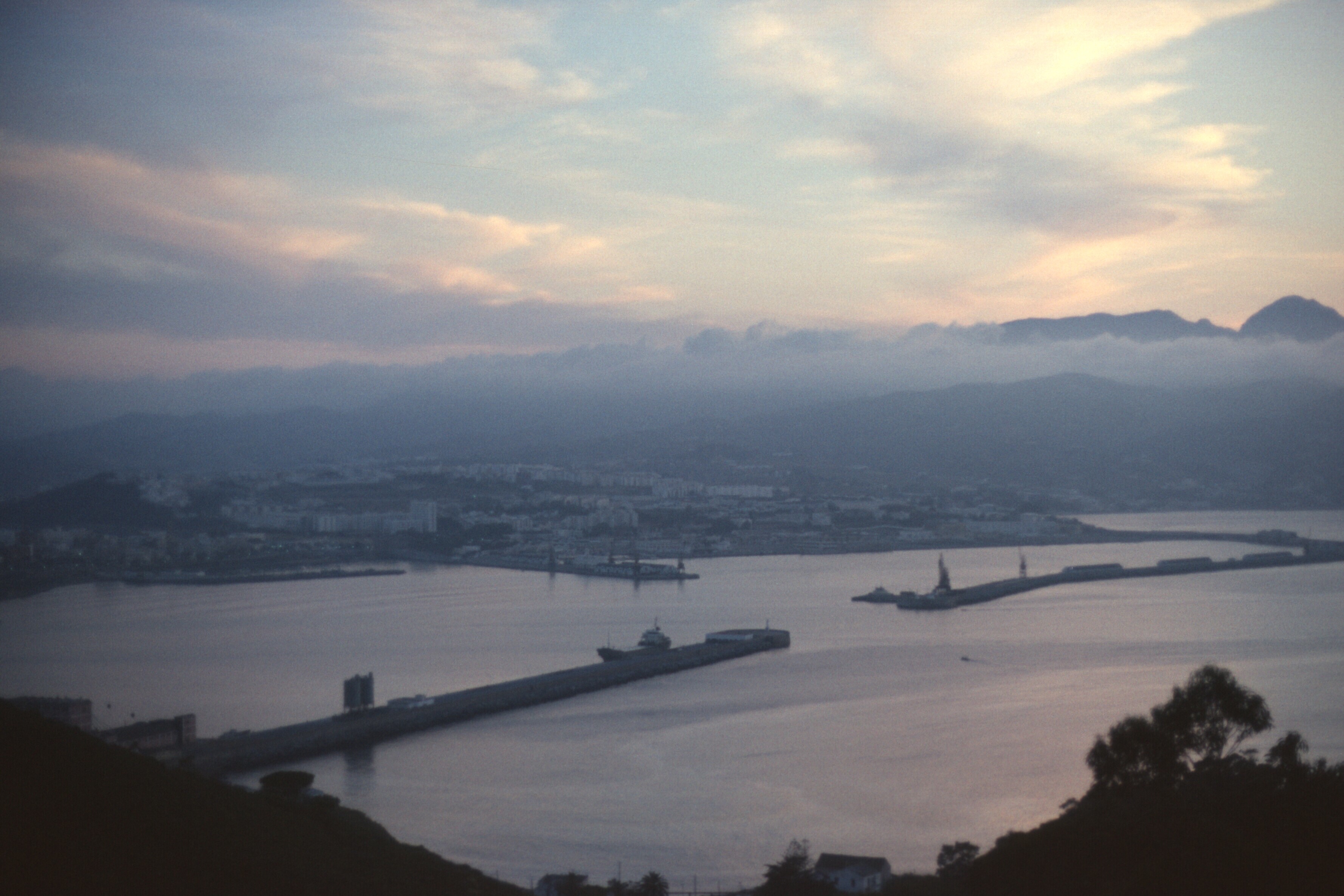
The Strait of Gibraltar. Looking toward the Mediterranean. The city of Fes is barely visible at the bottom left. Tangier, Tetouan, and Algeciras and Ceuta are clearly visible. Volubilis is slightly to the northwest of Fes. NASA photo.
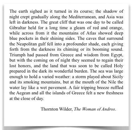
I love this passage. A god’s view of the Mediterranean, as I recently commented on another blog. Too bad the rest of Wilder’s novel wasn’t as interesting.
Morocco might be called an outlier. Until modern times, it has always been a place on the marches. It has always existed on the edge of large empires, but it was never part of them. Arabic historians traditionally referred to Morocco as the place of the Farthest Sunset (المغرب الأقصى), where the sun set in the Atlantic, an immense, unknown ocean.
The Phoenicians set up trading posts in Morocco. They were more traders than colonists or empire builders, though in Carthage, in the middle of the Mediterranean, they produced an empire that rivaled and threatened Rome.
The Romans had client states in the north of Morocco, where Rome eventually took full control during the Empire, but it left most of Atlantic Morocco untouched. The Byzantines had only nominal control, and the Ottomans never got past Algeria.
Some Moroccan dynasties reached across North Africa and into Spain, but none were long lived. The Mediterranean world was focused on the basin of its sea, and had its own dynamics. Morocco had an inhospitable Mediterranean coast with mountains crowding the shore. Most of the country, and its richest agricultural lands, faced the Atlantic. Morocco was barely part of the Mediterranean, the world of the “sea between the lands.” Mare Nostrum, our sea, the Romans called it, because it indeed was theirs at the height of Rome’s power.
The natural continuation of Morocco is Spain, not the Sahara or the rest of Africa. Only 15 kilometers wide, the Strait of Gibraltar can be crossed in one-half hour by car ferry. The Strait of Gibraltar posed few difficulties for the Vandals, who invaded Morocco in Byzantine times or for the Arabs and Berbers who invaded the Iberian peninsula a bit later. Today it poses few problems for migrants swarming into Europe.
In the distance, about eight miles away is Spain as seen from Morocco.
After the Spanish Reconquista, the Strait took on a new role as a moat, protecting from invasions, much like the English Channel protected England. It separated Christian Europe from Muslim Africa. The Spanish and Portuguese tried to establish toeholds on the African continent, but ultimately were repulsed except at Ceuta and Melilla.
Burial in the Portuguese fortress of Ksar es-Seghir. This toehold didn’t last long.
On the left, the tip of Gibraltar, on the right, Jbel Musa and Ceuta. The Mediterranean is in the distance.
Barbary pirates harassed European ships, but technology favored the Europeans. Now technology enables migrants, desperate for work and a better life, to cross cheaply and relatively easily into Europe.
As European sea power grew, the Mediterranean Sea became even more inhospitable. Morocco’s connections to the east were more and more by land, and there were no longer roads as in Roman times, but only horse and camel tracks until the advent of steam ships and cheap air travel put the Hajj within the reach of those with better means.
Trade continued via new routes. The British brought tea, and Queen Anne style teapots. But despite trade connections, Morocco became more and more landlocked until the twentieth century, when the French seized control and established a protectorate, a system under which the Moroccan sultan was relegated to a ceremonial role, while the French ran the colonial government as their own interests dictated. With independence and modern technology, the isolation is broken forever, for better and for worse.
When I lived in Morocco, I always thought of it as a backwater, and I suspect many Moroccans, proud as they were of their country, may have felt some inferiority. Important events in the Arab world took place in the east. Important history in Maghreb had taken place in Al-Andalus. The greatest monuments of western Islamic Art are in Al-Andalus.
None of this is said to disparage Morocco, which is a place I love dearly, but simply a recognition that Morocco is an outlier, and has been for a very long time. Yet another example: Morocco was one of the first, if not the first, countries to recognize the new United States.
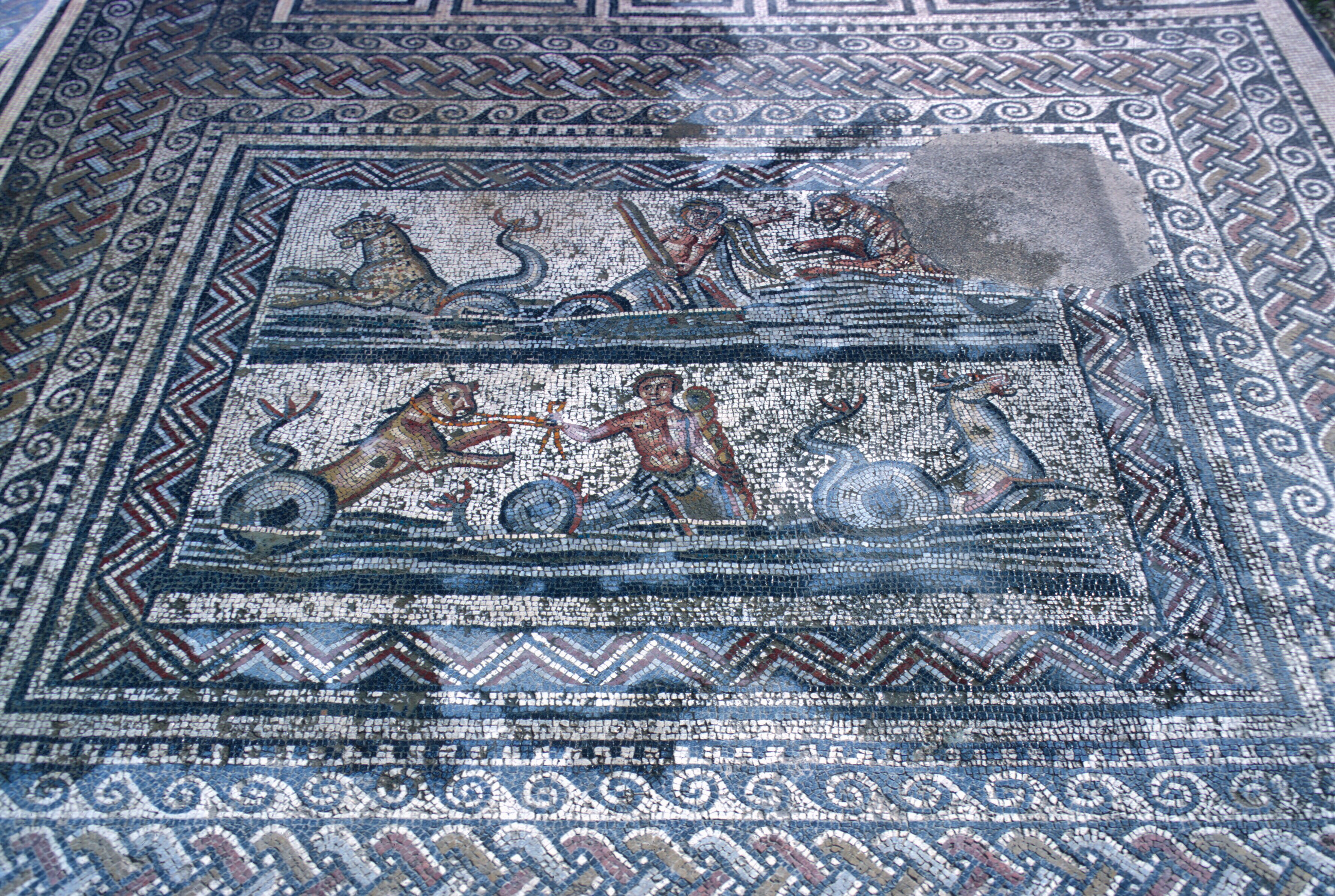
If someone asked me where to see the ruins of a Roman city in North Africa, I would say, without hesitation, Timgad in Algeria or Leptis Magna in Libya. Perhaps I would suggest that they go to El Djem in Tunisia, and visit the largest arena outside of Rome. If western Islamic architecture were their interest, I would suggest going to Córdoba to walk under the superimposed, multicolored arches and through the marble columns of the Mezquita, and then go to Granada, to wander through the rooms of the Alhambra and the gardens of the Generalife. I once did that at night. The palace was dimly lit, and virtually empty. It was as close as I could ever get to Washington Irving’s vision. You would be fortunate, indeed, to have that experience today.
The Court of the Lions, in the Alhambra palace.
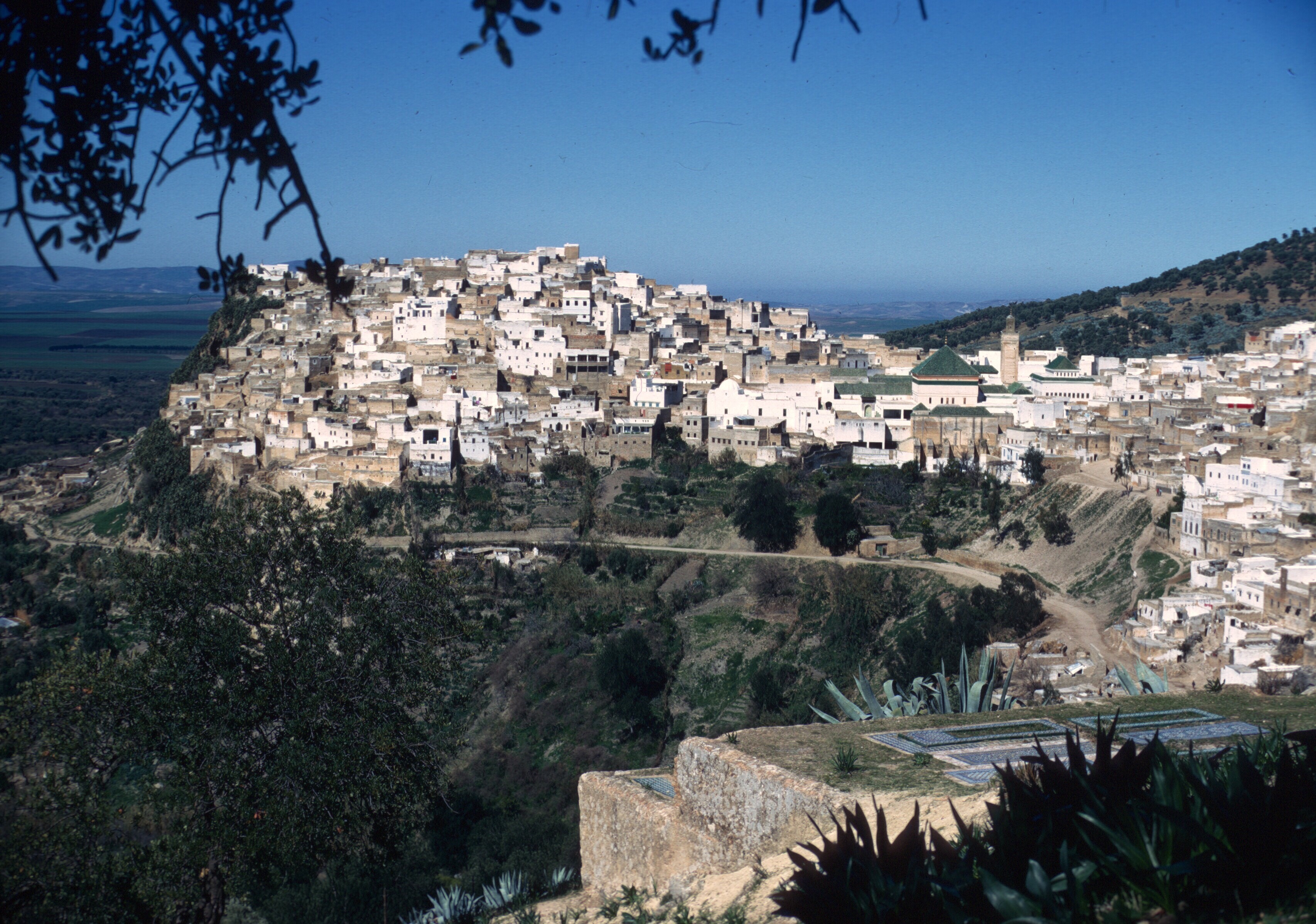
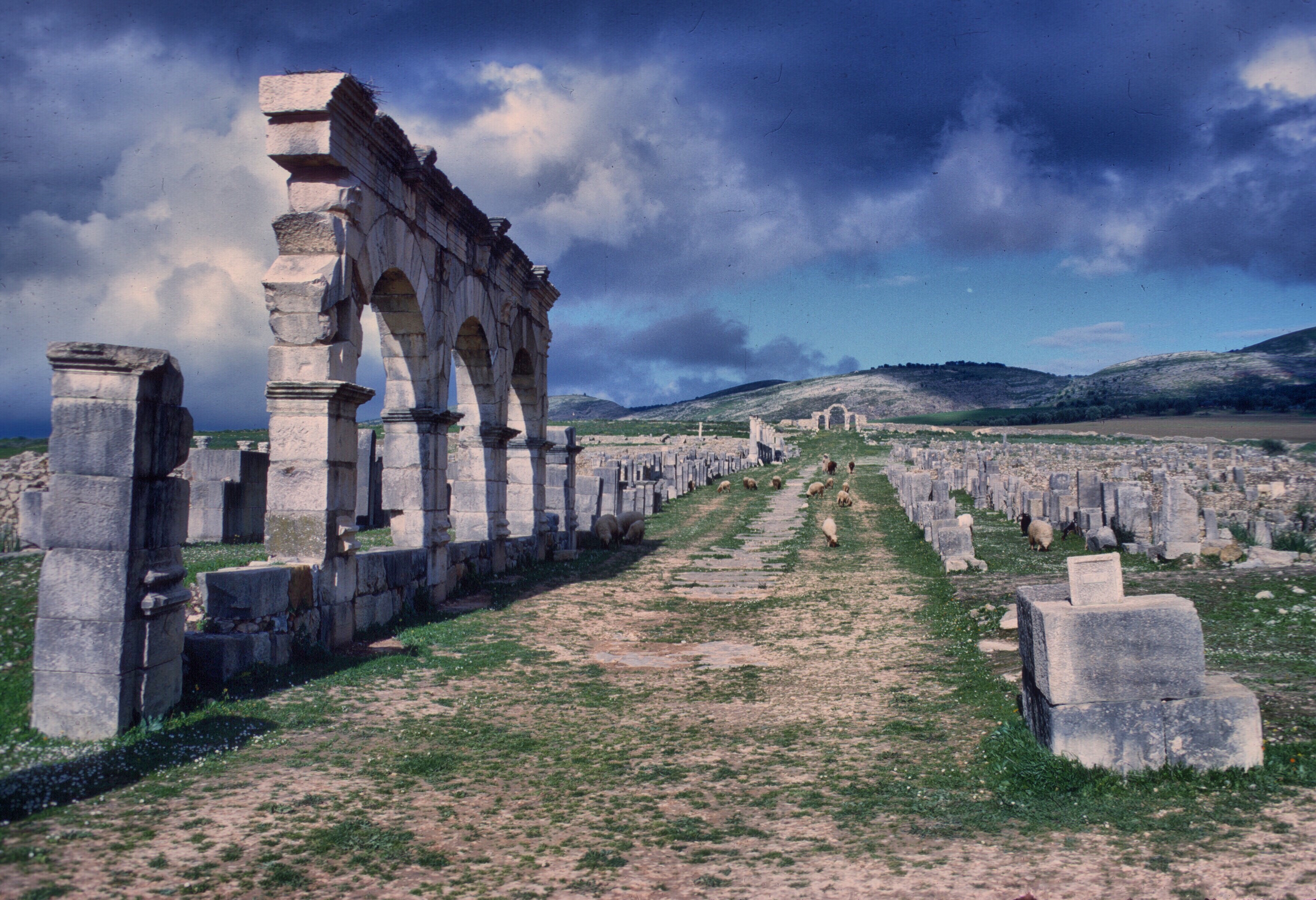
Still, there are virtues that arise from being off the beaten track. Morocco’s most important Roman site is Volubilis, a short drive from Fes, north of the Massif of Zerhoun, just a short distance from the town of Moulay Idriss. The Arab leader, Moulay Idriss established the first dynasty in Morocco at Volubilis, before building his capital a short distance away, partly from stones quarried from the Roman city. After the fall of Rome, it was common practice to reuse stone from the abandoned Roman cities.
The base of the Great Mosque at Kairouan. Note the block with Latin inscriptions to the left of the door.
Today there is a large shrine devoted to him.
The town of Moulay Idris. The green tiles roofs cover the shrine of the founder of Morocco’s first Arab dynasty.
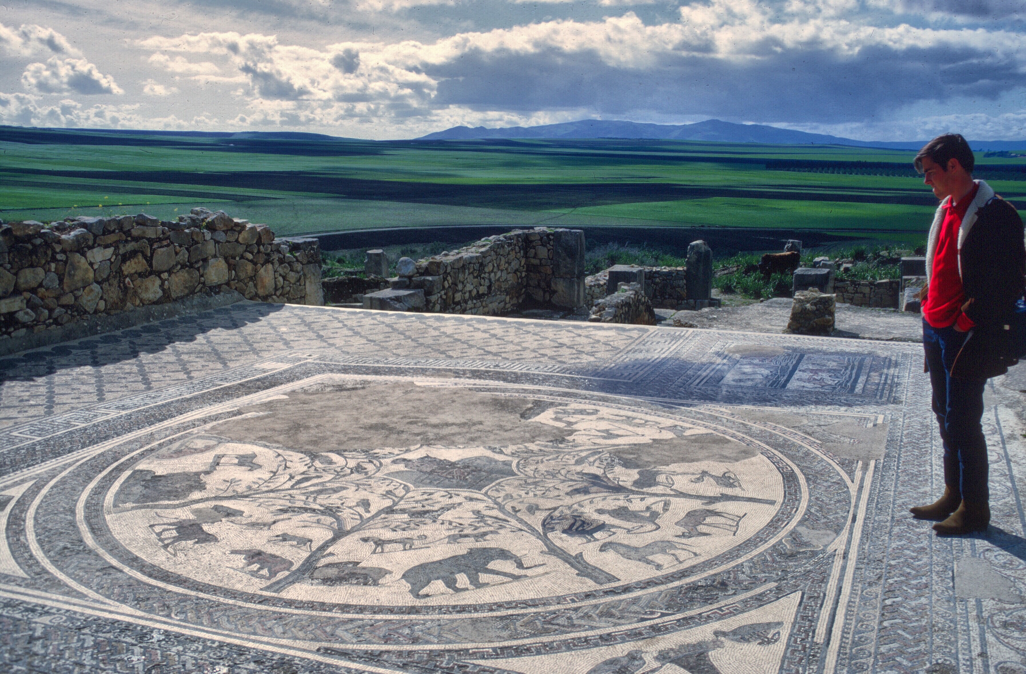
When I visited Volubilis in the late sixties and mid-seventies it was virtually without tourists, even on weekends.
The road leading to the site was a dirt track, in the middle of wheat fields
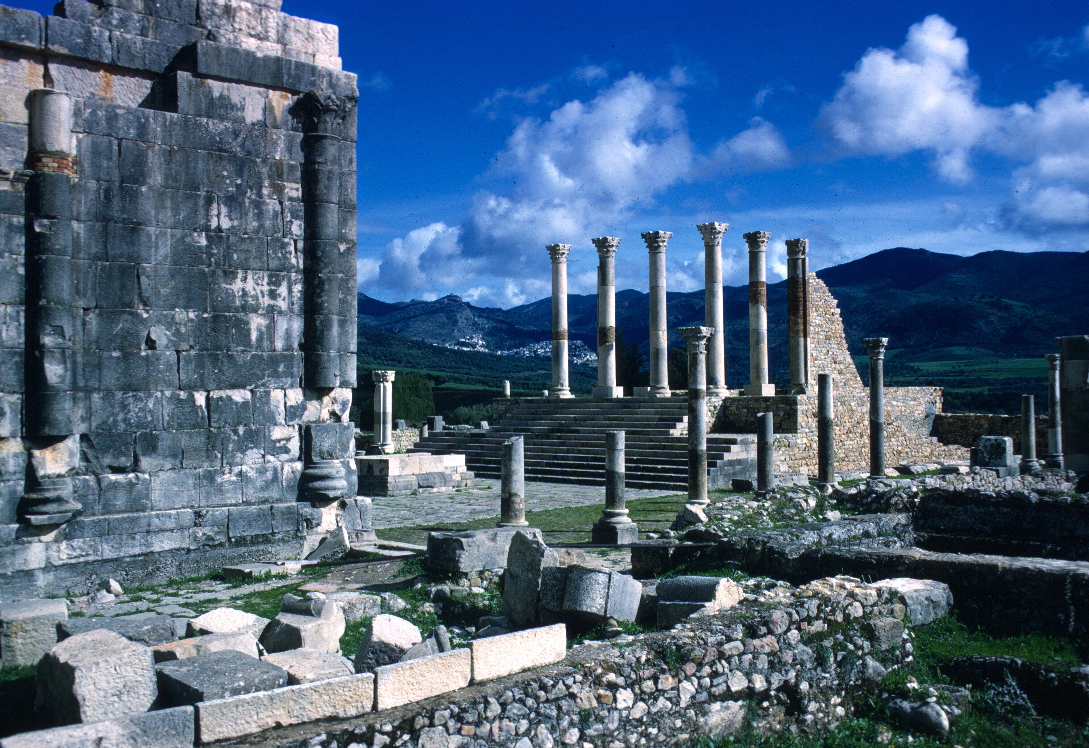
One could wander through the ruins, step into and out of Roman houses, climb the forum stairs, and do it all in complete freedom, with no crowds to distract from the quiet of the place.
The forum. Moulay Idris can be seen in the fold of the hills in the background.
Emperor for a day. The forum at Volubilis. 1968.
Tourist facilities were limited to a tiny cafe that served simple, but delicious, food.
Dining at the little cafe, Peace Corps volunteer Gaylord Barr. Spring, 1968.
It may be different today when Morocco has twice as many inhabitants and the tourism industry has grown substantially, but then it was a place lost in time and space. The city of Volubilis, wrecked by earthquakes, quarried for building materials, seemed to float over the rich agricultural lands that surrounded it, a stone oasis.
Volubilis. The main thoroughfare.
One could wander through it, dreaming of the life and people of that ancient place, reflect on history and the passage of time, and do it alone, in the quiet of the countryside.
Mosaic floor of a house.
House of the dolphins.
There were no guards to remind you to keep to the path. There were no tourists to jostle you. You were really alone.
Many houses had mosaics, a testimony to the town’s wealth.
This mosaic depicts the labors of Hercules.
Some of the animals that formerly were found in North Africa.
Volubilis was not a big or important center. It was an outlier. It grew to prominence just before the Empire entered its long decline. Still, to a young person, new to North Africa, it was a truly magical spot.
Main Street, leading to a former gate in the city wall.
There are many other places to see larger and better preserved triumphal arches.
Triumphal Arch. Volubilis.
There are larger, better preserved, and much finer mosaics elsewhere.
When wet, the mosaics show their colors.
There are spectacular aqueducts, great temples, immense baths, and fantastic amphitheaters scattered all over the Mediterranean. Volubilis lacks all that, but at Volubilis you felt and heard the wind, and you breathed the scent of the fields around you, while the only footsteps that echoed from the 2,000-year old stones were your own.
The Wind. Note that the modern labels were not in the best condition in 1968.
Morocco to the south of France. Fes is to the north of the snowy uplands in the right of the photo, and Brive-la-Gaillarde is under clouds at the top center or maybe slightly off the photo. NASA satellite.
The Trip to Spain
If you’re a movie fan, and, in particular, a Brit, you may be thinking Steve Coogan and Rob Brydon, but this blog post is more mundane and less amusing, and it also lacks the sadder, darker undercurrents of their comedies.
In a Walk above the woods I mentioned that Peace Corps vacation policy for Morocco volunteers was basically travel within Morocco, or anywhere in Africa, or Spain. Most of us had numerous opportunities to travel within Morocco, and, much as we loved Morocco, many of us wanted a change of scenery, and, perhaps, a bit more freedom. Algeria was officially considered a hostile country, so a visit there was out. That was unfortunate, because the Algerian people were friendly and happy to meet Americans, and Algeria is full of interesting places to visit. Airfare to the rest of Africa, or, to Europe for that matter, was limited and expensive. Spain ended up the place of choice by default. According to the Peace Corps, the cultural affinities and mutual histories made Spain a perfect visit. Some volunteers discovered even quieter and cheaper vacations in Portugal, but many of us went to Spain.
What you did in Spain depended a lot on your personality. Did you want to see historical sites, major cities, Islamic monuments? Lounge on the beaches, eat tapas in the bars, look for romance? Ski or hike the mountains? Appreciate art? Catch a recent movie? Spain already had an enviable tourist infrastructure, and the south coast had become an important destination for British pensioners. Spaniards were friendly and accommodating, and the food and wine was great.
And what you could do depended on where you went. Ceuta or Melilla were for duty-free shopping and a visit could be as short as an afternoon or an overnight.
Ceuta. Fishing boats. Monte Hecho in background
If you lived near these enclaves, they were only a bus ride away! The peseta was cheap, and the hotels were inexpensive.
Ceuta. The harbor and town at dusk
Once in Spain, the possibilities were unlimited. If you were going to peninsular Spain, you could take ferries from Tangier to Algeciras or Malaga. You could also go to Gibraltar, but during much of my stay in Morocco, Gibraltar, because of Spanish territorial claims, was blockaded, and you could not get into Spain from the Rock. The shortest, cheapest route was Ceuta to Algeciras on the passenger/car ferry. It only took an hour and a half. Once in Algeciras, the train would take you north to any big city.
One summer I took my vacation in Chamonix.
Downtown Chamonix. 1965. You could still encounter Gaston Rébuffat in the cafés.
The Appalachian Mountain Club statue dedicated to the first ascent of Mont Blanc, the beginning of modern mountaineering. Of course, the Brits and the Swiss like to talk about the first ascent of the Matterhorn. A number of other alpine clubs contributed to this statue of Balmat and de Saussure
This was, of course, against the rules, but I didn’t care. It was 1970. Perhaps the rules had even changed by then. The downside of making stupid rules is that no one pays much attention to them. Most organizations, even the most benevolent, have a penchant for making stupid rules.
The French had a special program for kids and young adults under the auspices of the Union Nationale des Centres de Plein Air. You could spend a couple of weeks learning and participating in just about any summer sport imaginable. The French government subsidized it heavily. During the previous year, I had been corresponding with a member from a Club Alpin Français section in the Pyrenees, and he suggested that I try it. I love the Pyrenees, and hope to return while I can still walk, but I chose Chamonix over the Pyrenees (and other Alps sites), because, frankly, Chamonix was more historical (the place where French climbing was born) and more spectacular (the highest mountain in Western Europe, and lots of high, vertical granite rising amid glaciers). I spent a month there, something I could never have done on my very limited Peace Corps budget if I hadn’t been subsidized by the French Government. Remerciements à l’UNCP!
Ascent of the Allalinhorn, above Saas Fée. Another nice thing about Chamonix is its location on the border of Switzerland and Italy. This is Switzerland, of course. The Valais is separated by a low pass from the valley of Chamonix. The border control didn’t even ask where I was from or check my passport. He assumed I was French. When our little 2Cv descended into the Valais, the first thing we all did was buy chocolate!
Mont Blanc at dawn from the Italian side. Courmayeur is in the valley below. Far below! We got here, above the Val d’Aosta, through the Mount Blanc tunnel, and stayed at the Italian Torino refuge on Point Helbronner. I no longer remember what peak we are on in this photo. We did several easy climbs in the area.
My young self, Elizabeth, and Jean, French members of the cordée. The Matterhorn is off in the distance.
Déjeuner sur l’herbe, alpine style. After a traverse of one of the minor “aiguilles.” I think the Aiguilles Rouges may be across the valley.
I will be forever grateful, too, and I am happy to learn that the UNCPA still exists after all these years. Thus I spent a month living with a group of fifty or so French kids, roughly my age, and I had a ball. It was co-ed, and we were housed in comfortable chalets. In the mountain refuges, when the weather was bad, we ate, told jokes, and played cards
The chalet in Chamonix, between hikes. We lived in a communal atmosphere, but most of the time we were outside. It really was a centre de plein air.
The food was fine, as you might imagine, certainly far better than French cité universitaire cuisine. This was a holiday in France! Would anyone tolerate bad food? Bon dieu!
Dinner in one of the huts above Chamonix. I think we were climbing the Petit Pélérin. Wine, bread, cheeses, and lots of good company. The sun is setting over the mountains to the west.
Above Saas Fée. In Switzerland.
Now if you are wondering what this has to do with Spain, remember that I was living poor and had few resources. I figured I could save and scrape up enough for the train trip, but fortune shined. Jean, a young French kid from Brive-la-Gaillarde, had been touring North Africa in his Peugeot 404, and was passing through Fes just about the time I was about to leave. He was hoping to find someone to share expenses and driving as he returned home. How he found me, I don’t recall, but there weren’t that many foreigners in Fes, and I worked there. He met someone who knew me and knew that I needed to get to France.
We drove up to Ceuta or Tangier and crossed to Algeciras. It was late, and we were tired and we spread our sleeping bags out on the beach facing refineries in La Linéa.
Gibraltar. On the left is the bay of Algeciras, in the distance, La Linéa
I would not try this today when crime in the region is a problem. Even then, though it was summer, it was damp and uncomfortable and the lights of the towers and burning gas lit up the beach with an unappealing industrial glow. The next day we drove up the coast, taking time to swim in the Mediterranean before turning inland.
North of Malaga. 1969.
A dip in the Mediterranean before a long dry day.
There were fewer roads, then, and even the main north-south routes were not very good. We skirted Madrid, and, after dark, pulled off the road into the stubble of a wheat field somewhere in Castile.
My mummy bag in a field in Castile. Dawn.
The following day we continued north, stopping briefly in Burgos to admire the Gothic cathedral.
A spire and part of the facade of Burgos Cathedral. One of the best of Gothic cathedrals in Spain. Spain is a place of beautiful and varied architecture, but Gothic is not Spain’s forte. Much of Spain was still Muslim during the high point of Gothic architecture.
Door knocker on the cathedral door. Burgos.
We crossed the French border at Irun and Hendaye. I had been there once before, when I lived in Pau.
San Sebastián Harbor, near the border with France. 1965.
Pic du Midi de Bigorre, seen from the Spanish border. Note the armed border guards on the hill. It was 1965 and Franco still ruled. You can see this mountain from Pau, 40 miles away, at the end of the valley of Laruns.
The Mediterranean weather gave way to that of the Atlantic, and, entering the pine forests of the Landes, it began raining. It was now dark and wet, and we were exhausted, so we found a small, inexpensive roadside hotel that had one room left, but with only a double bed. Sharing a bed with a stranger was odd, but not a problem: we were beat, and neither of us had slept in a bed for two days. Outside it was raining.
When we got back on the road the next morning, we were fresh. For Jean it was the homestretch. Brive-la-Gaillarde was only a few hours away.
That day began with some excitement. The Peugeot was beat up, made a lot of noise, and needed brake work. About midmorning, we drew the attention of a gendarme, who directed us off route to a police station. The police, finding that we were returning from Morocco, were interested in whether we were carrying drugs, which we were not, and, after a short interrogation, they released us to continue on our way. The route continued through the Dordogne. I would have liked to stop, but Jean was tired and eager to be home. He had done his sightseeing in Africa. Once in Brive-la-Gaillarde, I caught a train to Chamonix.
I can never think of Brive-la-Gaillarde without hearing the Brassens song, Hécatombe, in my head. Its anarchist message resonated with my younger self, though I am happy that Brassens eventually made his peace with the police in a later song, L’épave. If you can understand French, you may, depending on your sensibilities, find the songs hilarious or offensive. According to Wikipedia, Hécatombe is now associated with Brive-la-Gaillarde throughout France! And, of course, every place in France has something named after Georges Brassens. Rightly so!
So that was another Peace Corps volunteer experience with Spain. The following summer I got a postcard from Jean, who was then touring the Middle East in his car, but we never stayed in touch, which I regret because I enjoyed his good company, and he really had done me a big favor. The train ride home to Sefrou was far less interesting and totally uneventful. But Sefrou was home, then, and it felt good to be back.
Montpelier le Vieux, on the causes north of the city of Montpellier, France. Erosional remnants create a “city” of towers, arches, and other stranger shapes. To repeat an old cowboy line from Bryce Canyon, “It’s a tough place to find a cow.”
Some people have a fear of heights, some of water, others of confinement, and so on. Luckily, I do not seem to have any of them. What I do have is a love of the outdoors and also of novelty. Therefore, as I discovered the mountain scenery of Morocco, I also looked to some of its underground sights. Caves are common where there is limestone, since they are generally formed when acidic ground water slowly dissolves the rock. Morocco has plenty of limestone, as well as the water to dissolve it.
Some parts of the Middle Atlas look much like the causes of southern France, just north of Montpelier, where scrub vegetation, la garrigue, covers the limestone uplands. A variety of erosional features are found there, including collapsed surfaces and caverns.
In Morocco, the karst topography of the area between Azrou and Sefrou is plainly evident in the several small lakes, without inlets or outlets, fed by underground streams.
Daya Iffer, karst lake and Berber tents, south of Sefrou
Just south of Sefrou, Daya Afrouga, another karst lake, sheep drinking in the spring.
Springs are common, and sometimes they can be spectacular. The Ain Sebou, a large artesian spring which surfaces beside the Oued Sebou, is a good example. Diving into the cold, upswelling waters is an interesting experience.
Aïn Sebou. Notice how the clear water of the spring enters the muddy waters of the Oued Sebou,
The gorge of the Sebou, just upstream from the El Menzel road. The Ain Sebou is farther up the river, before it becomes a deep gorge.
The clear spring water tumbles over a small ledge into the waters of the Oued Sebou, which are usually colored by sediment from runoff, and the contrast, before they mix, is striking.
The Oued Sebou, where it flows out of the hills down toward Fes and beyond. The Rif Mountains form the horizon.
For anyone not familiar with Morocco, the word oued is dialectical Arabic for a stream. In the Middle East, the word is wadi, and is used for dry valleys as well as rivers. In Spain, you might note that some of the large rivers bear toponymes beginning with Guad-, a prefix that was derived from Arabic, such as Guadalquivir (oued el-kebir) or “big river”. Even spoken in different languages, the name sounds virtually the same.
The Roman bridge across the Guadalquivir at Córdoba. The great mosque, la Mezquita, has a cathedral rising out of its center. It is said that after having given permission to build the cathedral, the Emperor Carlos V visited the site and was so taken by the beauty of the mosque that he commented “…they have taken something unique in all the world and destroyed it to build something you can find in any city.”
In other places such as parts of the Rif Mountains, erosional remains such as natural bridges or even true caves give further evidence of water working on the limestone.
The natural bridge at Oued Lao seen from directly below. It was big enough to walk across in those days, maybe big enough for a mule or small car.
The natural bridge seen from the stream, Oued Lao, far below. The water, emerging from springs, is crystal clear.
Morocco has not made much of the tourist potential of its natural caves, and most guide books only mention them in passing, if at all. Some of this scenery is just a bit too far off the tourist track or simply not grandiose enough. Nevertheless, living in northern Morocco, it provided plenty of interest to me and did not demand long or difficult travel.
The city of Taza sits in a place where the Rif and Middle Atlas Mountains come together, about 70 miles east of Fes. More to the east are the plains of the Lower Moulouya River, and even farther, the Oujda and the Algerian border.
Just south of Taza, is Tazekka National Park. Originally created in 1950 to protect the isolated cedar forest on Jbel Tazekka, the park was later expanded significantly. Within it are two sets of caverns, Friouato and Chikker. The latter are considered to be spectacular, but require specialized equipment and spelunking experience. The former cave, first expored by the famous French caver, Norbert Casteret, was developed by the French for tourism, but by 1969 had pretty much fallen into disrepair. It extends several kilometers.
The terrain between Sefrou and the highlands south of Taza, is relatively low. One June evening as I sat on my roof in Sefrou the flashes of lightning from a big storm over Taza repeatedly lit up the mountain skyline. It was much too far to hear the thunder, and there was no rain in Sefrou, but the light show was spectacular.
One Saturday I set off with a couple of PCV architects from Fes to visit the Friouato Caverns. I don’t recall that the drive from Taza was very long, and you exit it on a high plateau surrounded by hills.
These wide stairs lead up to a small entrance. They remind me a little of the entrance to the morlocks domain in The Time Machine. A portal to another world. The stalwart Willys Jeep is parked on the right.
Once at the entrance of the Friouato Caves, we found some rather plain and worn concrete steps leading down to a balcony looking into the first chamber which was about 400 feet deep.
This was the entrance in 1969 or 1970. Steps take you to a kind of window into the first chamber, lit by an aven (circular opening).
The aven, created by collapse of the roof. On hundred feet across, it illuminates the first chamber.
The room was illuminated by a huge aven about 100 feet wide. The view was impressive, but we had to ask ourselves: Should we go further?
Friouato. The stone steps lead to iron steps fastened to the wall of the chamber. The bright spot is sunlight from the aven illuminating the wall below.
Descent into this deep pit was by iron steps that the French had secured to the wall. We tested them, and took a chance, slowly descending. The only life we saw was an owl that we flushed from a crevice in the mossy wall. Finally at the bottom, the aven was now just a small light, far above us.
The aven illuminating the first chamber from below, but not yet at the bottom. I have another picture from the bottom where it is smaller. The chamber was 400 feet deep.
We searched for a passage, and found one. With our headlights now on, we descended through a hole down dilapidated wooden ladders through rooms with seemingly bottomless pools. There was no noise, except for dripping water. There were few stalactites and stalagmites, but the rooms were mysterious and interesting. We only stopped when it was clear that our headlamps were dimming. We had no exact idea of how far we had gone, but as we had no extra batteries, we hurried out. We had no map with us, and didn’t have any clue as to how huge the cave system was.
At the surface, in the afternoon. My architect friend Dave and myself have just emerged.
The other cave I visited was Kef el-Ghar, which was in hilly land north of Taza, on the edge of the Rif mountains. From the distance, Kef el-Ghar is a dark elongated indentation in a mountain side. Entering it, we followed a rising, sandy path. At some point, we could feel bats flapping about, and, shortly after, I was disturbed to see a footprint of an animal, probably a dog or jackal. What was it doing, hundreds of feet into this cave, without any light to guide it? Despite the paw print, we saw no animals. The cave floor climbed and eventually we could feel the flow of air. After a narrow, winding passage, we emerged on the opposite side of the mountain. The cave pierced it!
On a dumber note, on the trip to Friouato described above, a dashboard light indicated an electrical problem. I ignored it. So driving in the dark, mostly empty road between Taza and Fes, the old Willis Jeep abruptly stopped, and could not be started. The battery was dead. The problem was the alternator, and, without a charged battery, there was nothing to do. One of us had to hitch to Fes, about 45 miles away, find a tow truck, and have us towed back to Fes. It must have been 5 am when we got to Fes. That jeep was incredibly rugged and dependable, but when it needed an alternator, I didn’t listen, and paid the price. In 1968, it cost about $20 dollars to get towed all the way to Fes!
Taza, in the twilight, looking North. The Rif mountains are in the distance. Taza is the choke point between the eastern plains and Algeria, and the rest of Morocco. If you invade Morocco by land, you must control Taza.
As I write, the wind is howling. The weather forecast for the night is three to six inches of snow and a wind chill of -15 to -30F° (roughly -20 to -30° C). There is shore ice on Lake Ontario and Lake Erie is rapidly freezing over. Temperature is -20° C.
Toronto is across the lake
Sitting indoors, the weather outside invites us to reflect on sunnier climes, both here and abroad. I have been thinking about Jbel Toubkal.
As it is the highest mountain in North Africa, and, one of the most easily accessible high mountains on the entire continent, hikers and climbers flock to Jbel Toubkal. A short bus or taxi ride takes one to Imlil, a large village in the valley below the mountain.
Imlil is below, in the valley. View is toward Tachdirt
Since I first visited Toubkal about 50 years ago, a serious tourism industry has grown up in this area. In my time, other than a stone dormitory building that the Club Alpin Français (CAF) left, there was just a village there, with villagers willing to sell you food, and muleteers offering their services to take you to the CAF huts of Neltner, De Lépiney, and Tachdirt. Today I see that a second hut exists next to the renamed Neltner, that businesses have grown up around Sidi Chamharouch, and that Imlil itself has holiday lets and lodging for tourists.
Sidi Chamharoush in 1969
Bemoaning commercialization would be mean and selfish. There is no begrudging the living that the locals can make off of tourism. Life in the mountains is always difficult, and tourism is a great addition to the local economy.
There is no pretending that Toubkal is remote. In the seventies, a motorcycle group surprised us at Neltner, getting all the way up to the hut with their large bikes. On the other hand, the hut was never crowded in those days, and, once out of the hut, one hardly saw other hikers or climbers in the mountains.
My first visit to Neltner was in the summer of 1969, with other Peace Corps friends. Mules took our baggage up, while we walked, a good way to acclimatize.
Aroumd, looking up toward Toubkal
Corn field in Aroumd, the highest settlement in the valley
Trail climbing toward Neltner Hut
Group with mules
Rest stop
Trail to Neltner Hut, clouds over Marrakech
Neltner Hut in sight
Mule eats thistles outside Neltner hut
View up valley from Neltner
We climbed the mountain by the gulley opposite the hut, an easy walk via a steep scree slope.
Beginning of trail to Toubkal
Long scree slope up gulley opposite Neltner hut leads to shoulder and summit of Toubkal
John Paulas and I had fun taking giant, gliding steps in the scree, and made it down from the summit in no time.
John Paulas looking down the scree slope. Neltner is below, Tadat is on the ridge across valley
Shoulder and summit of Toubkal. The west ridge route joins the main route on the right
This is the standard walk up route, and not much of a problem for a reasonably fit person in dry weather. There are good views from the summit.
Summit view of Jbel Siroua, a 10,000 foot extinct volcano, in Saharan Atlas. Want an interesting hike? Do Siroua!
Lounging on the summit of Toubkal, in background, from right to left, Ouanoukrim, Timesguida, and Akioud Bou Imrhaz
The real dangers on Toubkal are snow, ice, and bad weather. In 1970 an ill-prepared group of embassy people had a bad accident, with a member of the Turkish embassy slipping and sliding a long way down the standard route, and suffering serious injuries. Skiers can face avalanches in the winter, too.
View of Toubkal from Akioud
Tizi n Ouanoums, and profile of west ridge route, from Timesguida or Ras n Ouanoukrim. Jbel Siroua in far distance. The three towers on the ridge are clearly visible.
The classic climbing route is up the west ridge, which starts at Tizi Ouanoums. I found it easy, and did it once alone, and, another time, with an Englishman whom I met at Neltner.
Climbing the second tower on the west ridge of Toubkal.
Setting belay on last tower, west ridge
Rappelling down last tower on west ridge
I do remember meeting a couple of young French climbers in Imlil on one of my visits, who complained in disappointment that the rock was rotten and that the route was not very challenging. I can understand that. The climbing is straightforward, not very exposed, and the rock could be better. With my limited skills, however, I found it enjoyable, and it is more scenic than the gulley route.
Neltner, at 3,200 meters, also served as a base for other trips: Tadat, Akioud, and hikes to the Lac d’Ifni. Tadat is a rock spur or isolated tower on Tizi n Tadat. Akioud is a ridge between Ouanoukrim and Afella that offers an easy traverse. The Lac d’Ifni is a tarn lake in the Massif of Toubkal, and is said to contain native trout. One simply follows the main valley above the hut over Tizi n Ouanoums, and down to the lake. Of course, if you don’t know where you are going you may have problems. I once stood on Tizi Ouanoums shouting at the top of my lungs to my friends Maya and Dan, who wanted to go to the Lac d’Ifni, but were heading toward Tizi n Ouagane! At least a thousand feet above them, they simply could not hear me, and there were no others on the route to set them straight. They only discovered their mistake when they found no lake at the bottom of the valley! Still they had a great time.
Trail from Neltner hut up to Tizi n Tadat
Tadat, as sun sets, from shoulder of Toubkal
I ended up summiting most of the highest peaks around Neltner, all of which are easy walk ups. If you are thinking about doing it, go when there is snow on the mountains. They are parched and bleak in the summer.
Tadat. Cover of a special edition of the CAF Casablanca review, La Montagne Morocaine. I probably found this in the suq in Rabat. What a great piece of history.
I always wanted to climb Tadat, but never managed to do it, though my friend Jean-Michel Vrinat, and some other French friends with whom I climbed did it. Jean-Michel was a coopérant, who arrived in Morocco with a carload of sporting equipment (fencing foils, shotgun, etc.) which included climbing gear. I did lead this group, with friends Gilles and Sylvie Narbonne on a traverse of Akioud, which I had done by myself before, and I think that they really enjoyed it.
Akioud bou Imrhaz, from west ridge of Toubkal
Traverse of Akioud. Sylvie climbing as Gilles and Jean-Michel watch
Jean-Michel Vrinat in chimney on Akioud. Sylvie and Gilles watch
On top of Akioud, Jean-Michel and Gilles Narbonne nearing summit
Gilles and Sylvie Narbonne, au sommet d’Akioud. 1977. Toubkal à l’arrière plan.
Akioud is an easy walk from the Neltner Hut, and, done from south to north, requires no rappelling. A rope for belaying and security is useful, but not needed for good climbers.
Finally, a trail leads to the third CAF Hut, Tachdirt, near the village and below the pass of the same name. I visited Tachdirt twice. In the spring, there was too much snow, and I think that we spent a couple of cold days in the hut before going back down.
From trail to Tachdirt in March
Tachdirt after snowfall. Villagers clear snow from roofs.
A second time, we thought we could walk the ridges between Tizi n Tachdirt and connect to the trail to Neltner. We totally underestimated our physical condition and the difficulty involved. Having climbed from the pass to the ridge of Jbel Anrhemer, we camped out just below the ridge. I awoke sick the next morning. Climbing along the ridge, I became increasingly dehydrated, and needed water, which necessitated descending to the nearest snow patch (of which there were precious few—this was summer.) We ended up returning to Imlil, then walking the trail to Neltner, arriving in the middle of the night, in my case with the assistance of a mule for the last kilometer. What a day!
This article is about Christmas, of course, not the Prophet’s birthday, the Mouloud, which Moroccans, and most Muslims celebrate. This year the Mouloud fell in December, within a month of Christmas, which my wife and I just spent in Charlotte, North Carolina, with her brother and his wife. While there I reflected on the holidays that I spent abroad, though there have not been very many. Of them, the Christmases and Thanksgivings come to mind first, most likely because they involve iconic symbols, and childhood memories. Christmases also fall within a week of New Year’s Day, and often make up part of a larger period involving school semester breaks and intermissions, important in the lives of young people and probably producing more intense and lasting memories.
In Morocco, volunteers would often travel at Christmastime. The Moroccan calendar had all kinds of holidays, and accommodated as well as it could both Christians and Jews. Many foreigners still worked in the GOM in the sixties. If PCVs had vacation time, it enabled them to visit remoter parts of Morocco, or to go to Spain. When my cousin, who was studying in Angers, France, visited me in 1968 or 1969, I traveled with her and Gaylord Barr to Meknes, Rabat, Marrakech, and over the Atlas and across the pre-Sahara to Ouarzazate and Boulemane and Erfoud. Another time, I went to Gibraltar with administrator and volunteer friends.
On the Gibraltar runway, which had a grade level crossing for cars! Marty, Gaylord, Eileen, and Don. Franco blockaded Gibraltar in a dispute over sovereignty, and one could only get there by ferry from Tangiers or by air (we took a rickety old DC-3 from Tangiers)
Ceuta was still another possibility for those of us in northern and eastern Morocco.
Ceuta in December
Just as often, volunteers would get together in larger centers and big cities, where they were often numerous, and have parties. Those traveling would look up friends for places to stay and for good cheer. By the time I got to Morocco, there were fewer and fewer churches, and I do not recollect any volunteers going to them to pray.
Actually the celebration of Christmas and Thanksgiving usually had little religious significance to the volunteers whom I knew. Christmas had attained an almost secular status in the United States, and was, and is today, dominated by commercial rather than religious sentiments. Recently some right-wing Republican politicians have argued that there has been a “war against Christmas” by more secular politicians in the center. They point out attempts at what they see as “political correctness” as well as a more consistent effort to keep religion and the state separated, as the Constitution requires, though they do not see it exactly that way.
There is a real argument here over all kinds of issues, and if you are very religious you may be offended. My own opinion is that though most Americans are nominally Christians, government institutions should be secular. Am I making war on Christmas? I say Merry Christmas where appropriate, attend religious services, give gifts, and assiduously attend to the customs associated with Christmas. Do I care if there is a crèche in front of City Hall? Not much. And it certainly should not be there if it offends my compatriots.
Christmas is not the central focus of Christianity. Indeed, many early American religious denominations, such as the Puritans, did not hold Christmas sacred, did not celebrate it, because they considered it a pagan holiday. After all, it aligns with the winter solstice, which was widely celebrated in pagan religions of the ancient world, and it isn’t clear exactly when Jesus was born anyway. The real essence of Christianity, all true Christians would agree, is in the death of Jesus and his resurrection as the Christ, and the redemption of the sins of mankind by his death on the cross. Indeed, these very beliefs set off Christianity from Judaism and Islam. Though most Jews believe Jesus existed, and all Muslims revere him as a prophet the message of Judaism and Islam is elsewhere.
Christmas retains its religious significance for many, but in the United States today, as in the United States 50 years ago, Christmas is largely a children’s holiday involving family get-togethers, food, and, above all, gifts. I came from an Italian family, and my Aunt Mary and Uncle Bill would follow a Sicilian custom, though their ancestors did not come from Sicily, and serve guests a Christmas Eve dinner where seven different kinds of fish were offered. Those who were observan often fasted until after they attended Midnight Mass. Then one could eat and open presents, while relatives and friends talked and drank and often played cards.
The social aspects of religious holidays are so important, not just to Christians, but to Muslims and Jews as well as adherents of other faiths. I remember with fondness the kindness of Muslim friends and neighbors, who invited me to their homes for all the major feasts. Indeed, I think I looked forward to Muslim holidays as much as my Moroccan friends!
As a volunteer in the sixties, celebration of Thanksgiving and Christmas was dependent on mood and who was around or would be visiting. The first Christmas, having moved into the house in Seti Messaouda, Gaylord and I actually dragged a 12-foot cedar up the winding stairway and into the courtyard (where it touched the ceiling), and decorated it with homemade ornaments and garlands. The popcorn strung together in garlands eventually got stale and the hanging tangerines mildewed, and our Moroccan friends probably thought we were nuts or idolators. Only the cat really enjoyed the tree, climbing in the branches, and, there were no more trees after that.There were no religious celebrations, and I don’t remember exchanging gifts, either.
There was also a Thanksgiving or two when we cooked a turkey. One took place in 1970, when a couple of female volunteers, Ruth and Jan, were then teaching English in Sefrou. They lived next door in the house of the Hadja, a widow, so there was, with Jan’s boyfriend, a critical mass of Americans. Seti Messaouda for a while had a small American quarter within it, just within the gate. We invited friends, Moroccan and volunteers, and tried our best to put together a traditional Thanksgiving meal. Two ingredients were difficult or impossible to come by: cranberries were nonexistent and the turkey posed a problem. With more foresight we could have probably got the cranberries through someone we knew with PX privileges at the base in Kenitra.
Turkeys were a different matter. Turkeys were not common in Morocco. They are not part of traditional cuisine. They are harder to raise than chickens and less hardy. Where I lived, they were known as bibi, though in the former Spanish zone they were often called by the Spanish name, el pavo (from the tail, perhaps, as a peacock is el pavo real.) Turkeys have various names in the languages of the world. A late import from America, part of the Colombian exchange, the English named the birds after the country of Turkey. They were exotic beasts that merited an exotic name. In France, India was apparently more exotic as the birds were said to came from India. D’Inde became dinde eventually.
Whatever turkeys were called, they were not common. In Sefrou we were able to get one relatively easily, maybe from Fes, but, later, living in Chauen, I had to scour the countryside, driving to Ouazzane to find one.
Roasting the turkey also proved difficult. We had no oven, and, even if we had had one, it probably couldn’t have contained a large turkey. We decided to cook our turkey in the neighborhood ferran, the communal oven, where Khadija baked our bread daily. We always has a Muslim man kill animals for us so the meat was halal. The recipe called for basting it every twenty minutes with butter. After a couple of hours, the baker, the mul el ferran, said safi, enough is enough. The ferran was busy and it wasn’t helping his business to keep opening the oven and taking the turkey out. Luckily, with the hot temperature of the bread oven, the turkey was properly done, crispy and cooked through.
And so we ate turkey with stuffing, mashed potatoes and gravy, green beans, and other dishes, and celebrated our American holiday with Moroccan friends. And what was left over, and there was a lot of it, went to the poor outside the main mosque, where excess food often went if Khadija didn’t take it all home.
Living in the eastern Middle Atlas, the High Atlas beckoned from afar. Marrakech required a long bus ride through Kenitra and Beni Mellal or a trip to Rabat and then south to Marrakech. I never got to the Toubkal Massif as much as I wanted, and envied volunteers who lived closer. I did climb many of the peaks there, accompanied by friends, and even family. Perhaps as I digitize more of my old Kodachrome slides, I will get into specifics, but this post is a compendium of a number of trips and a tribute to a spot of the world that was important to me, the mountain named Tazaghart.
Today the High Atlas mountains are served well by climbing and hiking guides, but the main sources in my day were the Club Alpin Français’s long out-of-print guide to the Toubkal Massif, the curious guide book, Villes et Montagnes (a guide to cities and mountains, but nothing else), and topo maps. Today there are any number of tourist organizations that will take you on long walks and climbs. And there are good English language guides to the High Atlas by Hamish Brown and Des Clark. In my day, the heritage of the French Protectorate was a number of huts and a larger dormitory at Oukaïmeden, primarily for skiers. That may not have changed much, but I suspect all are used more intensively today. The route up to Toubkal is much more developed.
I have also noticed more young Moroccans climbing Toubkal, and it is nice to see they take that much interest in the natural beauty of their own country. Nature is always under pressure in the Mediterranean world. Morocco has more than twice as many people today as it had when I lived there 50 years ago.
One of the great charms of the place was that the mountains were empty. One seldom saw another human in the high mountains, and, except at Neltner, below Toubkal, the huts were generally empty. I was there at a time when few Moroccans climbed mountains and the French were still leaving Morocco.
Rather than try to assemble all my memories into a single post, I am limiting this one to Tazaghart, in the Toubkal Massif. Future posts will cover Toubkal, Angour, and some day excursions around Toubkal. As I find more of my old slides, I may add to this collection. I realize that they are of uneven quality, but in my day film was expensive and Kodachrome was beautiful, but slow. Exposure was often a problem. I do envy modern photographers who can shoot without running out of film.
Tazaghart
When I re-upped, I went home to the States by way of Paris, where I spent a few days. I went to Chartres to visit its Cathedral, I discovered that I could speak Arabic to Parisian waiters, mostly Algerians, who were delighted to hear their dialect from an American, and I missed an opportunity to hear Georges Brassens perform, for which I will ever experience a sense of loss.
But, in the cold and drizzle, I discovered Au Vieux Campeur, an outlet for camping, climbing, and other outdoors pursuits, on the Left Bank, not far from the Sorbonne. I invested in an ice axe, ropes, down clothes, and other paraphernalia which I thought I would need to climb more mountains. The memories of crossing the Pyrenees were fresh in my mind, and I wasn’t going anywhere unprepared again. The items that I bought got their first use on Tazaghart, my favorite place in the Toubkal Massif, and, later, more extensively in the French and Swiss Alps.
Louden Kiracofe and I had climbed Toubkal by the standard walk-up route in the summer of 1969, as part of a large group of volunteers. Now we would go to Tazaghart, and climb it via the Couloir de Neige, a steep gully filled with snow. We knew it had a bit of real climbing, and some steep snow, but we were up to it. Or so we thought.
Tazaghart caught my attention the first time I read its classic description: “Le plateau est un désert de pierres, plat, nu, vide, si haut perché qu’on n’aperçoit rien sous le ciel.”
A loose translation might be: “The summit is a rocky desert, flat, bare, empty, perched so high there is nothing but sky.” The name tazaghart is Berber and means “little plain or plateau.” What is remarkable is how high it is: over 13,000 feet. Most of the mountains in the area are lower than this. No others have a summit big enough for a football game!
Un désert de pierres: the summit plateau of Tazaghart. Louden.
One has a good view of the Tazaghart from Oukaïmeden and Jbel Angour. At Oukaïmeden, the French put up a tableau d’orientation, which identifies most of the mountains in the massif. I have a better picture of it that shows Tazaghart, but I haven’t found it yet.
The tableau d’orientation at Oukaïmeden
Tableau d’orientation: from Oukaïmeden to Tazaghart
You find these tableaus, usually installed by the Touring Club of France, now defunct, all over France and in many parts of its former empire. There is one in Fes, for example, that points to Sefrou and Bouiblane, among other places. Though you can see Tazaghart from Oukaïmeden, the most spectacular views of the mountain are from the valley below it and from Jbel Ouanoukrim.
Toubkal Massif from Oukaïmeden
Tazaghart, upper part of the Couloir de Neige
We traveled with Louden’s wife, Ginny, and an old school chum of hers, and stayed at Le Sanglier qui fume, a restaurant-hostellerie run by an elderly Frenchman, at the beginning of the road up Tizi n Test.
Toubkal Massif from Tizi n Test. Tazaghart is the large, flat area on the left
Louden and Ginny had stayed there before, after an exhausting winter drive over Tizi n Test, and had been charmed by the warm welcome, decent food, and the fire burning in their room. The owner was Paul Thenevin. Today the hotel is still there, but managed by his son. There was a boar’s head in the dining room, with a pipe in its mouth that puffed smoke.
At Le sanglier qui fume, 1973
It was June, I think, when I first went there. The weather was fine, and we drove to Imlil in Louden’s VW station wagon, and found some porters to take us to the de Lépiney refuge owned by the Casablanca section of the Club Alpin Français. As it happened, they only took us to an aluminum shelter much lower in the valley. I think the spot was Azib Mzik. The place was basic, hot, and stuffy.
1969. Ginny at Azib Mzik
The women must have stayed there, as Louden and I hiked up to the de Lépiney Refuge, which sits in a beautiful spot that offers views down the valley, and across it to the face of Tazaghart. We wanted to see Tazaghart. The walk up the valley was beautiful.
I think that we came back again to do the Couloir de Neige, I can’t say. It’s hard to imagine leaving the women by themselves below. So it was probably yet another trip. De Lépiney was an early French climber, and instrumental in making climbing a sport for all. He spent much of his life in Morocco, and, sadly, died there in a freak accident at Oued Yquem, a spot where climbers from Rabat still rock climb.
Rock climbing at Oued Yquem, just outside of Rabat. That was me in 1976
From the azib, the foot of Tazaghart is reached by proceeding directly up valley on a good mule trail. It follows a small stream through some ancient junipers, past a small falls, and eventually emerges above the tree line, in sight of the de Lépiney hut.
Ancient thuya
Approaching de Lépiney. Louden on mule. Top of waterfall visible
The de Lépiney Hut was comfortable. It was not heated, which was no problem in the summer. We left the windows open.
Louden at the de Lépiney Hut. 1969
Situated at about 10,000 feet, it was cold during the other seasons, but certainly preferable to camping in the snow.
In any case, late that day, we climbed out of the valley, up behind the refuge, for a good view of the Tazaghart face and the Clochetons de Ouanoukrim.
Face of Tazaghart at end of day, from above the de Lépiney Hut
Most of the Couloir de Neige can be seen. The only serious obstacle is a chimney, which, when the snow is melting, can become a shower.
Les clochetons de Ouanoukrim from above de Lépiney
It was late, and Louden had stumbled and cut himself on a sharp rock so we descended.
Couloir de Neige. Louden
Early the next day we entered the Couloir de Neige.
Louden in the couloir. The snow was icy and we needed to make steps.
Once we entered it, we found that the snow turned to ice, and our crampons hardly gripped it. Louden had an ice screw, but neither of us had experience cutting steps, so we gave up. I really think it might have been too soon. I think we could have negotiated the chimney, and, once above it where the snow would have been softened by the sun, we could have continued. We had ropes so setting up belays was not a problem. I wish now that we had tried that, but I always remember St. Loup’s La montagne n’a pas voulu. Better to be safe and sound. You cannot count on being lucky. We left the couloir, and continued up the main valley to Tizi Melloul.
Tizi Melloul. The summit plateau of Tazaghart is a short walk up to the right
The face of Tazaghart, from near Tizi Melloul
Five years later, I was back in Sefrou studying, and Gaylord Barr, my former Peace Corps housemate, showed up for a visit. He brought me a new pair of Reichle boots which I had ordered from R.E.I., and we went down to Marrakech to climb Tazaghart.
It was July or August. Marrakech was hot. In the USA, John Dean had just given testimony to the Senate Watergate committee, and President Nixon’s days were numbered.
Marrakech, Summer 1973
Summer, 1973. Procession, Marrakech
We stayed overnight, picking up some supplies, and took a bus to Asni, I think, from which we got a taxi to Imlil.
Gaylord had been to Marrakech several times, and crossed Tizi n Tichka on the way south, but he had never hiked in the Toubkal Area. We hired a mule for the baggage, and left Imlil in the middle of a moonlit night, passing through sleeping villages on the way to Tizi Mzik. The only noise was the clipclop of hooves and an occasional watchdog bark. The full moon provided great views of the valleys and peaks. We reached Tizi Mzik by dawn.
View east to Imlil, Tachdert, Angour, Oukaïmeden from Tizi Mzik
We had good weather. In the summer, bad weather is rare. Just don’t count on finding water along the mountain crests. We stayed a couple of days. The view from the De Lépiney Hut is grand, with a waterfall, an expansive view of the face, as well as pretty views down the valley. I think one can also see the lights of Marrakech far off on the plains below.
Waterfall at the de Lépiney refuge, Gaylord Barr
Valley below de Lépiney hut
Looking down the valley from de Lépiney at sunset
Everyone wants to climb Toubkal, but Tazaghart is much more scenic. If one has the time, it isn’t difficult to visit both areas in the same trip, and be rewarded with great scenery.
The easiest route up Tazaghart is up one of the several gullies that furrow the face. We chose one on the right, either Tsoukine or the one to its left. Or maybe the Diagonal. It’s a bit hazy now.
Face of Tazaghart, Louden, Couloir de Neige on left, Couloir en diagonale in center. We took the one to the right, I think
It was easy enough for a local dog, which we had been feeding, to follow us up to the summit, though the dog had to be resourceful to get around a few steep bits. Maybe we did do the Diagonal.
1973 Couloir. Gaylord Barr. Dog showed real ingenuity
At the summit there were clouds rolling in, and thunder in the distance, so after a brief rest, we descended by way of Tizi Melloul fearing rain and lightning. We got a bit of rain, but no lightning.
1973. Summit view looking toward Oukaïmeden
Gaylord Barr and Berber dog, on summit
The next time, and last time, I visited Tazaghart was in the late spring or early fall of 1977.
The De Lépiney refuge, Tazaghart
The weather was cold and wet, and I don’t remember climbing anything, but I did witness a spectacular landslide that involved some house-size boulders rolling down one of the couloirs, a good reminder that even easy routes may have unsuspected dangers.
The block visible in the lower left of the photo was far bigger than a house! That is rock and dust in the Couloir and trailing the immense block, and not a cloud!
My daughter, Liz, riding in shwari (Morocco saddle baskets)
On that trip we captured a dormouse and took it back to Chauen. When I left Morocco in 1978, a Peace Corps couple in Tetuan took the creature and continued keeping it as a pet. It was cute, but dormice are most active at night. We rarely saw it, but we always heard it scurrying in its enclosure after sunset. It was part of a menagerie of cats and tortoises.
Jbel Ayachi is the highest mountain of the eastern High Atlas. It appears from much of the eastern Middle Atlas as a long, snow-covered ridge that looms, all winter long, above the halfa covered plains of the Upper Moulouya River.
The High Atlas, seen from the Upper Moulouya River valley
Until precise geodetic measurements were made, some considered it the highest point of the Atlas, but Jbel Toubkal is over 400 meters higher, and many other High Atlas peaks exceed its height. Ayachi’s prominence arises from its proximity to the plain that borders it.
When I worked for the Ministry of Agriculture, Fes Province extended south to Missour, but most of my work was in the Saïs and the pre-Rif. I most often saw Ayachi as part of the faraway, snow-covered High Atlas crest when I traveled across the Middle Atlas plateaus.
Jbel Ayachi, on far right, seen from the Middle Atlas plateau near Ifrane
In the spring of 1969, however, I convinced my buddy, Gaylord Barr, who shared the Sefrou house with me, to drive down to a place known as the Cirque de Jaffar, which is a good starting point for climbing the mountain. We had no intention of doing that. We were just playing tourists for a day. We were able to do this because I had an old Willys Jeep for my job in Fes, and though I was not supposed to use it to sightsee, I did so once in a while.
The Cirque de Jaffar and Jbel Ayachi, May, 1969
The French use the word cirque loosely. When connected to mountain terrain, it is technically a term for a bowl carved out of a mountain valley by a glacier. The Atlas show little signs of glaciation. Even among the highest peaks in the Toubkal area, little snow survives the hot, dry summers, and glacial features are lacking. The Cirque de Jaffar is not glacier made, just a deep indentation in the edge of the mountains made by a stream. In this sense, it is a bit akin to the Cirque de Navacelle, a river-formed depression on the edge of the Massif Central, north of Montpellier.
May 1968. Jaffar piste
However the Cirque de Jaffar was formed, the natural scenery around it is spectacular. Some tourists pass through it en route to the Todra Gorges, but the piste is rough and this route probably should only be considered by those with solid four-wheel-drive vehicles equipped to operate off the road. The piste from Midelt to the Cirque, though unpaved, wasn’t bad at all when I was on it for the first time in the spring of 1969.
May 1969. Piste to Jaffar
May is a wonderful month in Morocco. The weather is warm and sunny, and the wheat fields are green or turning to gold. Wildflowers are everywhere, and the rivers and streams are brimming with water from the melting snows of the Atlas. The frigid cold is gone, but the land has not yet been baked dry by the unrelenting summer sun.
The drive from Sefrou to Midelt follows the old treq es-Sultan. The King’s Road connects Fes to Rissani and the Tafilalt, the birthplace of the Alouite dynasty that governs Morocco today. The road climbs over successive Middle Atlas plateaus, passes through Boulemane, under the shadow of Jbel Tichoukt, and then descends to the Upper Moulouya plains. It is an easy drive, though winter snows can make it difficult for truckers. After a storm it is not unusual to see trucks that have slid off the slick highway.
The Upper Moulouya is covered with halfa, Stipa tenacissima, a grass that is woven into ropes and mats, and also used in the mattresses of those not wealthy enough to stuff with wool, a manner of banking wealth as well as creating a soft mattress. All my banquette mattresses were stuffed with halfa, as was the mattress of my bed, and though not as comfortable as wool, the scent of the grass was sweet and pleasant.
Making rope from halfa, probably near Missour
Halfa is also known as Esparto grass, and grows over wide areas of the Maghreb and Spain, and everywhere it is used for artisanal purposes. In the rain shadow of the Middle Atlas, agriculture in the Upper Moulouya requires irrigation, and herding is common.
Berber herdsmen’s tents near Jaffar. The Middle Atlas is on the horizon
In the past, when Morocco was divided between the Bled es-Siba and the Bled el-Makhzen, the powerful Berber tribes of the Middle Atlas moved their flocks between the Moulouya and the plains surrounding Meknes and Fes, practicing a transhumance involving summer pasturage in the Middle Atlas mountains and winter in the lowlands.
Middle Atlas herd, near Ifrane
At Midelt, the itinerary leaves the paved highway, and becomes a dirt and gravel track, which Moroccans often denote by the French word, piste. Climbing along the edge of the mountains, the piste reaches an altitude at the Cirque, where it is high enough for cedars to grow. From that point, there are great views of Ayachi. All along the way, the fields were full of wild flowers which we stopped to photograph. In the cirque itself, the cedar forest was open with isolated and gnarled trees.
Upper Moulouya, August 1969 with Jbel Ayachi in distance
Alas, on one of many photography stops, I did not use the parking break. It was only by chance that I notice the jeep rolling back down the mountain road. I shouted to Gaylord, and he caught up with it and jumped in, but sadly he was too late. The jeep slipped off the road. Luckily, he wasn’t hurt.
May 1969. Photographing flowers
Our jeep ended in the drainage ditch on the mountain side of the road, and was not traveling fast enough to be damaged badly. The windshield had cracked, but did not shatter. On the other hand, the ditch was deep, and the undercarriage was caught up in such a way that even the jeep’s four-wheel drive couldn’t get any traction. As we wondered what we could do to get out, a forestry officer rode up on his mule, but the jeep was too heavy and too stuck for the three of us to lift it up and out. Then an elderly French couple, touring in their Peugeot 404, happened by. They kindly lent us their little emergency shovel, and we dug out enough of the jeep to get back on the road. We thanked them, they continued on their way, and we, thoroughly chastened, returned to Sefrou without further incident.
A Moroccan rule of thumb is whenever you are stuck along a road, someone happens by to help you! Another time, later in my life, I was driving from Chauen to Tangier in a winter rain storm. The battery of my little Simca 1000 wasn’t charging. I think the problem was corrosion on the battery terminals, but rather than clean them, I decided to chance not stopping on the trip and fix things in Tangier. I could easily roll the car fast enough to start it. To compound my stupidity, I chose to take the coastal road, not the main Tetuan to Tangier highway. About halfway between Tetuan and Tangier I came over a rise and descended into a valley where there was mud on the road and water running over it. The car became mired and stopped dead. The water was high enough to lap at the door sills. Rain was pouring. It was pitch black. I opened the car door to see how high the water was, and my glasses fell into the running water. At that point I began to wonder how much worse things could get.
I did not have another pair of glasses with me, and I am very nearsighted. I began to take off my shoes and socks in preparation for a search, but luck was with me and blind groping in the mud without leaving the Simca proved sufficient. I found them! Better yet, a group of men from a local douar appeared out of the darkness, and they were able to push the car out of the mud. I suspect that I was not the first motorist to get stuck there, but there were no other cars on the road. Maybe the local residents knew better than to drive that stretch on rainy winter nights.
Out of the mud and water, they gave me enough of a push to start the car. I thanked them and rewarded them, and, though I secretly wondered if they just hung around waiting for cars to get stuck in that spot, I was very, very grateful. In a later post, I will write of yet another personal stupidity involving cars and batteries that left me stuck halfway between Taza and Fes.
The encounter with Ayachi in May 1969 whetted my appetite for a real exploration of the mountain. I knew it was an easy ascent. I got my friend and climbing buddy, Louden, the Peace Corps doctor, to drive down to Ayachi in August. The director of the CT in Sefrou, Si Kammir, knew the supercaïd in Midelt, and arranged to get a local man to guide us.
January 1968. Midelt. Ayachi is out of the picture, an extension long ridge visible to the right of the photo. This photo was taken on a bus trip returning from the Tafilalet.
We drove directly to the cirque, where we camped that night. After the dry and hot on plains, the air in the cirque was refreshing. The guide showed up on his mule the next morning.
August 1969. Early morning in the cirque
August 1969. Moonrise above the cirque
He had been waiting at a location closer to Midelt, where another trail led to the summit. He must have been dead tired, riding much of the night after he figured out where we probably were.
The cirque trail follows a stream that goes through a narrow defile to pass through the lower hills, then just climbs up through relatively wide valleys. There really is no trail once one starts up.
August 1969. Past the gorge. Just a long walk
The mule went most of the way up the mountain, only stopping just under the summit.
August 1969. Louden about halfway up the mountain
The presence of numerous goat trails showed that shepherds took their flocks almost to the summit. We had no map, and decided that the more prominent western summit was the high point.
Below summit of Ayachi, goat trails
When we got there it was clear that it wasn’t. By then it was late in the day, so we descended, tired and disappointed, not only that we hadn’t reached the main summit, but also that the scenery, dry and parched, was so uninteresting. There was no water, a regular problem on the high peaks of the Atlas, but we found some snow and melted it.
August 1969, below west summit of Ayachi
The best views were to a huge anticline to the west and downward into a valley.
August 1969. Huge anticline to west of Ayachi
August 1969. View from west summit looking north west
The southern view was mountain after mountain with no vegetation. Beyond the far ridges lay the pre-Sahara.
August 1969. View south toward desert
The eastern view was blocked by the main ridge of Ayachi. We decided that we would return and do a spring climb. And so we did.
In March of 1970, Louden, Don Brown, and myself, equipped with down parkas, ice axes, and crampons camped at the Cirque, along with some Berber shepherds, who had their flocks there. We got there late in the afternoon, and set up camp.
March 1970. Camping at Jaffar. Don and Louden and Berber kids
March 1970. Berber kid at our camp
I arose in the night, probably to relieve myself, and looked up. The air was brisk, and the sky dark, clear, and full of stars. There were no lights visible anywhere, except for a spotlight shining from the top of a mountain on the left side of the cirque. This puzzled me until I figured out that I was looking at a comet, the first that I had ever seen! It was in a position that made the tail appear to extend off the top of the mountain, and the lack of light in the sky enhanced its brightness. I have seen several comets since, but none have been as striking as the first.
March 1970. Louden and Don
We got off to an early start and followed the same route that Louden and I had used the previous summer. Don petered out at a lower altitude than the mule had climbed to on the previous trip, but Louden and I continued up to the highest point on the mountain.
March 1970. Don Brown
This time the vistas had snow and greenery. It was cold and we only stayed long enough for some pictures. The descent was uneventful.
The trip was eventful for other reasons. Gaylord had gone to Aïn Kerma, south of Oujda, to visit the father of one of his lycée students at Sidi Lahcen Lyoussi. Marc Miller, a Morocco X volunteer who was by then in Casablanca working in fisheries, went along with them, but only stayed a week before returning to Casablanca. Shortly thereafter our paths crossed at the Hotel Royal, a Peace Corps haunt, clean and affordable, in a rooftop single that cost even less because it was unheated.
Hotel Royal, Rabat. 1968.
I was on my way to what was then the U.S. Air Force base at Torrejón outside Madrid on a flight from the U.S. Navy base at Kenitra. Marc was on his way home to the U.S., though he did not tell me. When I returned to Morocco, and found out he had left the Peace Corps, I was shocked and bewildered. When I saw him again in the U.S. he explained everything. Marc had contracted meningitis the previous year, and was hospitalized at the base hospital at Kenitra, where Gaylord and I went to see him not long after he regained consciousness. Marc looks well in the photo below, but he was still working to regain his memory.
Gaylord and Marc outside the hospital room.
Marc was one of the volunteers with whom I had developed a friendship in Morocco. In the Morocco X program, he was stationed at a CT in Azrou. I was at a Centre des Travaux Agricoles about 13 kilometers south of Meknes, off the main road to El Hajeb and Azrou. Marc was open and friendly, and always willing to lend a hand. When I had trouble with the hens laying eggs under the nesting boxes, Marc came up to Sefrou and helped fix up chicken-wire barriers to keep them out. Marc was handy and I was pretty hopeless.
In the months of service, I spent a lot of time traveling on weekends. I went up to Azrou early on. Marc was living with a group of guys that worked at the CT. His living conditions were no Posh Corps. The apartment was small, cold, and dark. Azrou is high enough to get seriously cold. I, at the CT, had my own room in a small house, and a heated shower. I was impressed by his adaptability to what I thought were harsh accommodations.
I will never forget the bus ride home from that trip. It was early morning. As the bus followed what the French called the belvedere, there was a view to the west over the Pays d’Ito. The valley was in clouds. Dozens of little volcanic peaks poked through them, appearing as an archipelago of islands. Sadly, my camera was not handy and I have only my memories.
Nothing is easy when you make it difficult. On that trip down to Rabat, when I was on my way to Spain and Marc was making preparations to leave Morocco, I planned to take a CTM bus from Fes. I bought a ticket to reserve my seat and checked my bag. Carelessly I had placed my passport in my old beat-up and unlocked suitcase. I had a couple of hours to kill, and went to see one of my friends who lived in the Ville Nouvelle. I ended up killing just a little too much time, and I missed the bus. Desperate, I decided that if I were lucky I might hitch a ride to somewhere along the route and catch up with the bus. I soon got a ride. The car was a new Peugeot 504, I think, and the young driver spoke French until I realized that he was an American, who had graduated from the same college as myself. Stationed in the military at the “secret base” at Sidi Yahia in the Gharb, he agreed to drive me to Rabat. Even stopping at the base, we beat the bus and I retrieved my bag and passport. My savior’s parents had served in the U.S diplomatic corps, and he acquired his French, which was excellent, growing up. When you are stuck in Morocco, someone always comes along to help you out.
Flight from Kenitra to Torrejón, with Rif Mountains and port of Tangier
I flew out of Kenitra on a routine Navy flight. Seated next to me was a civilian contractor, probably an ex-military. He worked for Lockheed, I think, training Moroccans to fly F-5 fighters. He was interested in the Peace Corps, quite impressed with my Arabic and French and knowledge of the country. As we flew into the Navy base at Rota, he remarked that he could use a few Peace Corps volunteers in his program. I just let the comment stand. In 1971, F-5 pilots were part of a coup attempt that involved shooting down the Royal Air Maroc passenger jet carrying the King. Embassy scuttlebut has it that Hassan II never really trusted Americans completely after that attempt on his life, believing that the Americans must have had advance knowledge of the plot and could have warned him.
The medical exam at Torrejón completed, I was asked if I wanted to go back to Morocco on the next flight. Of course I said no, so I was put on a later flight to Kenitra, and got to spend some time in and around Madrid. Madrid has been the capital of Spain for a long time, and many interesting places surround it that are easily reached by train or bus. I had studied Spanish as my first foreign language, and I could use what I remembered to get around comfortably. It is alway so much better to know a little of the local language. My travels in Iran were immensely enhanced by the fact that I could speak a smattering of Farsi, but that, too, is another story for the blog.
At Torrejón I learned that my GS-4 status only got me a crappy, shared accommodation on base, so I stayed in a modern hotel near a subway stop in Madrid for about five bucks a night. The airforce wanted as much for the GS-4 accommodations. In Toledo, I stayed in a pension for a dollar or two.
March 1970. Toledo street
I had been to Toledo before (and would return again), but this time I had some leisure to see the sights, and it was not tourist season. Close to Madrid, home to great art and architecture, historic from Arab times to the Spanish Civil War, Toledo is overrun by tourists in the summer.
Woman sewing in late afternoon sun, outside cathedral doors
Kids playing in a square
Former mosque
Detail from the Burial of the Count of Orgaz
I also visited Ávila and the birthplace of Cervantes in Alcalá de Henares.
The walls of Ávila
March is still very cold in Madrid and I do not remember being dressed very warmly. The proverb about Mardrid’s weather, “Nine months of winter, and three of Hell,” has a basis in fact.
Interestingly, a year and a half later, as I was leaving Morocco, Gaylord Barr was being airlifted on the same Kenitra to Torrejón flight, with a severe case of typhoid, and he spent a much longer time there than I did! Another story, which I may try to tell in his stead, since he tragically passed away five years ago.
Peace Corps volunteers who taught English as a foreign language were tied to their schools during the academic year, but had long summer vacations. A few undertook special projects, but many took the opportunity to travel. Outside of what was then called TEFL, volunteers had to take time when they could, though many had jobs that gave them a lot of freedom. The Moroccans often described our jobs using the French word stage, essentially meaning training, and didn’t always expect much from us.
As Peace Corps volunteers in Morocco, travel to Europe, except for Spain, violated the Peace Corps country rules that were in place in the sixties. Many volunteers simply ignored them as they did other rules that they thought were unreasonable such as owning motorcycles. Volunteers seldom got caught and there was no real punishment. Staff probably found the rules restrictive, too, and often looked the other way. Without examining your passport, how would Peace Corps know what you did last summer?
There was a problem for volunteers, however, and that was Morocco’s location. Where could one go? It is not without reason that Morocco is known as the land of the farthest sunset. With an ocean to the west and a desert to the south, Morocco was a cul-de-sac.
Algeria was off limits as a hostile country in the sixties, sadly as my experience in Algeria suggested that Algerians were friendly and eager to meet Americans. Anywhere else required expensive airfare or a daunting trip across the Sahara. If you follow this blog, you can read about my Saharan adventure later. A few of us actually did the trip, crossing the Algerian desert by truck, but it was not a casual affair.
On the road to Tamanrasset. Algeria, April 1971
I think that these rules may have loosened up over the years. Some volunteers had families with the means to provide funds for European trips. In the sixties, the Peace Corps was definitely elitist, just as the foreign service has always been, with many members coming from the Ivys. In any case, given the historical connections with Morocco, the Peace Corps judged Spain to be acceptable, but put the rest of Europe off limits.
By July, the heat had settled into Sefrou. The grain fields around the city had been harvested, and the country had taken on the thatch and earth colors that it would keep until the winter rains.
The Saïs plain with the hills west of Sefrou in the distance
Bouiblane disappeared into the haze at the horizon, and the streets became dusty. Melons were on sale in the market, and life slowed down a bit.
July at Bab Merbaa, Sefrou
Gaylord Barr, the volunteer with whom I shared the house in Seti Messaouda, and myself had persuaded one of the Peace Corps administrators, Don Brown, to come to Sefrou. Don had served in Oujda. He had never learned much Arabic, and wanted to improve his command of the language. We had a woman, Khadija, who cooked and cleaned for us. I fixed Don up with a tutor, my friend Hammad Hsein, and Don moved to Sefrou for a couple of weeks, where he had a chance to immerse himself in dialectical Arabic. Khadija would take care of Don and the pets. Off we went. I don’t know how much Arabic Don learned, but I know he enjoyed his time there that summer. Old Sefrou was lovely with its gardens and country walks.
Out for air, walking along the old Jewish cemetery, Sefrou.
It always gave me a lot of pleasure to see women taking strolls past the old Jewish Cemetery or students walking together, studying for their exams.
Hammad was an elementary school teacher. He lived in Seti Messaouda, as did his extended family, just outside the city wall and down the street from me. I had gone to his and his brother, Hassan’s wedding, and I often ate at his house on feast days. I was told that he emigrated to France, as many other people I knew have done.
Hammad Hsein, Sefrou, 1973
Gaylord and Don Brown at Taffert in Morocco
In early July, the mesetas of central Spain bake in the sun, just like much of Morocco. Oleanders flower in the dry water courses, but the only green is where farmers can irrigate. The early Arab invaders surely felt at home there. For them, Spain might have been Syria. And when the Abbasids wiped out the Umayyads in the East, the Umayyad kingdom in Spain survived and continued as the caliphate of Córdoba until overrun by successive waves of Berbers from the Atlas.
The previous summer Gaylord and I went off individually and traveled in Spain, making short forays into southern France and visiting Carcassonne, Albi, and Pau. By coincidence or by the nature of things we traveled much the same routes though we were not traveling together. In retrospect, I think I might have suggested the French sites as I was interested in visiting them myself.
La Cité de Carcassonne from the new town below
Carcassonne needs the least introduction. The fabled walled city, heavily restored by Viollet-le-Duc, justly deserves its reputation as an icon of medieval military architecture, though if you would like to see a more authentic walled town, you might visit Aiguës Mortes instead.
Carcassonne, looking toward the chateau and barbican.
I had wanted to visit Carcassonne, when I lived in France in 1965, but never made the time. In December 1965, I was living in Castelnau-le-Lez, and a neighbor and host to another foreign exchange student took us along with his daughter and dog, Blackie, to see the sun set on the walls of the city. I have returned a couple of times since. The last time my wife, Liz, and I walked the entire circuit of the wall, then dined on mussels at a little restaurant just outside the main gate.
Aiguës Mortes was built as a port for the Crusades, in a very short period of time, but it was never used as the French soon acquired more territory on the Mediterranean gaining better ports. It soon silted in, and lost all importance, for which we have to thank for its extraordinary authenticity and preservation.
Aïgues Mortes, at sunset, friends and neighbors
Albi is probably known to most Americans as the birthplace of Toulouse-Lautrec, and the place that gave its name to the Albigensian heresy, though it was never controlled by Cathars.
On March 16, 1224, after being surrounded by an army of 10,000 for a year, the Cathars at Monségur marched down from their castle, singing, and threw themselves into a giant fire that had been prepared for them. They had the choice of abjuring their faith or burning. This was the end to the crusade against them, and the start of the Inquisition.
The center of Albi is occupied by a fortified, red brick gothic cathedral, and the adjacent bishop’s palace is a museum for Toulouse-Lautrec art. The buildings in Albi are distinctively red brick, and strech along the banks of the Tarn.
Ste. Cécile, Albi
Pau would be the least known for most Americans. It sits on a hill that gives it an expansive view south to the Pyrenees.
Panorama from the Boulevard des Pyrénées, Pau. Pic du Midi d’Ossau on the horizon is on the border with Spain
Henri IV was born in the Renaissance château in Pau, and cradled in a giant turtle shell. A statue of him stands outside the château, with the inscription, «Lou nostre Henrico », and the locals remain rightly proud of their native son. To ascend to the throne of France, he converted to Catholicism, and is known for the apocryphal quote, « Paris is well worth a Mass. » This cynical comment belies his success in putting an end to the religious wars that were tearing France apart, as well as for a public works program that helped modernize his kingdom.
Unfortunately, Henry was assassinated by a Catholic fanatic, and the regency of Louis XIII began, which, you may remember, was the setting for Dumas’ The Three Musketeers. Its protagonist was the hotheaded D’Artagnan, a Gascon. Pau is in Béarn, a part of Gascony, a traditional term that applies to the lands south and east of Bordeaux. In Pau people appreciate armagnac as opposed to cognac, and local cuisine is shared with the Basque provinces next door.
Pau was a nineteenth-century watering spot for the British and a few Americans. The climate is mild and the atmosphere is calm. So much so that France trains paratroopers there. Today it is a regional administrative center with a university. I studied there in the summer of 1965, and my reason for returning was to see my former landlady, Madame Pinaud, who fed me a nice dinner, set me up with a date, and put me up over night. She was a widow, and the boarders she took in were an important source of her income.
My room in Pau, chez Mme Pineau
Pau was the setting for a movie with Gregory Peck, Anthony Quinn, and a young Omar Sharif. Behold a Pale Horse is worth a watch. Banned in Spain during the Franco years, it dealt with a bitter Catalan anarchist, veteran of the Spanish Civil War (Peck), and a corrupt officer of the Guardia Civil who is out to catch him (Quinn).
Anthony Quinn and Gregory Peck, during the shooting of Behold a Pale Horse
It never gained any popularity as Peck’s character is dour and bitter, the movie was in black and white, there was no love interest other than Quinn’s mistress, and the setting is obscure. Peck usually played a hero and nice guy, and his fans expected roles with those attributes. In his final trip to Spain, Peck enters Spain through the Brèche de Roland, of which more later.
The château of Pau also served briefly as a prison for Abdelkader, the Algerian patriot, known for military acumen as well as his chivalry. At the height of his power, Abdelkader controled much of western Algeria and even some of eastern Morocco.
From Pau, the easiest route back to Spain was by rail through Canfranc. The second largest railroad station in Europe, Canfranc is perched high in the mountains. Trains had to switch from one gauge of track to another, as the gauges differed between France and Spain. Trains do not pass there any longer. The station was shuttered in the early nineteen seventies, and today is just a curiosity, rusting away in the wilds.
I think that the idea of crossing the Pyrenees through the Brèche had been in my mind for a while. I knew that the site was spectacular as I had visited Gavarnie, and I had watched Behold a Pale Horse, probably one of the late night movies CBC Toronto used to show after the 11:00 p.m. news. It is said that the Spanish government blocked its showing on American TV networks. Over the winter of 1968-1969, I began a correspondence with a member of the French Alpine Club in Tarbes. I had wanted to get some serious climbing experience, and he counseled me to enroll in the Union Nationale des Centres de Plein Air, a summer sports program for French kids. I asked him about crossing the the Pyrenees from Torla to Gavarnie, and he recommended the hike, saying that it was not difficult. If you research it on the Internet, you may find it described as one of the finest treks in the world.
I cajoled Gaylord into going with me. He did not share my passion for wandering about high mountains, but he loved nature and appreciated Spain.
The Tangier-Algeciras Ferry with Gaylord snoozing in the deck chair
We set off in early July 1969, taking the train from Fes to Tangier. Crossing from Tangier to Algeciras, we took a night train to Córdoba, where we spent the next day looking at the medieval center and the Mezquita. I had been there before, and have gone back since. The Mosque is a gem. The previous summer I got off a night train from Algeciras and wandered at 4:00 a.m. through the twisting and turning streets of the old quarter. Here and there were lights of a bar or hotel, but most was shadow and dark and quiet. It felt very much as if I were at home in Sefrou.
La Mezquita, the great Mosque at Córdoba
Spain did not have many fast trains in those days, and second class ticket holders were crammed six or eight to a compartment. The weather was sweltering, but we were used to it and it didn’t bother us. I remember Águila beer was eight pesetas a bottle. With roughly seventy-five pesetas to a dollar, it was easy to quench our thirst. Águila was a pale lager, and, on the train, at least, it came in small bottles, cheap to buy and easy to drink. It has sadly disappeared, swallowed up by big European breweries.
Nothing better for a long, hot train ride
The long rides afforded some time to read and I think I read Hugh Thomas’ The Spanish Civil War, still one of the best books on the subject sixty years later. The previous year I reread The Lord of the Rings. I remember riding a bus through the Catalonian Pyrenees on the way to Andorra. It had piped music, and the driver was playing the Concerto de Aranjuez. It was a grey day, a bit misty, and the forests appeared in various shades of green. As the bus climbed toward Andorra, the peaks moved in and out of the clouds. It was a magical way to take in the spectacular scenery.
The old Atocha Station, Madrid
Arriving at the Atocha Station, we got a room at the Hotel Atocha. I had stayed there before. The rooms were threadbare and ratty, but it was conveniently located near the center of Madrid, across from the station, and the staff were friendly and used to dealing with budget travelers. I had come down with something, and had a fever. I remember going to see Walt Disney’s Fantasia, which I had never seen, in a big theater with chilling air conditioning. I ended up spending a day in bed while Gaylord saw sights in the city. I made a quick recovery, though, and we soon left for northern Spain by rail.
Torla, at the end of the day
Torla was a little mountain village and not on any rail line. I think we got off in Jaca, and had to hitch hike through Sabiñánigo to get there. It sits in a small valley, between the National Park of Ordesa and the town of Broto in the valley below.
Broto, in the valley below Torla
At the time, Torla wasn’t as developed as it is today. Near the entrance of the National Park of Ordesa, if you were wealthy, you could stay in the Parador in the valley of the park. That was something like staying at the Ahwahnee in Yosemite, and just as expensive. We stayed in a pension in Torla, paying five dollars per day for room and board. At the time, you were able to drive to the park, and we hitchhiked. Today there is a shuttle bus, and the park is closed to automobile traffic.
A view from the pension room over the roof tops of Torla
The food in Torla was local, fresh, and tasty, and was served with plenty of local wine. Gaylord remembered it, a few years before he passed away, as some of the best food in his life! There was a bar which had a TV, and one could sit and watch the Tour de France while drinking cheap Spanish brandy and expresso. There wasn’t much night life in Torla. With the windows open, you could hear the Río Ara.
The bridge over the Río Ara at Torla
We hiked around the valley for a few days before continuing.
One of the numerous waterfalls
Tower from valley bottom
We climbed the canyon walls to the clavijas of Cotatuero one day, but we had no harnesses or ropes so we couldn’t proceed.
Tower near the Cotatuero trail
Unfortunately, I had left my boots in Madrid. I desperately looked for replacements, but the choice was limited to either ski boots or canvas shoes with rope soled interiors, a cheap and popular choice in Spain.
On the way to the clavijas of Cotatuero
My French correspondent had not factored in difficient footwear nor large amounts of snow, and, though the canvas shoes were comfortable, neither they, nor the heavier work boots that Gaylord wore, were really suitable to the task. Most of the way from Góriz to Gavarnie I walked in the equivalent of wet tennis shoes! We should have suspected a lot of snow as we found the Río Ara with an ice bridge over it in the lower part of the canyon. Ice axes would have been handy. The previous winter had been a snowy one.
Ice bridge over the Río Ara
The National Park of Ordesa and Monte Perdido has been designated as a World Heritage site by UNESCO, and certainly merits the distinction. A steep glaciated canyon, with hanging waterfalls, lush beech and pine forests, and snowy uplands, the Park may not be huge, but it is breathtaking. It reminds me of Yosemite, with its waterfalls and vertical cliffs, but the rock is limestone and just above the canyon walls are snow-covered peaks.
Our plan, and a very reasonable one we thought, was to climb to the Góriz Hut, above the end of the valley, stay overnight, then to cross through the Brèche de Roland and descend to the town of Gavarnie, which I knew from a visit in 1965. We had no reservations at Góriz, but if you were to plan this trek today, you would probably need them. All we had to guide us was a rough trail map handed out by the park people. Today there are excellent maps. Góriz to Gavarnie is a long day’s hike.
The hike up the valley was easy, and we soon left the forest of beeches and pines behind.
Nearing the end of the canyon, with companion bota
Upper reaches of the canyon. The Góriz Hut is just above the end.
A view back down the canyon
At the Góriz Hut, there was a group of young Aragonese kids, dressed in local colors, who played flutes, sang, and danced after dinner.
I think they climbed Monte Perdido the next day, and I remember looking wistfully in that direction the next morning, before setting off for the Brèche. We would have been totally unprepared for that ascent.
We had left most of our clothes in Torla, to be retrieved on the way home, so that we could travel light. The proprietor of our pension packed a copious lunch and dinner of roasted chicken and sandwiches and, of course, wine. That was our food for the hike, and we didn’t buy food again until we reached Gavarnie.
On the way to the Grotte de Casteret
We had sleeping bags, but I don’t remember real outdoor wear of any sort. We just had jeans and shirts with sweaters and light jackets in our packs. I had an old wool Pendleton shirt that my uncle Bill had handed down.
Leaving Góriz
Luckily, the weather cooperated. The sun was brillant until we crossed through the Brèche. The French slope had damp clouds rising out of the valley, but no real precipitation.
Looking back toward Góriz.
We didn’t think finding that route would be difficult.
Had the weather turned, it might have been a problem, but the Spanish slopes are sunnier than those of France, and we had luck with us.
On the trail to the Grotte. The bota seems to have gotten a lot of use!
From Góriz we headed to the Grotte de Casteret, named after Norbert Casteret, the famous French caver.
A Spanish group and me, outside the Grotte de Casteret
There was a group of hikers there, and, at that time, you could easily enter the cave. At about 9,000 feet, the cave has a frozen lake and waterfall. That itinerary took us out of the way.
The Brèche from the environs of the Grotte
We decided that we would descend to the basin under the Brèche and climb back up. This turned out to be trickier than we had reckoned. It was around noon, and the snow on the Spanish slope had melted and become slippery. We plodded up to the Brèche, slowly and carefully.
Gaylord Barr ascending the Spanish side of the Brèche
The Brèche is a imposing natural feature, a gap in a knife-thin rock face, about 120 feet wide and 330 feet high. It sits at 9,100 feet, above and to the left side of the Cirque de Gavarnie. It cannot be seen from Gavarnie, but it is clearly visible from many high points of land. From the summit of Pic du Midi de Bigorre, it appears as a tiny notch on the horizon.
The mountains on the far horizon are on the Spanish border. The Brèche is a tiny notch on the right hand side of the photo. In the foreground is the Neouvielle Massif. Taken from the summit of Pic du Midi.
The Spanish call it La Brecha de Rolando, and the locals attributed it to the times of Charlemagne. Roland was Charlemagne’s best knight, who accompanied the king to Spain to fight the Moors. Roland was mortally wounded, and fearing that his magic sword, Durandal, would fall into enemy hands, he tried to break it against the rock. The rock was split, but the sword did not break.
With some trepidation, we arrived at the Breche. Looking back was Spain.
View back into Spain from the Brèche
Looking down into France, we saw a steep snow slope.
Hikers on their way to the Brèche
A couple of hikers were on their way up to the Brèche. They had ice axes, and we wished that we had had them, too.
The view to the east, into the cirque was spectacular.
Descending from the Brèche, I am crisscrossing the slope. The cirque is in the background
To the right, clouds floated in the cirque. With no ice axes, we zigzagged back and forth, carefully traversing the slope, until we reached the hut.
Sarradets Hut, from below the Brèche
I did not expect all the snow, and was relieved when we finally reached the hut, and got off the slope. A fall would have meant a long slide, and possibly an injury.
My canvas shoes had been soaked all morning, and my feet were wet and cold. We needed a break and ate some of our provisions while the clouds rolled up from the cirque. I was able to switch to a dry pair of socks.
There was a French couple with children at the Sarradets. I think that they were surprised to find foreigners, who did not seem very well prepared for what they were doing, and they eyed us suspiciously. Maybe they thought we’d walk off with their ice axes?
Resting at Sarradets
Having rested, we began the trip down to Gavarnie. The snow, which had caused so much consternation, soon disappeared, replaced by a broad stone trail. We met a young Frenchman coming up the trail to Sarradets, and said hello. He asked where we hailed from and was visibly surprised to find that we were Americans. The day turned darker as we continued down, and when we finally trudged into Gavarnie, it was almost night. We found a place to stay, showered, and went to bed. I think we were too tired to eat, and very sore to boot. I wanted out of those soggy canvas shoes much more than food.
The next morning we arose late to find the clouds parting. Sitting on a cafe terrace, we enjoyed café au lait, croissants, and a magnificent view of the cirque.
A rock wall rising thousands of feet, with a myriad of small waterfalls, the cirque has the highest waterfall in Europe. Victor Hugo described it as a coliseum, and, enclosed on three sides, it resembles an amphitheater. During the last ice ages, huge mountain glaciers occupied the cirque and hollowed it out. Layered strata form ledges and collect snow, and the snow provides horizontal banding that contrasts with the vertical walls adding contrast to the overall effect.
Since it was cloudy and dark, I took no pictures on the way down, but I have a couple from 1965 that give an idea of the trail and show the cirque from a different angle.
Gavarnie, August 1965
The beginning of the trail to Sarradets, in Gavarnie
If I were to do this trip today, I think I would return to Torla on foot via Bujaruelo, or a more scenic route. I’d also be dressed for the trip. But that summer we were just happy to have arrived, and still tired. After eating we hitched down the valley. We wanted to get to Pau, but hitchhiking wasn’t easy and we only got as far as Lourdes. With nothing else to do and stuck for the night, we poked around the souvenir shops and went to a Truffaut
movie, Mississippi Mermaid. The next day we bussed to Pau to catch the train to Spain. Picking up our belongings, we traveled back to Morocco, stopping in Madrid to get my boots at the Atocha Hotel. My big adventures were over till the next Peace Corps summer, the subject of yet another blog post.
Tichoukt (ثيشوكت)In the east, the Middle Atlas range ends in folded mountains that contrast with the elevated plateaus around Azrou and Ifrane. In the winter, from any elevated spot around Fes, Bouiblane and Moussa ou Salah dominate the southeastern horizon. Behind them, looming over the upper Moulouya, Bou Naceur is even higher. Access to these mountains used to require a long and rough ride, though they are easy ascents if one approaches them right (more on this in another post.)
Directly south of Fes, just outside of Boulemane, is a third, lower peak named Tichoukt, which I think means little mountain in Berber. At 2787 meters (a little over 9,100 feet), Tichoukt is close to the town, and an easy climb, requiring nothing more than good shoes, lungs, and feet. There are remnants of a cedar forest, and the area to the east of the mountain has now received a special status as a natural area.
We went up to the summit of Tichoukt three times. The first climb was memorable, because the soles on my boots fell apart. I had given them to Jim Humphrey, living in Rabat at the time, to have them resoled. The shoemaker put the soles on perfectly, but the rubber was so soft that the limestone tore it to shreds. I had hardly any soles left when we returned!
Louden Kiracofe was with me. We were disappointed by the views, which were limited by haze and clouds. We just went up the west side of the mountain, which is separated from the true summit by a little saddle.
Gaylord Barr and Karin Carter and I climbed Tichoukt in the late fall, but the best ascent was with Louden in the winter. We approached from the south side of the mountain, climbed to the saddle, and just followed the ridge to the top where there was a geodesic marker.
The mountain had snow, and the view at sunset was memorable. The snow-covered summits of Bouiblane and Bou Naceur were sandwiched between the setting sun and the clouds, in a terrific vista.
In the sixties, Sefrou had one movie theater, the Maghrib el Arabi, but it was great! On a hot summer night, the roof would retract, slowly and almost silently, and the cool evening air would pour in from a sky full of stars. I went to the movies whenever I could. I loved films, and, frankly, how many things could you do in a small provincial city where almost everyone went home to their families at night, tired from a day’s hard work? Not that the theater was an entirely respectable place. Now, whenever I watch the Italian movie, Cinema Paradiso, I’m always reminded of Sefrou, its movie theater, and the people I knew.
In those days the choice of films was mostly between Bollywood musicals and spaghetti westerns. Occasionally there was an Egyptian feature, beyond the comprehension of someone already struggling with Moroccan dialect, and, sometimes, a recent American movie, and sometimes a classic. I remember watching High Noon, which for me was iconic and for my colleague puzzling, and, In the Heat of the Night, a contemporary drama about the civil rights struggle in the American South. The big cities had a much better choice of films. I saw Space Odyssey 2001 in the Theatre Mohammed V, not long after the film opened in the U.S. Needless to say, the Western movies were always dubbed in French.
But that was Rabat. In Sefrou, I still remember hearing, through the front windows of the house, the sounds of young men walking home through the empty street at night, a darkened medina street lit by an occasional street light, whistling the theme music from A Fist Full of Dollars (https://youtu.be/9uFlE1cO8Fc), and knowing they enjoyed it, but also wondering what they made of it. It was certainly more a part of their America than mine.
I remember emailing Gaylord Barr, a Peace Corps volunteer who served in the late 1960s in Sefrou, some questions about Madame Mystérie. I was surprised that he did not recall that my reference was to the first missionary to come to Sefrou, in early years of the 20th century. Her name was Maude Cary (I have a little book about her somewhere, published by a missionary society.) Unmarried, she became known as Miss Cary, which made more sense to non-English speakers as Madame Miss Cary as she got older! Of course, I misheard her name Madame Miss Cary as Madame Mystery, mysterious till I figured it out. It seems that my Moroccan friends also knew her as Madame Mestiry.
Every one tries to take unfamiliar things and place them in a context that makes sense. Near the end of the French Protectorate, when King Mohammed V did not support the French and spoke out for independence, the French exiled him to Madagascar, then a French colony. For many Moroccans who had never gone to school, Madagascar meant nothing, and some, asked about the King, said that he was sent to see “Madame Cascar.” Madame Cary was a lot like that to us naïve Americans.
I think the last missionary, Mr. Jessup, left in 1969 or early 1970. He couldn’t proselytize, and he had nothing to do and spent a fair amount of time fishing. When I told this story to an old friend, Ali Azeriah, he wrote back with his own recollections, and they contain a lot more detail than my own, and his story is interesting.
“Now to Madam Mestiry. She too was part of my childhood. I was eleven years old, and I used to go to a school in Derb l’Miter. My family used to live in Setti Mesouda. At that time (about 1958-59) many Jews (the wealthy ones) began to move out of the mellah and settle in such districts as La Ville Nouvelle, Setti Mesouda and Derb l’Miter. So Derb l’Miter hosted many Jewish and Muslim families living side by side and maintaining good neighborly relations. Madam Mestiry, the American missionary, used to live in a house in Derb l’Miter, it being the ‘Beverly Hills’ of Sefrou then. She was well known in the Sefrou community, and especially among pupils my age and teenagers in general, including those who did not attend school. At six o’clock in the evening when we came out of school, most of us students would pass by her house, and there she would be standing at the door of her house with a big smile on her face. She would ask us to come in in Moroccan Arabic ‘Aji! Aji!’ (Come in! Come in!) And a whole bunch of us (ten or twelve of us) would walk in. She would take us to a large room furnished with many chairs, a piano (the first time I saw one), a cross on the wall, and a bookshelf full of books. She would make us sit on the chairs arranged for the event, and she would sing to us hymns in broken Arabic. I can still remember one half sentence from her many religious songs: ‘something (I can’t remember the word) will take me up to the Lord.’ After about twenty minutes or so, she would stop singing, and give us pictures of Jesus Christ and the Virgin Mary. Then she would invite us to the kitchen and give us the thing we cherished most: French bread and cheese or bread and chocolate, one day French bread and cheese, the next day bread and chocolate. Hungry as we were, at 6 o’clock we would flock to Madam Mestiry’s house to be fed food which we had never had at home: Boulanger (French Bread), red cheese and chocolate. We did not care as much about the religious songs or the pictures as we cared about the food, which we, the miserable kids, enjoyed very much. One day my uncle, having found the pictures of Jesus and the Virgin Mary in my satchel, asked me how I came to get them, and I told him the truth. He gave me a thrashing and ordered me to never go to Madam Mestiry’s house. ‘She will make a Christian of you, you donkey.’ I promised him to never go there again. But I did not keep my promise. I just could not resist the temptation of ‘boulanger” and cheese or chocolate.
My generation still remembers Mme Mestiry. I do not know any one (from among the circle of my friends) who converted to Christianity, but I heard of some who did actually embrace Christianity.
This is my story of Mme Mestiry. She was well known in Sefrou.”
Thanks, Ali, for shedding light on the mysterious Mestiry and the Sefrou that was.
I lived in Sefrou, but worked 20 miles away in the provincial capital, Fes. I commuted every day by taxi or bus, which I caught across from the Bab Mkam. During the half-hour rides, I read voraciously. In the early years, volunteers were furnished “book lockers,” collections of classic and contemporary books. The “book locker” collections were a varied mix, and, as volunteers added and subtracted from them, they grew ever more diverse. Volunteers visiting Rabat would find book lockers in storage at the Peace Corps office on rue Van Vollenhoven, and look for new titles.
The book locker was an American idea, conceived in the earliest days of the Peace Corps. The names of those who put the original collections together seem to be lost. The Peace Corps knew that volunteers in remote places might find it difficult to find reading, and that they would have lots of time to read.
In Morocco, I found English language books at a certain newsstand in the villenouvelle as well as at the missionary run store, La Bonne Nouvelle. I did a lot of reading in French, and searched the medina booksellers for old items on climbing and mountaineering, my passions, as well as history.
Since that time, I have never had so much time to read.
This may seem like a slow start, but the trivia of everyday existence is as relevant as anything else. I am not aiming at profundity, just a start to the blog.


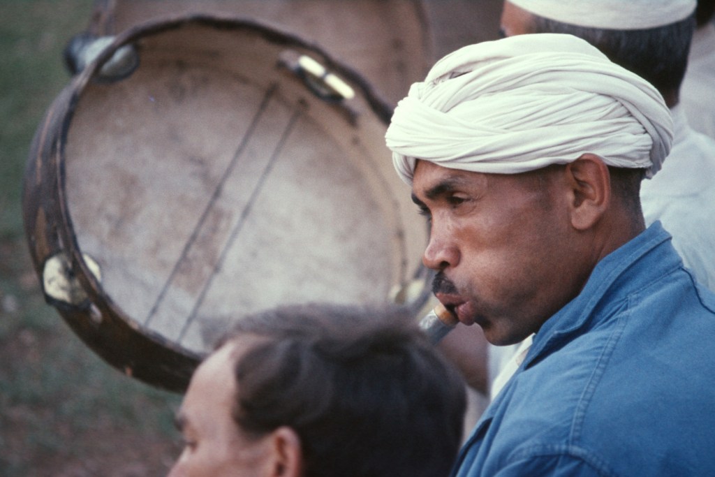
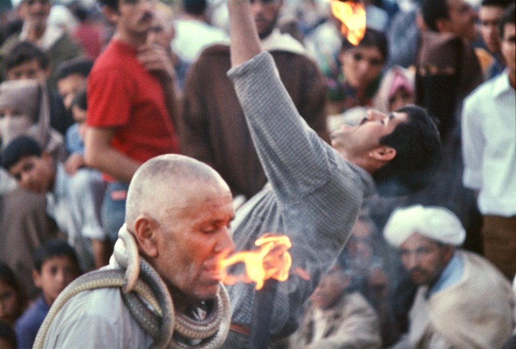

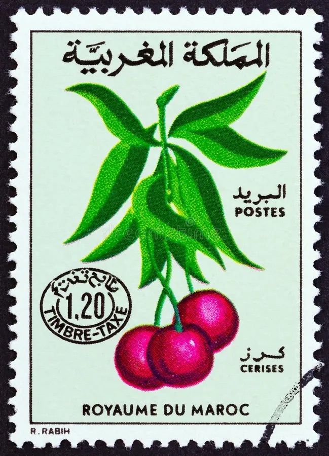


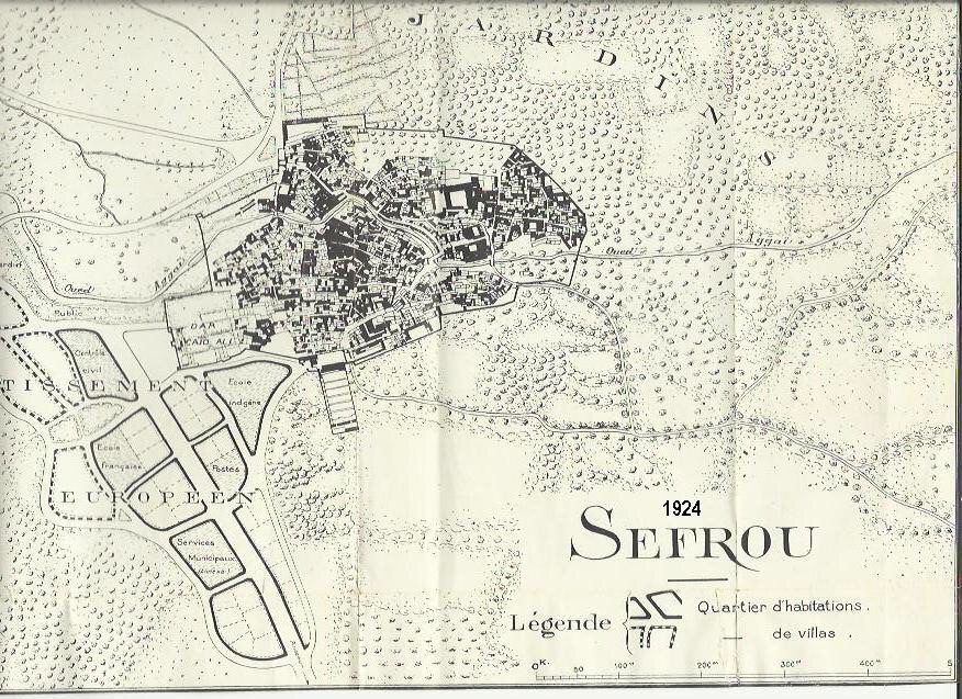

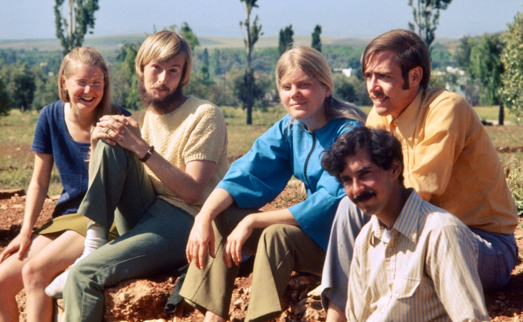
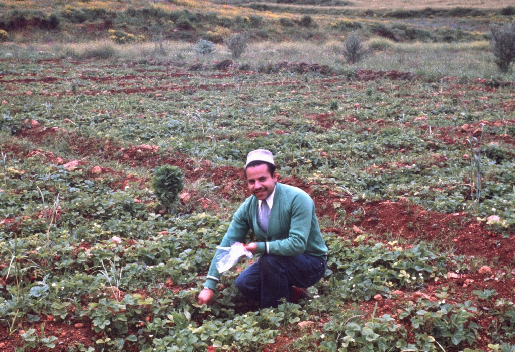
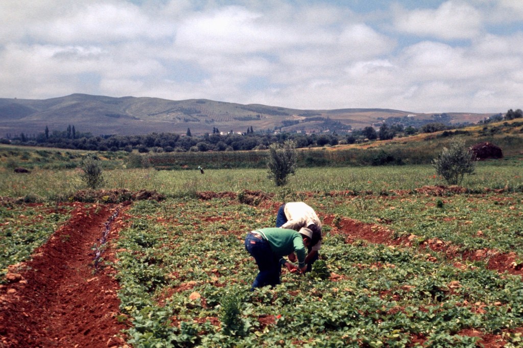

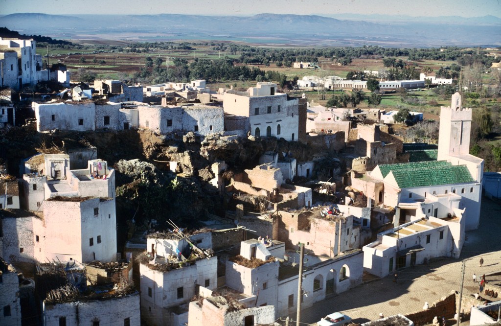

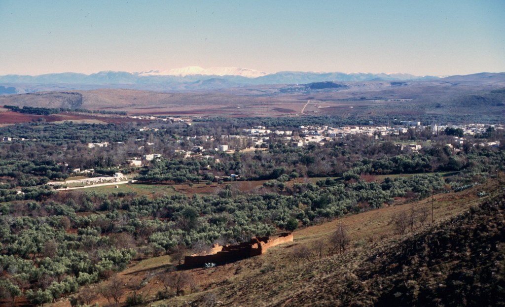


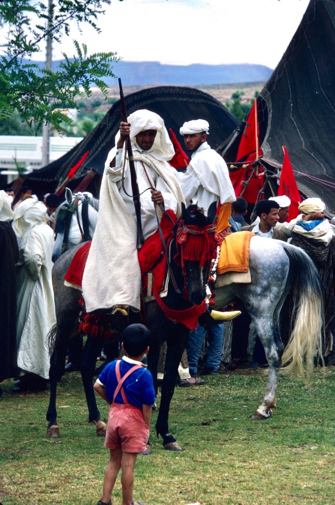
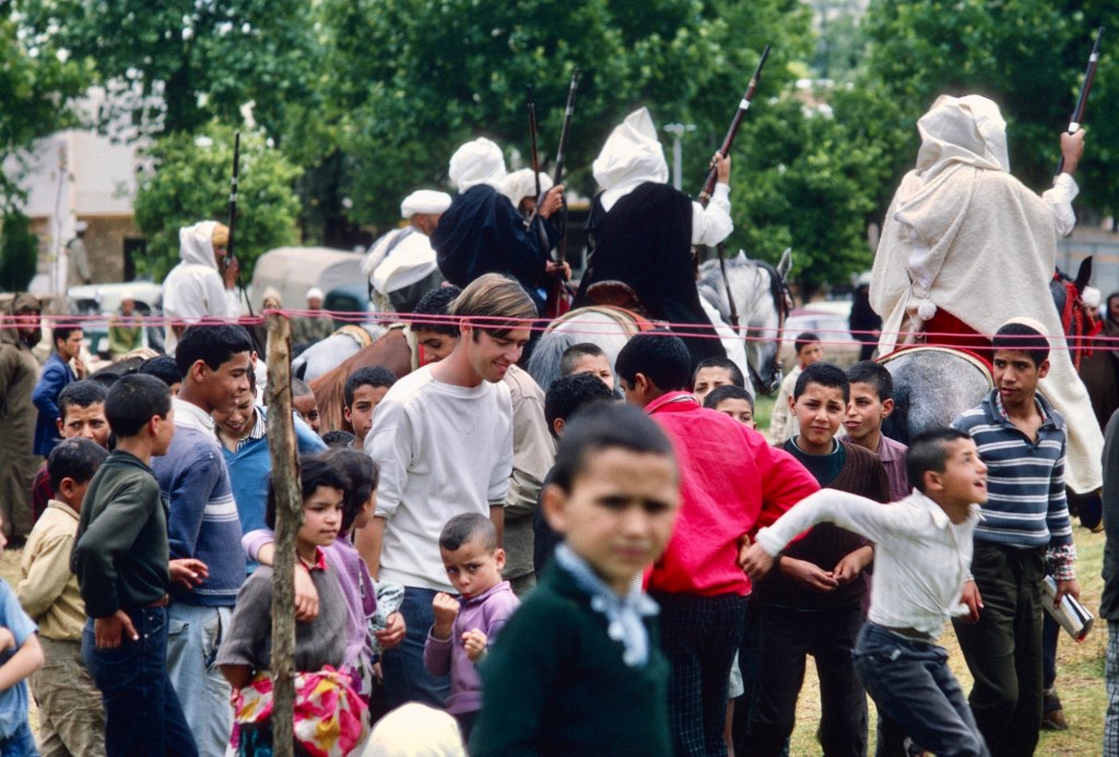
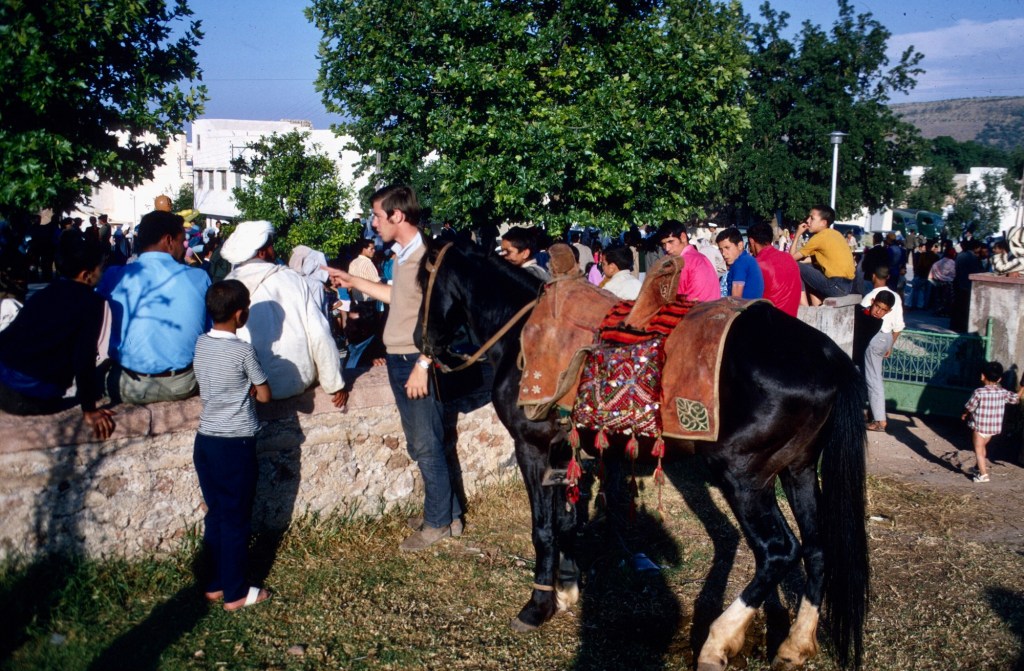


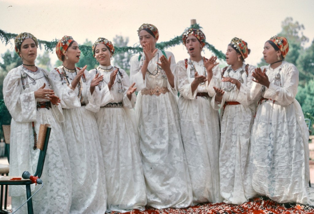
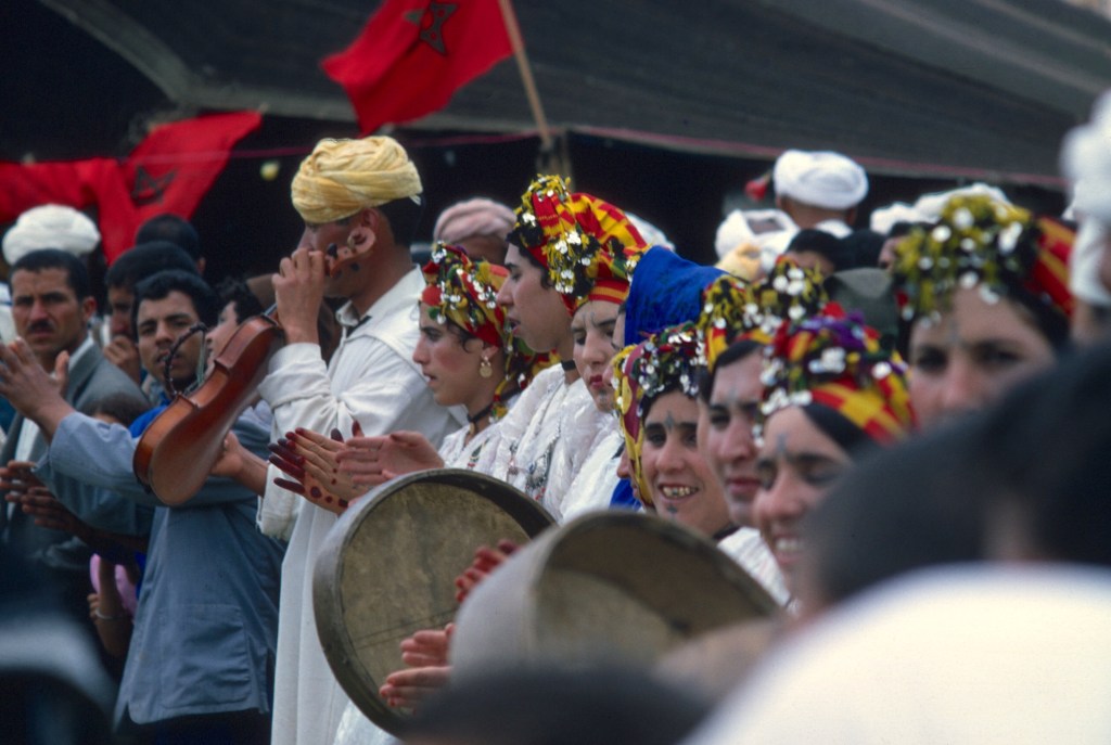

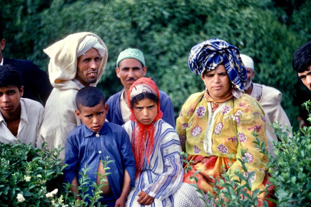
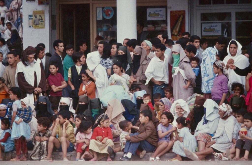


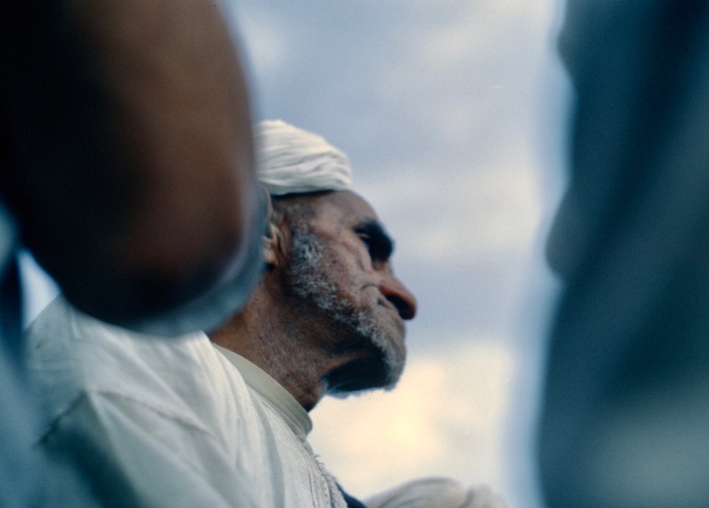
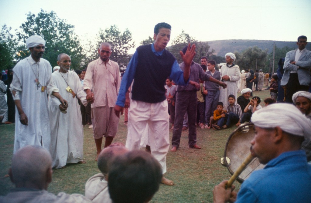


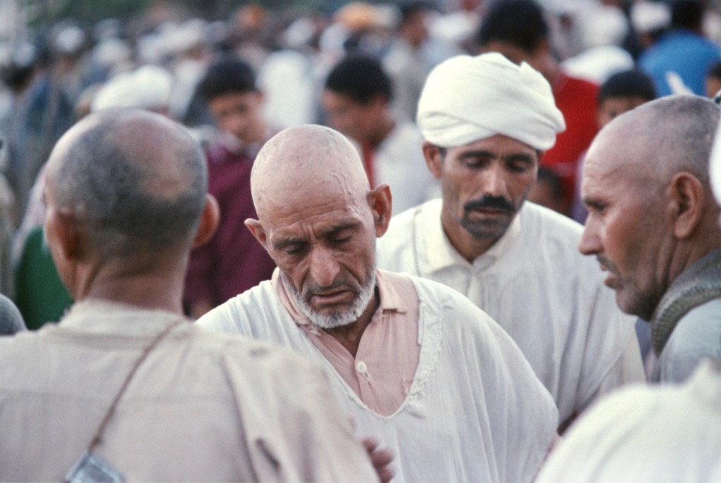
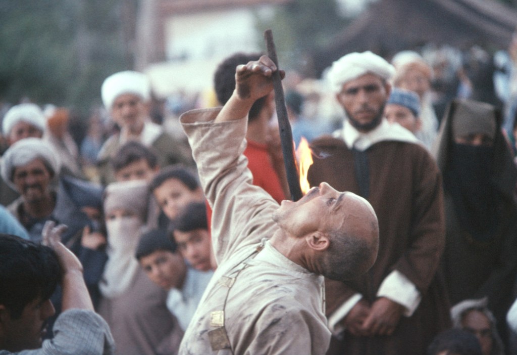

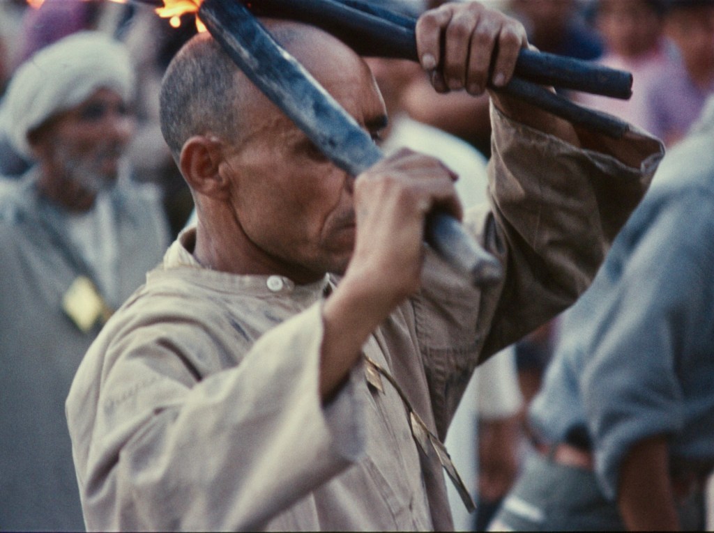


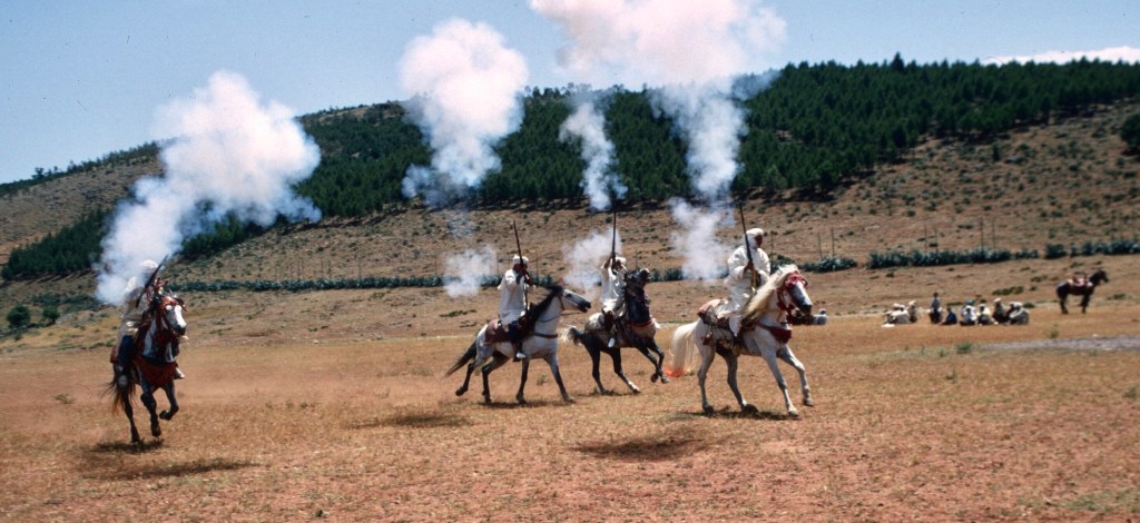
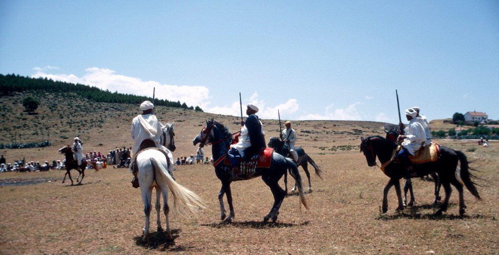

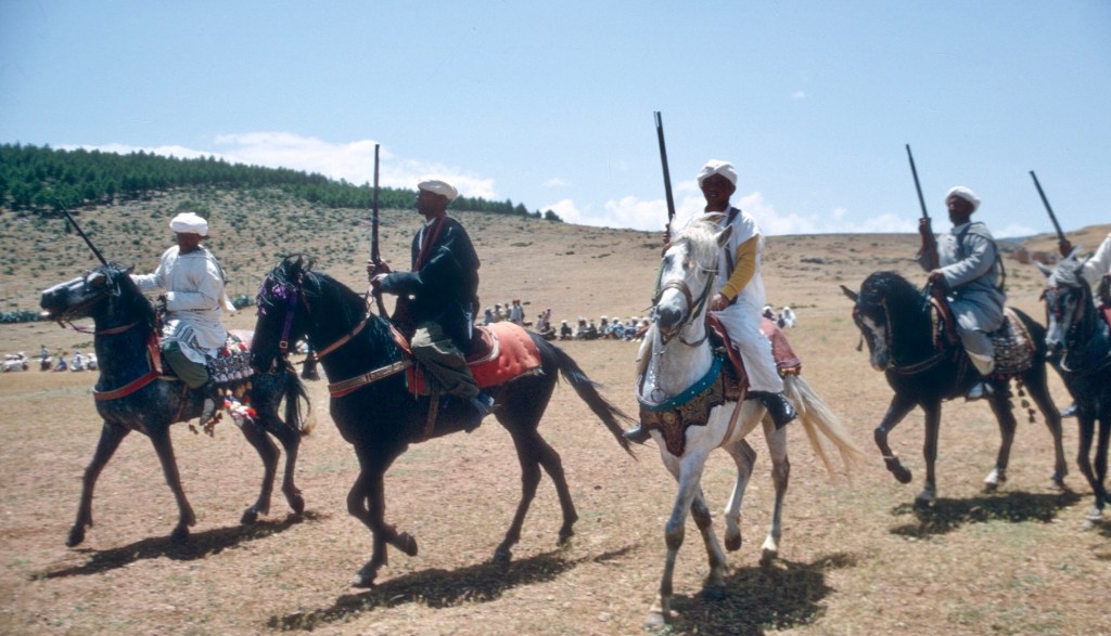
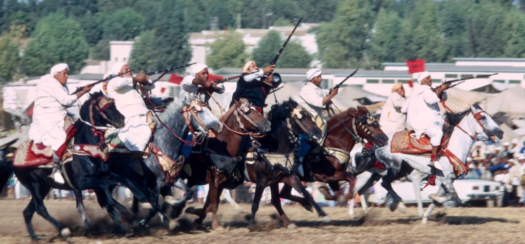


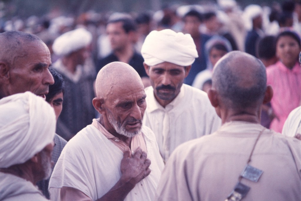
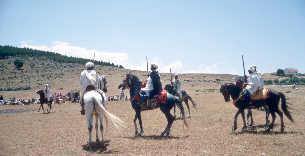

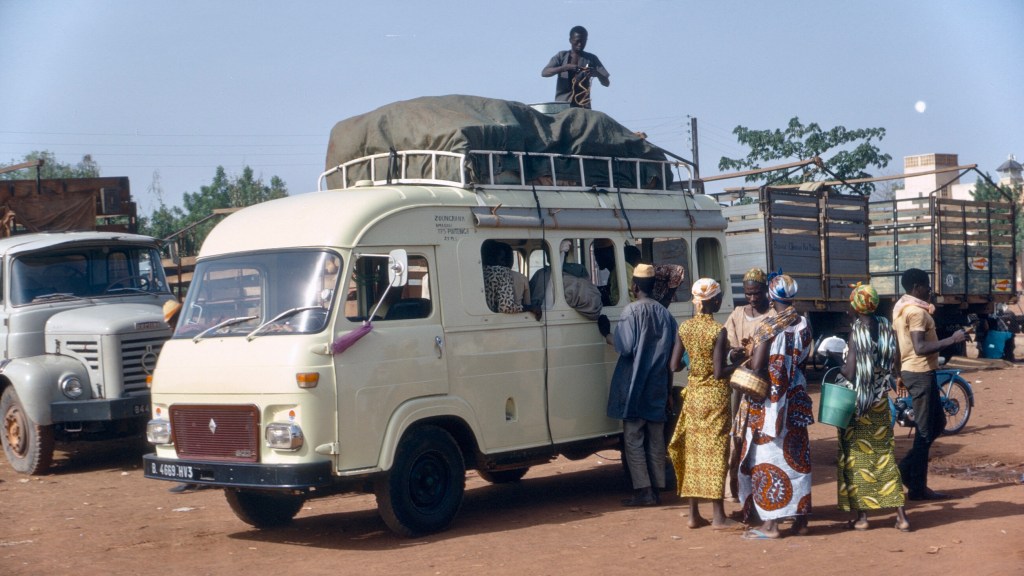
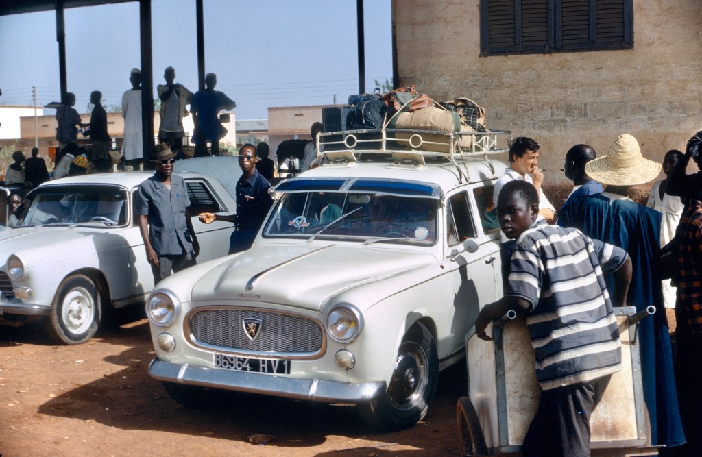


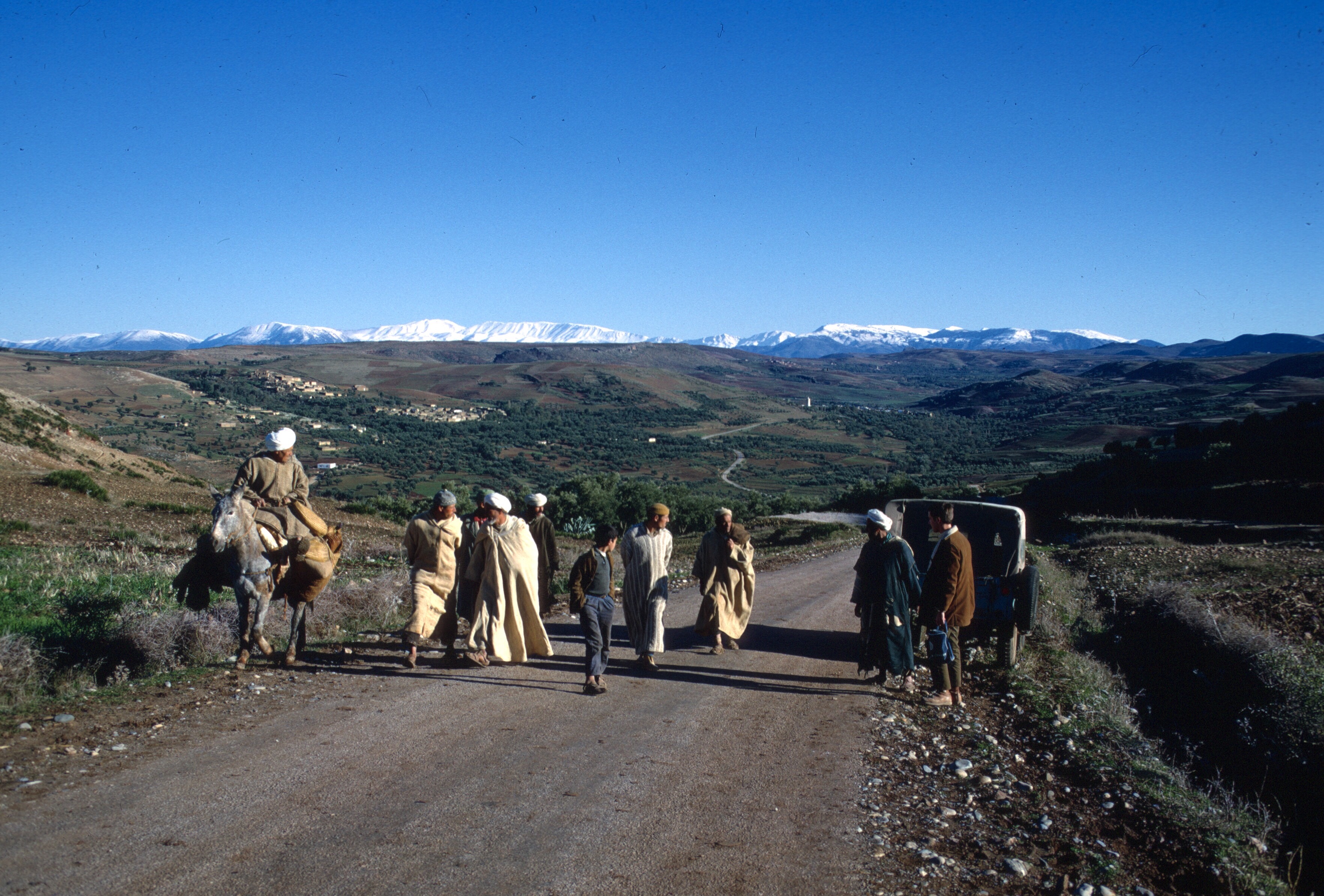

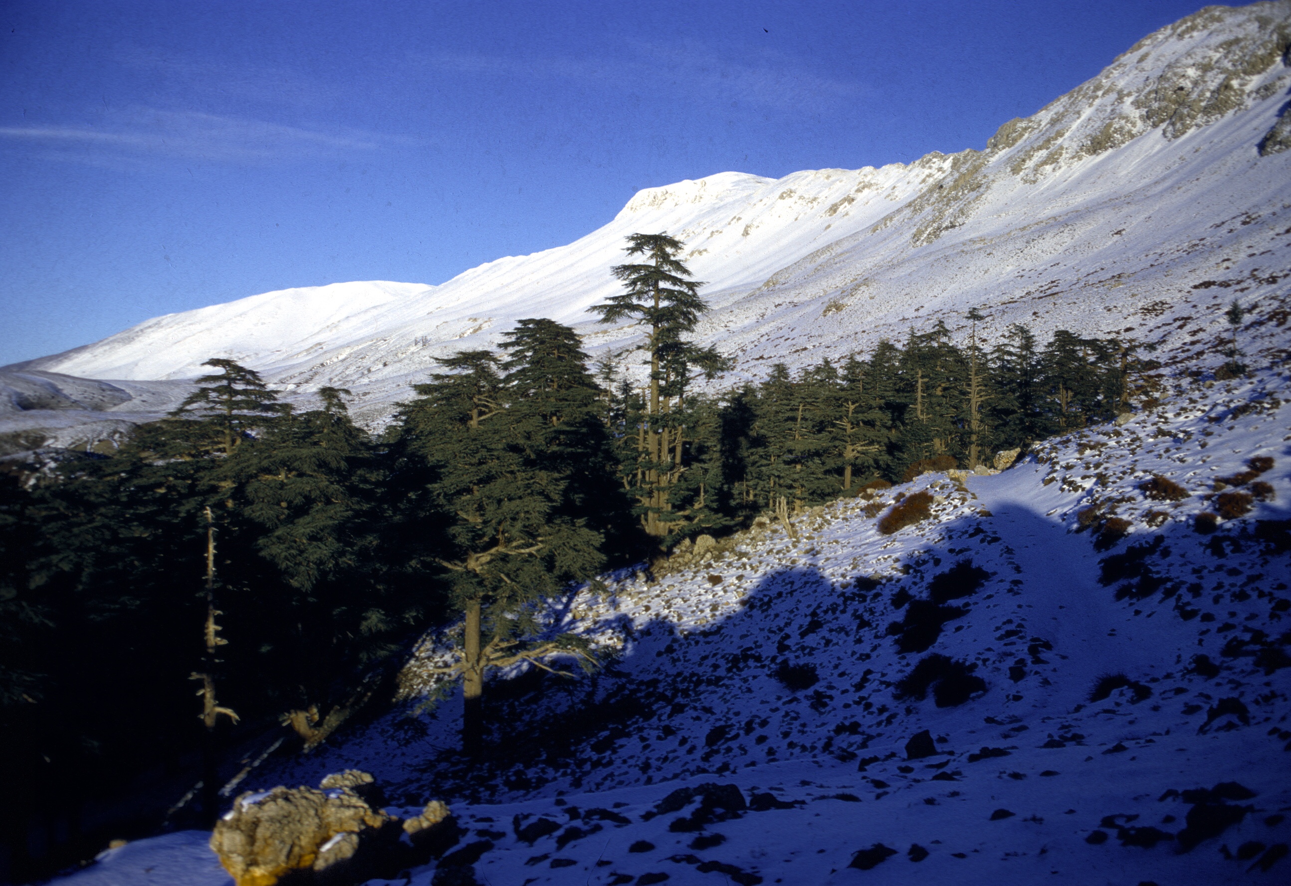

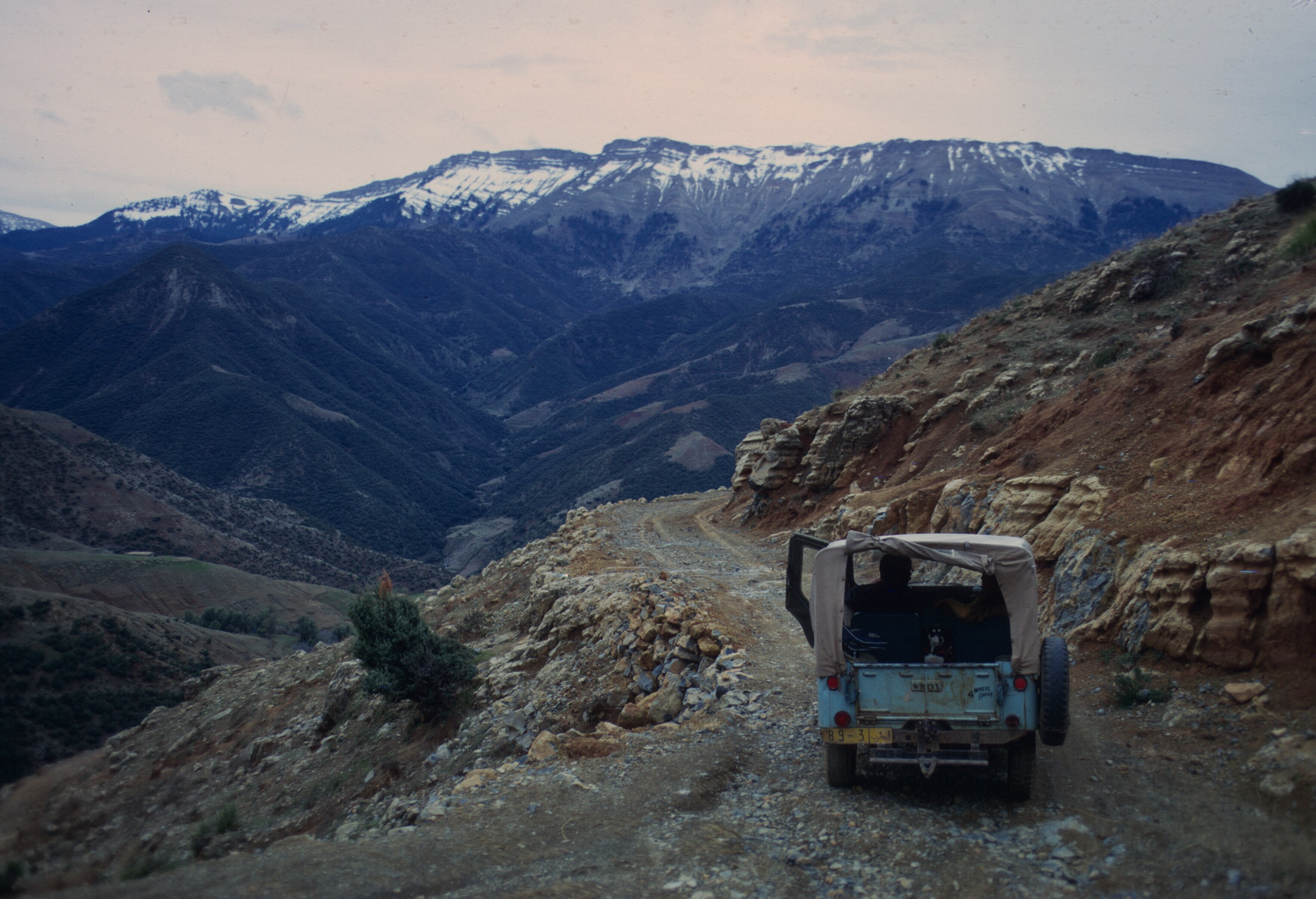


 I don’t remember whether we went on our hikes immediately.