Pic du Midi de Bigorre, as seen from the Boulevard des Pyrenees in Pau. A late summer afternoon in July 1965.
I seem to return again and again to Pic du Midi de Bigorre, a pole around which some of my memories rotate, collect, and coalesce like the dust of a primordial solar system or galaxy, perhaps to come to life again.
Just recently, an article in The Guardian with readers’ recommendations for out-of-the-way European travel spots suggested visiting the Pyrenees and highlighted the mountain range’s clean air. The Pyrenees have been somewhat ignored by foreigners, except for eccentric Englishmen like Count Henry Russell.
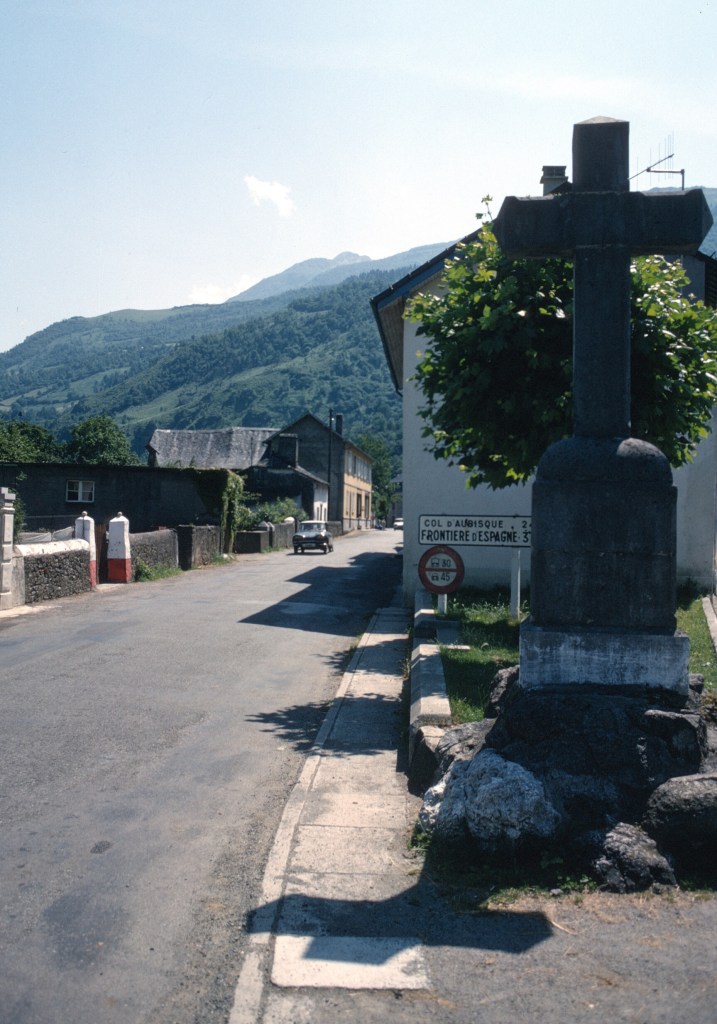
The Spanish frontier lies along the crest of the range, and is never far. On a school trip to the Col d’Aubisque. August 1965.
The fact that for a third of the twentieth century the mountains were a land frontier with a country under a dictatorship did not encourage drop-in visitors and was a factor, though in the south many British pensioners stretched their incomes by moving to the Costa del Sol.
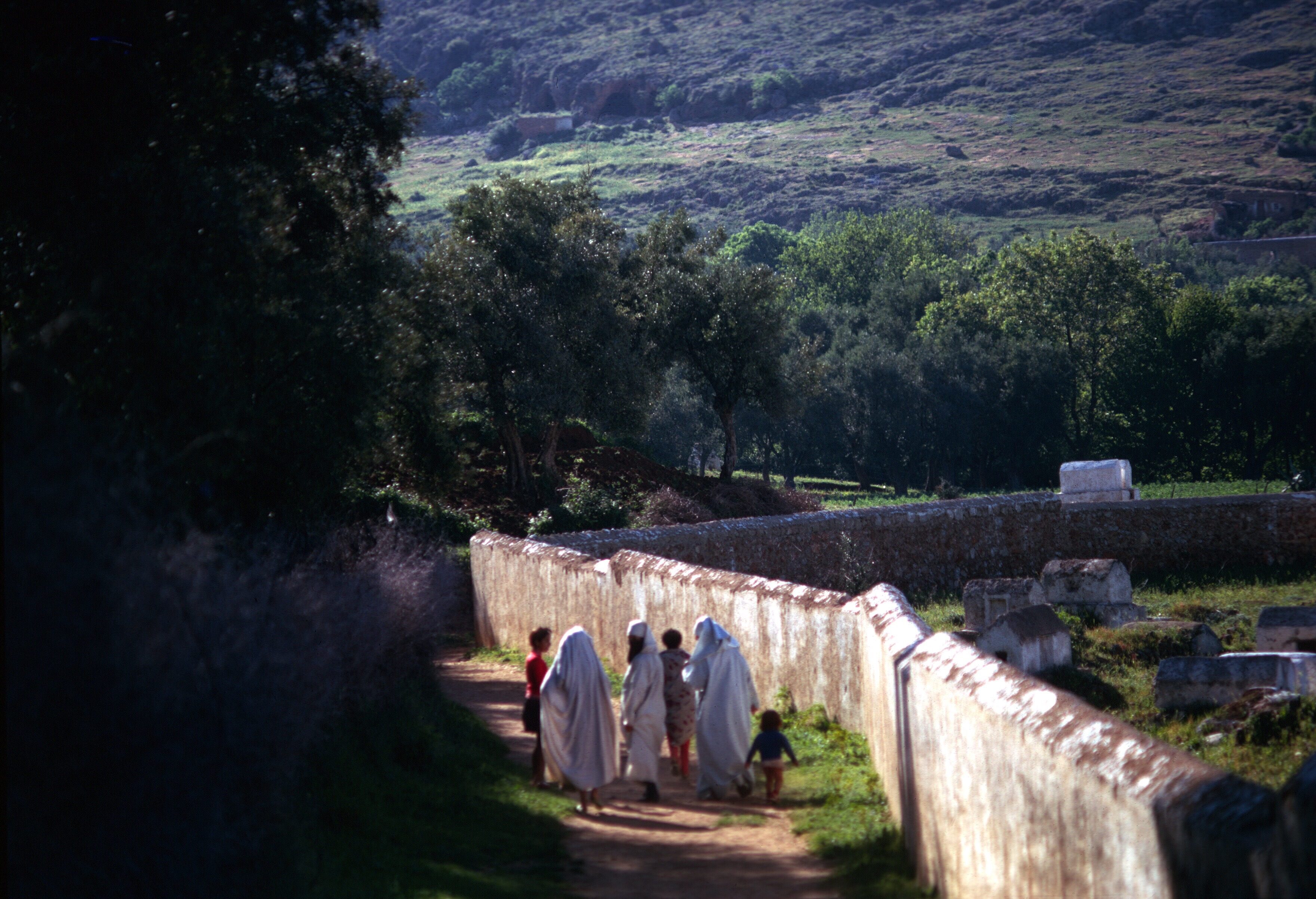
A customs post at the Col du Pourtalet about 6,000 feet in elevation (1,794 m). The tiny figures on the hill were border guards armed with submachine guns. Years after the Civil War, in 1965, the Spanish government still felt that it needed to show its strength along the border. I remember the guards as members of the Guardia Civil, but I might be wrong.
As for mountain scenery, the Alps are much higher, have big glaciers, are closer to large population centers, have more snow and longer lasting snow, and were an early center for climbing for the French and the English.
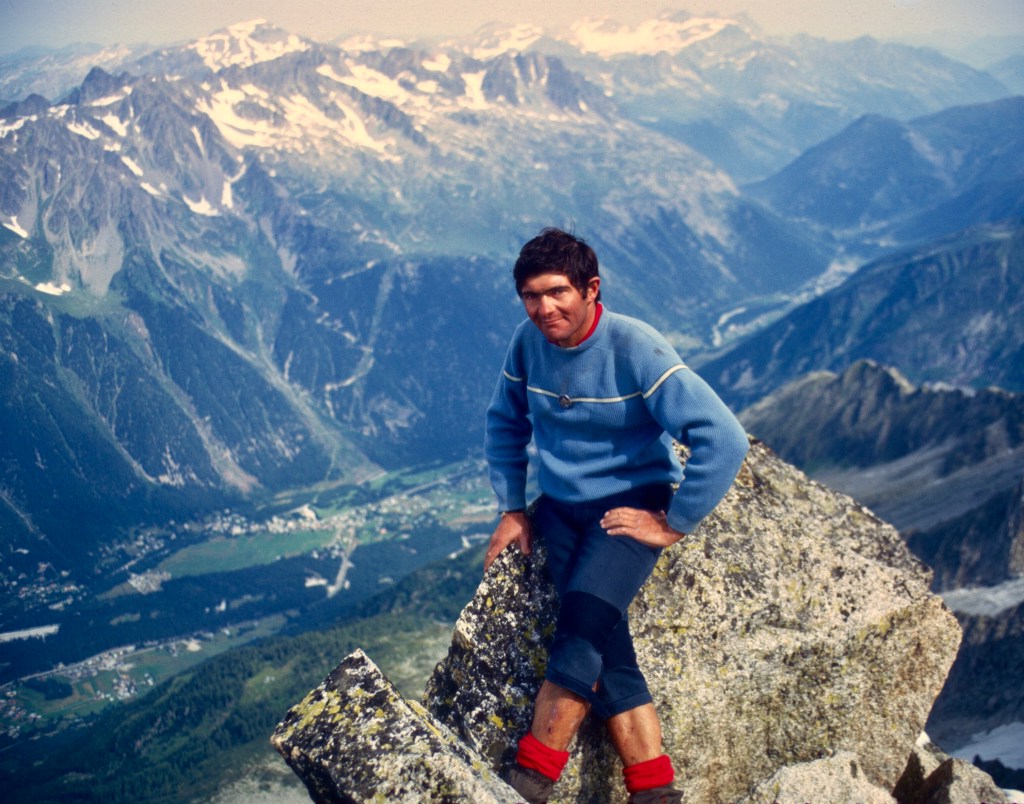
A view of Mont Blanc after a fresh snow, above Le Tour in the Chamonix valley. 1970.Le Petit Pèlerin among the Aiguilles de Chamonix. This summit is easily accessible and an easy ascent. The Aiguilles de Chamonix are legendary for European climbers. One of the highest cable cars in the world will take one to the summit of the Aiguille du Midi, and, if one wishes, over the Vallée Blanche and down to Courmayeur in Val d’Aosta in Italy. WikiCommons: Topo camptocamp.org.At the summit of the Petit Pèlerin, Pierre, a Chamonix guide and climbing instructor. Below, the valley of Chamonix looking up the valley toward Switzerland.
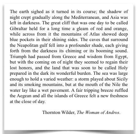
The Pyrenees are much more wild, and far less developed, particularly in the eastern part of the range, where French government and European environmental groups have been trying to reestablish a self-sustainable bear population. That effort has met vocal and vigorous opposition from pastoralists who must deal with occasional depredations on livestock. Transhumance in the Pyrenees has been an important part of the local economy from at least the Middle Ages.
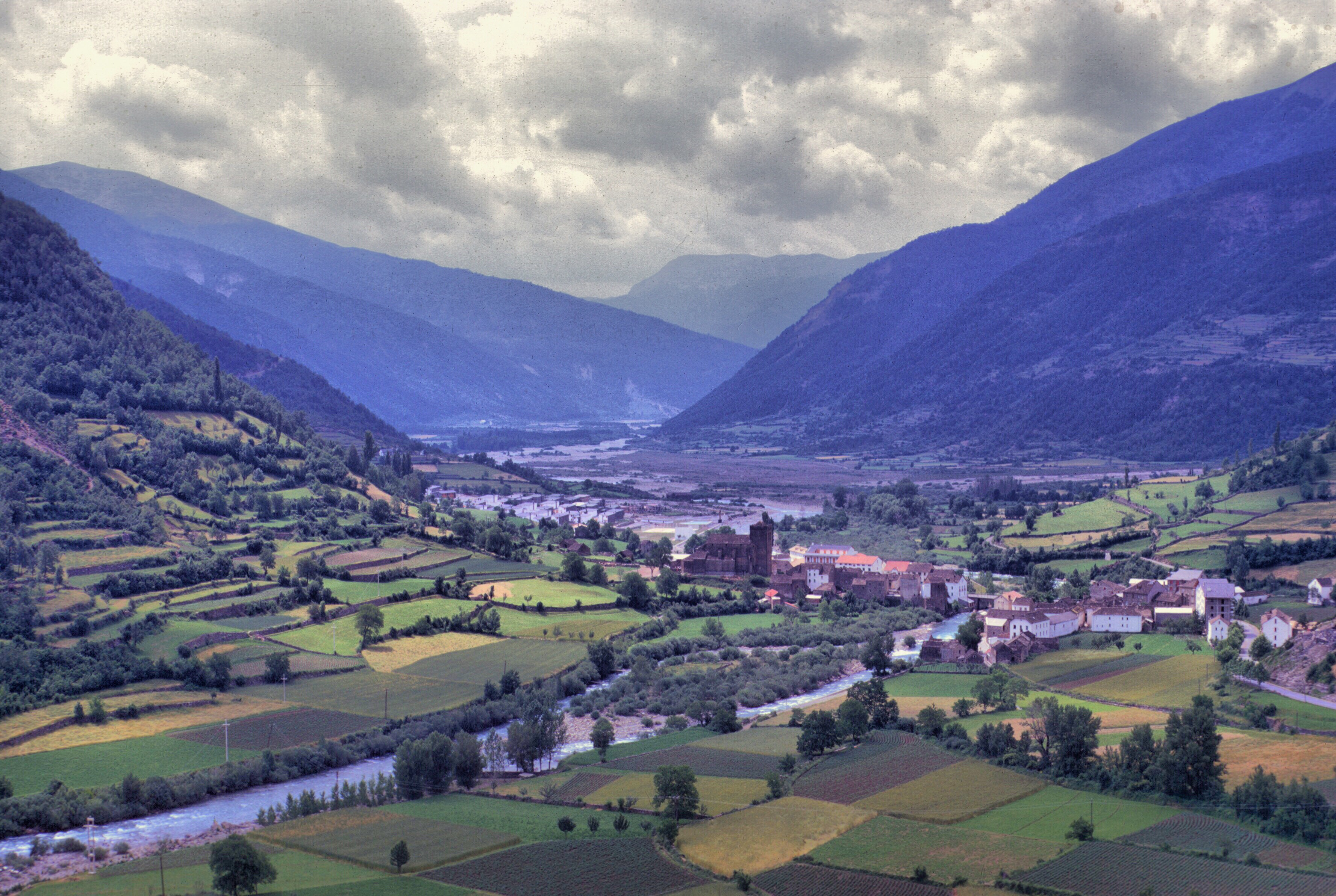
One of the towers in the National Park of Ordesa. Spain, 1969. The Pyrenees have several national parks on both sides of the frontier.
Hitchhiking through the Pyrenees in the mid-sixties, I seldom encountered cars with foreign license plates, and all the rides that I received were with French drivers.
More recently, however, British writers have produced some excellent guide books in the Ciceron series of mountaineering and climbing guides.
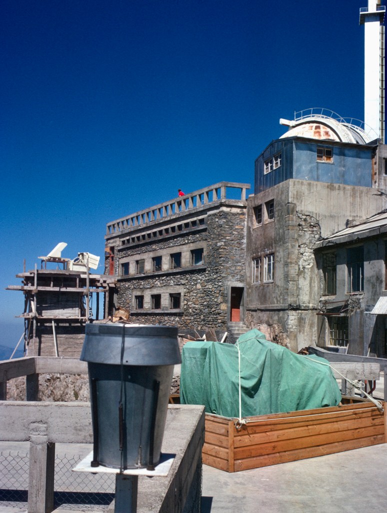
The observatory complex from just below the summit of Pic du Midi. August 1965.
Recently, French newspapers have reported on the discovery of micro plastics in the thin air of that Pic du Midi. This should come as no surprise since plastic particles have been found from pole to pole. Plastics have contaminated the food that we eat, and through food, our bodies. A huge mass of plastics floats in the Pacific, while I, myself, cannot go down to the shingle beach behind my house without seeing all varieties of plastic items, the flotsam and jetsam of life in our modern age.
What did come as a surprise to some scientists studying the plastic nanoparticules on the summit of Pic du Midi was their origin: the Atlantic and the Mediterranean, suggesting vast transport mechanisms.
Plastics are ubiquitous on earth, to the extent that some have suggested that a new geological age be created and named the Plastocene. We don’t have to search for irony in the scene from the movie, The Graduate, where an adult friend of the protagonist’s father approaches young Benjamin, and shares his important life secret: the future is in plastics.
The Graduate was released in 1967, the same year I trained for the Peace Corps. At that time in Morocco, grocers used old newspapers and bags made of cheap and coarse blue paper to wrap beans, rice, and other bulk items. In Tangier, an expatriate Englishman, who offered fish and chips from a hole-in-the-wall restaurant in the medina, served up his take-out food wrapped in newsprint as was the custom in Britain. Still, change was on the horizon. In the short four years of my first stay in Morocco, thin plastic bags slowly replaced the old paper ones and newspaper wrappings became ever less common.
In those days, municipal dump sites consisted largely of organic waste materials. Tin cans, glass, and plastic bottles were picked out of the waste sites by scavengers. Rather than a mound, waste sites in Morocco were often flat empty places, picked clean by people and animals. As in the account of life in a Mumbai slum, All the Beautiful Forevers, where some of the book’s characters earned their living by scavenging trash, so did some Moroccans. I have a photo somewhere of the municipal dump site of Chauen, from the mid-nineteen seventies, that shows a strikingly flat and barren place, picked clean of everything.
In the States and Canada, the term waste management is somewhat of an oxymoron, and now manifests itself as an industry with a few very giant players. Recycling is common, encouraged by environmental interests as well as governments hoping to preserve landfill space and perhaps make a bit of money. Much waste is shipped abroad where it ends up burned or otherwise inappropriately disposed of. Better waste management would include reducing the amount generated in addition to recycling and various disposal solutions.
Not too long ago, a U.S. forest services employee, who had tested the Colorado air for years for certain predetermined substances, decided out of curiosity to look at his samples under a microscope one day, and, to his surprise, saw tiny black particles. Need I tell you what they were?
Today Morocco has joined other nations of the world in the fight to reduce and manage waste and keep it out of the environment. The effort is expensive and Morocco’s progress has been slow. Perhaps, if Peace Corps returns to the country after the pandemic, it will bring young waste management experts. More likely is that giant waste management firms will eventfully find the Moroccan market profitable and move in with their own people.
The chemical giant DuPont used to have an advertising slogan, “Better living through chemistry.” While there is no doubt that the modern world is dependent on plastics, there is also little doubt that non-recyclable plastics, used indiscriminately and disposed of improperly, are ruining the planet. Yes, a Moroccan farmer in Taounate can produce cheaper tomatoes using drip irrigation from plastic tubes, but there always remains the question of where the plastic goes after it is used, not to mention the environmental cost of producing it.
Modern life is unimaginable without plastics, but we might all be better served by their more judicious and less frivolous use.
Sunset from below the summit of Pic du Midi. As noted in an earlier post, the cost of taking this photo was a long, cold descent to La Mongie.
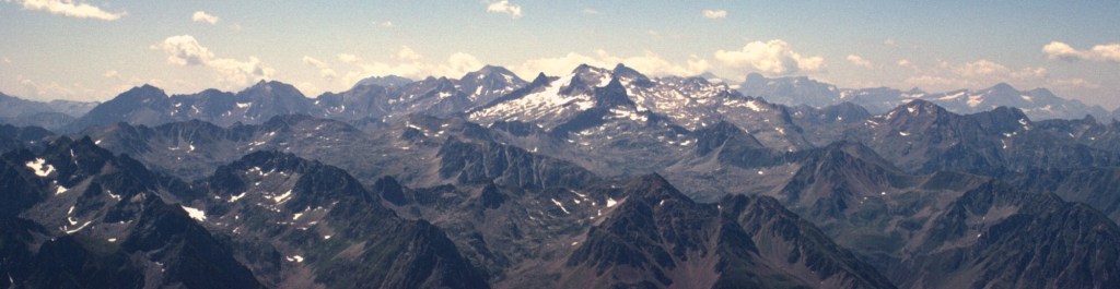
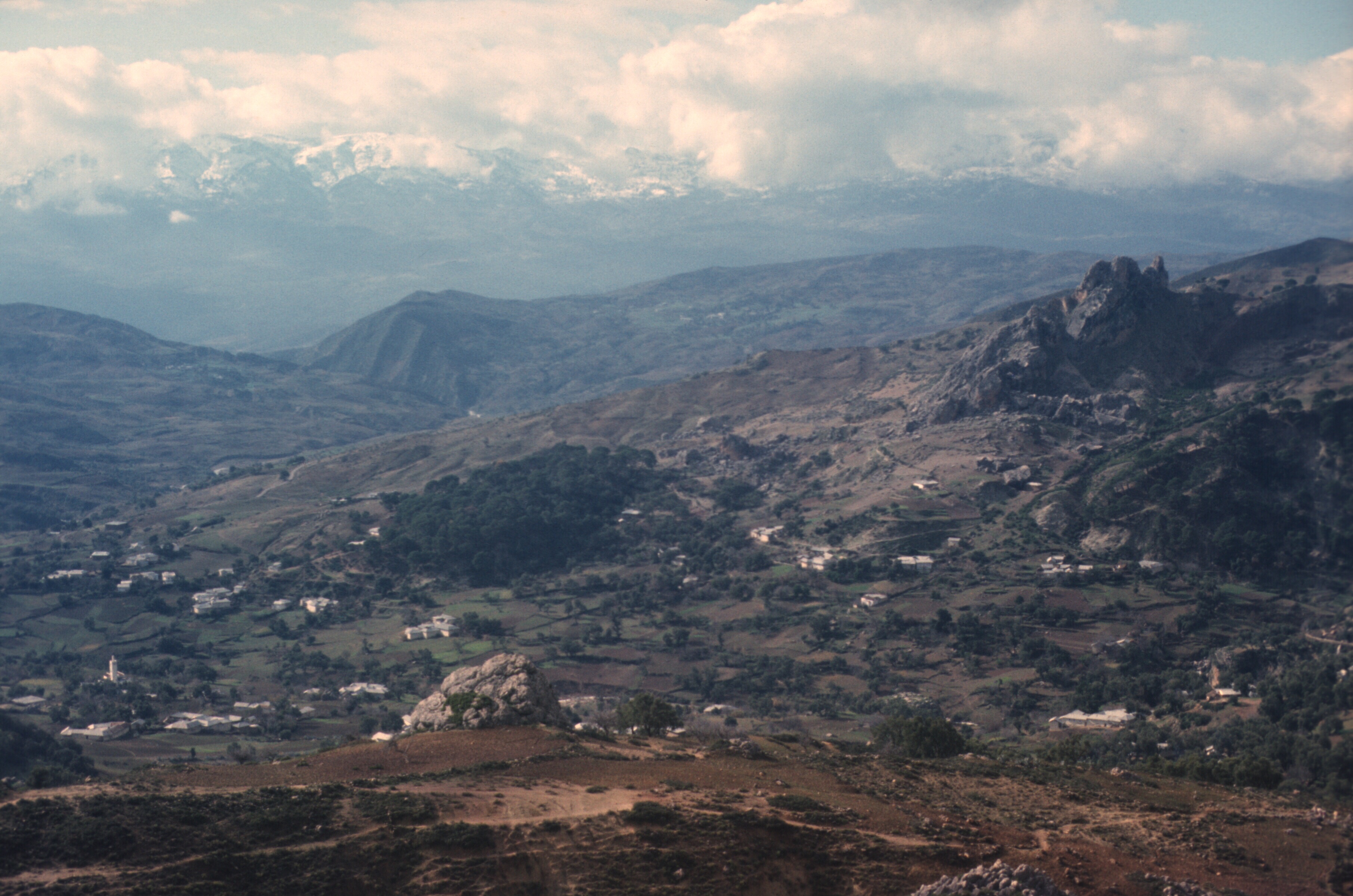
The central Pyrenees as seen from the Pic du Midi de Bigorre. The Néouvielle Massif is in the foreground, and the mountain crests in the background mark the French-Spanish border.
In the wake of the latest IPCC report on climate change, I noticed an item in the French press about recent temperatures recorded on the summit of the Pic du Midi. Now, there are actually two sites called Pic du Midi in France, both in the Pyrenees. Pic du Midi d’Ossau sits near the Spanish border.
This view of Pic du Midi d’Ossau is from the French side of the border. There are much better views. I thought that the view from the cable car station at Artouste was spectacular. Notice the Guardia Civil on the hilltop at the left. They carried submachine guns. In 1965 Franco still ruled Spain with an iron fist.
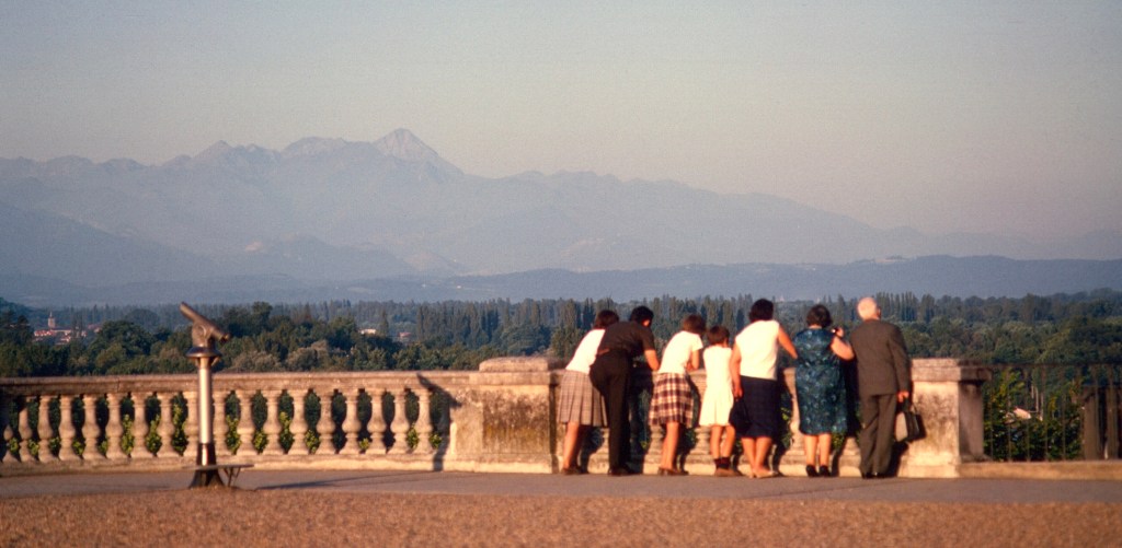
Detached from the rest of the range, the mountain towers over the valley of Laruns, and its silhouette immediately attracts the eyes of those strolling on the Boulevard des Pyrenees in Pau.
On the Boulevard des Pyrenees, the old fellow’s telescope seems to be pointing directly at the Pic du Midi d’Ossau. The valley of Laruns goes directly south to the Spanish boarder and its dip gives a view of the mountain.
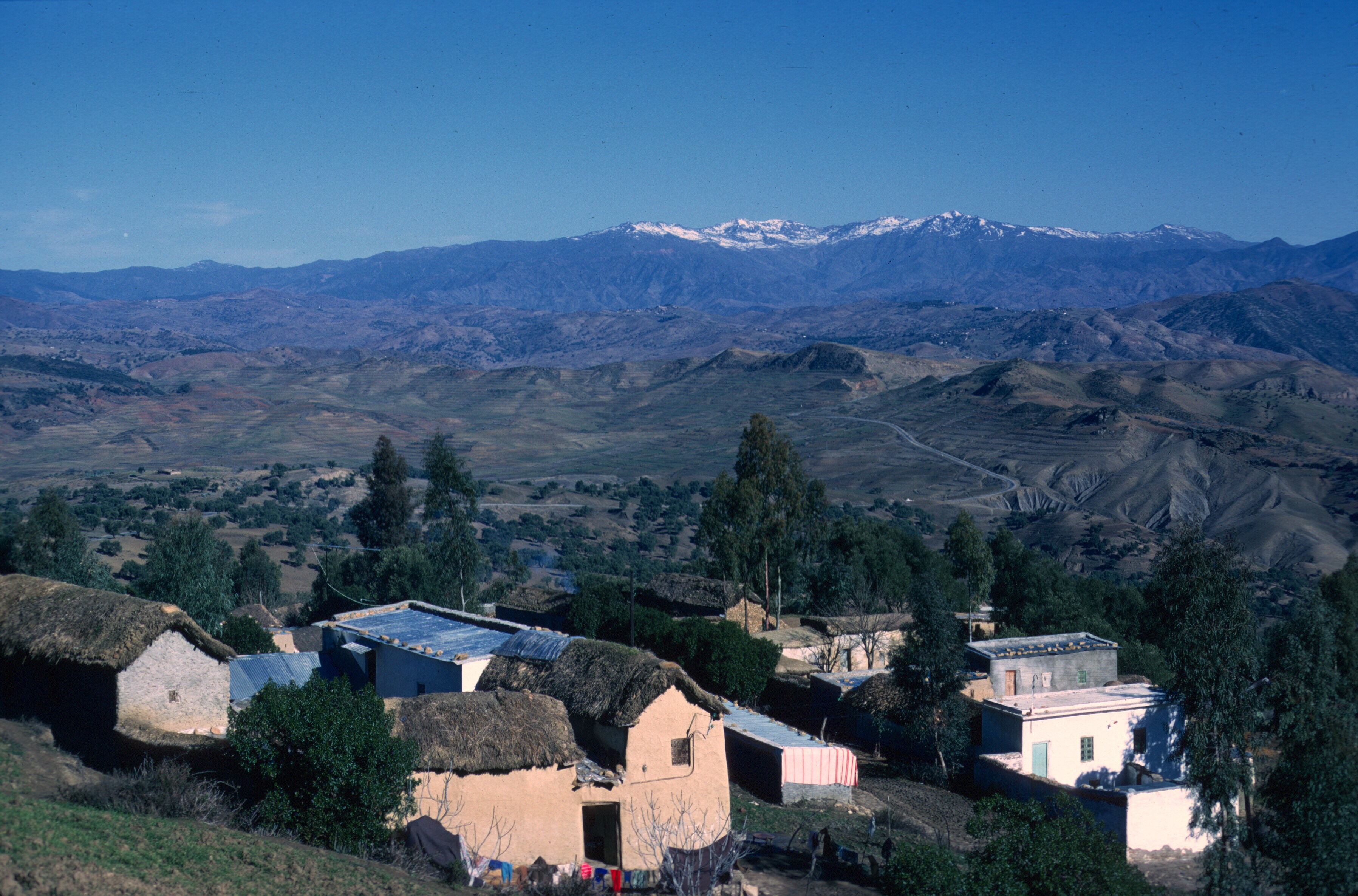
The Pic du Midi de Bigorre is also visible from Pau, though one must look to the southeast. This 9,500 foot mountain is on the northern edge of the Pyrenees, well in advance of the main crest which marks the frontier with Spain, and higher than most of the mountains around it.
The Pic du Midi de Bigorre, in the center of the photo, is also visible from Pau.
The Pic du Midi de Bigorre has several claims to fame. An observatory on the mountain is famous and many years ago telescopes there captured photos of the moon used by the British astronomer Patrick Moore to create a detailed atlas of our satellite’s surface.
The remote site on the peak was chosen for its dark sky and clean air and accessibility. By the twenty-first century, light pollution had become a major problem for the astronomers working there. France has initiated a Dark Sky Reserve, the first in Europe, to deal with the problem.
When I was 11 or so, I developed an interest in astronomy, and I actually knew who Patrick Moore was when I arrived in Pau, as well his role in astronomy. On the other hand, I hardly knew anything about France, especially the southwest. The discovery of big mountains and proximity to the ocean was a joy.
A few days ago, the press noted that the temperature on the summit of the Pic du Midi de Bigorre had just equaled the previous record high temperature for an August night and approached the all time nighttime high for any month. On the night of August 13–14 the temperature reached 58° F (14.5° C), only equaled once before in August, 2012. None of these temperatures can be described as balmy, but the mountain is almost 9,500 feet high. The record high of 58.8 (14.9° C) was recorded in June 2019, and the climate on the mountain is clearly warming. Incidentally, the annual nighttime low for mid-summer is 35.4° F (1.9° C).
The article on the Pic du Midi reminded me of my own youthful encounter with the summit many years ago. In the summer of 1965, I was studying French at a summer program for foreigners in Pau in southwest France. I had come to France that summer to extend my stay in Europe, occasioned by an autumn semester abroad in Montpellier. The trip to Europe was my first and I was determined to make the most of it. Learning French was the goal, but after that I had no clear idea about what I wanted. I had never heard of Pau until the summer program there was recommended by an upperclassman at my college. Despite having had 4 years of French, my command of the spoken language was minimal, and my ignorance of the history and culture of France was immense.
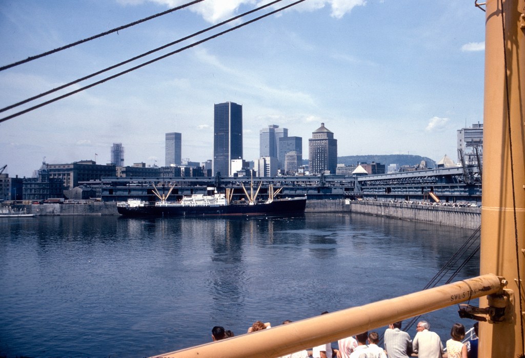
The people of Pau are justly proud of their native son, Henri IV, who brought peace and prosperity to France after years of religious turmoil. He was assassinated by a religious fanatic. The inscription is in the local language, not French.Leaving Montreal on a Cunard liner.
Around July 1, Canada Day, I took the train from Niagara Falls to Montreal, and left the next day on a Cunard liner bound for Liverpool. As I remember, the ship took well over a week to arrive. The route up the St. Lawrence River and out of the Gulf of St. Lawrence took two days by itself. The ship didn’t stop in Quebec City, but it slowed down and took on passengers from a motor launch.
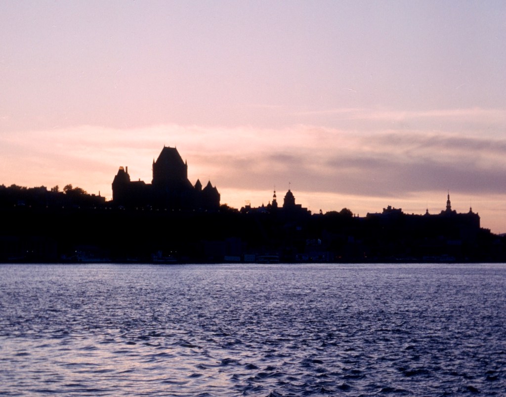
Quebec City is only a few hours downriver from Montreal. My ship reached it late in the afternoon. This photo was taken a year or two later, probably from a ferry from Lévis.
The ship passed through the strait of Belle Isle between Newfoundland and Labrador, rounded northern Ireland, and stopped briefly to unload passengers in Greenock, Scotland. There were a lot of Scots on the trip including a table full of Scottish Canadians from Toronto with whom I took my meals. Scots make up Canada’s third largest ethnic origin after the English and the French.
My dining companions aboard the ship. Ross, three ladies of the Orchard family, and Peter, all ready to debark at Greenock.
After leaving the St Lawrence, whales and icebergs were the only sights till Scotland. There wasn’t much to do aboard. The ship, in its last years of service, was definitely not a luxury liner, but it was as inexpensive as the cheapest air travel, and gave me an opportunity to experience a transatlantic ship passage. At Christmas, I flew back on an Air Canada flight to Toronto, seated beside Italian immigrants.
Floating ice off the coast of Labrador.
Arriving in Liverpool, I took the train to London and spent a couple of days sightseeing. By chance, standing outside Westminster Hall, I saw a carriage with the Queen and President Eduardo Frei of Chile, in London for a state visit. I suppose that this event was a highlight. Otherwise, I saw only a small selection of the standard tourist sights. I knew a lot about how parliament operated from my Canadian studies, but virtually nothing about Great Britain.
On July 14, I took a train to France and arrived at the Gare du Nord, the streets still displaying litter in the aftermath of Bastille Day. I then caught an overnight train with couchettes to Pau, arriving on a brilliant summer morning. I don’t think it rained more than a day during my six-week stay. Pau deserves its reputation for a mild and pleasant climate. One of the least windy areas of France, Pau was a center for training paratroopers.
I didn’t live in a dormitory. I rented a room from a wonderful elderly widow who took in students studying in Pau during the summer. The other lodgers were older than me and I didn’t socialize much with them. By the third week I hadn’t made any friends, and was beginning to feel a bit lonely.
Though I had a room in Madame Pineaud’s house, I took my meals in the communal dining hall at the summer school, a lycée during the regular scholastic year. I still remember the entrance to the school building, which had a quote from the Roman playwright Terence over the doors: “Je suis un homme, rien de ce qui est humain ne m’est étranger.” (“I am a man, nothing that is human is foreign to me.”)
One night at dinner I met a Finnish student and asked her if she’d like to go out for coffee. Sitting on the terrace of a cafe, we conversed in somewhat halting French until the subject of where we were from came up. When I said that I was from Niagara Falls, she replied that she had grown up in Niagara Falls, Ontario. From that point, we spoke English which she spoke just as well as I did, though with a softness from her native Finnish. Her family had moved to Canada after WWII, when she was very young, then moved back to Finland when she was in her teens. She had spoken enough English by then to affect her Finnish.
Terry and I spent much of the rest of the summer together, hitchhiking around the local countryside. In those times it was easy to get rides, and we carried flags that identified us as foreigners. The French were gracious about picking us up.
The road from Pau to Spain.The valley of Argelès-Gazost. Our route from Pau to Pic du Midi probably went through Lourdes and Argelès.
Wednesday afternoons were free from classes so it was easy to visit places within 30 to 40 miles or even more, though sometimes we got back to Pau as dark was falling. Weekends offered the chance to go much farther, and on one of them we decided to visit the Pic du Midi.
The 6,000 foot high pass, le Col du Tourmalet, on one side of the mountain, is part of a famously difficult bike segment of the Tour de France, but Pic du Midi’s real renown comes from its observatory as well as the summit, which was then accessible by auto for visits to the observatory and a spectacular panorama.
The main telescope.
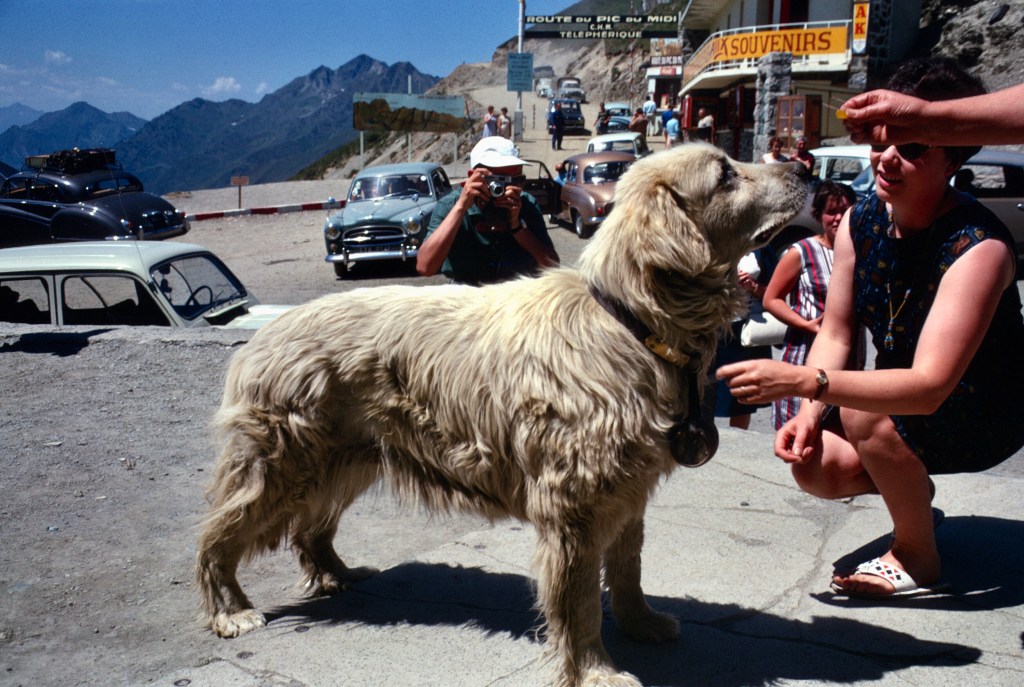
One Saturday Terry and I set off for the mountain. Though it was the beginning of August and the roads were full of tourists, we did not arrive at the Col du Tourmalet until late in the afternoon.
On the Col du Tourmalet, tourists pause for photos of a Pyrenees dog. Bred to guard sheep, these dogs can be fiercely protective of their flocks. In the background, the old unpaved road to the summit. Difficult to maintain, the road was closed after a number of fatal accidents. Tourists can only reach the summit on foot or by cable car today.
Without much thought about the time, we decided walk up the toll road to the top, about 3,000 feet above the pass. The road had already closed for the night so we knew we would have to walk up and back down.
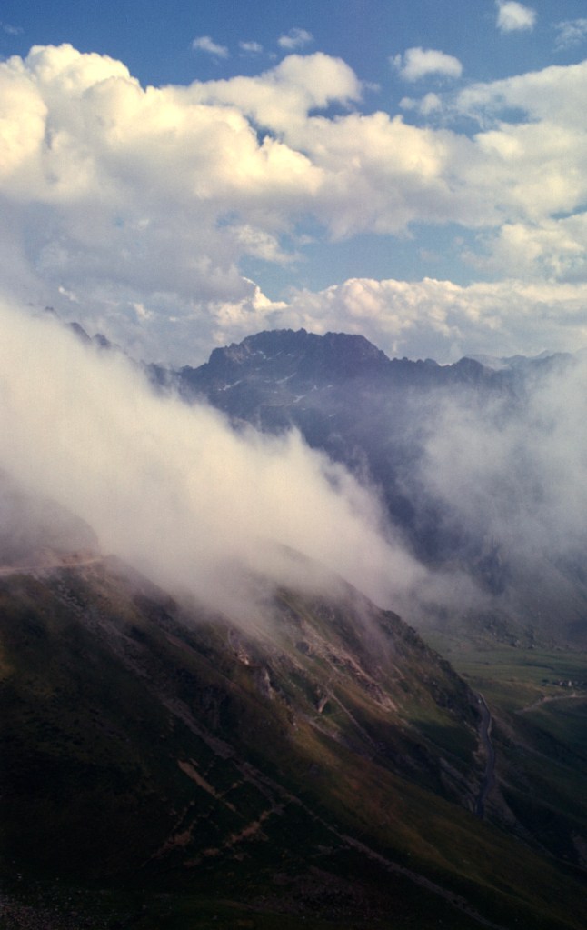
On the way up, afternoon clouds slid down the mountainsides and filled the valleys.
We arrived just before dark. The valleys were clouded in, but the sunset view was spectacular. We knew that we had a long, but downhill walk back to the main road and there might not be much traffic there when we reached it, but we took the chance. We were rewarded by a breathtaking sunset on the deserted mountain.
Pausing for photos neat the summit, Terry poses for me.Time to start down, most people would say. Terry is shooting the sunset.
The temperature was beginning to drop, and at 9,000 feet in the Pyrenees the nights are quite cold. On an earlier trip to the Lac d’Artouste, we descended on the last cable car of the day in summer attire and the trip down and back to Pau was chilly. We were lucky. This August night was not especially cold, and though the air cooled rapidly, our walk kept us warm enough. Terry had a light jacket. I just had a sweatshirt.
From Tourmalet down, the few cars that passed us did not stop. We had decided to head to the closest ski resort, La Mongie, a few thousand feet and four kilometers away. The clouds evaporated. The night was clear and a full moon lit the ridges and valleys. The heights cast deep shadows, and the sky was full of stars despite the moonlight. We were very tired when we reached the resort, but not exhausted. When we arrived, the desk clerk expressed surprise that he had not heard a car—few guests arrived without one. The hotel was virtually empty. La Mongie in those days was a place for winter fun, and today is one of the largest ski centers in the Pyrenees. Since the road we walked to the summit is now closed, most of today’s visitors take a cable car from La Mongie.
The next day we headed back to Pau by the same route. A French family picked us up, and took us back up to the top of the mountain with them and, as the weather was clear, we got to see the expansive panorama of the central Pyrenees that the mountaintop offers visitors.
The next day, with the family who took us up to the summit with them.
We had little trouble hitching back to Pau that fine Sunday afternoon, and were satisfied with an excursion that turned into an adventure, a long moonlit walk through rugged and deserted mountain scenery.
Climate change has indeed come to the Pic du Midi. Daytime summer temperatures there used to reach 68° F (20° C) only about once every twenty years. That temperature has now been exceeded for three years in a row: 2019, 2020, and 2021.
The Glacier d’Ossoue. Photo: Wiki Commons.
The largest glacier in the Pyrenees, le Glacier d’Ossoue, stretched 5 kilometers when Count Henry Russell, an Englishman who fell in love with the Pyrenees, climbed Vignemale and surrounding peaks.
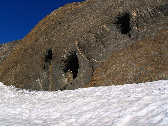
Count Henry RussellHenry Russell outside a cave on Vignemale.
Today it is only 1.3 kilometers long, and the glacier is likely to disappear by mid-century, if not much sooner. When it disappears, the caves that Henry Russell had blasted into the side of Vignemale will only be accessible to skilled climbers. In his day, Russell had them stocked with food and wine, threw elaborate dinner parties, and spent nights in them from time to time.
Three of Russel’s caves on Vignemale. Photo: Wiki Commons.The classic view of Vignemale. Photo: Wiki Commons.
The Pyrenees are about as high as the northern Rockies in the United States where the glaciers of Glacier National Park are melting. Mountain glaciers around the world are receding rapidly. In some cases, the effects may be catastrophic. The demise of the Himalayan glaciers will have tremendous impacts on India and Pakistan, where the great rivers that flow from those mountains into the plains of the Indian subcontinent provide irrigation water during the dry season of the monsoons. Tens of millions of small farmers will face disaster, ironically, in the very area where one of the earliest civilizations arose.
Everyone should take a course in historical geology, coupled perhaps, with another on the history of science. Few people seem to be able to grasp the scale of geologic time. The earth is about 4.5 billion years old. A million years is a relatively short period.
I try to explain geologic time this way: the earth’s climate has been rising rapidly due to man-made activity since the beginning of the Industrial Revolution in the mid-eighteenth century. The change has accelerated substantially since the 1950s. What we are talking about in our discussions of the causes of climate change has happened over only a century or two.
The meteorite that created the Chicxulub crater sixty-five million years ago created immense damage in a few days. The power of the collision of that meteorite with the Earth really staggers the imagination, and I doubt that even the best efforts of Hollywood special effects artists could capture it. The extent of plant and animal extinction, and, especially, the total disappearance of sea animals, such as the hitherto highly successful ammonites, as well as all non-avian dinosaurs testifies to the effects of habitat disruption by a climate change that happened virtually overnight, though we can be certain that the effects of the Chicxulub meteorite continued on for hundreds and thousands of years before the climate stabilized. If one measures a few days up against a few centuries on a geologic scale that is measured in millions, the difference becomes almost insignificant, particularly in view of the fact that the effects of current climate change, like those of the Chicxulub strike, will continue long after the causes have disappeared.
There is an old joke about a man who tries to talk with God. One day, at long last, his efforts are finally rewarded when God answers.
“What is it that you want from Me?”
The man replies, “Please tell me, God, how long is a million years to you?”
God replies, “A million years is as a second.”
“And how much is a million dollars to you?” asks the man.
God answers that a million dollars is as a penny.
Finally, the man asks God, “Can you lend me a million dollars?”
God replies, “Of course. Just a second.”
People must adjust their thinking to time frames far beyond quarterly profits and election cycles to have any chance of managing climate change. Time has almost run out for limiting the rise of the earth’s temperature to 1.5° C. Should climate change continue unchecked and global temperatures continue to rise, the world as we know it will be gone forever.
Last week scientists noted the first rainfall ever on the Greenland Icecap. Rain had never been witnessed there before. Indeed, the scientists had no rain gauge among their meteorological equipment to measure the amount, since none had ever fallen.
My theory is that it wasn’t rain at all, but tears shed by God as He looked down upon what man has done to His creation.
Here in America, Netflix has just premiered a Spanish series, Love in Times of War, which takes place in Morocco in the nineteen twenties, during the Rif uprising by Abdelkrim. Filmed in Morocco, much of the series is situated in the Spanish enclave of Melilla.
Not well known outside of Morocco, except in Spain, the Rif rebellion was an unmitigated military disaster for the Spanish, and an episode of Moroccan history that showcases Berber resistance in the North, never a popular subject with the Makhzen, the Moroccan government. The Rif remains a region where the government is unpopular and its rule is heavy-handed.
The Rif War was marked with corruption and incompetence, and fought with conscripts so poor they sometimes sold their weapons for food and clothing. Against common sense, the Spanish set up a series of forts extending west from Melilla, through the dry hills and rugged mountains of the Rif. Many were located in spots without permanent water sources. In the hot summer of 1921, the Riffians, after warning the Spanish not to advance deeper into their territory, struck simultaneously along the line and cut off each fort from resupply. The rout in the battle of Annual is immortalized in the Spanish novel by Arturo Barea, The Track (La Ruta), part of his larger work, The Forging of a Rebel. Over 13,000 Spanish soldiers died, and for a long time afterwards the Spanish army was confined to Melilla. Barea sought asylum in Britain after the civil war, and his wife and friends helped him translate his autobiographical novel into English. An interesting footnote to this story, Barea lost the Spanish copy after the translation. The Spanish version of his book, La forja de un rebelle, is a translation of its English translation.
In only two battles of the war, the Spanish suffered casualties of roughly 30,000 men. The next disaster was Chauen.
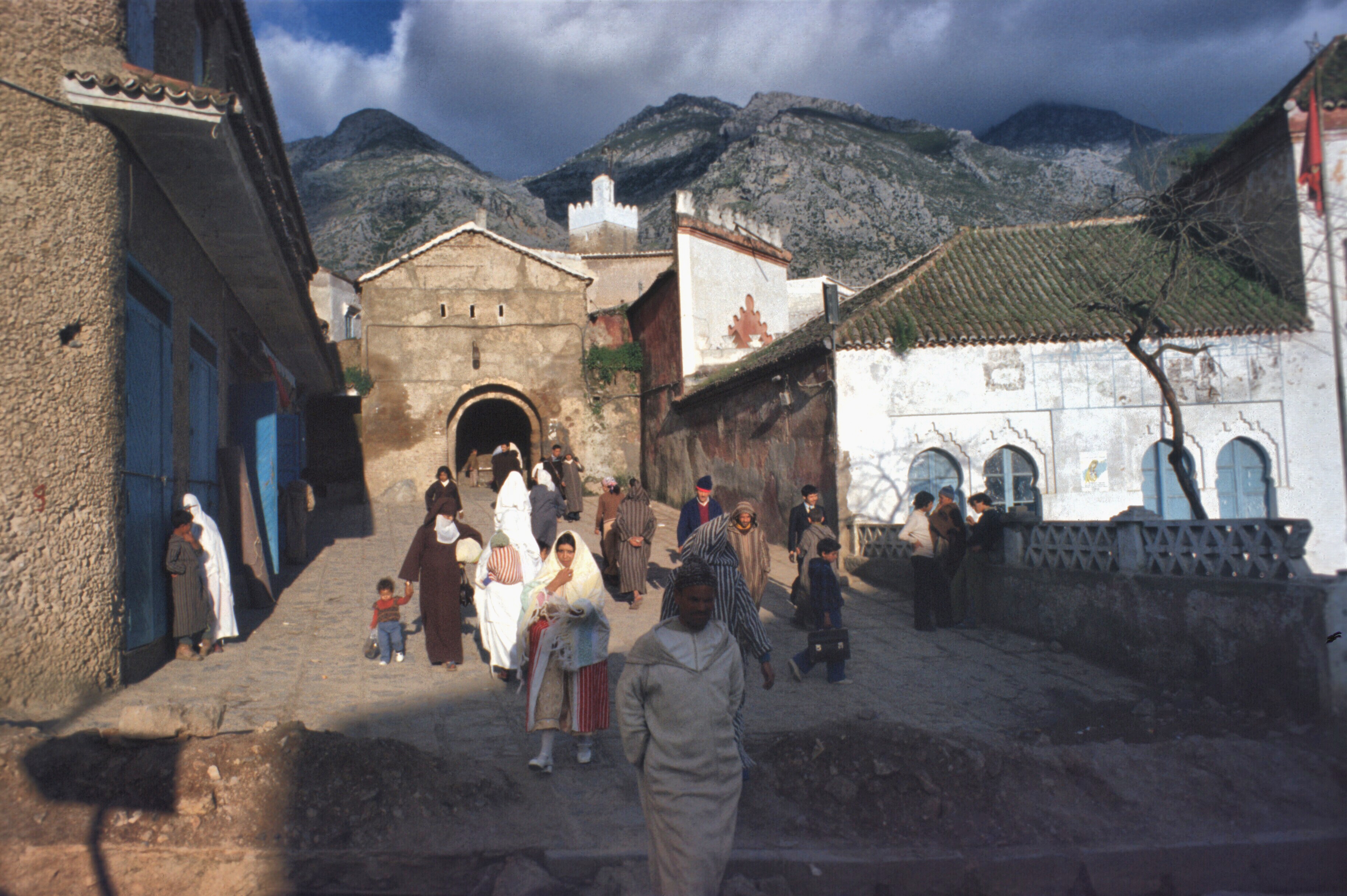
City gate, Chauen..
In the retreat from Chauen in 1924, with the weather turning bad and fear that the army would be trapped in the mountains without supplies for the winter, the Spanish attempted withdraw to Tetuan through narrow mountain valleys with poor roads.
Chauen. During the rainy season.
The weather was rainy and the road turned into mud. The Riffians waited until the Spanish column was strung out, then attacked along its whole length.
Road between Chauen and Tetuan.
It was a slaughter for the Spanish and a major victory for Abdelkrim. Franco was an officer involved in the debacle. Indeed, Spanish Morocco might be seen as the incubator for the Spanish Civil War.
Rif viewed from Jbel Alam. The Chauen-Tetuan road runs in the valley below.
Abdelkrim’s succes was also his downfall. The French, deciding that he had become a threat to their interests, intervened massively, put down the rebellion, and sent Abdelkrim into exile.
My first encounter with the Rif was early in my Peace Corps service. My job often took me to the pre-Rif as Fes Province extended north.
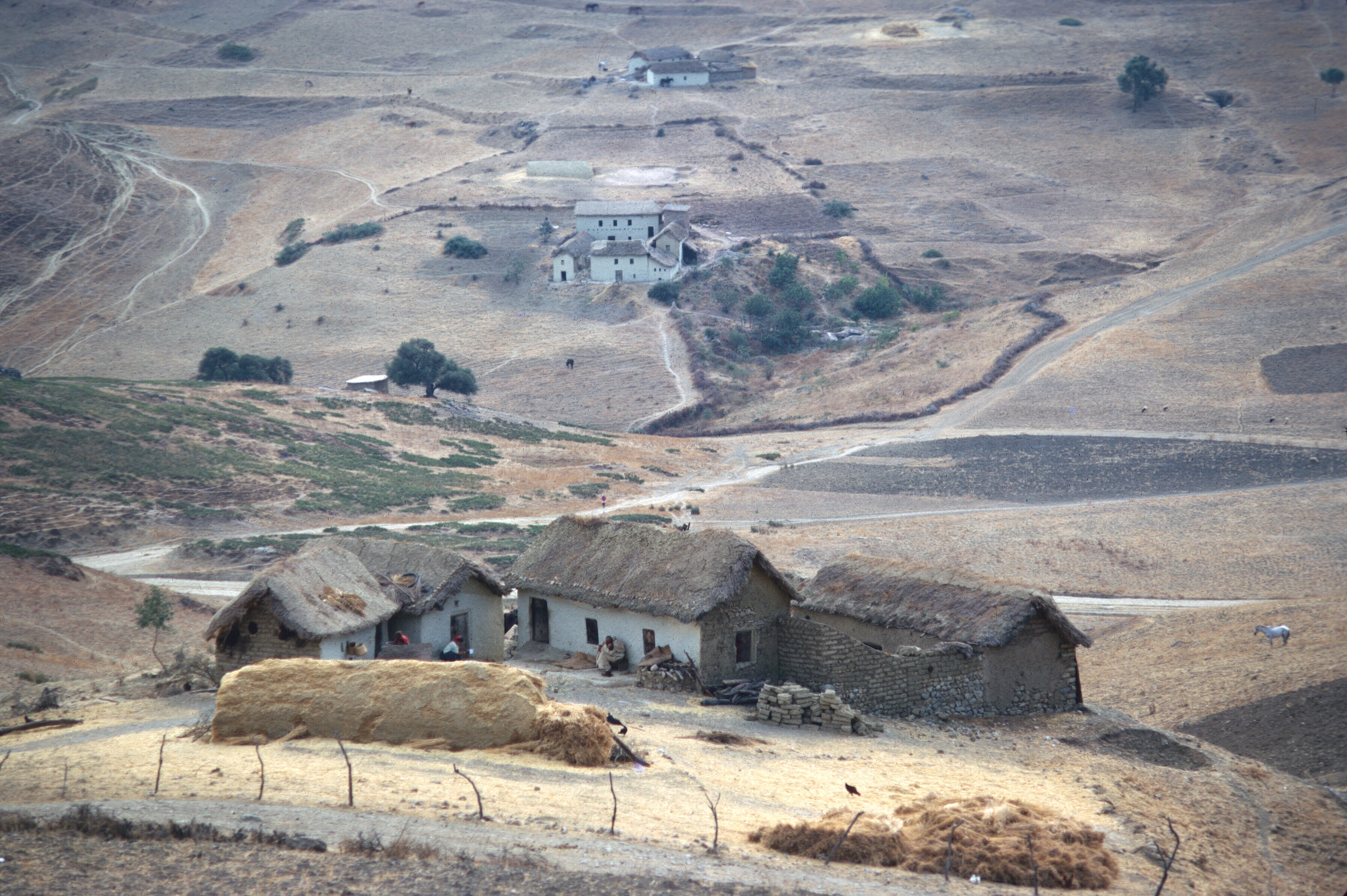
Pre-Rif seen from ruins of old fortress near Moulay Bouchta.
By the winter of 1968, I was sharing a house in the Sefrou medina (old city) with another volunteer, Gaylord Barr. He had decided that he needed a 35 mm SLR. He had brought over an 8 mm movie camera from home, but found it insufficient. I had been taking color slides, and he wanted to do the same. We decided to hitchhike to Ceuta from Fes. Ceuta was a free port: no taxes. The route was straightforward, north of Fes, along the western edge of the Rif Mountains. It went through the hilly country of the pre-Rif, where I occasionally worked, and by Chauen to Tetuan.
Typical pre-Rif houses.
In the winter, the houses kept you warm and dry, but the roads turned into mud where they were not improved.
The Rif seen from the pre-Rif. Road north of Fes.
We did it in one harrowing ride. It really was a dark and stormy night. There were rockfalls along the route from the recent earthquake and all the usual mudslides from the winter rains, and the driver had been drinking!
Erosion and heavy winter rains played havoc with the roads. Here in the pre-Rif a bus is being extracted. This was a common scene in the sixties.
In the heart of the Rif, near Ketama. So much marijuana is grown here that all over southern Spain air samples show marijuana pollen.
Chauen from the Tetuan to Fes road.
The ride was scary, but we arrived safely in Tetuan and Gaylord got his new camera in Ceuta. Sadly, it got lost on the train crossing Algeria in 1971. Gaylord was a good photographer, but most of his Moroccan slides seem to have been lost.
If you decide to watch Love in Times of War, perhaps you may reflect on the drama playing outside of Melilla today. NPR just feature the story of an African migrant trying to get past the fences and barriers, hoping for refugee status.
In the This American Life program, look for this reportage:
ByDavid Kestenbaum
There are two tiny Spanish towns on the African continent protected by multiple layers of razor wire, cameras and guards. A man from Cameroon tells producer David Kestenbaum about his attempt to get through the obstacle course and onto European soil. (19 minutes)
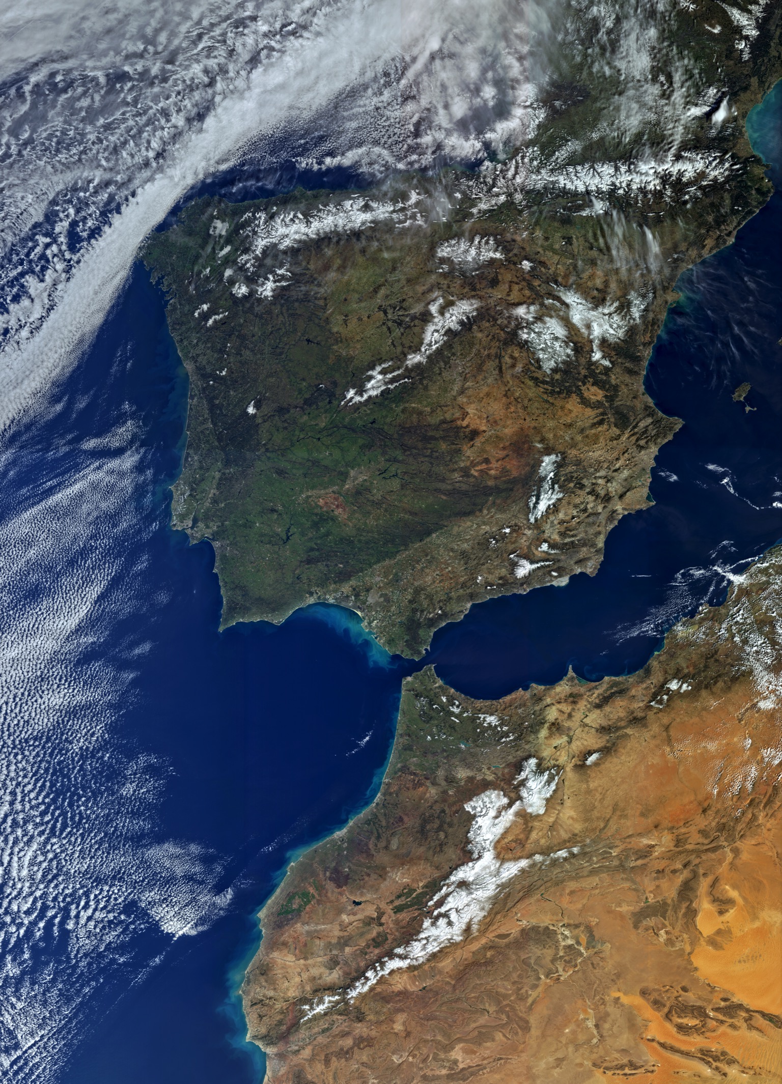
The Strait of Gibraltar. Looking toward the Mediterranean. The city of Fes is barely visible at the bottom left. Tangier, Tetouan, and Algeciras and Ceuta are clearly visible. Volubilis is slightly to the northwest of Fes. NASA photo.
I love this passage. A god’s view of the Mediterranean, as I recently commented on another blog. Too bad the rest of Wilder’s novel wasn’t as interesting.
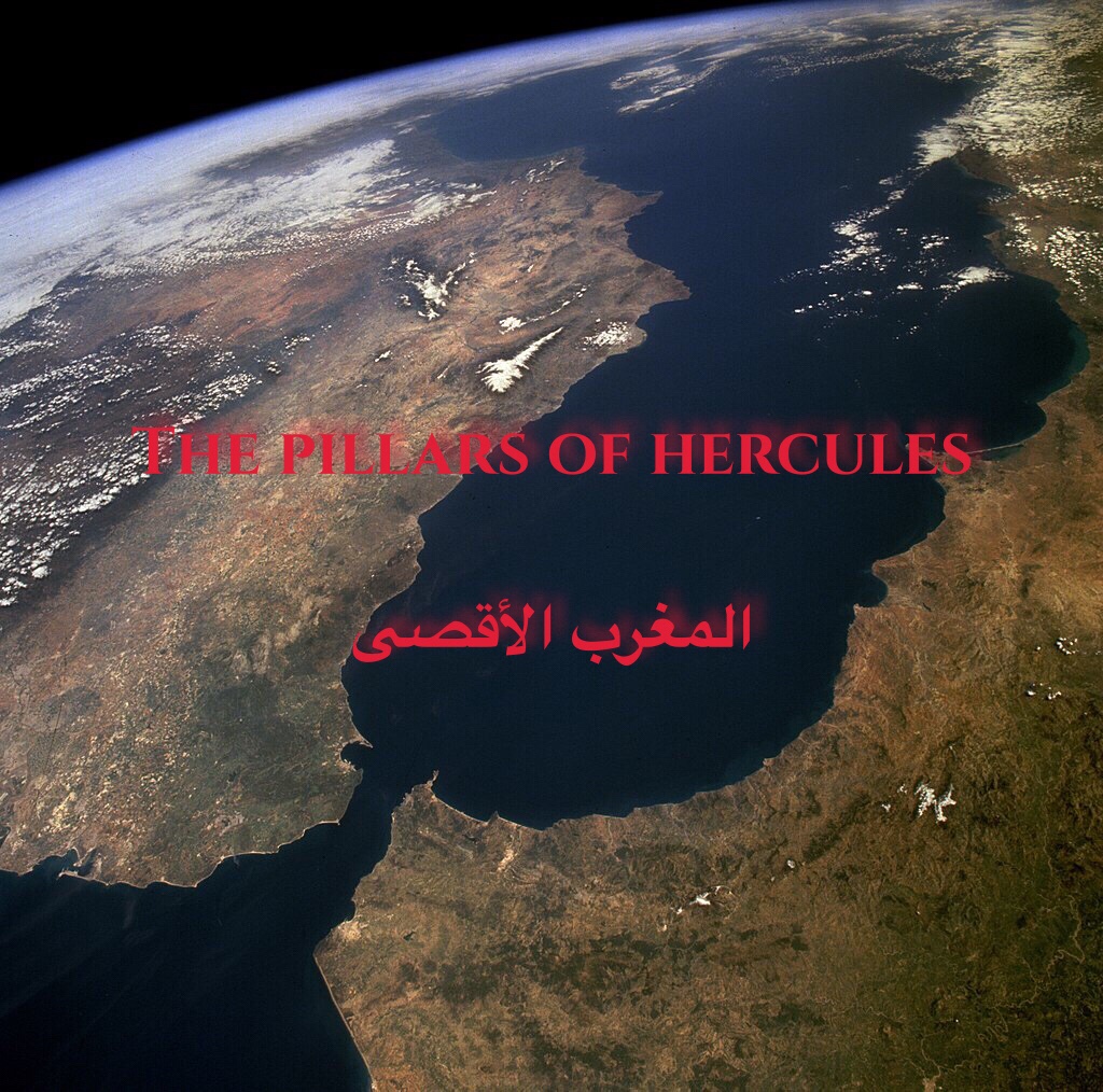
Morocco might be called an outlier. Until modern times, it has always been a place on the marches. It has always existed on the edge of large empires, but it was never part of them. Arabic historians traditionally referred to Morocco as the place of the Farthest Sunset (المغرب الأقصى), where the sun set in the Atlantic, an immense, unknown ocean.
The Phoenicians set up trading posts in Morocco. They were more traders than colonists or empire builders, though in Carthage, in the middle of the Mediterranean, they produced an empire that rivaled and threatened Rome.
The Romans had client states in the north of Morocco, where Rome eventually took full control during the Empire, but it left most of Atlantic Morocco untouched. The Byzantines had only nominal control, and the Ottomans never got past Algeria.
Some Moroccan dynasties reached across North Africa and into Spain, but none were long lived. The Mediterranean world was focused on the basin of its sea, and had its own dynamics. Morocco had an inhospitable Mediterranean coast with mountains crowding the shore. Most of the country, and its richest agricultural lands, faced the Atlantic. Morocco was barely part of the Mediterranean, the world of the “sea between the lands.” Mare Nostrum, our sea, the Romans called it, because it indeed was theirs at the height of Rome’s power.
The natural continuation of Morocco is Spain, not the Sahara or the rest of Africa. Only 15 kilometers wide, the Strait of Gibraltar can be crossed in one-half hour by car ferry. The Strait of Gibraltar posed few difficulties for the Vandals, who invaded Morocco in Byzantine times or for the Arabs and Berbers who invaded the Iberian peninsula a bit later. Today it poses few problems for migrants swarming into Europe.
In the distance, about eight miles away is Spain as seen from Morocco.
After the Spanish Reconquista, the Strait took on a new role as a moat, protecting from invasions, much like the English Channel protected England. It separated Christian Europe from Muslim Africa. The Spanish and Portuguese tried to establish toeholds on the African continent, but ultimately were repulsed except at Ceuta and Melilla.
Burial in the Portuguese fortress of Ksar es-Seghir. This toehold didn’t last long.
On the left, the tip of Gibraltar, on the right, Jbel Musa and Ceuta. The Mediterranean is in the distance.
Barbary pirates harassed European ships, but technology favored the Europeans. Now technology enables migrants, desperate for work and a better life, to cross cheaply and relatively easily into Europe.
As European sea power grew, the Mediterranean Sea became even more inhospitable. Morocco’s connections to the east were more and more by land, and there were no longer roads as in Roman times, but only horse and camel tracks until the advent of steam ships and cheap air travel put the Hajj within the reach of those with better means.
Trade continued via new routes. The British brought tea, and Queen Anne style teapots. But despite trade connections, Morocco became more and more landlocked until the twentieth century, when the French seized control and established a protectorate, a system under which the Moroccan sultan was relegated to a ceremonial role, while the French ran the colonial government as their own interests dictated. With independence and modern technology, the isolation is broken forever, for better and for worse.
When I lived in Morocco, I always thought of it as a backwater, and I suspect many Moroccans, proud as they were of their country, may have felt some inferiority. Important events in the Arab world took place in the east. Important history in Maghreb had taken place in Al-Andalus. The greatest monuments of western Islamic Art are in Al-Andalus.
None of this is said to disparage Morocco, which is a place I love dearly, but simply a recognition that Morocco is an outlier, and has been for a very long time. Yet another example: Morocco was one of the first, if not the first, countries to recognize the new United States.
If someone asked me where to see the ruins of a Roman city in North Africa, I would say, without hesitation, Timgad in Algeria or Leptis Magna in Libya. Perhaps I would suggest that they go to El Djem in Tunisia, and visit the largest arena outside of Rome. If western Islamic architecture were their interest, I would suggest going to Córdoba to walk under the superimposed, multicolored arches and through the marble columns of the Mezquita, and then go to Granada, to wander through the rooms of the Alhambra and the gardens of the Generalife. I once did that at night. The palace was dimly lit, and virtually empty. It was as close as I could ever get to Washington Irving’s vision. You would be fortunate, indeed, to have that experience today.
The Court of the Lions, in the Alhambra palace.
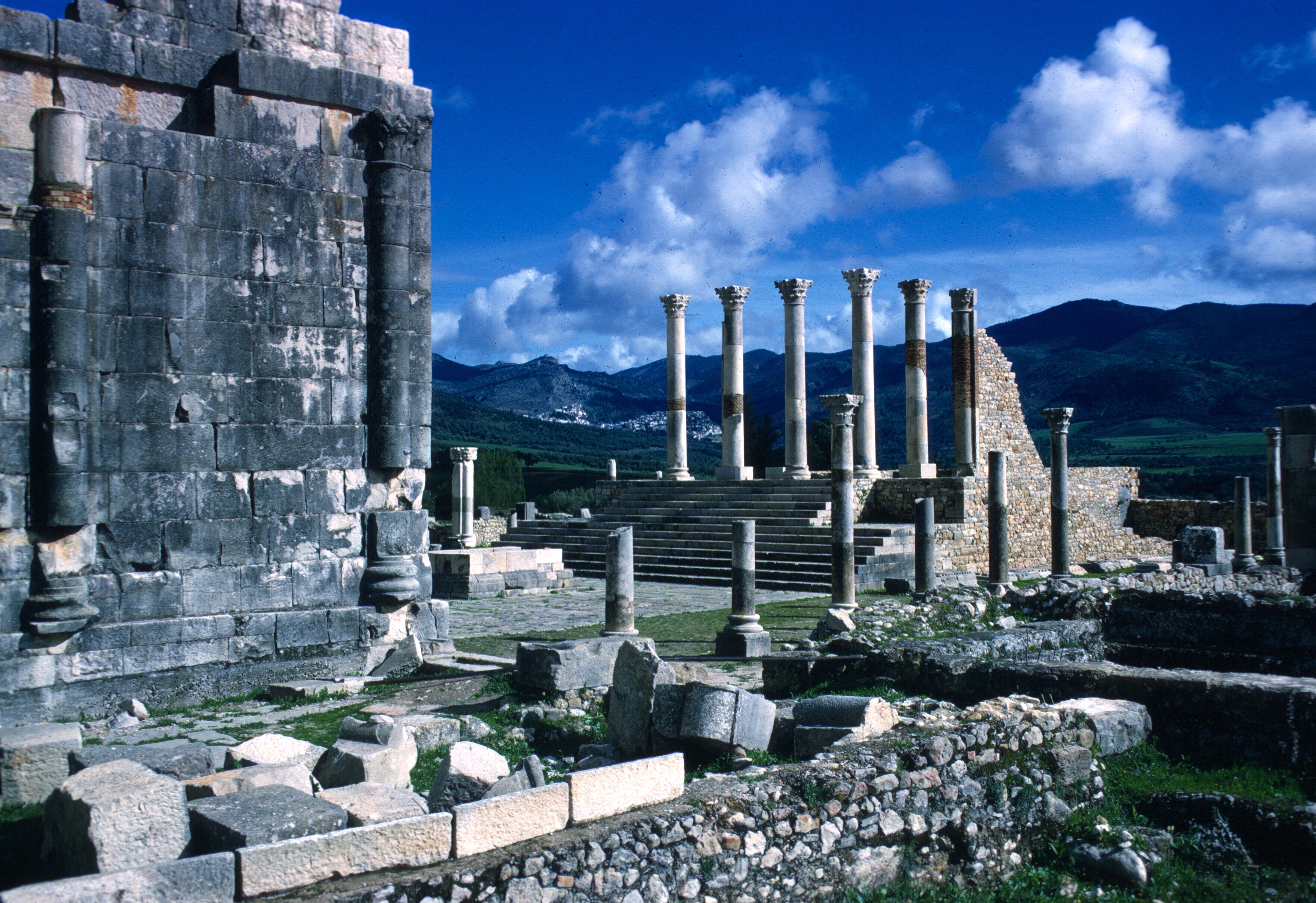
Still, there are virtues that arise from being off the beaten track. Morocco’s most important Roman site is Volubilis, a short drive from Fes, north of the Massif of Zerhoun, just a short distance from the town of Moulay Idriss. The Arab leader, Moulay Idriss established the first dynasty in Morocco at Volubilis, before building his capital a short distance away, partly from stones quarried from the Roman city. After the fall of Rome, it was common practice to reuse stone from the abandoned Roman cities.
The base of the Great Mosque at Kairouan. Note the block with Latin inscriptions to the left of the door.
Today there is a large shrine devoted to him.
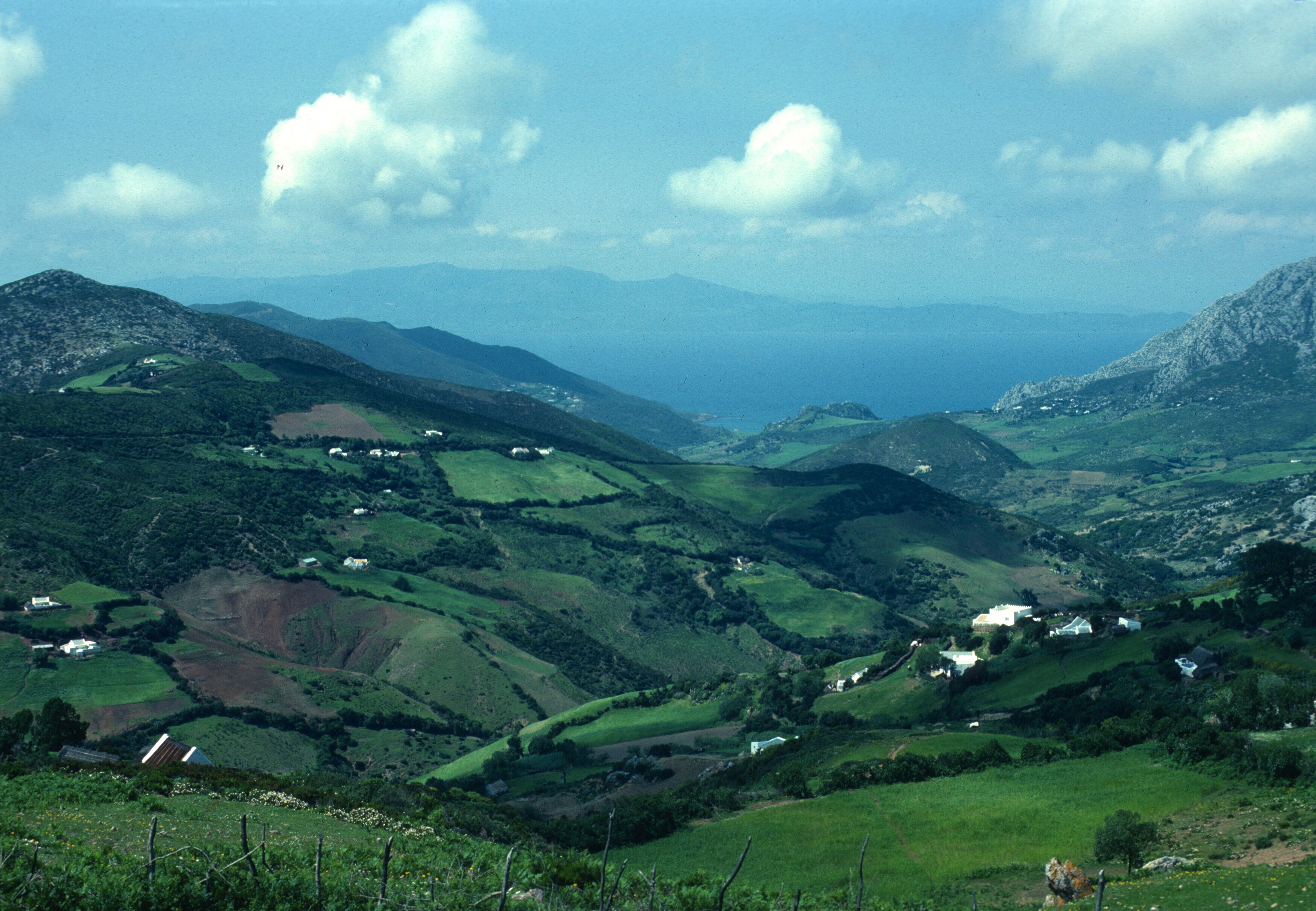
The town of Moulay Idris. The green tiles roofs cover the shrine of the founder of Morocco’s first Arab dynasty.
When I visited Volubilis in the late sixties and mid-seventies it was virtually without tourists, even on weekends.
The road leading to the site was a dirt track, in the middle of wheat fields
One could wander through the ruins, step into and out of Roman houses, climb the forum stairs, and do it all in complete freedom, with no crowds to distract from the quiet of the place.
The forum. Moulay Idris can be seen in the fold of the hills in the background.
Emperor for a day. The forum at Volubilis. 1968.
Tourist facilities were limited to a tiny cafe that served simple, but delicious, food.
Dining at the little cafe, Peace Corps volunteer Gaylord Barr. Spring, 1968.
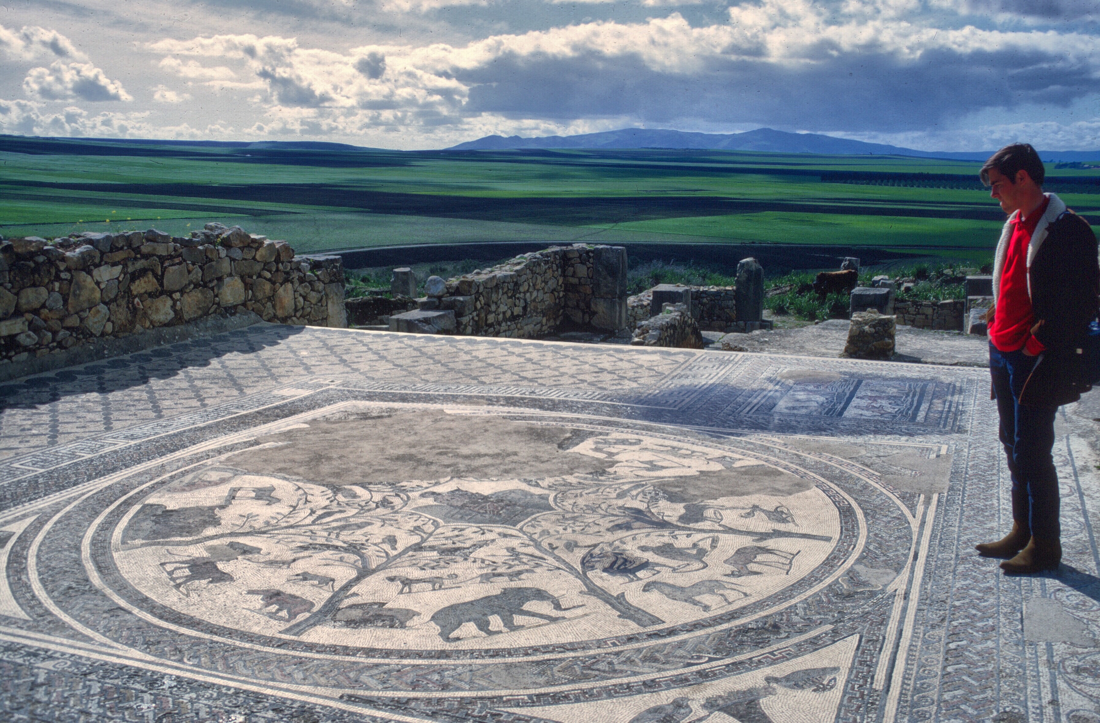
It may be different today when Morocco has twice as many inhabitants and the tourism industry has grown substantially, but then it was a place lost in time and space. The city of Volubilis, wrecked by earthquakes, quarried for building materials, seemed to float over the rich agricultural lands that surrounded it, a stone oasis.
Volubilis. The main thoroughfare.
One could wander through it, dreaming of the life and people of that ancient place, reflect on history and the passage of time, and do it alone, in the quiet of the countryside.
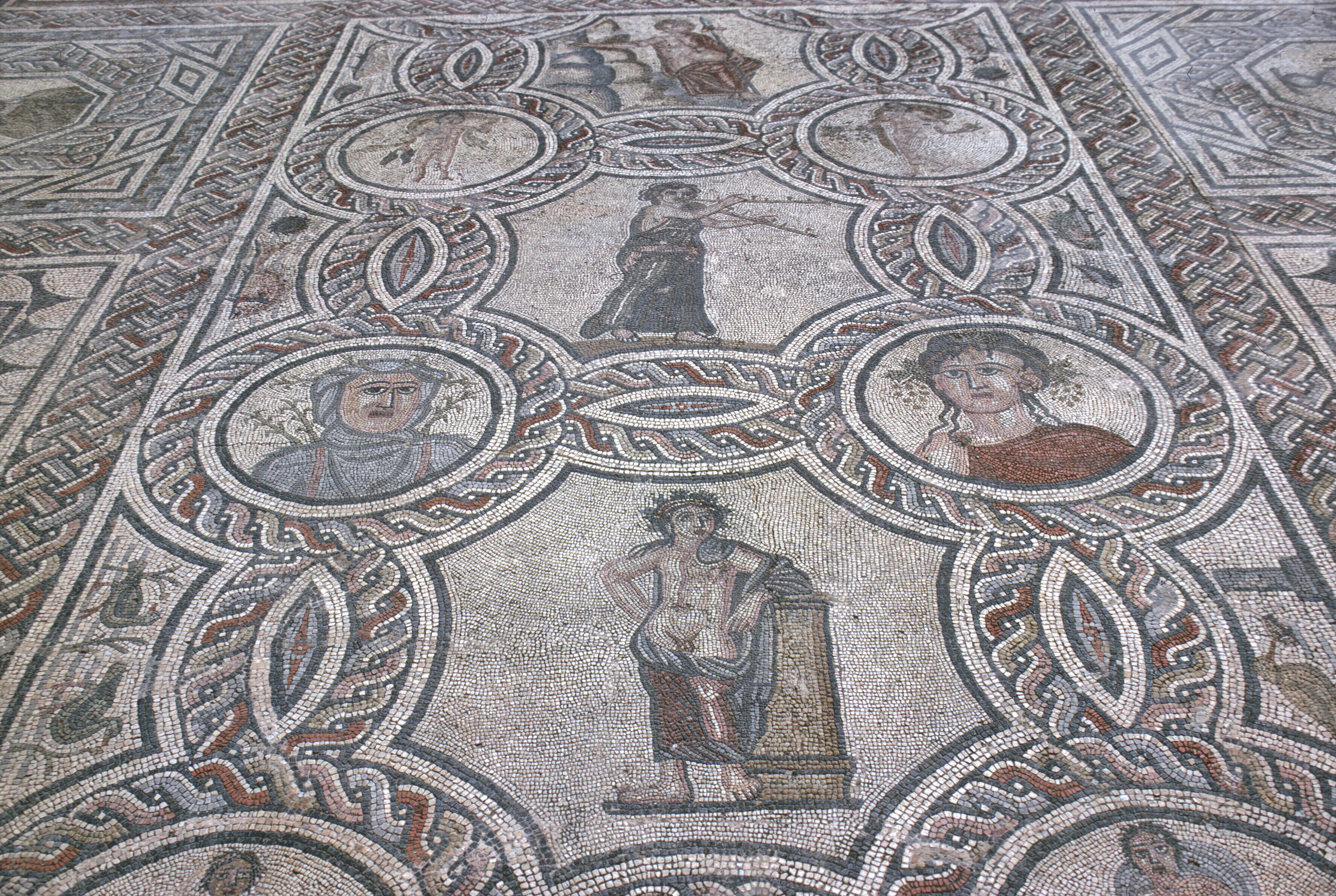
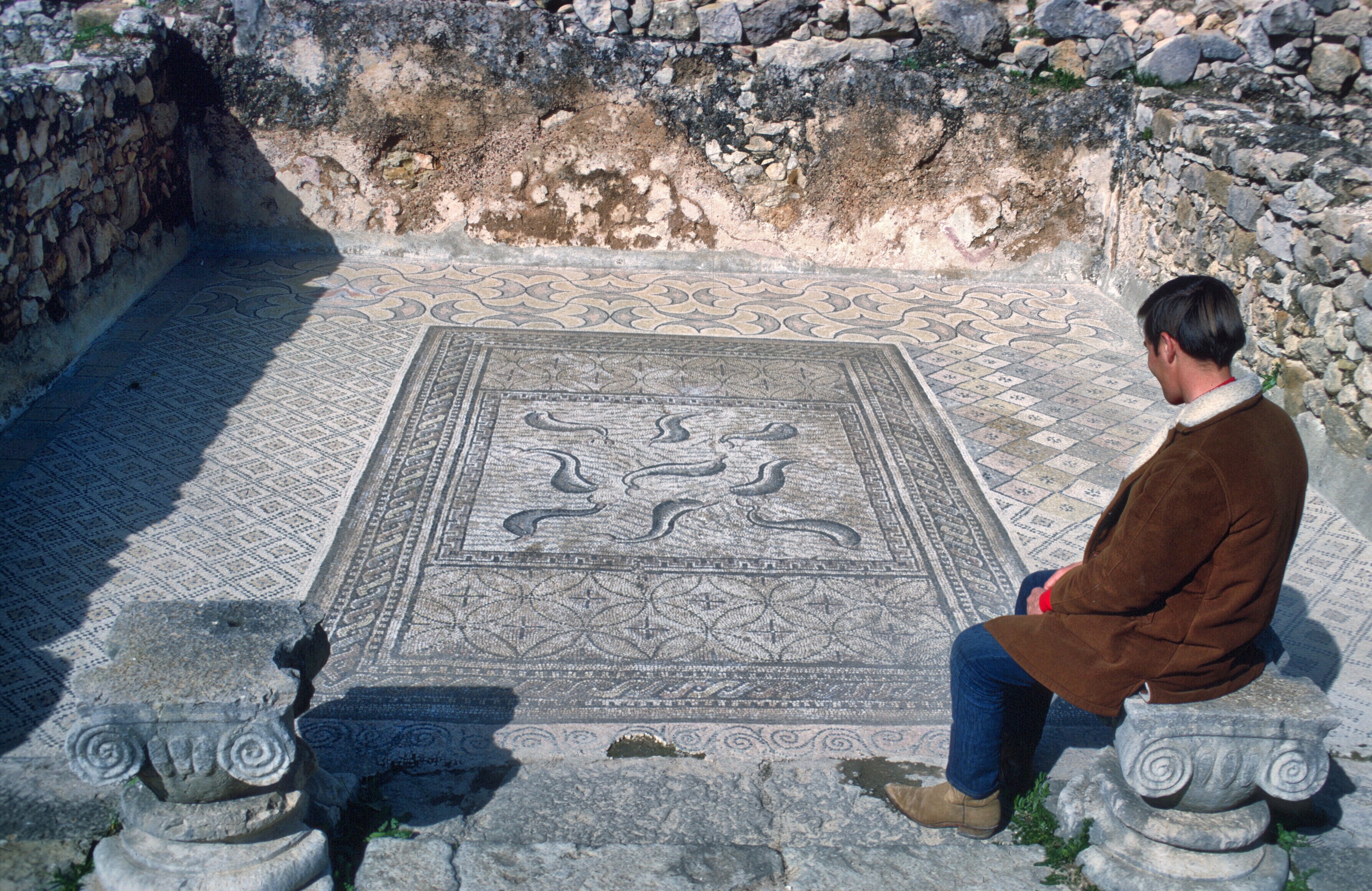
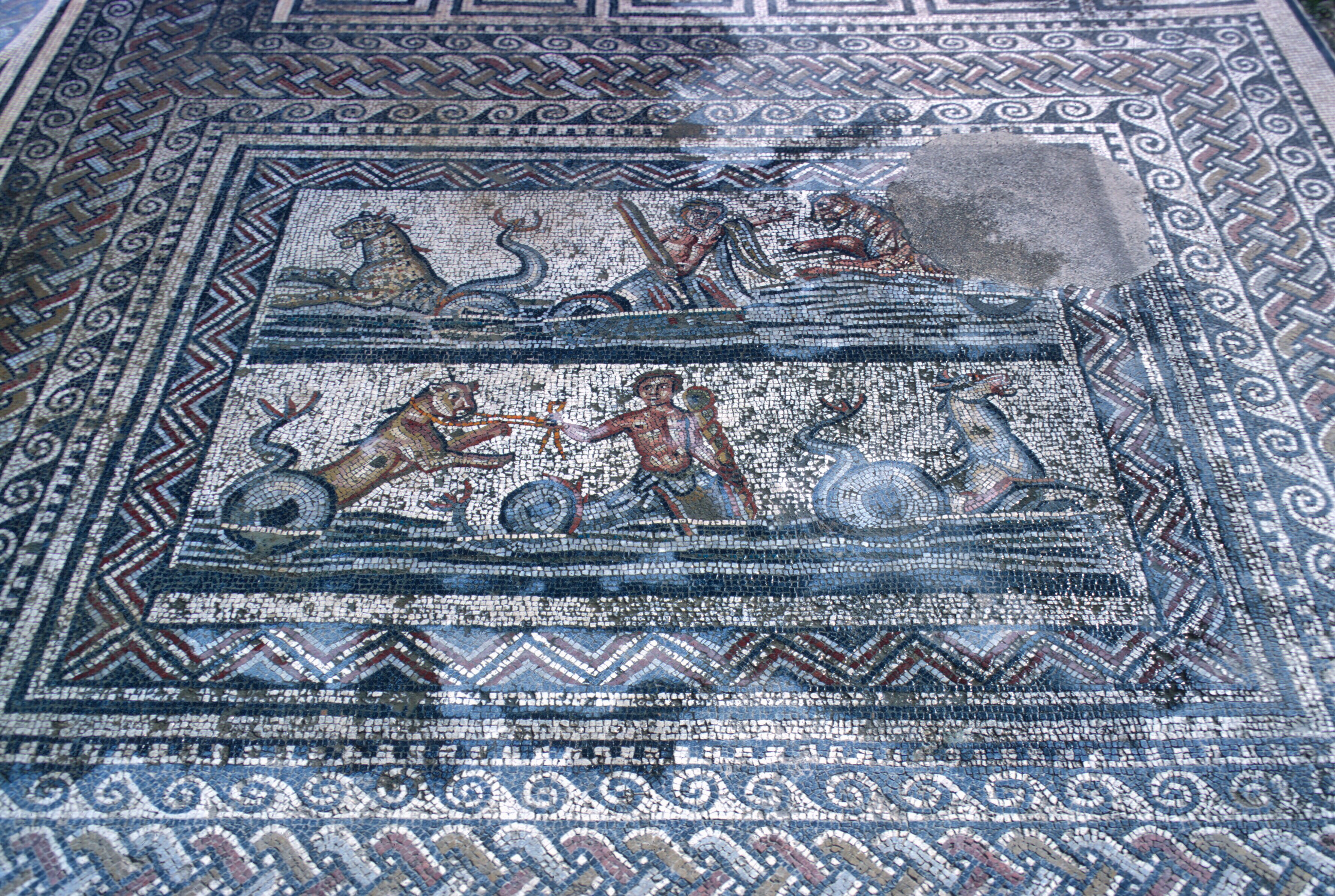
Mosaic floor of a house.
House of the dolphins.
There were no guards to remind you to keep to the path. There were no tourists to jostle you. You were really alone.
Many houses had mosaics, a testimony to the town’s wealth.
This mosaic depicts the labors of Hercules.
Some of the animals that formerly were found in North Africa.
Volubilis was not a big or important center. It was an outlier. It grew to prominence just before the Empire entered its long decline. Still, to a young person, new to North Africa, it was a truly magical spot.
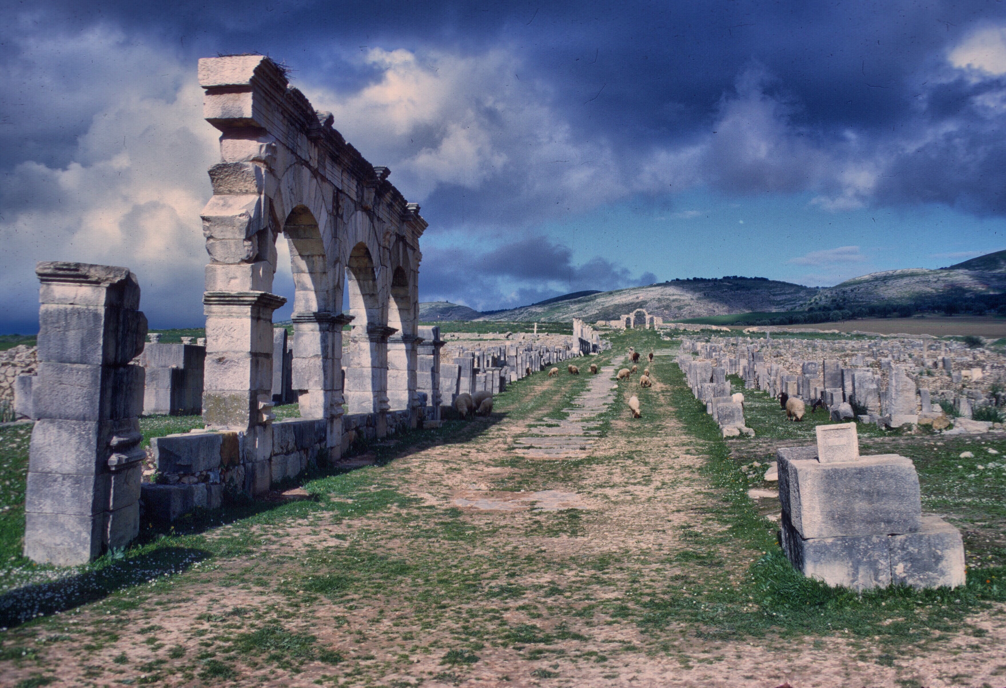
Main Street, leading to a former gate in the city wall.
There are many other places to see larger and better preserved triumphal arches.
Triumphal Arch. Volubilis.
There are larger, better preserved, and much finer mosaics elsewhere.
When wet, the mosaics show their colors.
There are spectacular aqueducts, great temples, immense baths, and fantastic amphitheaters scattered all over the Mediterranean. Volubilis lacks all that, but at Volubilis you felt and heard the wind, and you breathed the scent of the fields around you, while the only footsteps that echoed from the 2,000-year old stones were your own.
The Wind. Note that the modern labels were not in the best condition in 1968.
Morocco to the south of France. Fes is to the north of the snowy uplands in the right of the photo, and Brive-la-Gaillarde is under clouds at the top center or maybe slightly off the photo. NASA satellite.
The Trip to Spain
If you’re a movie fan, and, in particular, a Brit, you may be thinking Steve Coogan and Rob Brydon, but this blog post is more mundane and less amusing, and it also lacks the sadder, darker undercurrents of their comedies.
In a Walk above the woods I mentioned that Peace Corps vacation policy for Morocco volunteers was basically travel within Morocco, or anywhere in Africa, or Spain. Most of us had numerous opportunities to travel within Morocco, and, much as we loved Morocco, many of us wanted a change of scenery, and, perhaps, a bit more freedom. Algeria was officially considered a hostile country, so a visit there was out. That was unfortunate, because the Algerian people were friendly and happy to meet Americans, and Algeria is full of interesting places to visit. Airfare to the rest of Africa, or, to Europe for that matter, was limited and expensive. Spain ended up the place of choice by default. According to the Peace Corps, the cultural affinities and mutual histories made Spain a perfect visit. Some volunteers discovered even quieter and cheaper vacations in Portugal, but many of us went to Spain.
What you did in Spain depended a lot on your personality. Did you want to see historical sites, major cities, Islamic monuments? Lounge on the beaches, eat tapas in the bars, look for romance? Ski or hike the mountains? Appreciate art? Catch a recent movie? Spain already had an enviable tourist infrastructure, and the south coast had become an important destination for British pensioners. Spaniards were friendly and accommodating, and the food and wine was great.
And what you could do depended on where you went. Ceuta or Melilla were for duty-free shopping and a visit could be as short as an afternoon or an overnight.
Ceuta. Fishing boats. Monte Hecho in background
If you lived near these enclaves, they were only a bus ride away! The peseta was cheap, and the hotels were inexpensive.
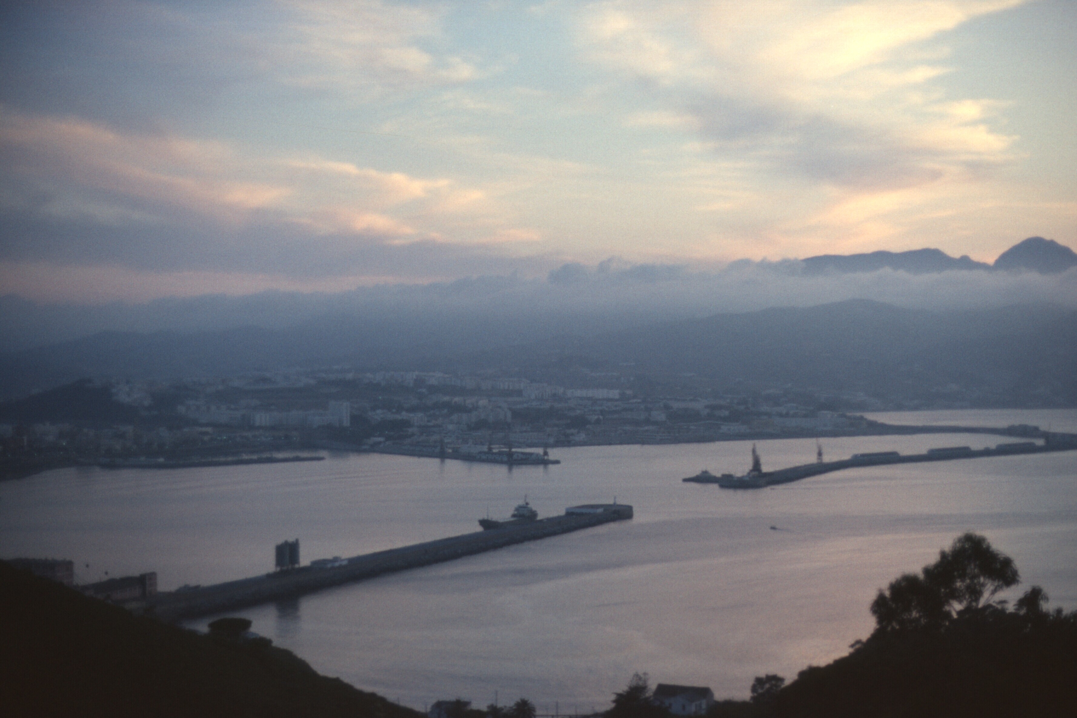
Ceuta. The harbor and town at dusk
Once in Spain, the possibilities were unlimited. If you were going to peninsular Spain, you could take ferries from Tangier to Algeciras or Malaga. You could also go to Gibraltar, but during much of my stay in Morocco, Gibraltar, because of Spanish territorial claims, was blockaded, and you could not get into Spain from the Rock. The shortest, cheapest route was Ceuta to Algeciras on the passenger/car ferry. It only took an hour and a half. Once in Algeciras, the train would take you north to any big city.
One summer I took my vacation in Chamonix.
Downtown Chamonix. 1965. You could still encounter Gaston Rébuffat in the cafés.
The Appalachian Mountain Club statue dedicated to the first ascent of Mont Blanc, the beginning of modern mountaineering. Of course, the Brits and the Swiss like to talk about the first ascent of the Matterhorn. A number of other alpine clubs contributed to this statue of Balmat and de Saussure
This was, of course, against the rules, but I didn’t care. It was 1970. Perhaps the rules had even changed by then. The downside of making stupid rules is that no one pays much attention to them. Most organizations, even the most benevolent, have a penchant for making stupid rules.
The French had a special program for kids and young adults under the auspices of the Union Nationale des Centres de Plein Air. You could spend a couple of weeks learning and participating in just about any summer sport imaginable. The French government subsidized it heavily. During the previous year, I had been corresponding with a member from a Club Alpin Français section in the Pyrenees, and he suggested that I try it. I love the Pyrenees, and hope to return while I can still walk, but I chose Chamonix over the Pyrenees (and other Alps sites), because, frankly, Chamonix was more historical (the place where French climbing was born) and more spectacular (the highest mountain in Western Europe, and lots of high, vertical granite rising amid glaciers). I spent a month there, something I could never have done on my very limited Peace Corps budget if I hadn’t been subsidized by the French Government. Remerciements à l’UNCP!
Ascent of the Allalinhorn, above Saas Fée. Another nice thing about Chamonix is its location on the border of Switzerland and Italy. This is Switzerland, of course. The Valais is separated by a low pass from the valley of Chamonix. The border control didn’t even ask where I was from or check my passport. He assumed I was French. When our little 2Cv descended into the Valais, the first thing we all did was buy chocolate!
Mont Blanc at dawn from the Italian side. Courmayeur is in the valley below. Far below! We got here, above the Val d’Aosta, through the Mount Blanc tunnel, and stayed at the Italian Torino refuge on Point Helbronner. I no longer remember what peak we are on in this photo. We did several easy climbs in the area.
My young self, Elizabeth, and Jean, French members of the cordée. The Matterhorn is off in the distance.
Déjeuner sur l’herbe, alpine style. After a traverse of one of the minor “aiguilles.” I think the Aiguilles Rouges may be across the valley.
I will be forever grateful, too, and I am happy to learn that the UNCPA still exists after all these years. Thus I spent a month living with a group of fifty or so French kids, roughly my age, and I had a ball. It was co-ed, and we were housed in comfortable chalets. In the mountain refuges, when the weather was bad, we ate, told jokes, and played cards
The chalet in Chamonix, between hikes. We lived in a communal atmosphere, but most of the time we were outside. It really was a centre de plein air.
The food was fine, as you might imagine, certainly far better than French cité universitaire cuisine. This was a holiday in France! Would anyone tolerate bad food? Bon dieu!
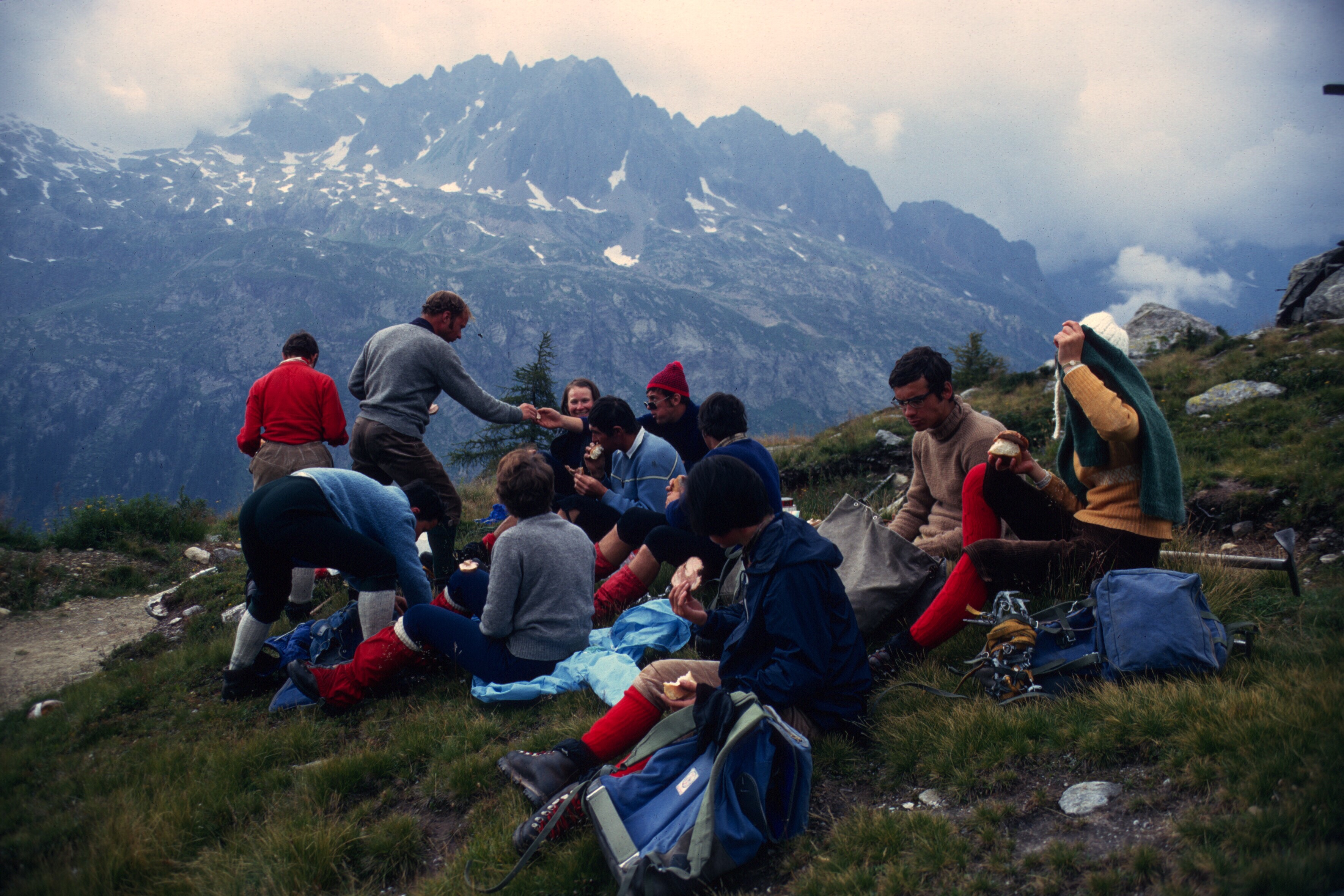
Dinner in one of the huts above Chamonix. I think we were climbing the Petit Pélérin. Wine, bread, cheeses, and lots of good company. The sun is setting over the mountains to the west.
Above Saas Fée. In Switzerland.
Now if you are wondering what this has to do with Spain, remember that I was living poor and had few resources. I figured I could save and scrape up enough for the train trip, but fortune shined. Jean, a young French kid from Brive-la-Gaillarde, had been touring North Africa in his Peugeot 404, and was passing through Fes just about the time I was about to leave. He was hoping to find someone to share expenses and driving as he returned home. How he found me, I don’t recall, but there weren’t that many foreigners in Fes, and I worked there. He met someone who knew me and knew that I needed to get to France.
We drove up to Ceuta or Tangier and crossed to Algeciras. It was late, and we were tired and we spread our sleeping bags out on the beach facing refineries in La Linéa.
Gibraltar. On the left is the bay of Algeciras, in the distance, La Linéa
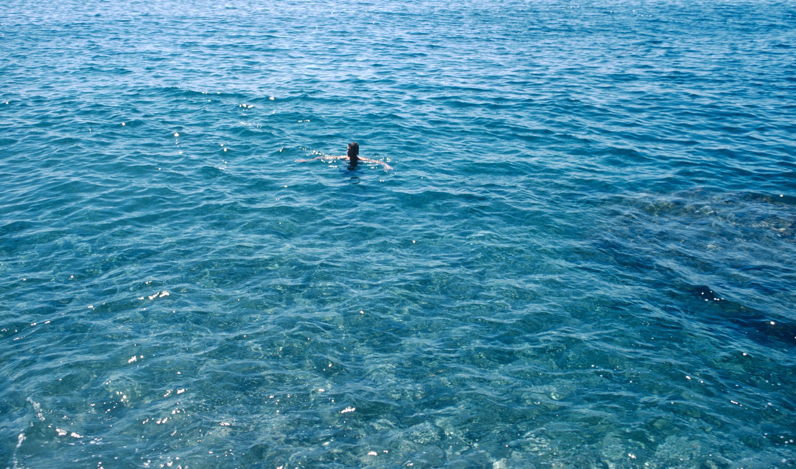
I would not try this today when crime in the region is a problem. Even then, though it was summer, it was damp and uncomfortable and the lights of the towers and burning gas lit up the beach with an unappealing industrial glow. The next day we drove up the coast, taking time to swim in the Mediterranean before turning inland.
North of Malaga. 1969.
A dip in the Mediterranean before a long dry day.
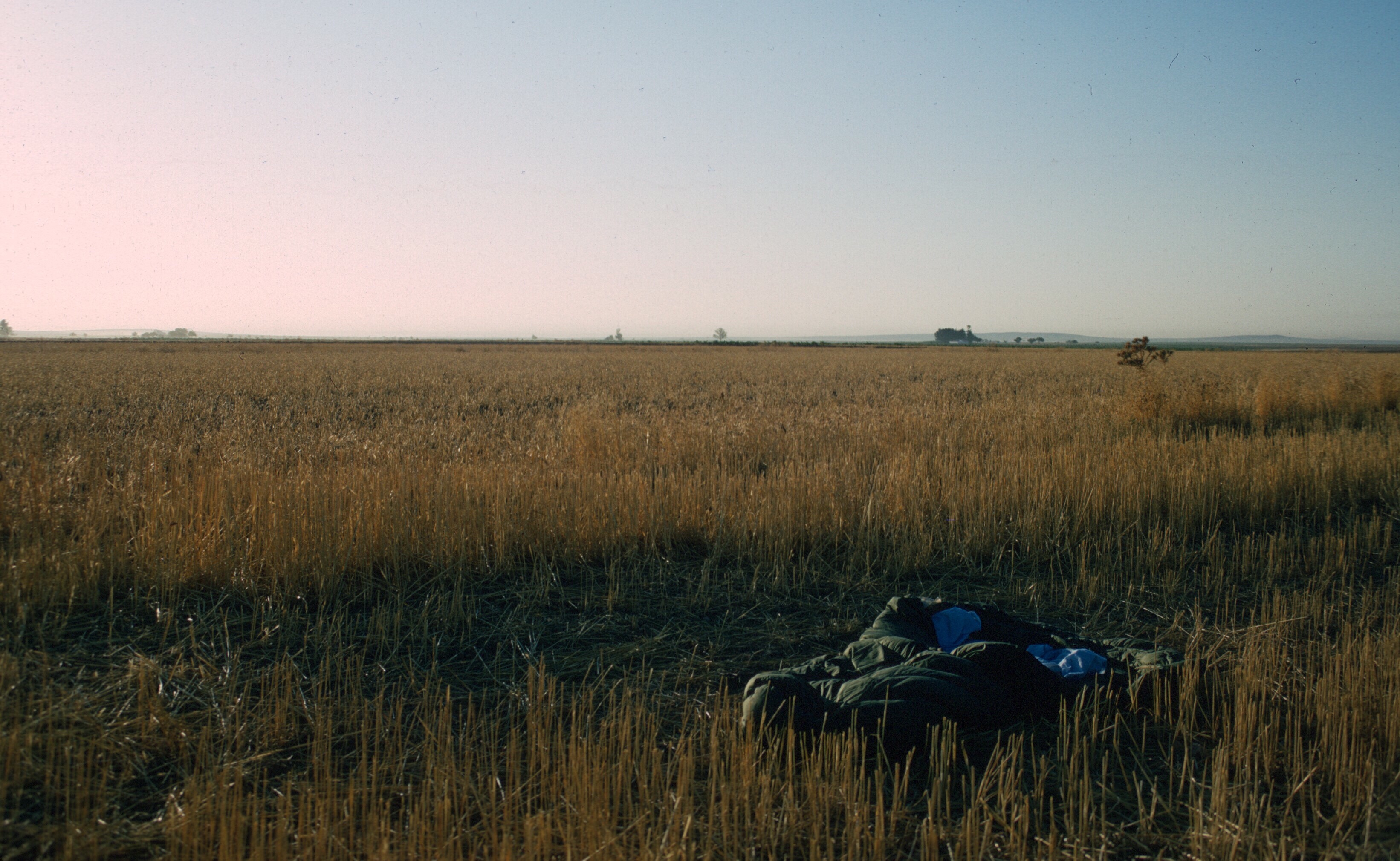
There were fewer roads, then, and even the main north-south routes were not very good. We skirted Madrid, and, after dark, pulled off the road into the stubble of a wheat field somewhere in Castile.
My mummy bag in a field in Castile. Dawn.
The following day we continued north, stopping briefly in Burgos to admire the Gothic cathedral.
A spire and part of the facade of Burgos Cathedral. One of the best of Gothic cathedrals in Spain. Spain is a place of beautiful and varied architecture, but Gothic is not Spain’s forte. Much of Spain was still Muslim during the high point of Gothic architecture.
Door knocker on the cathedral door. Burgos.
We crossed the French border at Irun and Hendaye. I had been there once before, when I lived in Pau.
San Sebastián Harbor, near the border with France. 1965.
Pic du Midi de Bigorre, seen from the Spanish border. Note the armed border guards on the hill. It was 1965 and Franco still ruled. You can see this mountain from Pau, 40 miles away, at the end of the valley of Laruns.
The Mediterranean weather gave way to that of the Atlantic, and, entering the pine forests of the Landes, it began raining. It was now dark and wet, and we were exhausted, so we found a small, inexpensive roadside hotel that had one room left, but with only a double bed. Sharing a bed with a stranger was odd, but not a problem: we were beat, and neither of us had slept in a bed for two days. Outside it was raining.
When we got back on the road the next morning, we were fresh. For Jean it was the homestretch. Brive-la-Gaillarde was only a few hours away.
That day began with some excitement. The Peugeot was beat up, made a lot of noise, and needed brake work. About midmorning, we drew the attention of a gendarme, who directed us off route to a police station. The police, finding that we were returning from Morocco, were interested in whether we were carrying drugs, which we were not, and, after a short interrogation, they released us to continue on our way. The route continued through the Dordogne. I would have liked to stop, but Jean was tired and eager to be home. He had done his sightseeing in Africa. Once in Brive-la-Gaillarde, I caught a train to Chamonix.
I can never think of Brive-la-Gaillarde without hearing the Brassens song, Hécatombe, in my head. Its anarchist message resonated with my younger self, though I am happy that Brassens eventually made his peace with the police in a later song, L’épave. If you can understand French, you may, depending on your sensibilities, find the songs hilarious or offensive. According to Wikipedia, Hécatombe is now associated with Brive-la-Gaillarde throughout France! And, of course, every place in France has something named after Georges Brassens. Rightly so!
So that was another Peace Corps volunteer experience with Spain. The following summer I got a postcard from Jean, who was then touring the Middle East in his car, but we never stayed in touch, which I regret because I enjoyed his good company, and he really had done me a big favor. The train ride home to Sefrou was far less interesting and totally uneventful. But Sefrou was home, then, and it felt good to be back.
This article is about Christmas, of course, not the Prophet’s birthday, the Mouloud, which Moroccans, and most Muslims celebrate. This year the Mouloud fell in December, within a month of Christmas, which my wife and I just spent in Charlotte, North Carolina, with her brother and his wife. While there I reflected on the holidays that I spent abroad, though there have not been very many. Of them, the Christmases and Thanksgivings come to mind first, most likely because they involve iconic symbols, and childhood memories. Christmases also fall within a week of New Year’s Day, and often make up part of a larger period involving school semester breaks and intermissions, important in the lives of young people and probably producing more intense and lasting memories.
In Morocco, volunteers would often travel at Christmastime. The Moroccan calendar had all kinds of holidays, and accommodated as well as it could both Christians and Jews. Many foreigners still worked in the GOM in the sixties. If PCVs had vacation time, it enabled them to visit remoter parts of Morocco, or to go to Spain. When my cousin, who was studying in Angers, France, visited me in 1968 or 1969, I traveled with her and Gaylord Barr to Meknes, Rabat, Marrakech, and over the Atlas and across the pre-Sahara to Ouarzazate and Boulemane and Erfoud. Another time, I went to Gibraltar with administrator and volunteer friends.
On the Gibraltar runway, which had a grade level crossing for cars! Marty, Gaylord, Eileen, and Don. Franco blockaded Gibraltar in a dispute over sovereignty, and one could only get there by ferry from Tangiers or by air (we took a rickety old DC-3 from Tangiers)
Ceuta was still another possibility for those of us in northern and eastern Morocco.
Ceuta in December
Just as often, volunteers would get together in larger centers and big cities, where they were often numerous, and have parties. Those traveling would look up friends for places to stay and for good cheer. By the time I got to Morocco, there were fewer and fewer churches, and I do not recollect any volunteers going to them to pray.
Actually the celebration of Christmas and Thanksgiving usually had little religious significance to the volunteers whom I knew. Christmas had attained an almost secular status in the United States, and was, and is today, dominated by commercial rather than religious sentiments. Recently some right-wing Republican politicians have argued that there has been a “war against Christmas” by more secular politicians in the center. They point out attempts at what they see as “political correctness” as well as a more consistent effort to keep religion and the state separated, as the Constitution requires, though they do not see it exactly that way.
There is a real argument here over all kinds of issues, and if you are very religious you may be offended. My own opinion is that though most Americans are nominally Christians, government institutions should be secular. Am I making war on Christmas? I say Merry Christmas where appropriate, attend religious services, give gifts, and assiduously attend to the customs associated with Christmas. Do I care if there is a crèche in front of City Hall? Not much. And it certainly should not be there if it offends my compatriots.
Christmas is not the central focus of Christianity. Indeed, many early American religious denominations, such as the Puritans, did not hold Christmas sacred, did not celebrate it, because they considered it a pagan holiday. After all, it aligns with the winter solstice, which was widely celebrated in pagan religions of the ancient world, and it isn’t clear exactly when Jesus was born anyway. The real essence of Christianity, all true Christians would agree, is in the death of Jesus and his resurrection as the Christ, and the redemption of the sins of mankind by his death on the cross. Indeed, these very beliefs set off Christianity from Judaism and Islam. Though most Jews believe Jesus existed, and all Muslims revere him as a prophet the message of Judaism and Islam is elsewhere.
Christmas retains its religious significance for many, but in the United States today, as in the United States 50 years ago, Christmas is largely a children’s holiday involving family get-togethers, food, and, above all, gifts. I came from an Italian family, and my Aunt Mary and Uncle Bill would follow a Sicilian custom, though their ancestors did not come from Sicily, and serve guests a Christmas Eve dinner where seven different kinds of fish were offered. Those who were observan often fasted until after they attended Midnight Mass. Then one could eat and open presents, while relatives and friends talked and drank and often played cards.
The social aspects of religious holidays are so important, not just to Christians, but to Muslims and Jews as well as adherents of other faiths. I remember with fondness the kindness of Muslim friends and neighbors, who invited me to their homes for all the major feasts. Indeed, I think I looked forward to Muslim holidays as much as my Moroccan friends!
As a volunteer in the sixties, celebration of Thanksgiving and Christmas was dependent on mood and who was around or would be visiting. The first Christmas, having moved into the house in Seti Messaouda, Gaylord and I actually dragged a 12-foot cedar up the winding stairway and into the courtyard (where it touched the ceiling), and decorated it with homemade ornaments and garlands. The popcorn strung together in garlands eventually got stale and the hanging tangerines mildewed, and our Moroccan friends probably thought we were nuts or idolators. Only the cat really enjoyed the tree, climbing in the branches, and, there were no more trees after that.There were no religious celebrations, and I don’t remember exchanging gifts, either.
There was also a Thanksgiving or two when we cooked a turkey. One took place in 1970, when a couple of female volunteers, Ruth and Jan, were then teaching English in Sefrou. They lived next door in the house of the Hadja, a widow, so there was, with Jan’s boyfriend, a critical mass of Americans. Seti Messaouda for a while had a small American quarter within it, just within the gate. We invited friends, Moroccan and volunteers, and tried our best to put together a traditional Thanksgiving meal. Two ingredients were difficult or impossible to come by: cranberries were nonexistent and the turkey posed a problem. With more foresight we could have probably got the cranberries through someone we knew with PX privileges at the base in Kenitra.
Turkeys were a different matter. Turkeys were not common in Morocco. They are not part of traditional cuisine. They are harder to raise than chickens and less hardy. Where I lived, they were known as bibi, though in the former Spanish zone they were often called by the Spanish name, el pavo (from the tail, perhaps, as a peacock is el pavo real.) Turkeys have various names in the languages of the world. A late import from America, part of the Colombian exchange, the English named the birds after the country of Turkey. They were exotic beasts that merited an exotic name. In France, India was apparently more exotic as the birds were said to came from India. D’Inde became dinde eventually.
Whatever turkeys were called, they were not common. In Sefrou we were able to get one relatively easily, maybe from Fes, but, later, living in Chauen, I had to scour the countryside, driving to Ouazzane to find one.
Roasting the turkey also proved difficult. We had no oven, and, even if we had had one, it probably couldn’t have contained a large turkey. We decided to cook our turkey in the neighborhood ferran, the communal oven, where Khadija baked our bread daily. We always has a Muslim man kill animals for us so the meat was halal. The recipe called for basting it every twenty minutes with butter. After a couple of hours, the baker, the mul el ferran, said safi, enough is enough. The ferran was busy and it wasn’t helping his business to keep opening the oven and taking the turkey out. Luckily, with the hot temperature of the bread oven, the turkey was properly done, crispy and cooked through.
And so we ate turkey with stuffing, mashed potatoes and gravy, green beans, and other dishes, and celebrated our American holiday with Moroccan friends. And what was left over, and there was a lot of it, went to the poor outside the main mosque, where excess food often went if Khadija didn’t take it all home.
Peace Corps volunteers who taught English as a foreign language were tied to their schools during the academic year, but had long summer vacations. A few undertook special projects, but many took the opportunity to travel. Outside of what was then called TEFL, volunteers had to take time when they could, though many had jobs that gave them a lot of freedom. The Moroccans often described our jobs using the French word stage, essentially meaning training, and didn’t always expect much from us.
As Peace Corps volunteers in Morocco, travel to Europe, except for Spain, violated the Peace Corps country rules that were in place in the sixties. Many volunteers simply ignored them as they did other rules that they thought were unreasonable such as owning motorcycles. Volunteers seldom got caught and there was no real punishment. Staff probably found the rules restrictive, too, and often looked the other way. Without examining your passport, how would Peace Corps know what you did last summer?
There was a problem for volunteers, however, and that was Morocco’s location. Where could one go? It is not without reason that Morocco is known as the land of the farthest sunset. With an ocean to the west and a desert to the south, Morocco was a cul-de-sac.
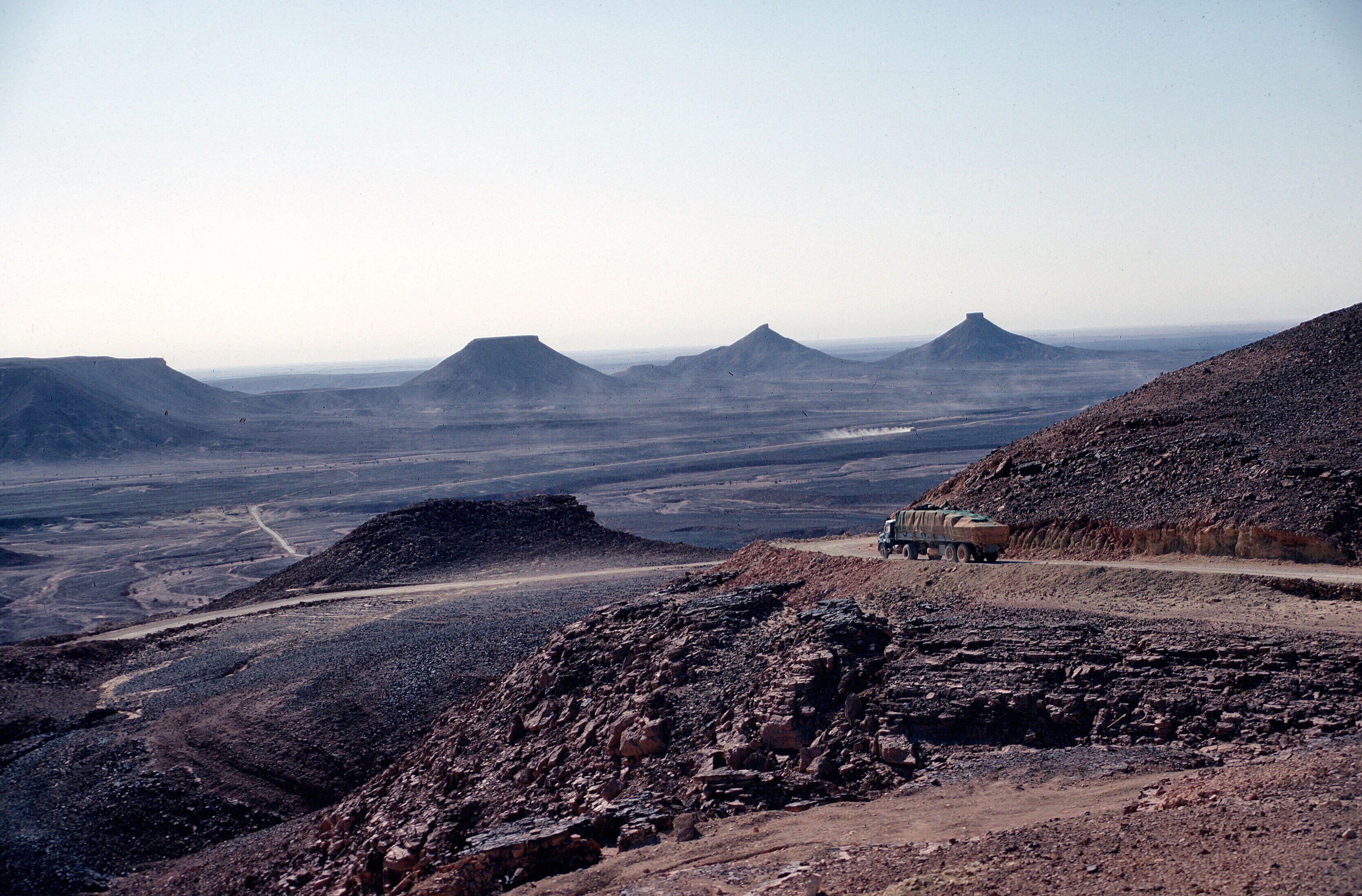
Algeria was off limits as a hostile country in the sixties, sadly as my experience in Algeria suggested that Algerians were friendly and eager to meet Americans. Anywhere else required expensive airfare or a daunting trip across the Sahara. If you follow this blog, you can read about my Saharan adventure later. A few of us actually did the trip, crossing the Algerian desert by truck, but it was not a casual affair.
On the road to Tamanrasset. Algeria, April 1971
I think that these rules may have loosened up over the years. Some volunteers had families with the means to provide funds for European trips. In the sixties, the Peace Corps was definitely elitist, just as the foreign service has always been, with many members coming from the Ivys. In any case, given the historical connections with Morocco, the Peace Corps judged Spain to be acceptable, but put the rest of Europe off limits.
By July, the heat had settled into Sefrou. The grain fields around the city had been harvested, and the country had taken on the thatch and earth colors that it would keep until the winter rains.
The Saïs plain with the hills west of Sefrou in the distance
Bouiblane disappeared into the haze at the horizon, and the streets became dusty. Melons were on sale in the market, and life slowed down a bit.
July at Bab Merbaa, Sefrou
Gaylord Barr, the volunteer with whom I shared the house in Seti Messaouda, and myself had persuaded one of the Peace Corps administrators, Don Brown, to come to Sefrou. Don had served in Oujda. He had never learned much Arabic, and wanted to improve his command of the language. We had a woman, Khadija, who cooked and cleaned for us. I fixed Don up with a tutor, my friend Hammad Hsein, and Don moved to Sefrou for a couple of weeks, where he had a chance to immerse himself in dialectical Arabic. Khadija would take care of Don and the pets. Off we went. I don’t know how much Arabic Don learned, but I know he enjoyed his time there that summer. Old Sefrou was lovely with its gardens and country walks.
Out for air, walking along the old Jewish cemetery, Sefrou.
It always gave me a lot of pleasure to see women taking strolls past the old Jewish Cemetery or students walking together, studying for their exams.
Hammad was an elementary school teacher. He lived in Seti Messaouda, as did his extended family, just outside the city wall and down the street from me. I had gone to his and his brother, Hassan’s wedding, and I often ate at his house on feast days. I was told that he emigrated to France, as many other people I knew have done.
Hammad Hsein, Sefrou, 1973
Gaylord and Don Brown at Taffert in Morocco
In early July, the mesetas of central Spain bake in the sun, just like much of Morocco. Oleanders flower in the dry water courses, but the only green is where farmers can irrigate. The early Arab invaders surely felt at home there. For them, Spain might have been Syria. And when the Abbasids wiped out the Umayyads in the East, the Umayyad kingdom in Spain survived and continued as the caliphate of Córdoba until overrun by successive waves of Berbers from the Atlas.
The previous summer Gaylord and I went off individually and traveled in Spain, making short forays into southern France and visiting Carcassonne, Albi, and Pau. By coincidence or by the nature of things we traveled much the same routes though we were not traveling together. In retrospect, I think I might have suggested the French sites as I was interested in visiting them myself.
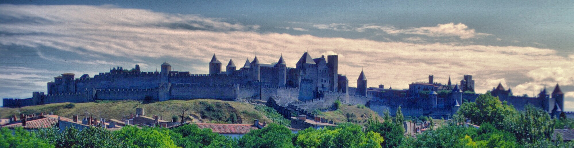
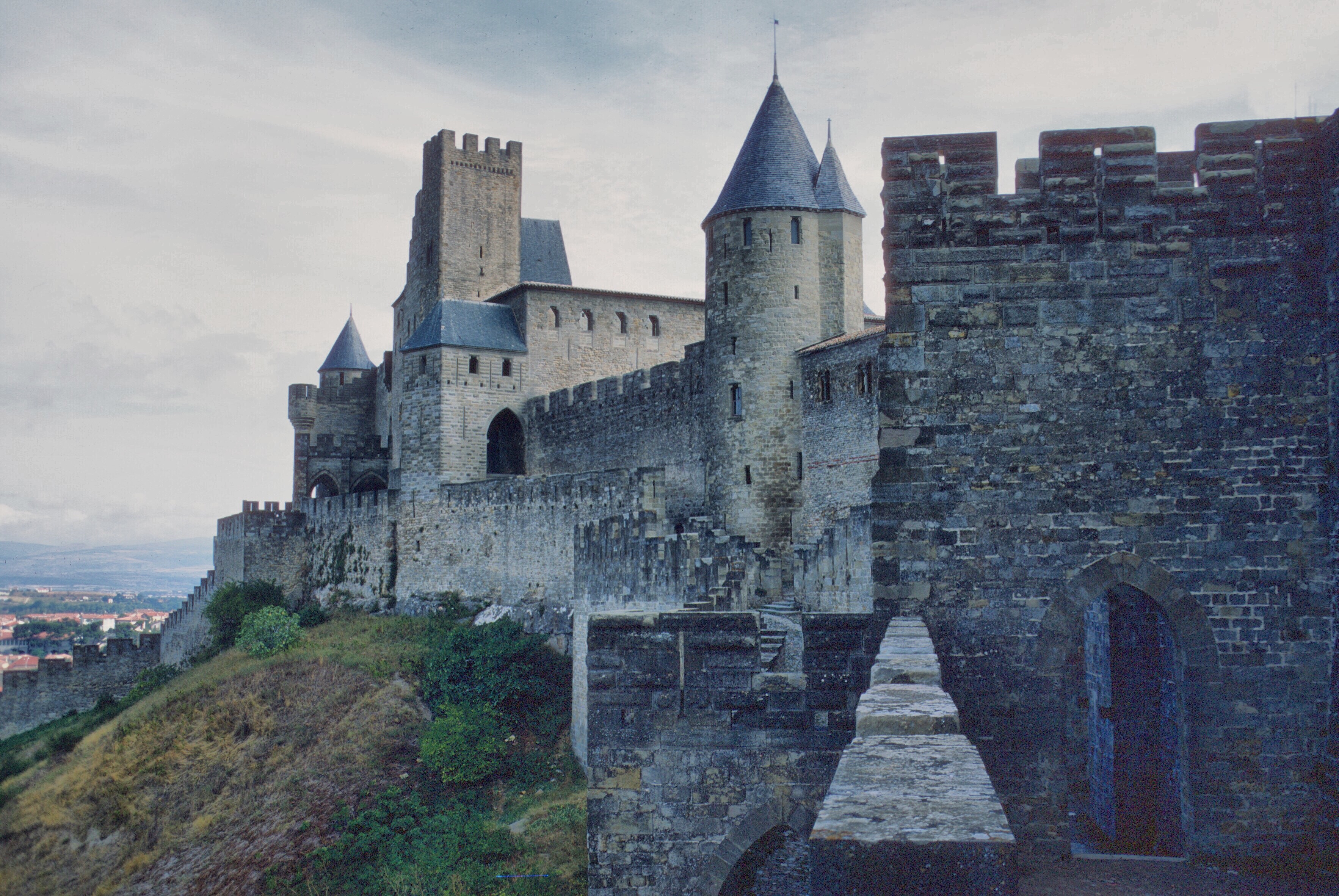
La Cité de Carcassonne from the new town below
Carcassonne needs the least introduction. The fabled walled city, heavily restored by Viollet-le-Duc, justly deserves its reputation as an icon of medieval military architecture, though if you would like to see a more authentic walled town, you might visit Aiguës Mortes instead.
Carcassonne, looking toward the chateau and barbican.
I had wanted to visit Carcassonne, when I lived in France in 1965, but never made the time. In December 1965, I was living in Castelnau-le-Lez, and a neighbor and host to another foreign exchange student took us along with his daughter and dog, Blackie, to see the sun set on the walls of the city. I have returned a couple of times since. The last time my wife, Liz, and I walked the entire circuit of the wall, then dined on mussels at a little restaurant just outside the main gate.
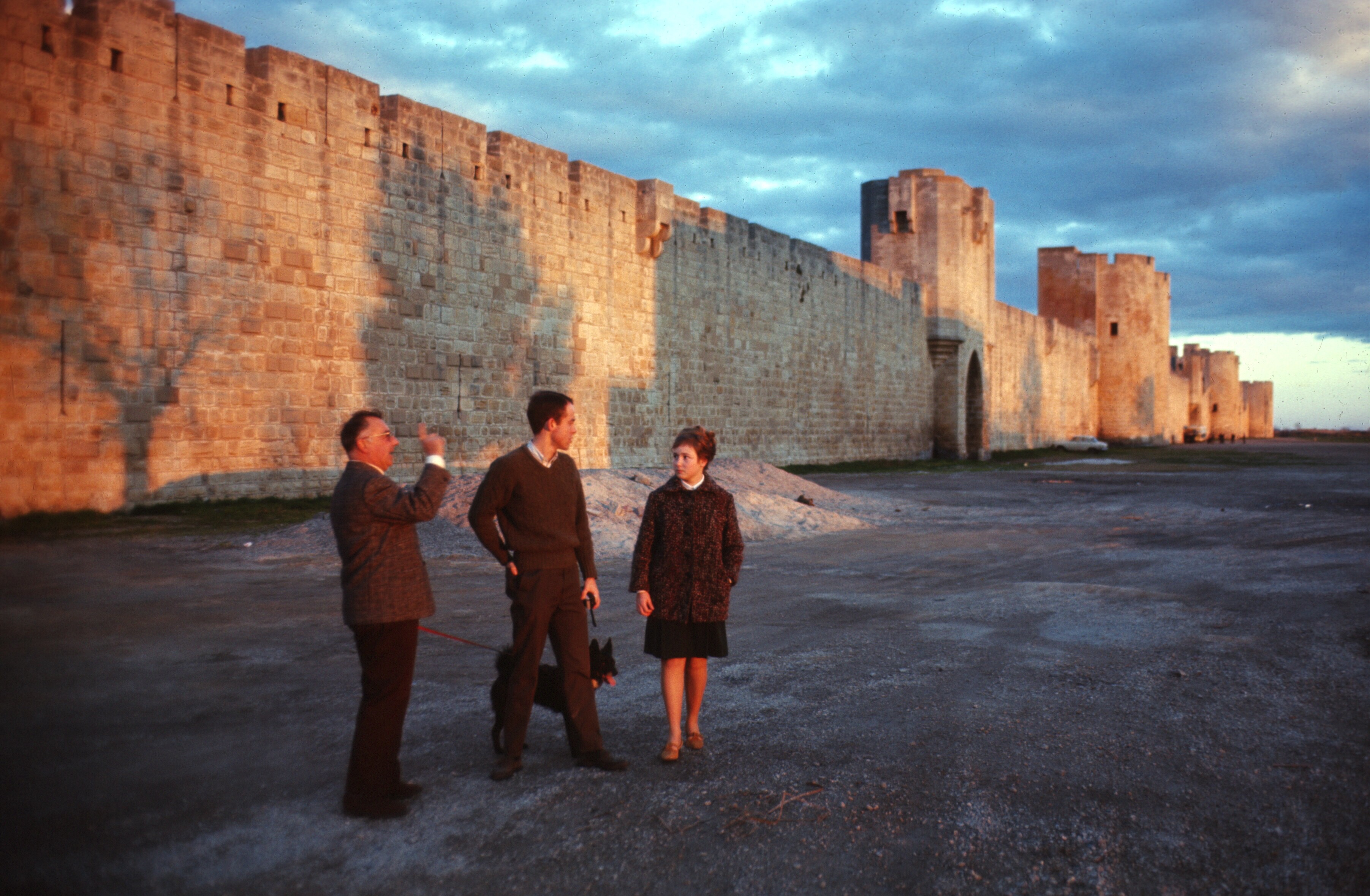
Aiguës Mortes was built as a port for the Crusades, in a very short period of time, but it was never used as the French soon acquired more territory on the Mediterranean gaining better ports. It soon silted in, and lost all importance, for which we have to thank for its extraordinary authenticity and preservation.
Aïgues Mortes, at sunset, friends and neighbors
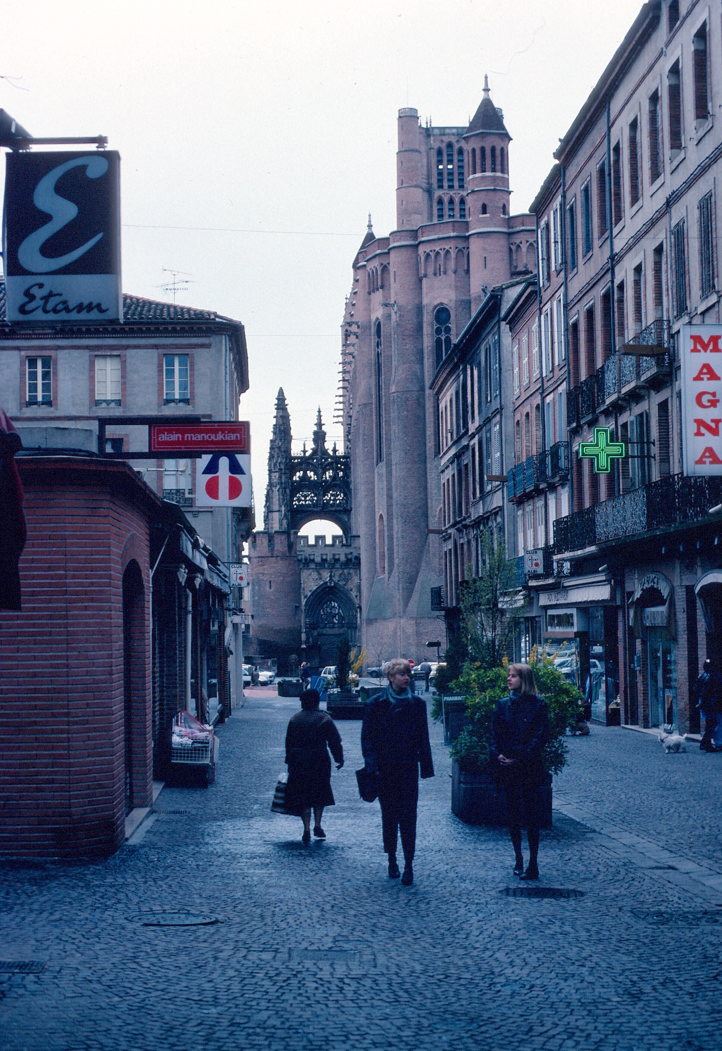
Albi is probably known to most Americans as the birthplace of Toulouse-Lautrec, and the place that gave its name to the Albigensian heresy, though it was never controlled by Cathars.
On March 16, 1224, after being surrounded by an army of 10,000 for a year, the Cathars at Monségur marched down from their castle, singing, and threw themselves into a giant fire that had been prepared for them. They had the choice of abjuring their faith or burning. This was the end to the crusade against them, and the start of the Inquisition.
The center of Albi is occupied by a fortified, red brick gothic cathedral, and the adjacent bishop’s palace is a museum for Toulouse-Lautrec art. The buildings in Albi are distinctively red brick, and strech along the banks of the Tarn.
Ste. Cécile, Albi
Pau would be the least known for most Americans. It sits on a hill that gives it an expansive view south to the Pyrenees.
Panorama from the Boulevard des Pyrénées, Pau. Pic du Midi d’Ossau on the horizon is on the border with Spain
Henri IV was born in the Renaissance château in Pau, and cradled in a giant turtle shell. A statue of him stands outside the château, with the inscription, «Lou nostre Henrico », and the locals remain rightly proud of their native son. To ascend to the throne of France, he converted to Catholicism, and is known for the apocryphal quote, « Paris is well worth a Mass. » This cynical comment belies his success in putting an end to the religious wars that were tearing France apart, as well as for a public works program that helped modernize his kingdom.
Unfortunately, Henry was assassinated by a Catholic fanatic, and the regency of Louis XIII began, which, you may remember, was the setting for Dumas’ The Three Musketeers. Its protagonist was the hotheaded D’Artagnan, a Gascon. Pau is in Béarn, a part of Gascony, a traditional term that applies to the lands south and east of Bordeaux. In Pau people appreciate armagnac as opposed to cognac, and local cuisine is shared with the Basque provinces next door.
Pau was a nineteenth-century watering spot for the British and a few Americans. The climate is mild and the atmosphere is calm. So much so that France trains paratroopers there. Today it is a regional administrative center with a university. I studied there in the summer of 1965, and my reason for returning was to see my former landlady, Madame Pinaud, who fed me a nice dinner, set me up with a date, and put me up over night. She was a widow, and the boarders she took in were an important source of her income.
My room in Pau, chez Mme Pineau
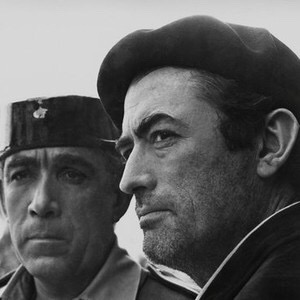
Pau was the setting for a movie with Gregory Peck, Anthony Quinn, and a young Omar Sharif. Behold a Pale Horse is worth a watch. Banned in Spain during the Franco years, it dealt with a bitter Catalan anarchist, veteran of the Spanish Civil War (Peck), and a corrupt officer of the Guardia Civil who is out to catch him (Quinn).
Anthony Quinn and Gregory Peck, during the shooting of Behold a Pale Horse
It never gained any popularity as Peck’s character is dour and bitter, the movie was in black and white, there was no love interest other than Quinn’s mistress, and the setting is obscure. Peck usually played a hero and nice guy, and his fans expected roles with those attributes. In his final trip to Spain, Peck enters Spain through the Brèche de Roland, of which more later.
The château of Pau also served briefly as a prison for Abdelkader, the Algerian patriot, known for military acumen as well as his chivalry. At the height of his power, Abdelkader controled much of western Algeria and even some of eastern Morocco.
From Pau, the easiest route back to Spain was by rail through Canfranc. The second largest railroad station in Europe, Canfranc is perched high in the mountains. Trains had to switch from one gauge of track to another, as the gauges differed between France and Spain. Trains do not pass there any longer. The station was shuttered in the early nineteen seventies, and today is just a curiosity, rusting away in the wilds.
I think that the idea of crossing the Pyrenees through the Brèche had been in my mind for a while. I knew that the site was spectacular as I had visited Gavarnie, and I had watched Behold a Pale Horse, probably one of the late night movies CBC Toronto used to show after the 11:00 p.m. news. It is said that the Spanish government blocked its showing on American TV networks. Over the winter of 1968-1969, I began a correspondence with a member of the French Alpine Club in Tarbes. I had wanted to get some serious climbing experience, and he counseled me to enroll in the Union Nationale des Centres de Plein Air, a summer sports program for French kids. I asked him about crossing the the Pyrenees from Torla to Gavarnie, and he recommended the hike, saying that it was not difficult. If you research it on the Internet, you may find it described as one of the finest treks in the world.
I cajoled Gaylord into going with me. He did not share my passion for wandering about high mountains, but he loved nature and appreciated Spain.
The Tangier-Algeciras Ferry with Gaylord snoozing in the deck chair
We set off in early July 1969, taking the train from Fes to Tangier. Crossing from Tangier to Algeciras, we took a night train to Córdoba, where we spent the next day looking at the medieval center and the Mezquita. I had been there before, and have gone back since. The Mosque is a gem. The previous summer I got off a night train from Algeciras and wandered at 4:00 a.m. through the twisting and turning streets of the old quarter. Here and there were lights of a bar or hotel, but most was shadow and dark and quiet. It felt very much as if I were at home in Sefrou.
La Mezquita, the great Mosque at Córdoba
Spain did not have many fast trains in those days, and second class ticket holders were crammed six or eight to a compartment. The weather was sweltering, but we were used to it and it didn’t bother us. I remember Águila beer was eight pesetas a bottle. With roughly seventy-five pesetas to a dollar, it was easy to quench our thirst. Águila was a pale lager, and, on the train, at least, it came in small bottles, cheap to buy and easy to drink. It has sadly disappeared, swallowed up by big European breweries.
Nothing better for a long, hot train ride
The long rides afforded some time to read and I think I read Hugh Thomas’ The Spanish Civil War, still one of the best books on the subject sixty years later. The previous year I reread The Lord of the Rings. I remember riding a bus through the Catalonian Pyrenees on the way to Andorra. It had piped music, and the driver was playing the Concerto de Aranjuez. It was a grey day, a bit misty, and the forests appeared in various shades of green. As the bus climbed toward Andorra, the peaks moved in and out of the clouds. It was a magical way to take in the spectacular scenery.
The old Atocha Station, Madrid
Arriving at the Atocha Station, we got a room at the Hotel Atocha. I had stayed there before. The rooms were threadbare and ratty, but it was conveniently located near the center of Madrid, across from the station, and the staff were friendly and used to dealing with budget travelers. I had come down with something, and had a fever. I remember going to see Walt Disney’s Fantasia, which I had never seen, in a big theater with chilling air conditioning. I ended up spending a day in bed while Gaylord saw sights in the city. I made a quick recovery, though, and we soon left for northern Spain by rail.
Torla, at the end of the day
Torla was a little mountain village and not on any rail line. I think we got off in Jaca, and had to hitch hike through Sabiñánigo to get there. It sits in a small valley, between the National Park of Ordesa and the town of Broto in the valley below.
Broto, in the valley below Torla
At the time, Torla wasn’t as developed as it is today. Near the entrance of the National Park of Ordesa, if you were wealthy, you could stay in the Parador in the valley of the park. That was something like staying at the Ahwahnee in Yosemite, and just as expensive. We stayed in a pension in Torla, paying five dollars per day for room and board. At the time, you were able to drive to the park, and we hitchhiked. Today there is a shuttle bus, and the park is closed to automobile traffic.
A view from the pension room over the roof tops of Torla
The food in Torla was local, fresh, and tasty, and was served with plenty of local wine. Gaylord remembered it, a few years before he passed away, as some of the best food in his life! There was a bar which had a TV, and one could sit and watch the Tour de France while drinking cheap Spanish brandy and expresso. There wasn’t much night life in Torla. With the windows open, you could hear the Río Ara.
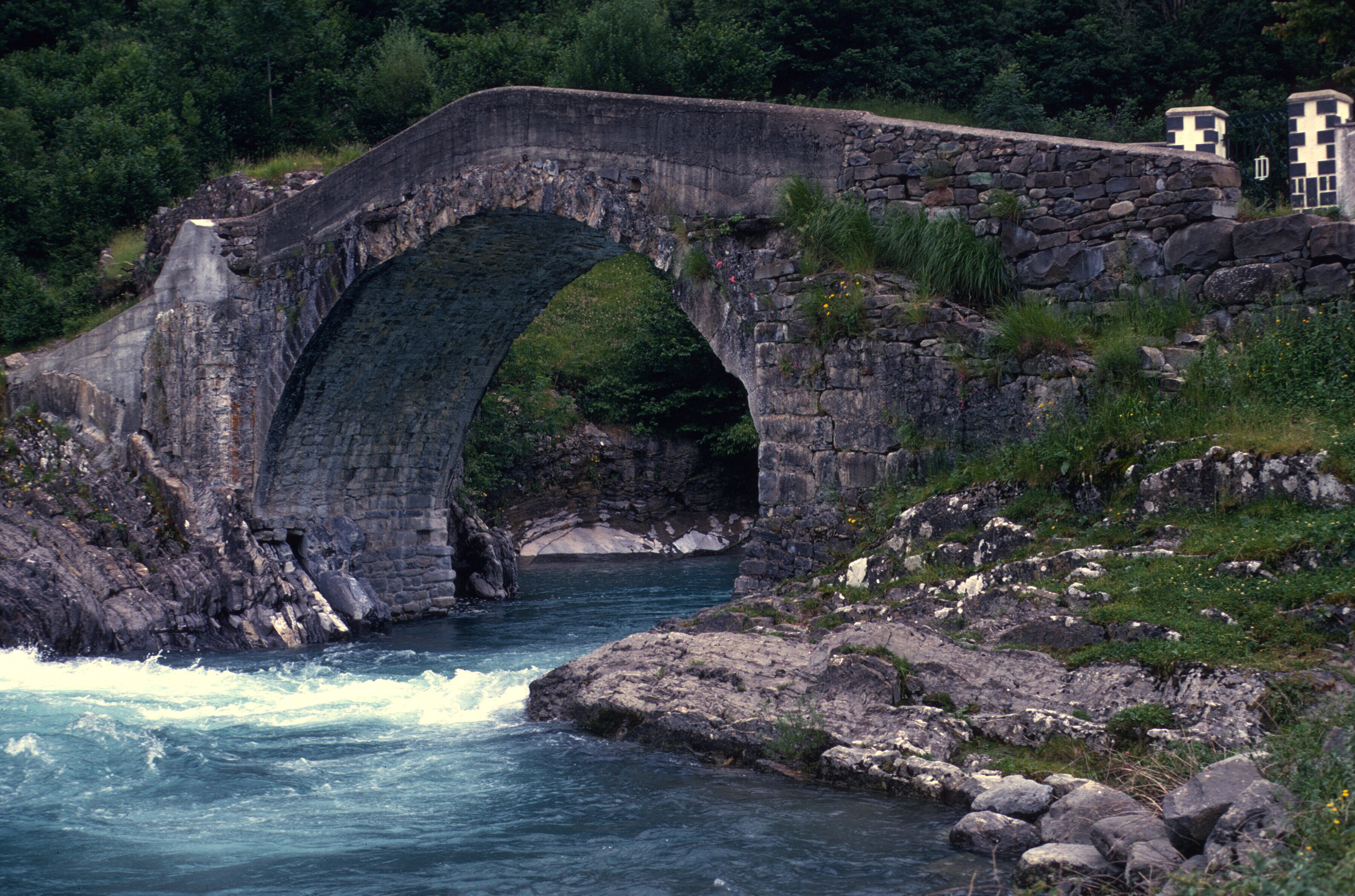
The bridge over the Río Ara at Torla
We hiked around the valley for a few days before continuing.
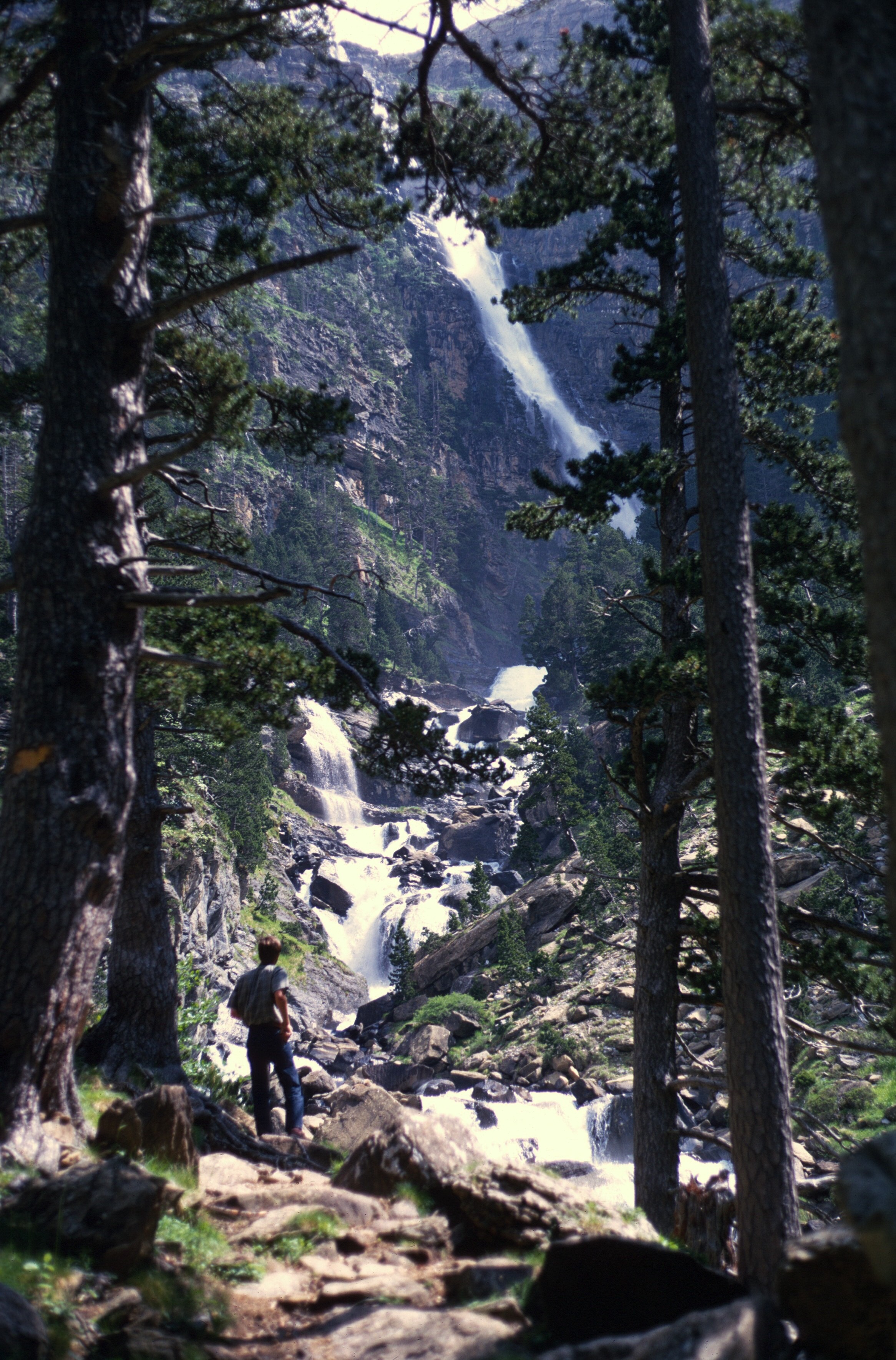
One of the numerous waterfalls
Tower from valley bottom
We climbed the canyon walls to the clavijas of Cotatuero one day, but we had no harnesses or ropes so we couldn’t proceed.
Tower near the Cotatuero trail
Unfortunately, I had left my boots in Madrid. I desperately looked for replacements, but the choice was limited to either ski boots or canvas shoes with rope soled interiors, a cheap and popular choice in Spain.
On the way to the clavijas of Cotatuero
My French correspondent had not factored in difficient footwear nor large amounts of snow, and, though the canvas shoes were comfortable, neither they, nor the heavier work boots that Gaylord wore, were really suitable to the task. Most of the way from Góriz to Gavarnie I walked in the equivalent of wet tennis shoes! We should have suspected a lot of snow as we found the Río Ara with an ice bridge over it in the lower part of the canyon. Ice axes would have been handy. The previous winter had been a snowy one.
Ice bridge over the Río Ara
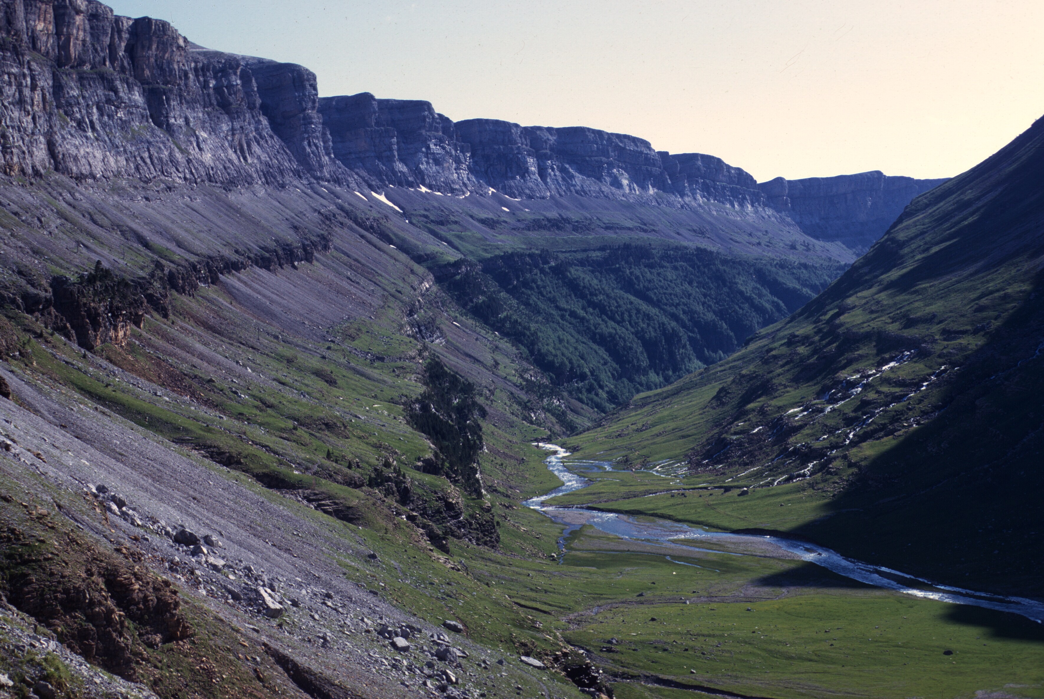
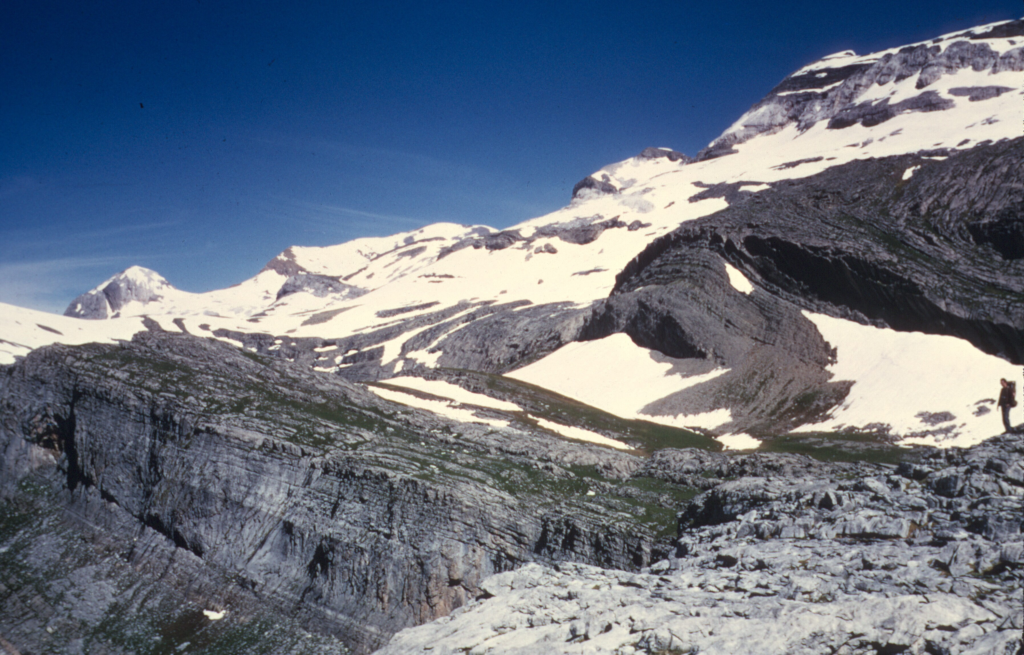
The National Park of Ordesa and Monte Perdido has been designated as a World Heritage site by UNESCO, and certainly merits the distinction. A steep glaciated canyon, with hanging waterfalls, lush beech and pine forests, and snowy uplands, the Park may not be huge, but it is breathtaking. It reminds me of Yosemite, with its waterfalls and vertical cliffs, but the rock is limestone and just above the canyon walls are snow-covered peaks.
Our plan, and a very reasonable one we thought, was to climb to the Góriz Hut, above the end of the valley, stay overnight, then to cross through the Brèche de Roland and descend to the town of Gavarnie, which I knew from a visit in 1965. We had no reservations at Góriz, but if you were to plan this trek today, you would probably need them. All we had to guide us was a rough trail map handed out by the park people. Today there are excellent maps. Góriz to Gavarnie is a long day’s hike.
The hike up the valley was easy, and we soon left the forest of beeches and pines behind.
Nearing the end of the canyon, with companion bota
Upper reaches of the canyon. The Góriz Hut is just above the end.
A view back down the canyon
At the Góriz Hut, there was a group of young Aragonese kids, dressed in local colors, who played flutes, sang, and danced after dinner.
I think they climbed Monte Perdido the next day, and I remember looking wistfully in that direction the next morning, before setting off for the Brèche. We would have been totally unprepared for that ascent.
We had left most of our clothes in Torla, to be retrieved on the way home, so that we could travel light. The proprietor of our pension packed a copious lunch and dinner of roasted chicken and sandwiches and, of course, wine. That was our food for the hike, and we didn’t buy food again until we reached Gavarnie.
On the way to the Grotte de Casteret
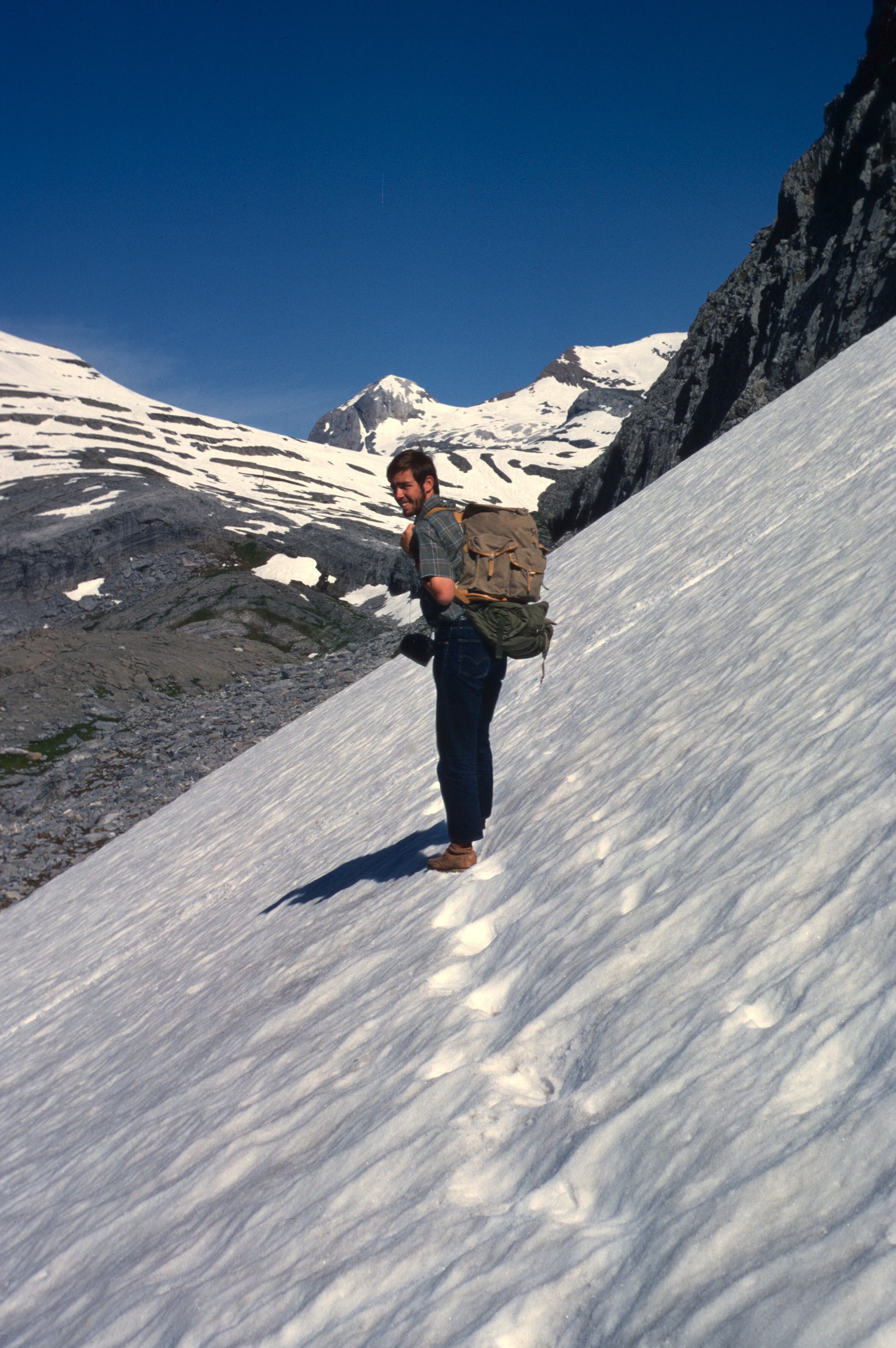
We had sleeping bags, but I don’t remember real outdoor wear of any sort. We just had jeans and shirts with sweaters and light jackets in our packs. I had an old wool Pendleton shirt that my uncle Bill had handed down.
Leaving Góriz
Luckily, the weather cooperated. The sun was brillant until we crossed through the Brèche. The French slope had damp clouds rising out of the valley, but no real precipitation.
Looking back toward Góriz.
We didn’t think finding that route would be difficult.
Had the weather turned, it might have been a problem, but the Spanish slopes are sunnier than those of France, and we had luck with us.
On the trail to the Grotte. The bota seems to have gotten a lot of use!
From Góriz we headed to the Grotte de Casteret, named after Norbert Casteret, the famous French caver.
A Spanish group and me, outside the Grotte de Casteret
There was a group of hikers there, and, at that time, you could easily enter the cave. At about 9,000 feet, the cave has a frozen lake and waterfall. That itinerary took us out of the way.
The Brèche from the environs of the Grotte
We decided that we would descend to the basin under the Brèche and climb back up. This turned out to be trickier than we had reckoned. It was around noon, and the snow on the Spanish slope had melted and become slippery. We plodded up to the Brèche, slowly and carefully.
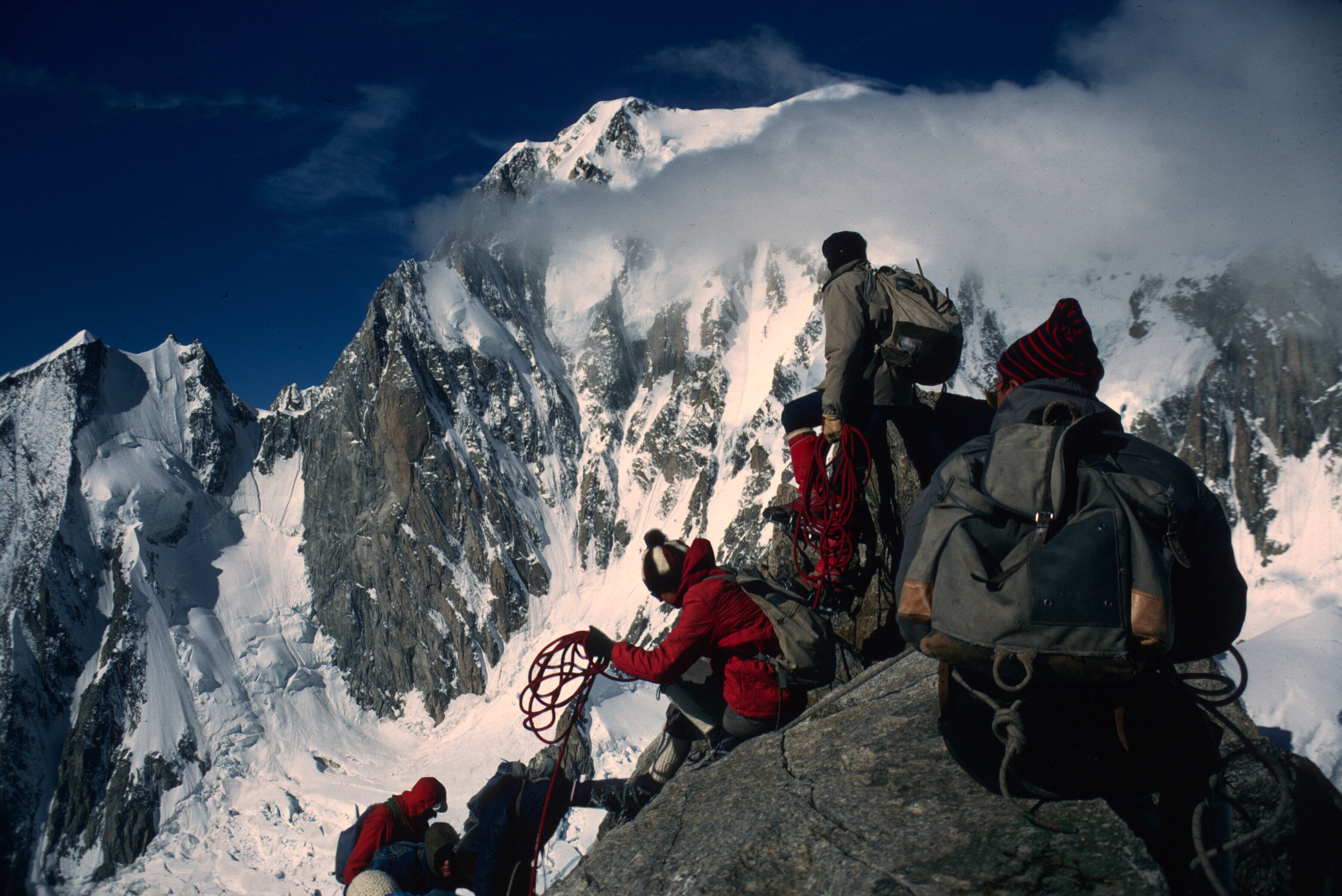
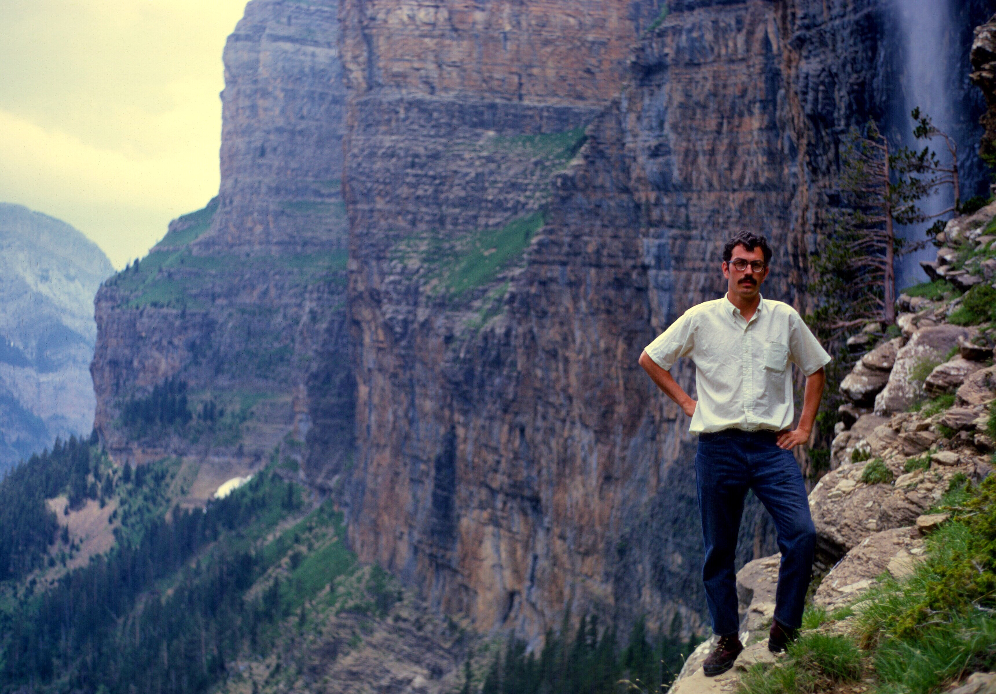
Gaylord Barr ascending the Spanish side of the Brèche
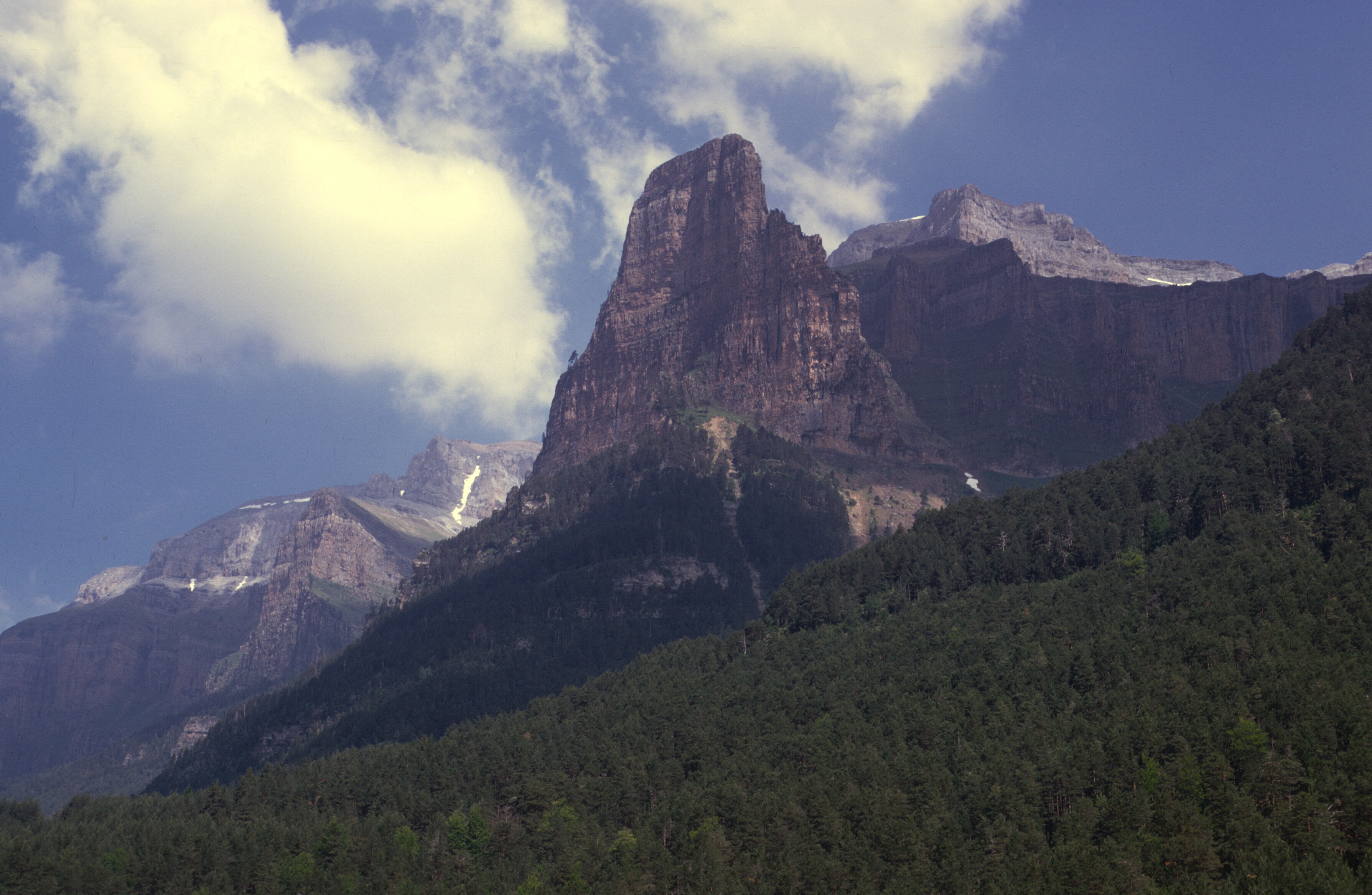
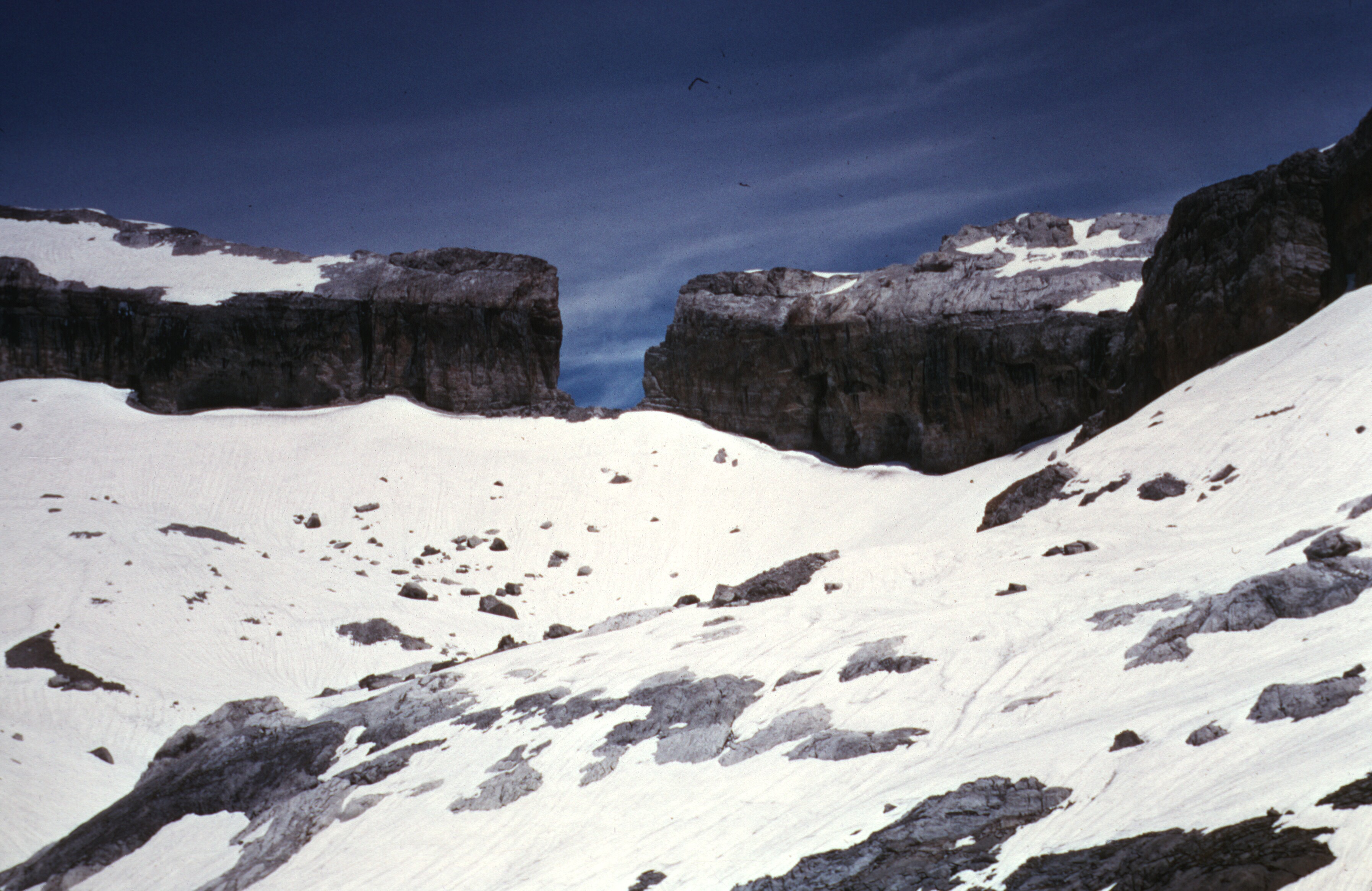
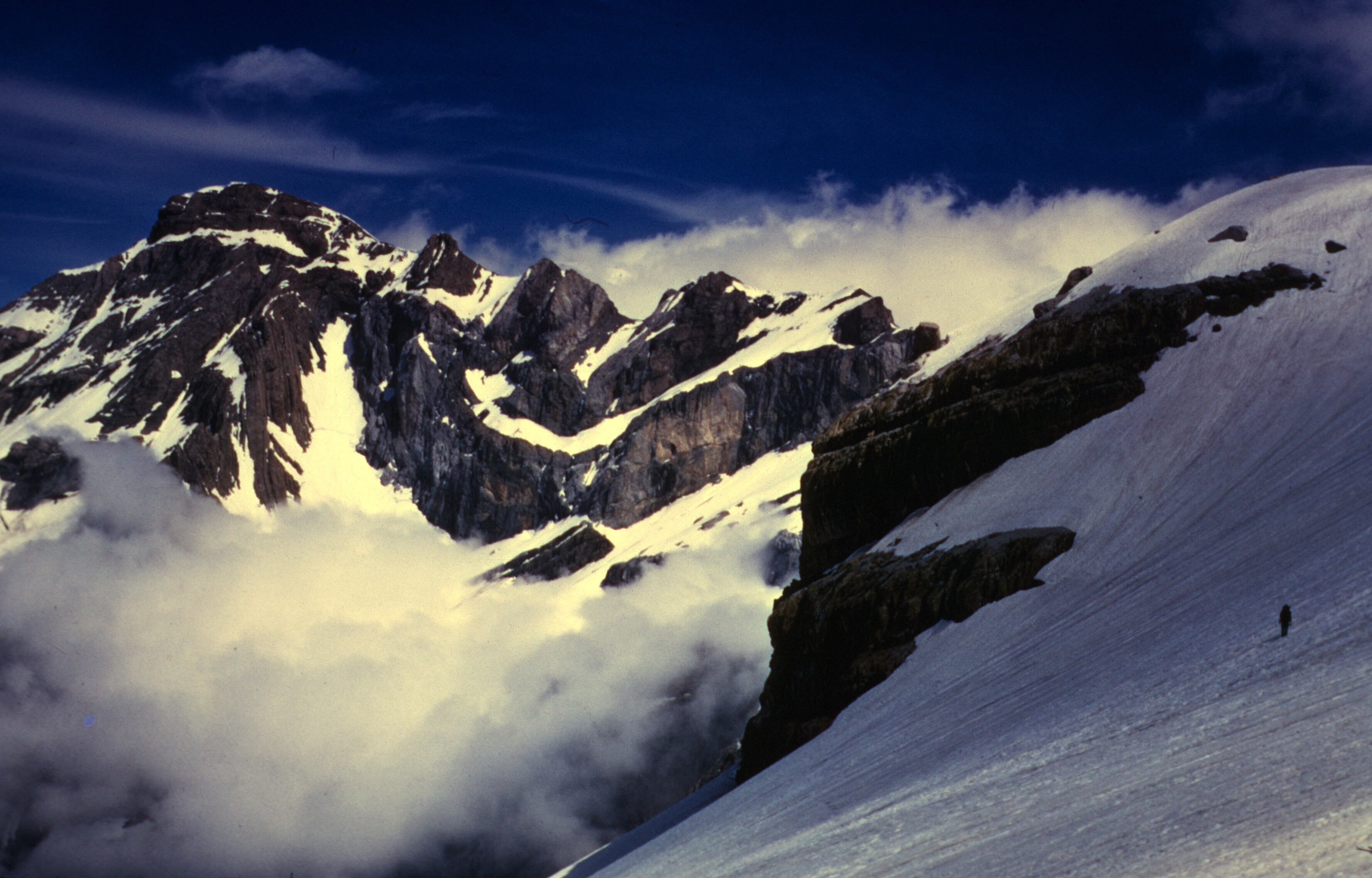
The Brèche is a imposing natural feature, a gap in a knife-thin rock face, about 120 feet wide and 330 feet high. It sits at 9,100 feet, above and to the left side of the Cirque de Gavarnie. It cannot be seen from Gavarnie, but it is clearly visible from many high points of land. From the summit of Pic du Midi de Bigorre, it appears as a tiny notch on the horizon.
The mountains on the far horizon are on the Spanish border. The Brèche is a tiny notch on the right hand side of the photo. In the foreground is the Neouvielle Massif. Taken from the summit of Pic du Midi.
The Spanish call it La Brecha de Rolando, and the locals attributed it to the times of Charlemagne. Roland was Charlemagne’s best knight, who accompanied the king to Spain to fight the Moors. Roland was mortally wounded, and fearing that his magic sword, Durandal, would fall into enemy hands, he tried to break it against the rock. The rock was split, but the sword did not break.
With some trepidation, we arrived at the Breche. Looking back was Spain.
View back into Spain from the Brèche
Looking down into France, we saw a steep snow slope.
Hikers on their way to the Brèche
A couple of hikers were on their way up to the Brèche. They had ice axes, and we wished that we had had them, too.
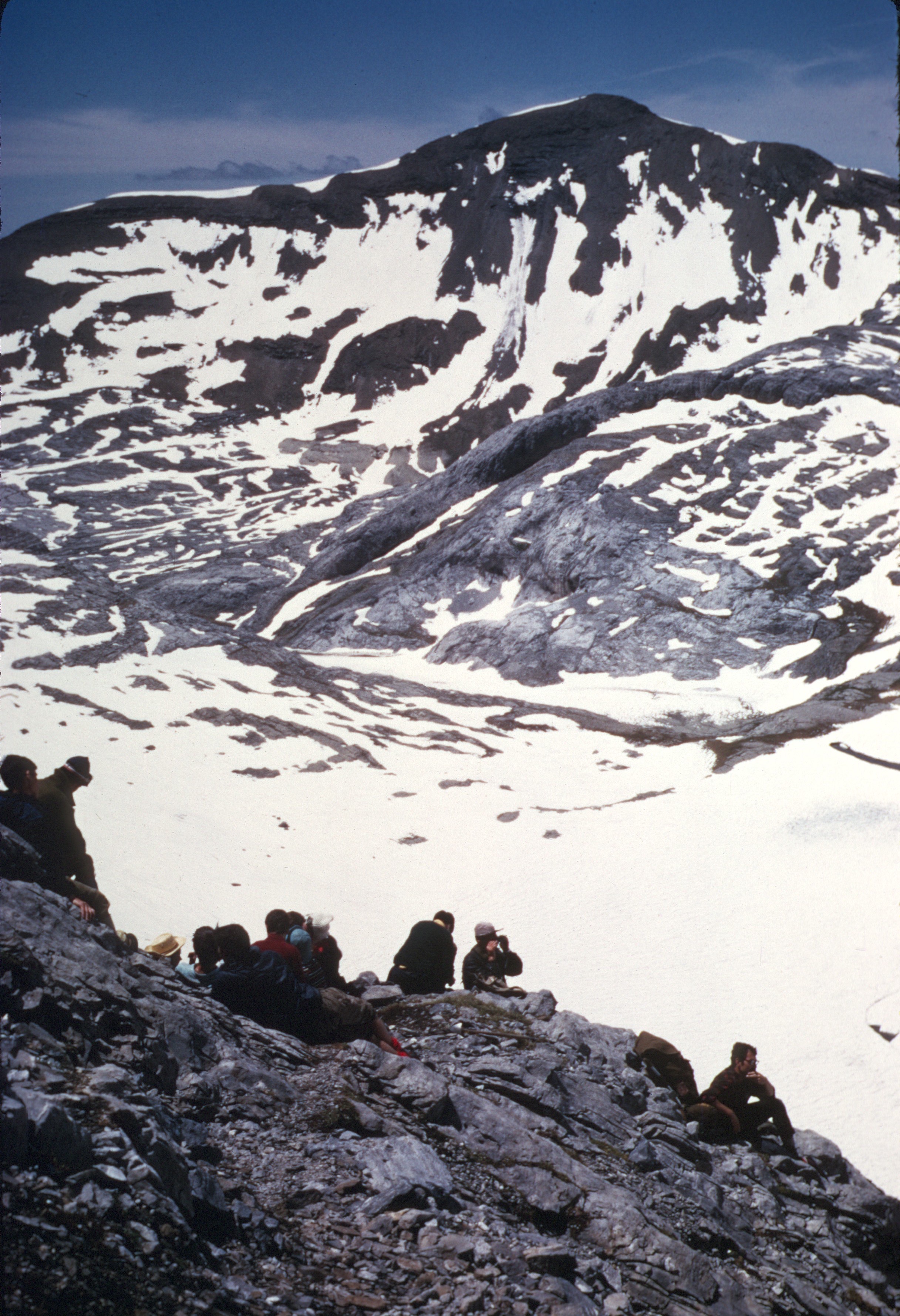
The view to the east, into the cirque was spectacular.
Descending from the Brèche, I am crisscrossing the slope. The cirque is in the background
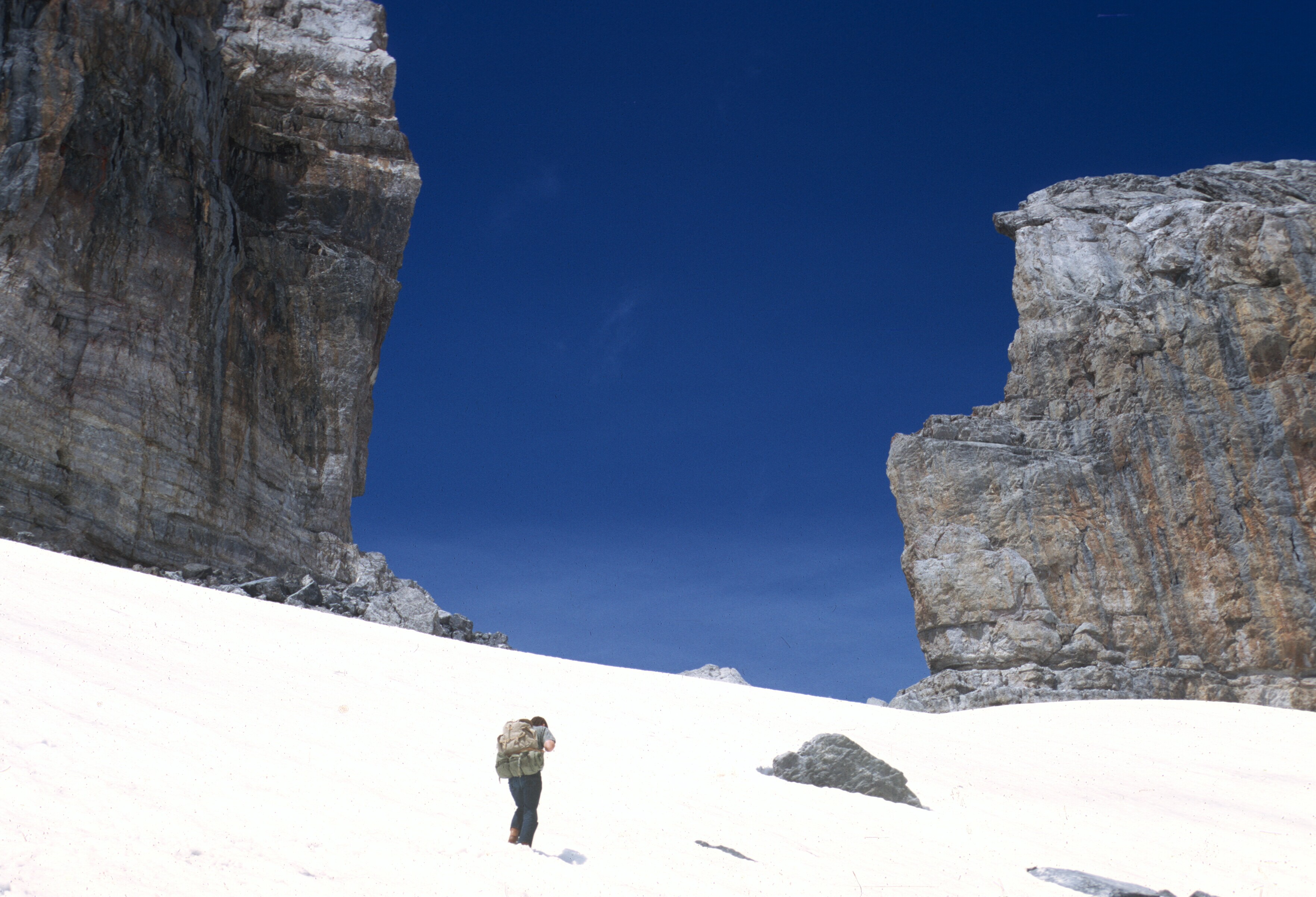
To the right, clouds floated in the cirque. With no ice axes, we zigzagged back and forth, carefully traversing the slope, until we reached the hut.
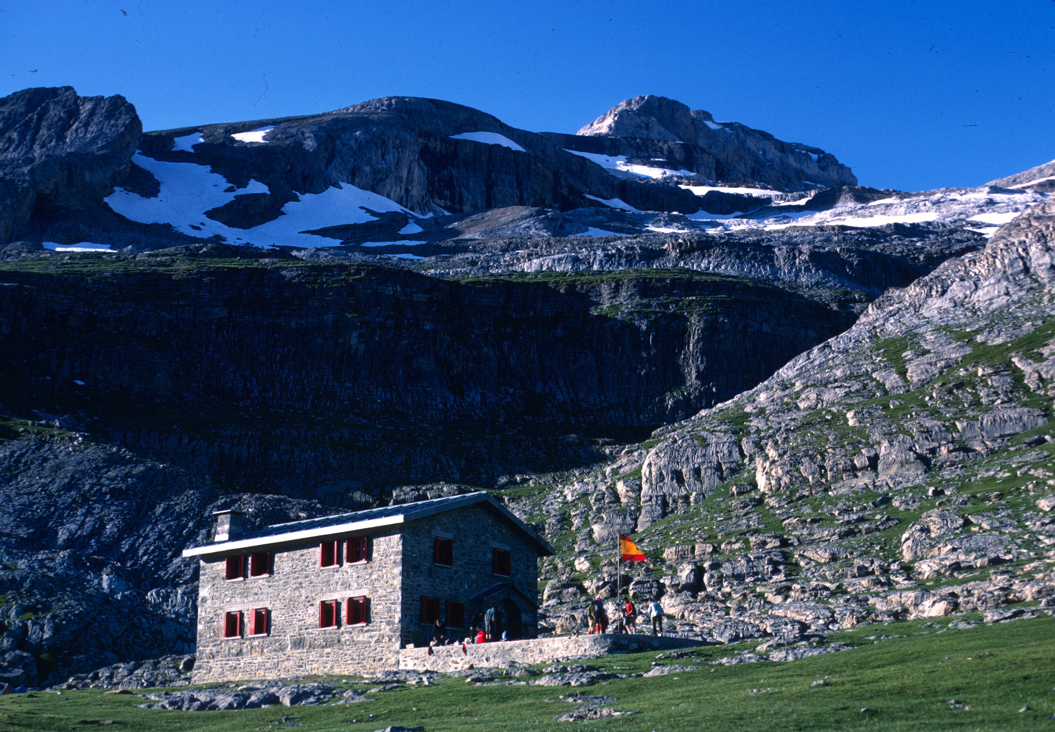
Sarradets Hut, from below the Brèche
I did not expect all the snow, and was relieved when we finally reached the hut, and got off the slope. A fall would have meant a long slide, and possibly an injury.
My canvas shoes had been soaked all morning, and my feet were wet and cold. We needed a break and ate some of our provisions while the clouds rolled up from the cirque. I was able to switch to a dry pair of socks.
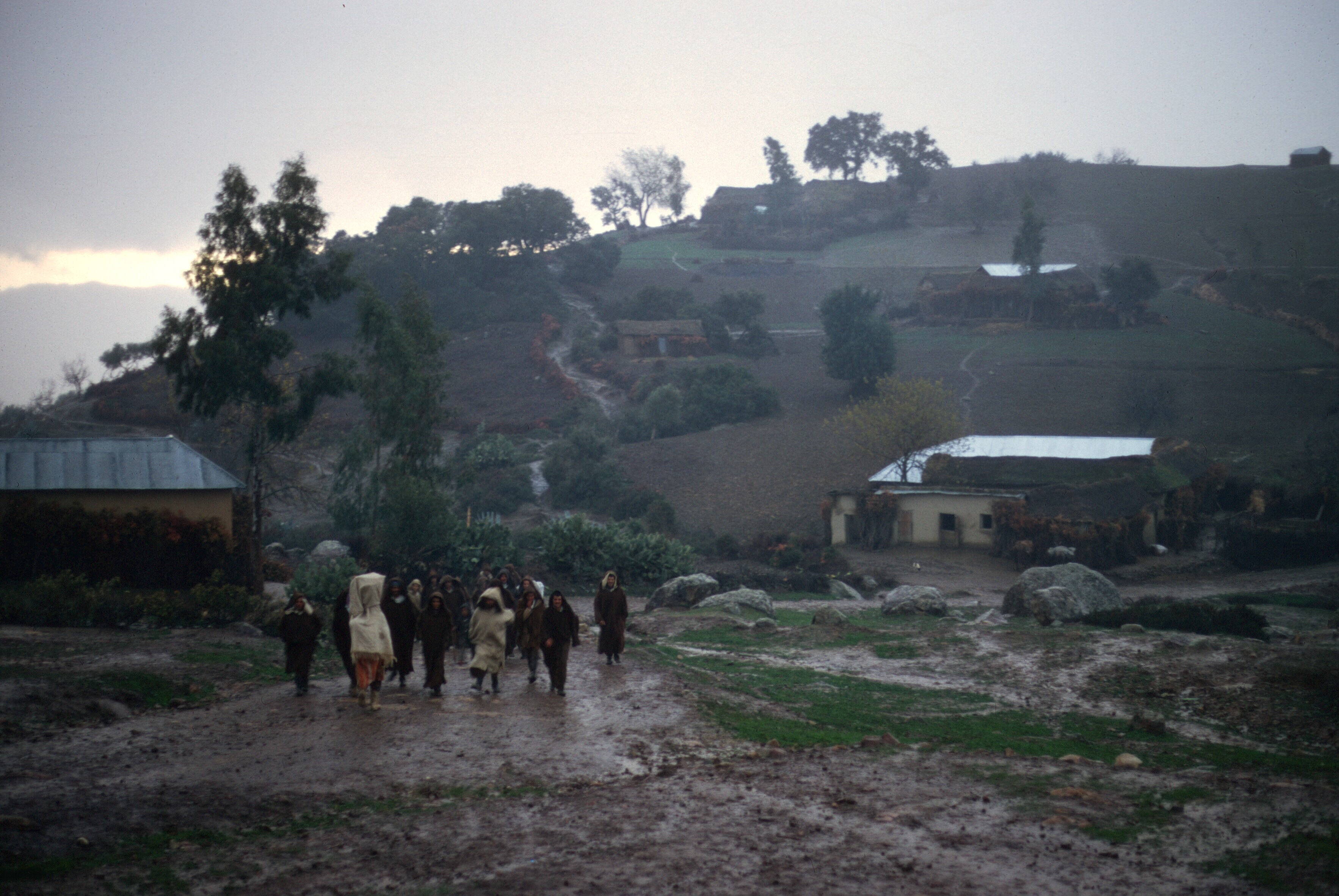
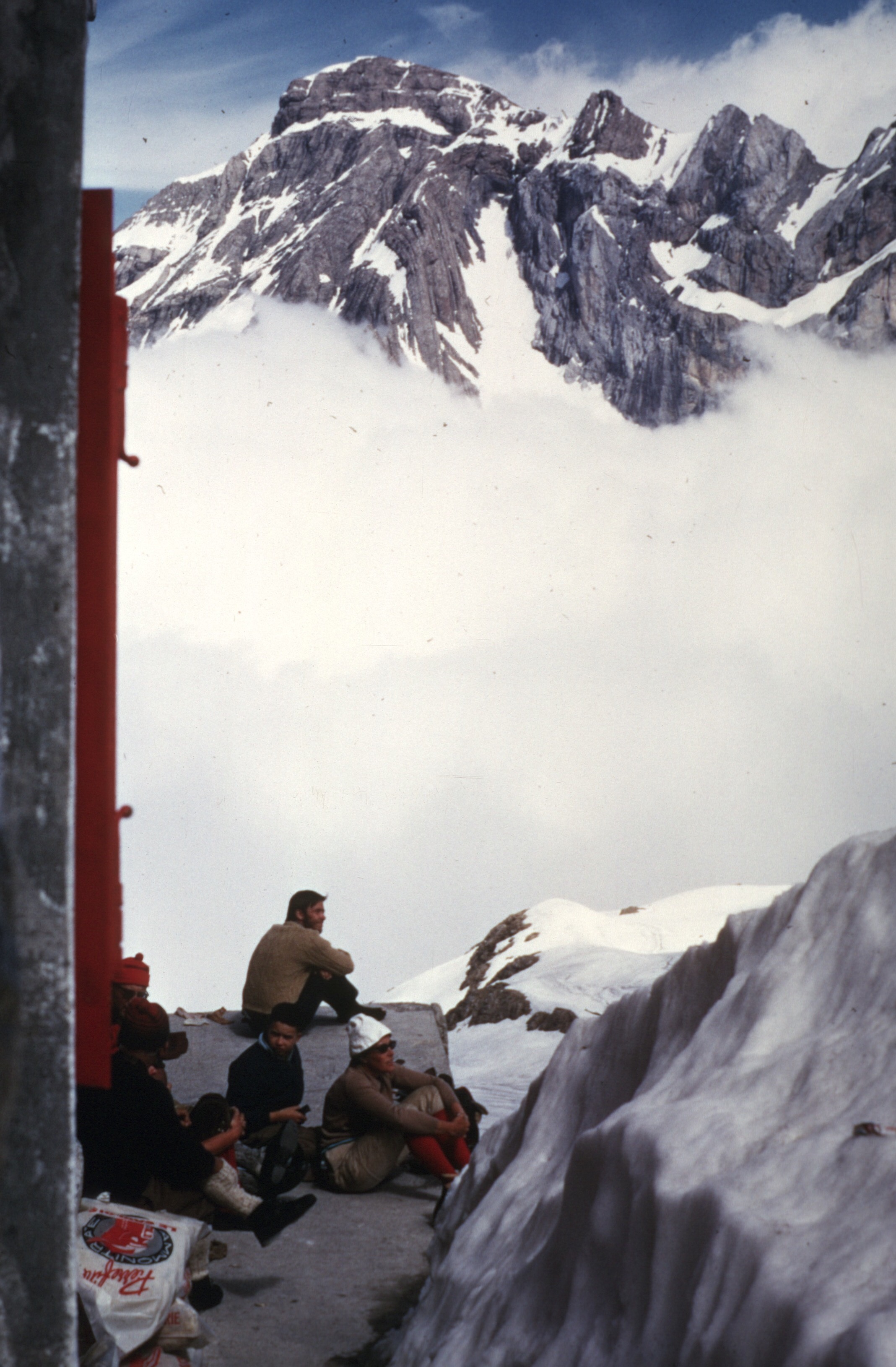
There was a French couple with children at the Sarradets. I think that they were surprised to find foreigners, who did not seem very well prepared for what they were doing, and they eyed us suspiciously. Maybe they thought we’d walk off with their ice axes?
Resting at Sarradets
Having rested, we began the trip down to Gavarnie. The snow, which had caused so much consternation, soon disappeared, replaced by a broad stone trail. We met a young Frenchman coming up the trail to Sarradets, and said hello. He asked where we hailed from and was visibly surprised to find that we were Americans. The day turned darker as we continued down, and when we finally trudged into Gavarnie, it was almost night. We found a place to stay, showered, and went to bed. I think we were too tired to eat, and very sore to boot. I wanted out of those soggy canvas shoes much more than food.
The next morning we arose late to find the clouds parting. Sitting on a cafe terrace, we enjoyed café au lait, croissants, and a magnificent view of the cirque.
A rock wall rising thousands of feet, with a myriad of small waterfalls, the cirque has the highest waterfall in Europe. Victor Hugo described it as a coliseum, and, enclosed on three sides, it resembles an amphitheater. During the last ice ages, huge mountain glaciers occupied the cirque and hollowed it out. Layered strata form ledges and collect snow, and the snow provides horizontal banding that contrasts with the vertical walls adding contrast to the overall effect.
Since it was cloudy and dark, I took no pictures on the way down, but I have a couple from 1965 that give an idea of the trail and show the cirque from a different angle.
Gavarnie, August 1965
The beginning of the trail to Sarradets, in Gavarnie
If I were to do this trip today, I think I would return to Torla on foot via Bujaruelo, or a more scenic route. I’d also be dressed for the trip. But that summer we were just happy to have arrived, and still tired. After eating we hitched down the valley. We wanted to get to Pau, but hitchhiking wasn’t easy and we only got as far as Lourdes. With nothing else to do and stuck for the night, we poked around the souvenir shops and went to a Truffaut
movie, Mississippi Mermaid. The next day we bussed to Pau to catch the train to Spain. Picking up our belongings, we traveled back to Morocco, stopping in Madrid to get my boots at the Atocha Hotel. My big adventures were over till the next Peace Corps summer, the subject of yet another blog post.