
Part 1 – The Trans-Saharan Highway

Part of a band of deserts that cross both Africa and Asia, the Sahara is the largest single desert in the world, stretching over 3,000 miles across the continent of Africa, from the Atlantic Ocean to the Red Sea. Wider than the continental United States, the Sahara separates North Africa from the rest of the continent. Still, despite being a formidable physical barrier, the Sahara has never totally isolated sub-Saharan Africa from the north. Travelers made the trip in medieval times, and, in the 20th century, mechanized transport and roads have made it easier for traders and tourists alike. I was one of the latter, eager to visit parts of Africa I had not seen before, and not afraid to engage in what might be an adventure.
A few years ago, my younger daughter, a photojournalist, had the idea of retracing my journey across the Sahara. A little investigation on her part soon dissuaded her. With warfare waged almost daily across the Sahel by Islamic insurgencies, the trip presented far too much danger.
Now, Kate is no stranger to danger. She entered Afghanistan with the first U.S. troops, lived in Baghdad after the U.S. invasion, and made her home in Beirut, watching as the Israelis systematically bombed south Beirut while the Lebanese occasionally bombed themselves. She gave up on her idea of a footsteps-of-her-father article as much too risky.
Though I am relieved, the article would have been a timely one. The world has evolved greatly since I was in my twenties. Today the roads linking sub-Saharan Africa have become major routes for migrants fleeing warfare and poverty in hopes of finding a new home in Europe. These migrants take great risks for uncertain futures, and their trials remind me of another, totally involuntary migration across the desert, that of slaves traded to North Africa.

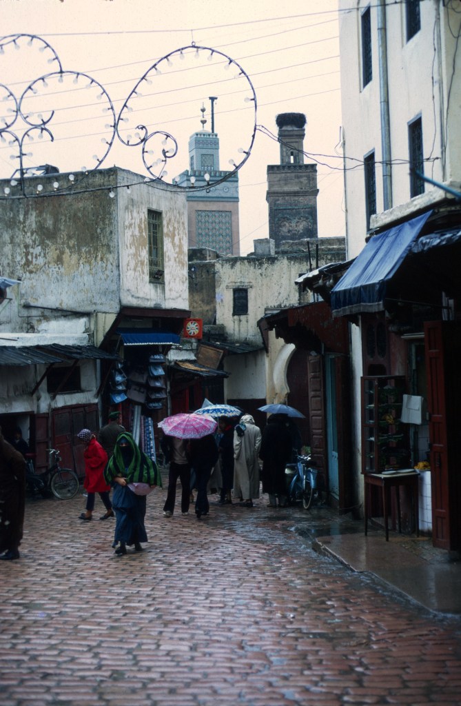
The early nineteen-seventies was a more peaceful and innocent time. Before the Green March in 1975, there wasn’t much desert within the borders of the Kingdom of Morocco. Most of what was then Morocco had a Mediterranean climate, as the Kingdom, once a French protectorate, did not yet include the Spanish Sahara. Only far south of the Atlas Mountains did one encounter true desert, although there is no denying that all of Morocco’s south is very dry.

Tensions along the contested eastern border led to military skirmishes with Algeria in the early sixties, and Algeria was closed to volunteers, not by the Algerians, but by Peace Corps rules set by the U.S. State Department. We were not allowed to visit Algeria. That was a great shame, as the country was safe, similar to Morocco but different in distinct ways, and had many things to see. The United States had been sympathetic the Algerians’s demands for independence, but that independence had come with much more struggle and violence than Morocco’s, and the government in Algiers was nonaligned. Sadly, the Cold War was playing in theaters everywhere then, and Washington had decided Algeria was just much too dangerous for Americans. Peace Corps volunteers did sometimes ignore travel restrictions, but stamps in a passport could be incriminating: Algeria required a visa for Americans.
By 1971, however, the Peace Corps was willing to let volunteers at least transit Algeria. Gaylord Barr, a PC English teacher in Sefrou, returned to Morocco by train from Tunisia in where he had studied Modern Standard Arabic during the summer.
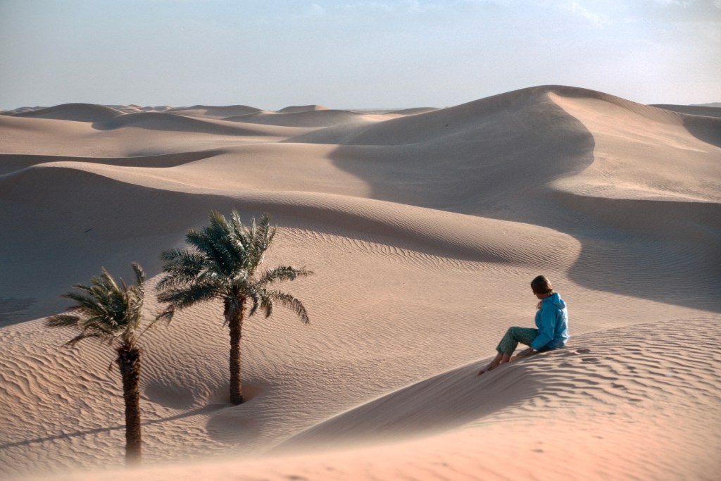
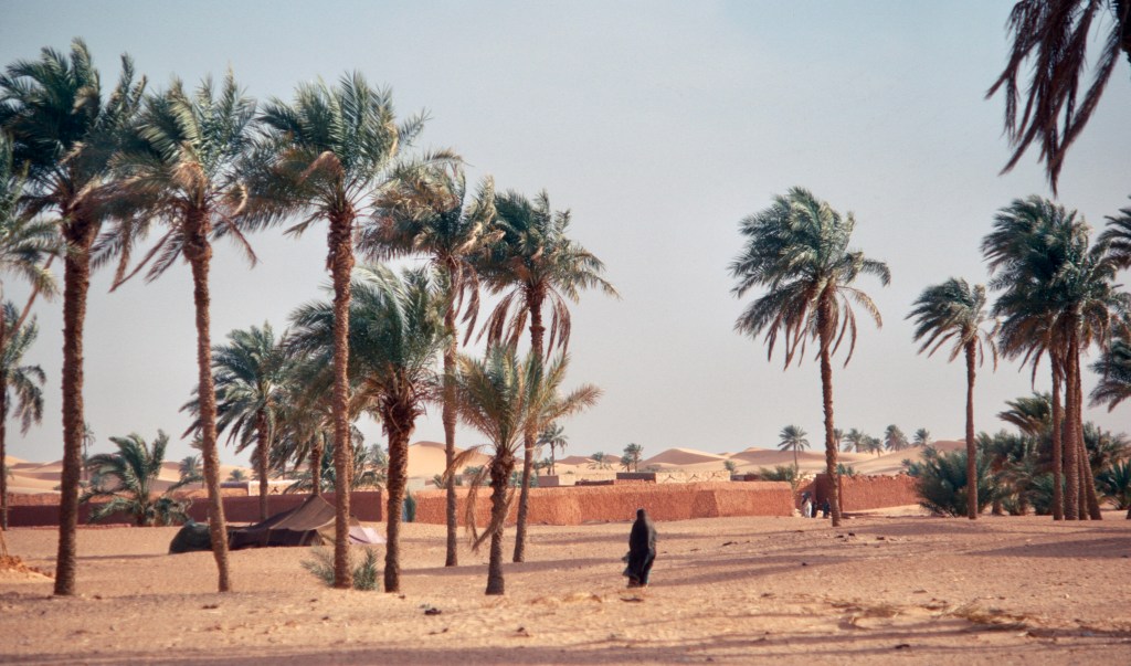
South of the Moroccan Atlas, high plateaus and foothills descend toward the edges of the vastness that defines the Sahara. There are few true oases in the Morocco That Was. Most of the southern settlements of Morocco lay along rivers that flow when winter snows blanket the mountain ranges collectively known as the Atlas. There are tall dunes at Merzouga and smaller ones at MHammid, both of which tourists may visit without too much trouble, and this is probably as much of the desert as most tourists want to see. Not everyone wants to cross the Empty Quarter by camel as Wilfred Thesiger did.
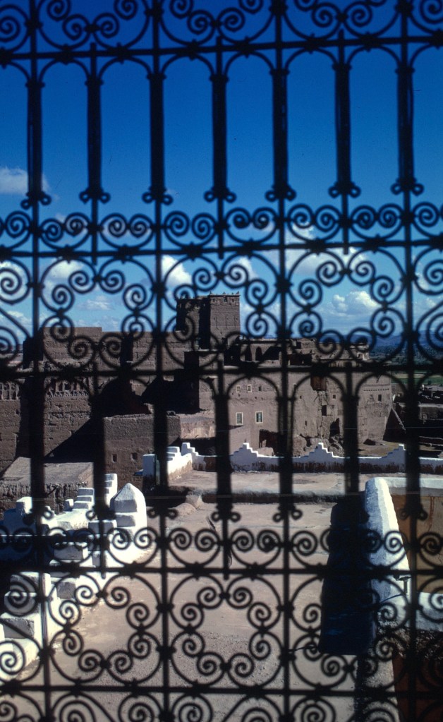
Southern Morocco is wonderful, a landscape of ksour (large fortified earth dwellings), palm groves, spectacular canyons, and gleaming mountains.

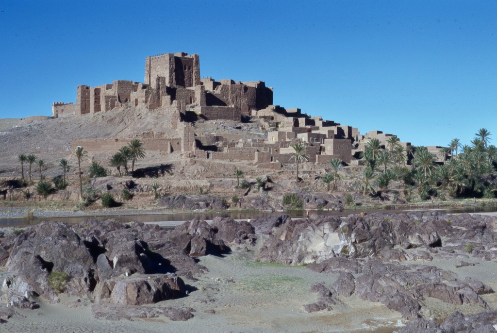
David Lean filmed part of Lawrence of Arabia at the Aït-Ben-Haddou ksar near Ouarzazate, and his crew stayed at the Glaoui palace nearby.
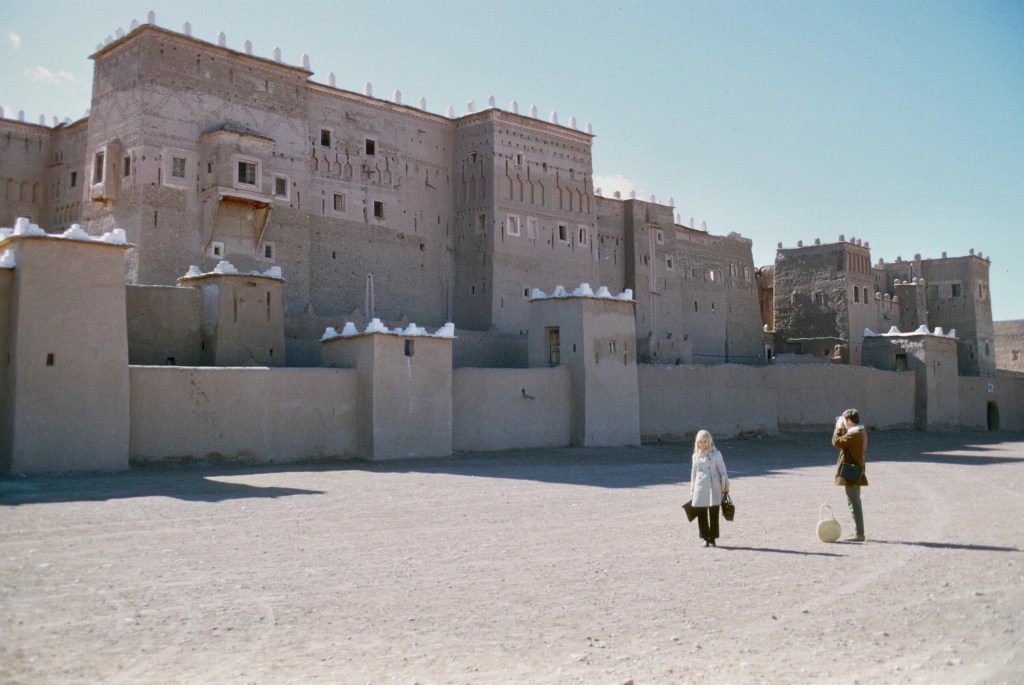
Today the latter is falling into ruin, a symbol of a modern political dynasty brought to an end by a failed joint effort with the French to remove King Mohammed V from the throne and the consequent demise of tribal power in a modern centralized nation state.
Beautiful as it is, Southern Morocco was not quite the Sahara; what might have been Morocco’s Sahara had been annexed to French Algeria, though few Moroccan sultans had exercised any real control over it. Indeed, in recent Moroccan history, sultans controlled relatively little outside of the royal capitals of their land.

As volunteers, we heard stories of a volunteer or two who had succeeded in crossing the Sahara by overland routes, so we knew it could be done, but the crossing and return required more vacation time than volunteers were allotted. TEFL volunteers, who taught English, had loads of time, but that time was in the summer— not an ideal time to cross a wide desert in the northern hemisphere. And, of course, it required gumption and an appetite for adventure.
If a volunteer wanted to make the crossing in another season, he had to set aside some vacation time and then hurry back. I had wanted to see a bit of West Africa as well as experience the desert, and so I did not seriously consider the trip until my volunteer service was nearing an end. I would not have done it then, but, fortunately, I found someone else who also wanted to do it. Adventurous though I am, I would not have undertaken that trip by myself.
My Peace Corps service was finishing up in early 1971. Another volunteer, Anne McLaughlin, who had already left Peace Corps service in 1970, also wanted to make the trip. She had worked in rural women’s centers in the pre-Rif and Rif, and spoke Arabic well. By that time, we were close friends.
We discussed going through Algeria to Niger, which seemed to be the most interesting route. Anne had been to Algeria recently and toured edges of the desert in a Volkswagen bus. Both of us spoke North African dialects and French, so we did not consider the culture and language a real problem. After living poor in the Peace Corps, traveling on a bare budget would not trouble us either.
We were fearless. We foresaw no real difficulty other than obtaining rides. So in the autumn of 1970, we made plans to leave Sefrou in March of 1971, and return to Casablanca by French steamship in late May. Two months would leave enough time for sightseeing and travel in West Africa, though much time consuming long-distance travel was required. In retrospect, more time would have offered a more leisurely trip, some interesting side visits, and possibly even an attempt to go east across the continent. However, we both intended to return to the States that summer, so a long trip seemed out of the question. I had applied to graduate school for studies that autumn, and was waiting to hear about my applications. And our funds were limited.
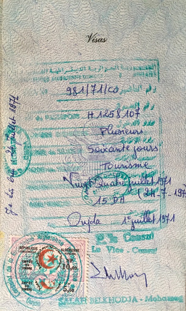
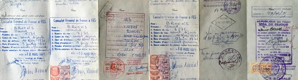
We needed visas, but most were easily obtained through the French consulate in Fes, and the rest could be obtained along the route.
We chose the right season to leave, and the weather turned out to be perfect for crossing the Sahara. The desert was comfortable that early spring, neither too hot nor too cold. The Sahel, the zone immediately south of the desert was another matter, as we were to find out.
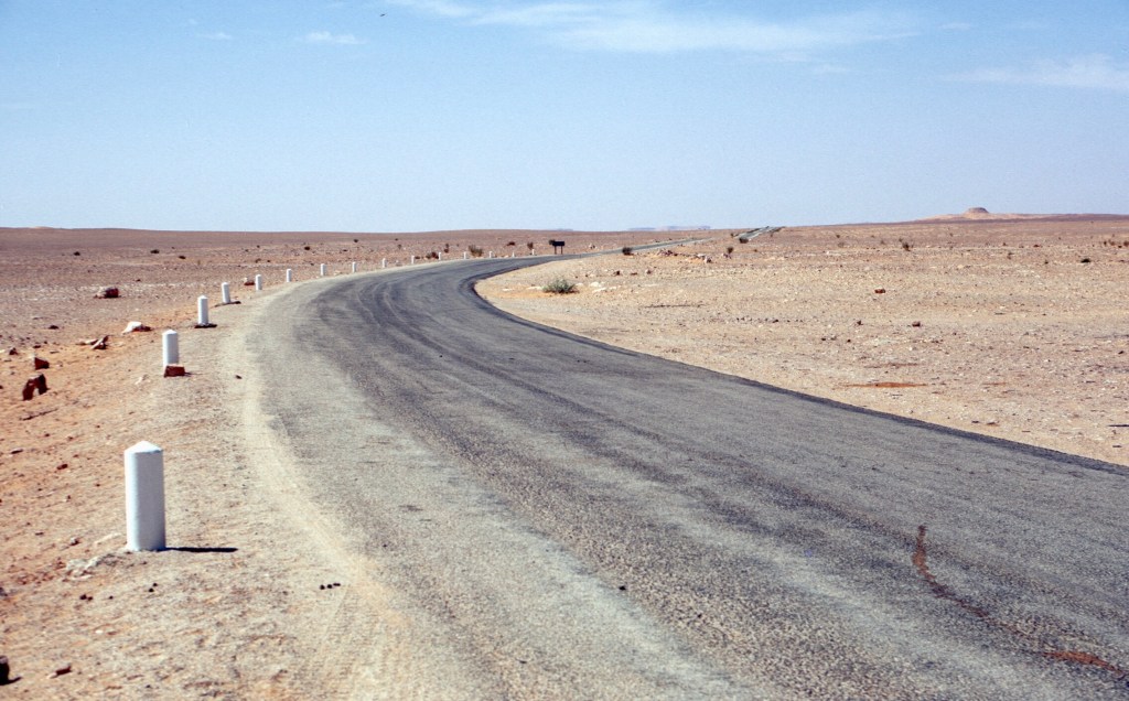
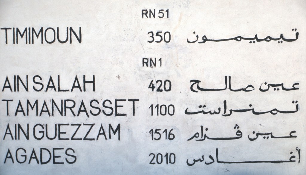
At that time, there were two or three practical routes across the Sahara for anyone living in Morocco. All were traditional routes that had been used by camel caravans for hundreds of years, and adapted for wheeled vehicles in the 20th century. The western route went through the Spanish Sahara, a colonial possession of Spain at that time, then through Mauritania to Senegal. I think that it was the most level and the quickest, but one ended up in Senegal, the farthest corner of West Africa. The central one went south of Béchar, eventually arriving in Gao, Mali, from where one could travel upstream along the Niger River to Timbuktu, or downstream to Niamey, in Niger. The least traveled of the routes, one could leave it at two points in the northern Sahara and connect to the route that we followed, the most easterly one, which went through Algeria, from Algiers, on the Mediterranean coast to Algeria’s southern border with Niger, and then on to Agadez. The road was regularly traveled as far as Tamanrasset, and even had occasional tourist vehicles on it, as it went through some interesting and classic desert scenery.
The first motorized traffic that connected the oases along the route with Tamanrasset occurred about 50 years before our trip, but the road was still not paved beyond El Golea in the nineteen-sixties. I do not recall seeing any private cars crossing the desert while we traveled, though there might have been a few; there were a few abandoned wrecks. The truck traffic was light. There were also scheduled buses as far as Tamanrasset, but not every day. As I write, the names of the places and countries come easily, but countries such as Algeria, Mali and Niger were immense and remote, something a simple and short name cannot convey.
We decided on the central Algerian route, where we thought that we would visit more interesting desert towns and regions, and, more importantly, find more traffic. The continuation of that route across Niger would take us to Nigeria, and through that country to the coast. I was interested in visiting the Cameroun, too, having had worked in a Peace Corps training program in La Pocatière, Quebec for English teachers going to that country.

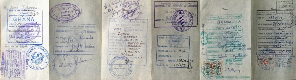
Hence, we went to the Nigerian Consulate in Casablanca for the necessary visa. As it turned out, Nigeria, smarting from its civil war, did not welcome us. International oil companies, Christian groups, and most Western Europeans had supported Biafra in its attempted breakaway from Nigeria. By January 1971, the war had been over for a year, and American sympathy for Biafra still preoccupied Nigerian officialdom. When we applied in advance for a visa at the Nigerian consulate in Casablanca, an interview with the consular officer began with the startling question, “You Americans don’t like Nigeria very much, do you?” He put it to us with a sardonic smile, and signaled that the rest of the meeting would be a waste of time. We were caught up in the politics of the time, and he would not grant us a visa. In retrospect, perhaps we should have tried a bribe. Could he have been fishing for one? We gave up with his refusal. Maybe it would have been possible to get visas for Nigeria in Niger, but we had given up in Casablanca and did not try.
We could continue the Algiers-Tamanrasset-Agadez route southward to Zinder, in central Niger, and make our way overland west to Niger’s capital, Niamey, then proceed to Ouagadougou a little further west, in what was then Upper Volta, but is now Burkina Faso, before finally turning south again and making our way through Ghana. It was a long detour and added hundreds of miles of travel over unpaved washboard roads. Had we been able to enter Nigeria, we would have been on paved roads very quickly. In 1971, Niger, by way of contrast with Nigeria, had about 20 miles (or 30 km) of paved highway, all or almost all, in the capital city, Niamey. Niger is twice as large as Texas, more than twice the size of France, almost three times the size of Morocco, and four times bigger than the U.K.


Today the route through Algeria is paved only to the border of Niger. Niger itself has far more paved roads than it had 50 years ago, and the route nowadays would be easier on drivers and passengers alike.


In our case, the Zinder to Niamey trip was a grueling ordeal, far more so than travel across the Algerian Sahara itself.
Our preparation included getting our vaccinations updated, and prescriptions for an antimalarial drug. Malaria was not common in Morocco, and volunteers did not worry about it, but the risk would grow as we pushed south. Elsie Honkala, the Peace Corps nurse, helped us.

At some point, Washington decided to replace Peace Corps doctors in Morocco with nurses. The last Peace Corps doctor, Louden Kiracofe, was a good friend, and I missed him when he returned home.

The logic was that Peace Corps volunteers were mostly young and very healthy, and local doctors and the U.S. Naval base at Kenitra could handle emergencies. Elsie had served in the Navy, I think, and, in my first encounters with her, I found her demeanor gruff and military. As it turned out, that was a bit of a facade, and I will always remember her kindness in setting us up for the trip, with vaccinations and appropriate antimalarial drugs.
With visas in hand and vaccinations in various other parts of the body, Anne and I prepared to set off in March of 1971. Sefrou was cold and wet at the time. Bouiblane lay hidden in the clouds, and the drizzle kept the medina streets muddy. I don’t remember if there had been some snow in town, but there was snow across higher elevations.
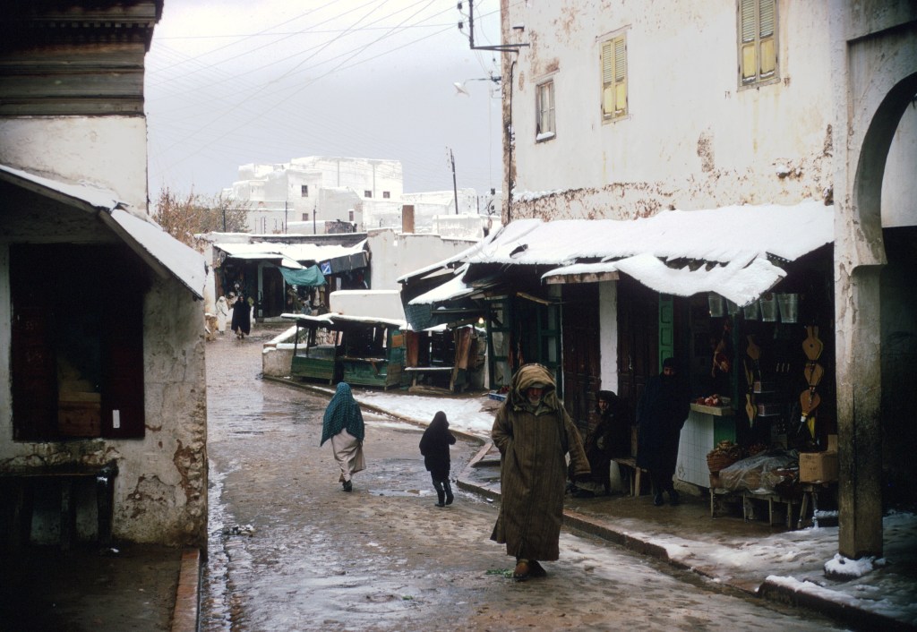
There was certainly plenty of cold rain, and my house was clammy. March is often cold and damp in northern Morocco. I remember waiting in Sefrou for the rain to break, listening to records of Simon and Garfunkel and the greatest hits of Serge Reggiani, which Anne had brought back from her travels.
Our intention was to hitchhike, but hitching was relatively difficult in Morocco, and as it continued to pour rain, we began our trip by taking a bus from Fes to Oujda, on the eastern border of Morocco.
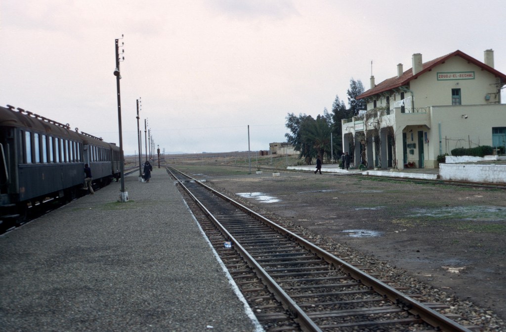
We entered Algeria through the Zoudj-El-Beghal crossing, and took the train to Tlemcen, where we stayed the night.

In Tlemcen, heavy snow had fallen and a visiting circus tent had collapsed when the main mast broke. We didn’t really sightsee there, though I would have liked to have explored the city. Tlemcen, the only Algerian city closely connected to Moroccan history, had substantial historical ruins.
Our practical goal, however, required getting out of the cold north and crossing the desert before the weather became too hot for comfort. We worried, uncertain about how long the desert crossing might take, so delay did not seem prudent. Anne had already seen her share of northern Algeria from travel in a VW bus just months earlier. Getting to West Africa was the main objective so we pushed on.

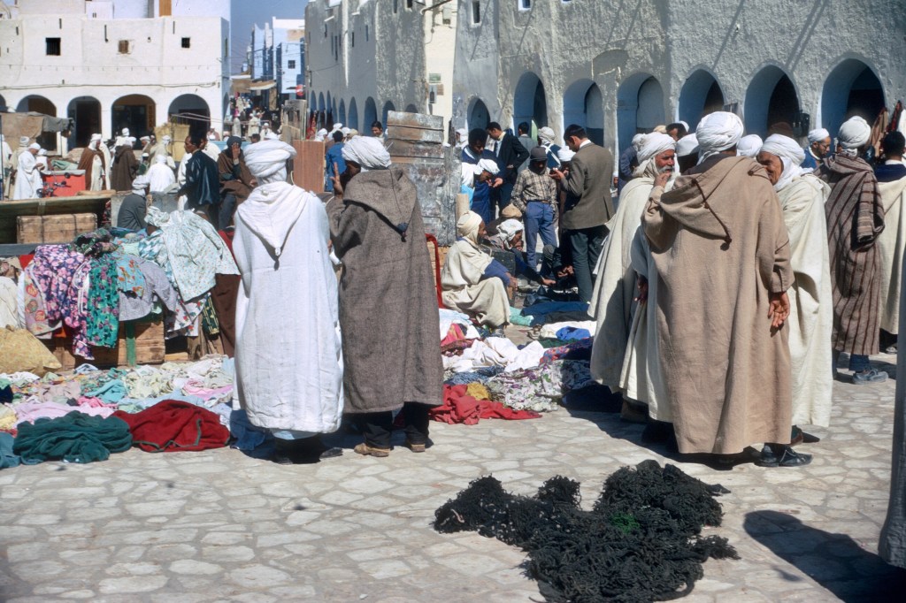
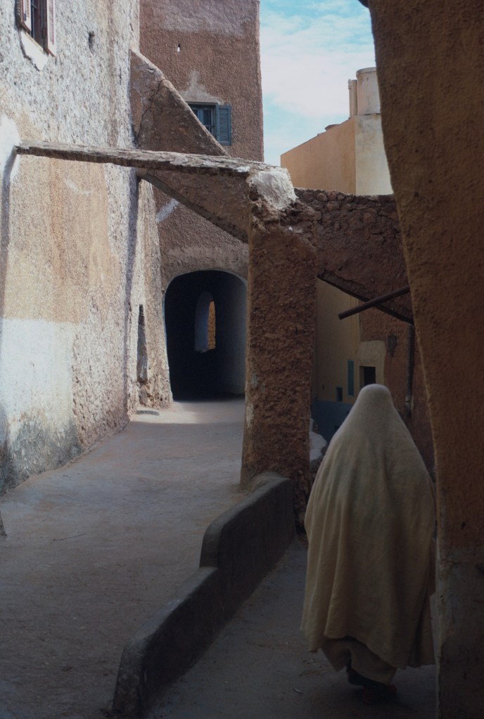
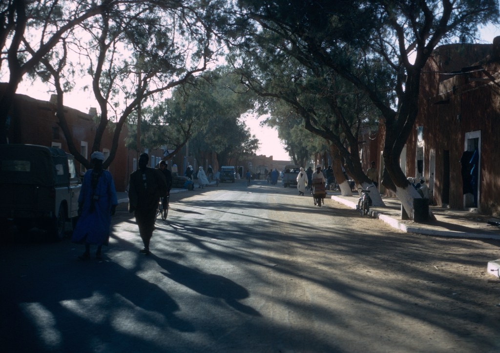
The French had only left Algeria eight years earlier. Tlemcen, and everywhere else in Algeria looked French. There were the same bandstands in parks for summer concerts that you might see in France. Indeed, Algeria had been ruled for over a century as part of Metropolitan France. Street life, however, was not French. Most of the people on the streets were men, many in djellabas, and women were not prominent in public and many wore haïks.

Algeria was my first exposure to harissa, a hot sauce used extensively in Algerian and Tunisian cooking, but less common in Morocco, where people eschewed hot pepper for a wide range of spices. I still miss Moroccan cooking as I write this.
As we planned to connect with the Algiers-Tamanrasset road, we needed to travel southeast. We continued by train to Sidi Bel Abbes, which had been the home of the French Foreign Legion until Algerian independence. In the 1920s, there was a story that the ladies temperance league of France had put up posters with a skull and crossbones and the message, “Alcohol kills,” on the walls of the Legionnaire barracks. On every one, the legionnaires had added: “But the Legionnaire does not fear Death!” The Legion is a legendary and romantic part of the Sahara for many people, but, in fact, legionnaires did little fighting there, and were often used in construction projects. The French Army in Africa itself conquered the Sahara, and, to do it, took initiatives that were not always popular among the politicians in Paris, and often even contrary to the army’s orders.
We did not really know our way around, and decided to continue by public transport to smaller towns where hitchhiking might be easier. We took a bus to Bou Hanifia and Hamamet, then hitched to Mascara, spending the night. The hotel there has twenty-foot high depictions of Mickey and Minnie Mouse, as well as other Disney characters. The next day we continued on through Frenda to Tiaret where we spent another night.

From Tiaret we traveled by bus to Ghardaïa, where we stretched our legs and took some photos. On March 24, we were in the desert at last, and the local architecture hinted at what we might see in West Africa.

Located in an area named the M’Zab, Ghardaïa is one of five oasis towns inhabited by a refugee population of Ibadi Muslims, who follow a heretical sect and were forced to flee into the wilderness early in the history of Algeria. The French gave the Mzabis considerable autonomy when they ruled Algeria.
A similar group of Ibadis live on the isle of Djerba, in Tunisia. By way of contrast, Morocco has been free of heresies for centuries, though many modern fundamentalist Muslims consider saint worship and superstitions heretical. I heard this more than once in Saudi Arabia, where Moroccans were also criticized for indulging in black magic and, somewhat ingenuously, speaking French better than Arabic, an unfair criticism, as many Saudis could surely be accused of speaking better English than Arabic! A Saudi newspaper editor in Jeddah said this to me in fluent and unaccented English. I wish I had been able to test his speaking knowledge of Modern Standard Arabic.


The M’Zabis were a group known in Algeria for their migration to the north, and M’Zabi men ran small grocery shops and other businesses, leaving their families at home in the M’Zab, much as did the Swassa, Moroccan Berbers from the Sous Valley in southwestern Morocco, and also the Djerbans, in Tunisia.
The three groups are all known for their probity. When I lived briefly in a shared apartment in Sale in 1973, we left the apartment key at the shop of the Soussi around the corner, rather than invest in many sets of keys. In Sefrou, I did much of my daily shopping at the store of the late Miloud Soussi.


From Ghardaïa we were able to get a shared taxi to El Golea, also known as El Menia. The shared taxi was a Peugeot station wagon, and the ride was comfortable as the road was paved.


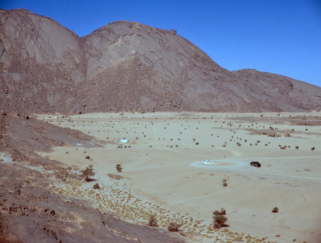
El Golea marked the end of the paved road, and we remained there for a week, waiting for a truck to take us farther. The wait gave us a bit of respite from travel, and a chance to explore the oasis.


The weather was warm and pleasant, and the stress of travel disappeared. A lemon tree bloomed in the courtyard of the hotel where we stayed.
The oasis was large, and had an important airport, but very little traffic at that time.
A number of Algerians befriended us and one Palestinian. One day the Algerians took us out to the airport, and a fellow who worked there inflated and launched a weather balloon just to amuse us. The younger people we met were mostly from the north, bored, and homesick.
One evening we were invited to a party, where the Algerian kids smoked marijuana in the paranoid way that young Americans did in those days. It was illegal of course. We ate lunch with them, too, during the day. At one lunch, we discussed the trip and talked about what West Africa must be like. There was a local fellow eating with us. He had a very dark skin, and the others kept looking at him to confirm their comments about West Africa. Somewhat frustrated, he finally interjected “ Wait a minute, I was born here in Algeria just like you guys.”


With a lengthy stay, we had an opportunity to wander the oasis, and observe life there. The weather was mild, and walking was pleasant.


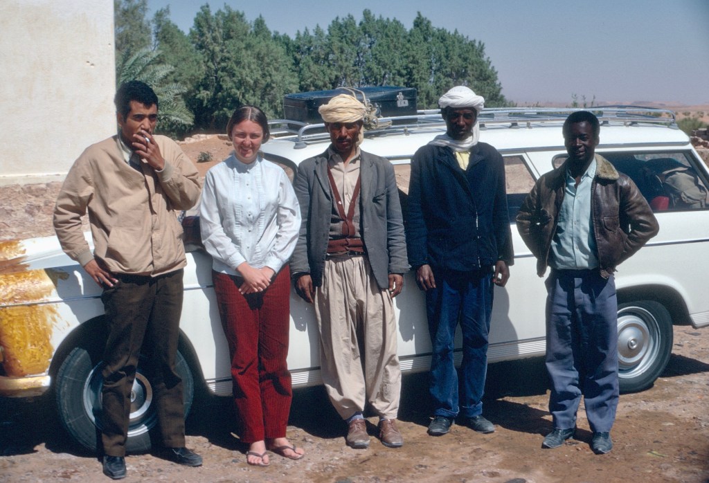
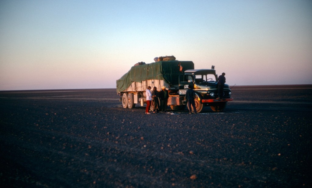
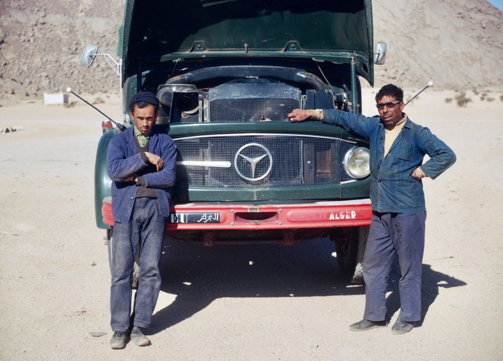
On April 2, after eight days in El Golea, when we were beginning to wonder when, if ever, we would proceed in our journey, a truck making the Algiers to Tamanrasset run agreed to take us. After a time the dusty road and the windy top of the truck proved too much for Anne and when the driver offered her a spot in the cabin, she wasted no time taking up the offer, leaving me alone. At the time I was angry, but, in retrospect, I really couldn’t blame her. The bumps, the cold, and the constant buffeting by the wind, ranged from uncomfortable to almost unbearable. I settled down, attempting to read La Chartreuse de Parme, but at some point the book flew out of my hands and was gone. I have tried to read this novel again several times, both in English and in French, but I have never finished it. I hope someone found it and read it. Today the novel is on my iPad, but
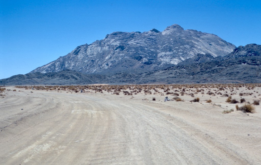
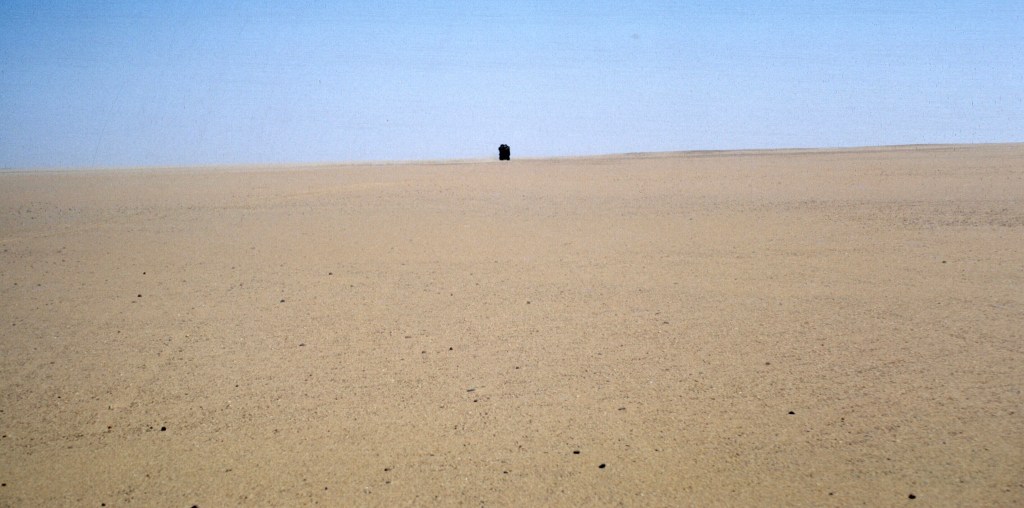
The first night we simply stopped on the Tademaït plateau, an absolutely flat, featureless, stony desertscape. The rock was dark and sharp, and reminded me of the highest mountain tops in the Atlas. We ate with the driver and his helper, and slept under the stars.

We did not stop in In Salah, the next major oasis, where a sandstorm blew, but at a small roadside hut near Tadjmout, farther south.
The drivers must have stopped there regularly. They knew the owner and brought him sugar.
His name was Bou Baggara, as I recall. Perhaps he had a cow, though there wasn’t much grass around. Bou Baggara fancied himself a poet, and improvised for us. Since we had come from Morocco, one of his improvisations honored the Moroccan king, Hassan II. I don’t remember much from that night, other than the lamplight inside the small dwelling, the convivial conversation, and the cool desert air outside. We fell asleep in our sleeping bags under a bright star-filled sky.
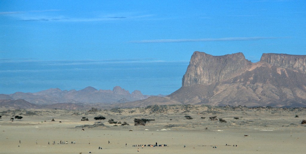
The next day, these low mountains, rising from a sea of acacia, were a relief for the eyes.
Between Aïn Salah and Tamanrasset, there was the tomb of a saint, a marabout, Chérif Sidi Moulay Lahcene, a descendant of the Prophet, who died there while making his hadj to Mecca from the Touat.

The Touat is a large group of oases and ksour in western Algeria, to the west of our route. The route from Béchar passes through them. Ibn Battuta crossed through the region on his way to Timbuctoo in the 14th century, remarking that the people’s diet consisted of dates and locusts. So did Leo Africanus, a Muslim refugee from Granada in Spain, who ended up as a Christian slave in the Vatican, given the family name Medici by the pope. Leo Africanus was a major source of information for European geographers. Amin Malouf, a Lebanese author who writes in French has written a wonderful fictionalized biography, Leon L’Africain, which has been translated into English.

Though the Touat was conquered by a Moroccan sultan, the French occupied the region in the late 19th and early 20th centuries, when Moroccan control was only nominal, and annexed it to Algeria, then a part of France. Today the area is a major producer of natural gas.
Alongside the road, at the base of a huge group of rocks, lay the tomb. Those who traveled on the road customarily drove around it three times, and stopped to ask the saint for his blessing. Circling the tomb was thought to bring good luck, and we stopped there for a long break while our driver and his assistant prayed and rested.
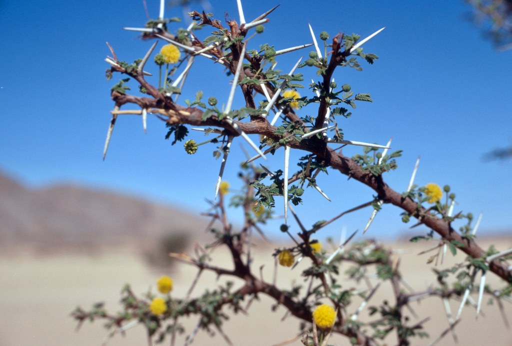
Widely spaced acacia trees, in bloom, covered the plain at the base of the mountain, and I remember it as one of the prettiest spots in the desert. Today the paved road skirts the site, and a detour is necessary to visit it. The little marabout no longer seems to exist, and the spot is marked by piles of rock.


Further along, we met some Touareg nomads beside the road, and the driver stopped to chat and drink tea with them.

I think it was the first time we saw anyone along the entire stretch from El Golea to Tamanrasset. Shortly after this stop, we crossed the Tropic of Cancer.

Once arrived in Tamanrasset, we said our goodbyes and began looking for our next ride.

The first evening there was a tremendous red sunset. Had we been stuck there for a while, perhaps we would have taken an excursion to the Hoggar mountains to the northeast and clearly close and visible.
The Hoggar was the center of Touareg resistance to the French. Charles de Foucauld, French nobleman and early explorer of Morocco turned ascetic hermit, made his retreat in the barren wilds of those mountains where he was assassinated in 1916. Once the region was firmly controlled by the French, tourists, pilgrims to the hermitage, admirers of the natural beauty, and rock climbers began to visit the Hoggar regularly. We heard that there was an American astronaut there while we visited, in spite of the travel restrictions, I guess. Tamanrasset was accessible by air to those whom could pay.


We did not wait long for a ride in Tamanrasset. After a day or so, the locals found us two Libyan truck drivers who were willing to take us to Agadez, on the southern edge of the desert, in Niger. We agreed to pay them the equivalent of about $20. The weather was hotter, and the road more a track, less distinct and flat and sandy in places. With the Libyans we both rode in the truck cabins. There wasn’t much scenery. We had to spend another night camped in the desert, this time in a flat, sandy and featureless plain. The Libyans, like the Algerians, shared their evening meal with us, but communication with them was more difficult because of their dialect.
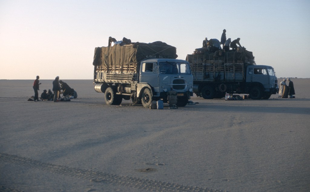
The final segment of the voyage was very slow. The trucks stopped often to prevent overheating. The weather was hot and windy. When we stopped at one well, we eschewed our iodine tablets and drank the cool water immediately, taking our chances with an opportunity to quench our thirst.
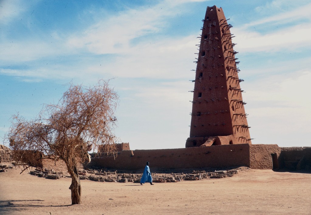
Having crossed the frontier into Niger, we finally reached Agadez around midnight. We had left Sefrou three weeks earlier to the day.
End of part one. In part two, we struggle through the Sahel and cross tropical areas along the coast before returning by boat from Senegal.
